Lonsdale

Valley in Yorkshire Hambleton

England

Lonsdale

In the Depths of the Forest on Coate Moor The Cleveland Way takes to dark plantation between Kildale and Roseberry Topping.
In the Depths of the Forest on Coate Moor Credit: Chris Heaton

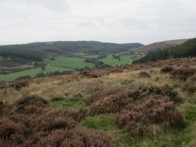
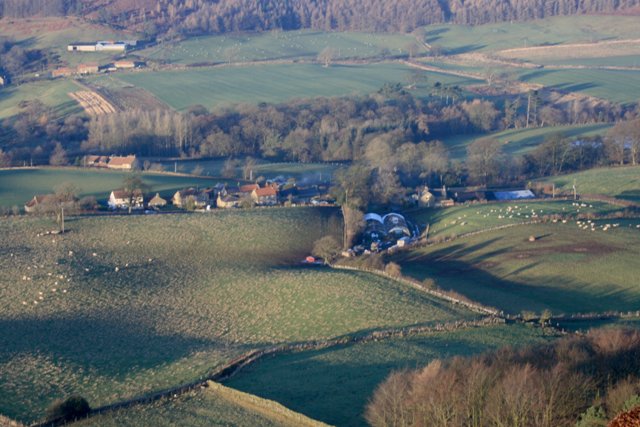
Lonsdale is a small yet picturesque valley located in the county of Yorkshire, England. Situated amidst rolling hills and lush greenery, it is a haven for nature lovers and outdoor enthusiasts. The valley is named after the River Lonsdale, which flows through its heart, adding to the natural charm of the area.

Lonsdale boasts a rich history dating back centuries. The valley was once home to several medieval settlements and has remnants of ancient structures still standing. Ruins of old castles and abbeys can be found scattered across the landscape, serving as reminders of a bygone era.

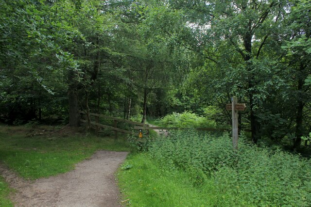
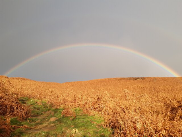
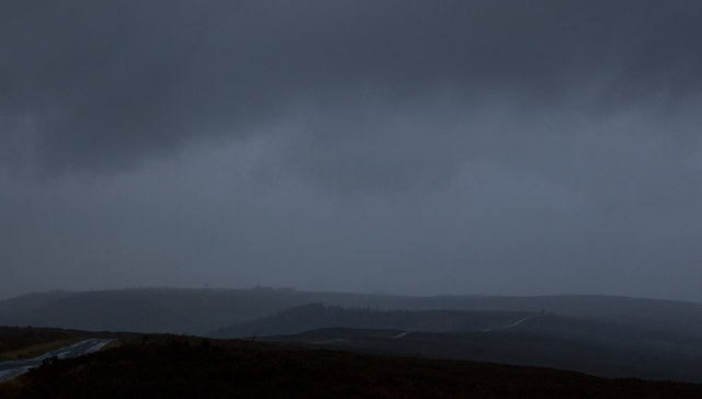
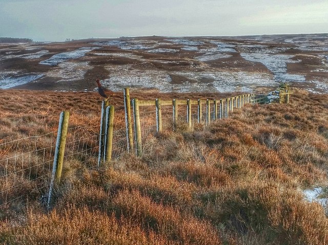
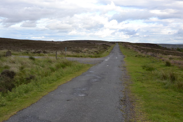
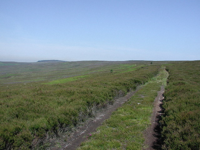
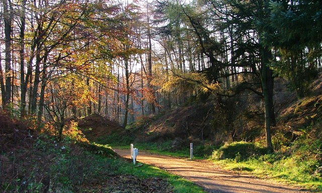
The valley is known for its breathtaking scenic beauty. Visitors are treated to stunning vistas of the surrounding countryside, with panoramic views of the valley from elevated points. The area is particularly popular among hikers and walkers, as it offers a plethora of trails and footpaths to explore. The Yorkshire Dales National Park, which encompasses Lonsdale, provides ample opportunities for outdoor activities like cycling, horseback riding, and birdwatching.

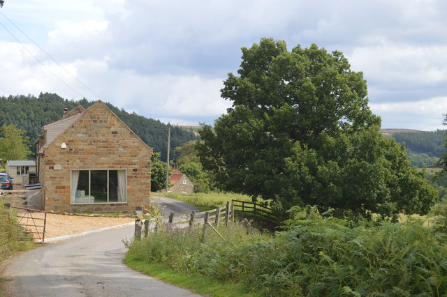
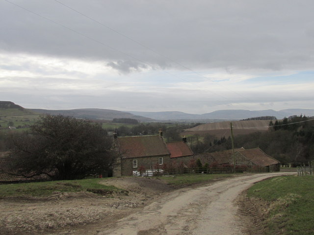
Lonsdale is also home to a vibrant local community. The valley is dotted with charming villages and hamlets where residents maintain a close-knit way of life. Visitors can experience the warmth and friendliness of the locals by engaging in the various village events and festivities that take place throughout the year.

In summary, Lonsdale, Yorkshire, is a hidden gem nestled in the heart of the English countryside. With its natural beauty, historical significance, and welcoming community, it offers a delightful retreat for those seeking an escape from the hustle and bustle of city life.

If you have any feedback on the listing, please let us know in the comments section below.

Lonsdale Images

Images are sourced within 2km of 54.487337/-1.0555145 or Grid Reference NZ6110. Thanks to Geograph Open Source API. All images are credited.

In the Depths of the Forest on Coate Moor The Cleveland Way takes to dark plantation between Kildale and Roseberry Topping.
In the Depths of the Forest on Coate Moor
The Cleveland Way takes to dark plantation between Kildale and Roseberry Topping.
Rainbow over Great Ayton Moor Taken across the autumn bracken.
Rainbow over Great Ayton Moor
Taken across the autumn bracken.
Cod Hill Slack from Percy Rigg
Sleddale and Codhill Heights
Rain squall on Brown Hill It was well forecast, but still quite a surprise when about 3pm it became very dark and the moor was lashed with wind and rain for maybe five minutes.
The temperature fell from 12°C to 6°C as a cold front moved through.
A short video can be found here. <span class="nowrap"><a title="http://www.youtube.com/watch?v=ylsmuJd-ALQ" rel="nofollow ugc noopener" href="http://www.youtube.com/watch?v=ylsmuJd-ALQ">Link</a><img style="margin-left:2px;" alt="External link" title="External link - shift click to open in new window" src="https://s1.geograph.org.uk/img/external.png" width="10" height="10"/></span>
Rain squall on Brown Hill
It was well forecast, but still quite a surprise when about 3pm it became very dark and the moor was lashed with wind and rain for maybe five minutes. The temperature fell from 12°C to 6°C as a cold front moved through. A short video can be found here. LinkExternal link
Barn conversion at Oak Tree Farm
View from Percy Cross Rigg Looking west to Lonsdale.
View from Percy Cross Rigg
Looking west to Lonsdale.
Codhill Heights From Percy Cross.
Codhill Heights
From Percy Cross.
Bankside Farm Along the Cleveland Way.
Bankside Farm
Along the Cleveland Way.
Great Ayton Moor Entrance and track across Great Ayton Moor near to Kildale, North Yorkshire.
Great Ayton Moor
Entrance and track across Great Ayton Moor near to Kildale, North Yorkshire.
Percy Cross Rigg Footpath off Percy Cross Rig near to Kildale, North Yorkshire.
Percy Cross Rigg
Footpath off Percy Cross Rig near to Kildale, North Yorkshire.
Moorland with valley of Lonsdale Beck A stream groove develops on the south side of Great Ayton Moor and drains into the valley below in this image, that of Lonsdale Beck.
Moorland with valley of Lonsdale Beck
A stream groove develops on the south side of Great Ayton Moor and drains into the valley below in this image, that of Lonsdale Beck.
Abandoned Tents Coate Moor is a popular place for wild campers. The trouble is they have absolutely no respect for the countryside. Part of the problem is tents cheap enough to be binned after one use. These tents have been abandoned along with other rubbish. It will be cleared; usually by local volunteers.
Abandoned Tents
Coate Moor is a popular place for wild campers. The trouble is they have absolutely no respect for the countryside. Part of the problem is tents cheap enough to be binned after one use. These tents have been abandoned along with other rubbish. It will be cleared; usually by local volunteers.
Old Meggison, River Leven A waterfall on the River Leven, near Kildale
Old Meggison, River Leven
A waterfall on the River Leven, near Kildale
Old Meggison, River Leven
Lonsdale Vale Ironstone Mine The ironstone mine at Lonsdale is another example of the feeding frenzy that followed the discovery of ironstone in the Eston Hills in the 1850s. And as with the Warren Moor Mine (see <span class="nowrap"><a title="https://fhithich.wordpress.com/2016/01/13/boom-and-bust-on-the-north-york-moors/" rel="nofollow ugc noopener" href="https://fhithich.wordpress.com/2016/01/13/boom-and-bust-on-the-north-york-moors/">Link</a><img style="margin-left:2px;" alt="External link" title="External link - shift click to open in new window" src="https://s1.geograph.org.uk/img/external.png" width="10" height="10"/></span> ) it was a royalty let by the Kildale Estate which failed to live up to expectations. The main man is again John Watson, a Fellow of the Geological Society from Essex. who must have had powers of persuasion to match Arthur Daley. In 1865 he leased the whole of the royalties of the Kildale Estate and persuaded his wealthy London friends to invest in ironstone. Together they formed the Lonsdale Vale Ironstone Mine which sub-leased the 2,000 acre royalty in Lonsdale from Watson.

So far so good. A shaft was sunk to reach the Main Seam, 145′ deep. Plans were made to built a furnace in the valley. But the quality of the ironstone again was poor. It is doubtful if any ore from the Main Seam was actually gained. A small drift mine half a mile to the south east into the outcropping Dogger seam did produce almost 48,000 tons but by 1868 the Kildale Estate was owed a year’s rent and forced the company into liquidation.

The stone arch of the engine house is the most visible reminder of ironstone mining Lonsdale. The outlines of other buildings and the railway extension can be traced in the fields beyond the arch.
Lonsdale Vale Ironstone Mine
The ironstone mine at Lonsdale is another example of the feeding frenzy that followed the discovery of ironstone in the Eston Hills in the 1850s. And as with the Warren Moor Mine (see LinkExternal link ) it was a royalty let by the Kildale Estate which failed to live up to expectations. The main man is again John Watson, a Fellow of the Geological Society from Essex. who must have had powers of persuasion to match Arthur Daley. In 1865 he leased the whole of the royalties of the Kildale Estate and persuaded his wealthy London friends to invest in ironstone. Together they formed the Lonsdale Vale Ironstone Mine which sub-leased the 2,000 acre royalty in Lonsdale from Watson. So far so good. A shaft was sunk to reach the Main Seam, 145′ deep. Plans were made to built a furnace in the valley. But the quality of the ironstone again was poor. It is doubtful if any ore from the Main Seam was actually gained. A small drift mine half a mile to the south east into the outcropping Dogger seam did produce almost 48,000 tons but by 1868 the Kildale Estate was owed a year’s rent and forced the company into liquidation. The stone arch of the engine house is the most visible reminder of ironstone mining Lonsdale. The outlines of other buildings and the railway extension can be traced in the fields beyond the arch.
View over Sledale View over the valley of Sledale beck. The high ground beyond is Kildale Moor

Constructed from three images 6480x4320 each, stitched with Microsoft ICE into a single image 13177x4383 pixels. The extra vertical pixels were created by the stitching programme at the crop stage, by extrapolating the sky.  I removed the similar infilling at the bottom. This was reduced using Irfanview to 7065x2350 pixels to get the file size within the Geograph limit.


The panorama is slightly less than 180 degrees wide, and the distortions in projecting it onto a flat .jpg are less than obvious, but a pannable viewer for it can be found at <span class="nowrap"><a title="https://photosynth.net/view.aspx?cid=b0f86d88-4722-4e4a-b830-4142bb9d4074" rel="nofollow ugc noopener" href="https://photosynth.net/view.aspx?cid=b0f86d88-4722-4e4a-b830-4142bb9d4074">Link</a><img style="margin-left:2px;" alt="External link" title="External link - shift click to open in new window" src="https://s1.geograph.org.uk/img/external.png" width="10" height="10"/></span>
View over Sledale
View over the valley of Sledale beck. The high ground beyond is Kildale Moor Constructed from three images 6480x4320 each, stitched with Microsoft ICE into a single image 13177x4383 pixels. The extra vertical pixels were created by the stitching programme at the crop stage, by extrapolating the sky. I removed the similar infilling at the bottom. This was reduced using Irfanview to 7065x2350 pixels to get the file size within the Geograph limit. The panorama is slightly less than 180 degrees wide, and the distortions in projecting it onto a flat .jpg are less than obvious, but a pannable viewer for it can be found at LinkExternal link
In-camera panorama of Sledale This is an in-camera panorama shot from the same point, and with the same camera, as <a href="https://www.geograph.org.uk/photo/5045894">NZ6210 : View over Sledale</a>.  The camera produced an image of 3936x1040 pixels
In-camera panorama of Sledale
This is an in-camera panorama shot from the same point, and with the same camera, as NZ6210 : View over Sledale. The camera produced an image of 3936x1040 pixels
Show me another place!

Lonsdale is located at Grid Ref: NZ6110 (Lat: 54.487337, Lng: -1.0555145)

Division: North Riding

Administrative County: North Yorkshire

District: Hambleton

Police Authority: North Yorkshire

What 3 Words

///printouts.card.unsettled. Near Great Ayton, North Yorkshire

Nearby Locations

Quarry Hill Lonsdale

Related Wikis

Kildale railway station

Kildale is a railway station on the Esk Valley Line, which runs between Middlesbrough and Whitby via Nunthorpe. The station, situated 12 miles 65 chains...

Kildale

Kildale is a village and civil parish in Hambleton district of North Yorkshire, England. It lies approximately 3 miles (4.8 km) south-east from Great Ayton...

Warren Moor Mine

The Warren Moor Mine, was a short-lived mining concern south of Kildale, North Yorkshire, England. Activity at the site was limited to drift mining, and...

Easby Moor

Easby Moor is a hill located in the civil parish of Little Ayton in the North York Moors national park within the Cleveland Hills, North Yorkshire, England...

Gisborough Moor

Gisborough Moor is a moor in England's North York Moors, lying to the south of the town of Guisborough. The summit is a broad flat ridge, with the highest...

Roseberry Mine

Roseberry Mine was an ironstone mine in the North Riding of Yorkshire, England, which operated between 1883 and 1924, with a break of 24 years. Both periods...

Hutton Village

Hutton Village is a settlement in the Hutton Lowcross area of Guisborough in North Yorkshire, England. Whilst the area itself is mentioned in the Domesday...

Great Ayton railway station

Great Ayton is a railway station on the Esk Valley Line, which runs between Middlesbrough and Whitby via Nunthorpe. The station, situated 8 miles 37 chains...

Nearby Amenities

Located within 500m of 54.487337,-1.0555145
Ford: yes
Source: OS-OpenData_StreetView
Lat/Long: 54.484/-1.0523565
The data included in this document is from www.openstreetmap.org. The data is made available under ODbL.

Have you been to Lonsdale?

Leave your review of Lonsdale below (or comments, questions and feedback).