Elder Slack

Valley in Yorkshire Hambleton

England

Elder Slack

Track junction, North Side A crossing of tracks on the edge of woodland at Gilling Park. None of the tracks here are on a public right of way, but there is access and there's also a waymark on the post to the right of the track.
Track junction, North Side Credit: Gordon Hatton

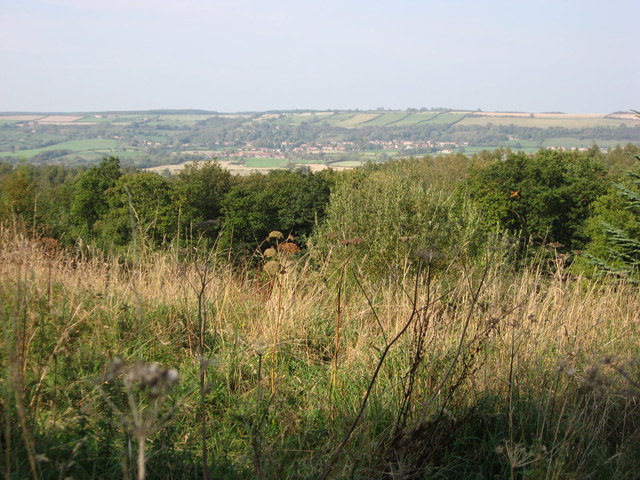
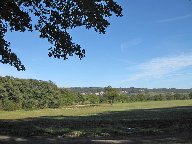
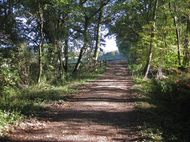
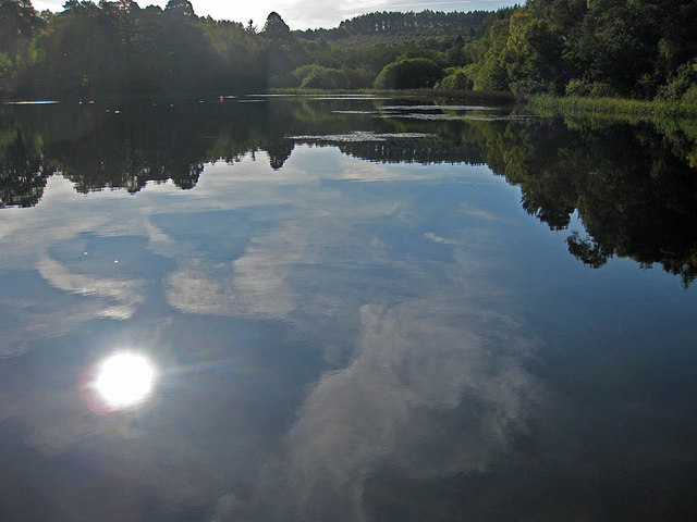
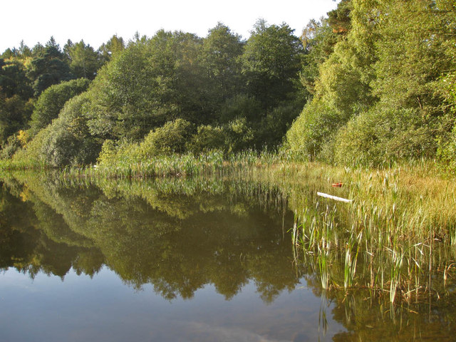
Elder Slack is a picturesque valley located in Yorkshire, England. Nestled amidst rolling hills and verdant countryside, it spans a length of approximately 3 miles, offering visitors a serene and tranquil setting to explore.

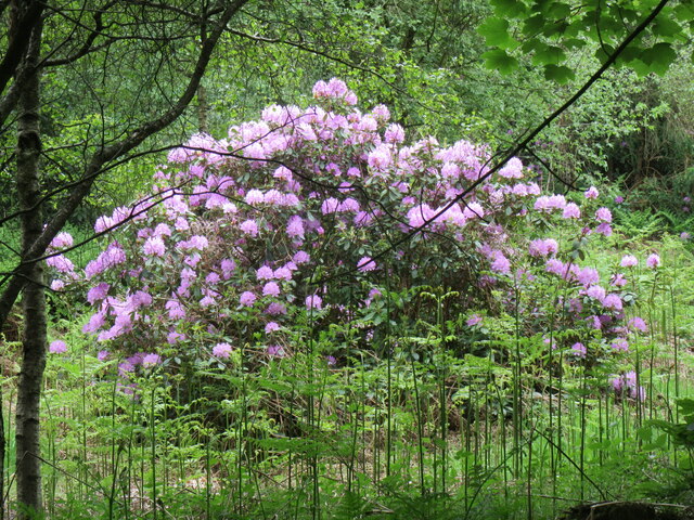
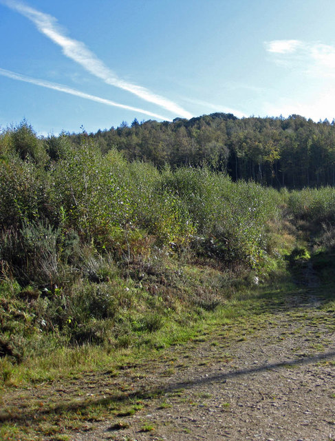
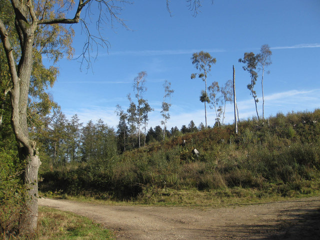
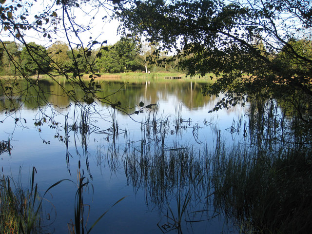
The valley is renowned for its natural beauty, characterized by lush green meadows, meandering streams, and a diverse range of flora and fauna. The area is home to a variety of wildlife, including rabbits, foxes, and various species of birds, making it a haven for nature enthusiasts and birdwatchers alike.

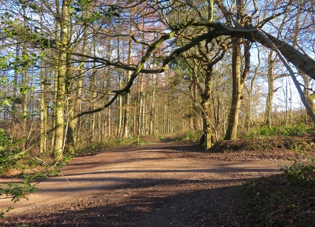
Elder Slack is also known for its captivating walking trails, which wind their way through the valley, providing breathtaking views of the surrounding landscape. As visitors traverse the trails, they can immerse themselves in the tranquility of the countryside, breathing in the fresh air and reveling in the beauty of their surroundings.

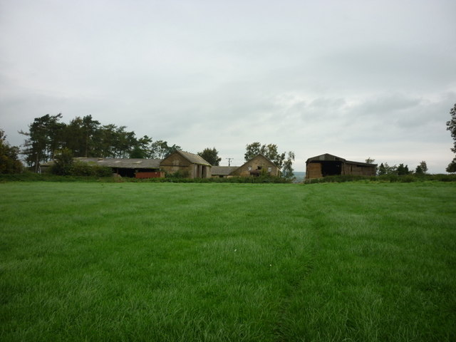
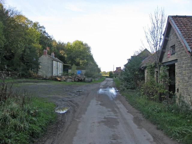
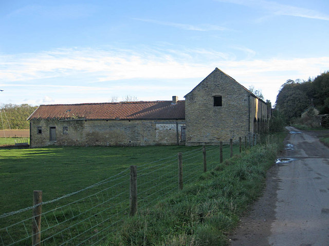
In addition to its natural allure, Elder Slack boasts a rich history. The valley is dotted with charming old cottages, some of which date back several centuries, adding a touch of rustic charm to the landscape. There are also remnants of ancient stone walls and ruins, offering glimpses into the valley's past.

For those seeking a peaceful retreat or an escape from the hustle and bustle of city life, Elder Slack is an ideal destination. Its idyllic scenery, abundant wildlife, and rich history make it a truly enchanting place to visit and explore.

If you have any feedback on the listing, please let us know in the comments section below.

Elder Slack Images

Images are sourced within 2km of 54.175185/-1.1029464 or Grid Reference SE5875. Thanks to Geograph Open Source API. All images are credited.

Track junction, North Side A crossing of tracks on the edge of woodland at Gilling Park. None of the tracks here are on a public right of way, but there is access and there's also a waymark on the post to the right of the track.
Track junction, North Side
A crossing of tracks on the edge of woodland at Gilling Park. None of the tracks here are on a public right of way, but there is access and there's also a waymark on the post to the right of the track.
Rhododendron bush A Rhododendron bush in Yearsley Woods.
Rhododendron bush
A Rhododendron bush in Yearsley Woods.
A path leading to Yearsley
Walking towards High Lions Lodge
Walking towards Low Lions Lodge
A wind turbine at Thorpe Grange
Looking North from Yearsley Forest Looking North from the deserted farmhouse in Yearsley Forest, Ampleforth in the distance.
Looking North from Yearsley Forest
Looking North from the deserted farmhouse in Yearsley Forest, Ampleforth in the distance.
Park House View along the track close to the empty barns.
Park House
View along the track close to the empty barns.
Barns near Park House Heading towards Gilling.
Barns near Park House
Heading towards Gilling.
Farmland near Park House View North towards Black Plantation.
Farmland near Park House
View North towards Black Plantation.
View to Ampleforth Abbey Taken from the path near the lower fish pond.
View to Ampleforth Abbey
Taken from the path near the lower fish pond.
Track near the lower fish pond Heading towards Park House.
Track near the lower fish pond
Heading towards Park House.
Mixed woodland Park Wood.
Mixed woodland
Park Wood.
Cleared woodland A few spindly specimens remain in the cleared area east of the lower fish pond.
Cleared woodland
A few spindly specimens remain in the cleared area east of the lower fish pond.
Lower Fish Pond A tranquil pond on the Ampleforth Abbey Estate which covers over 2000 acres. The Estate is carefully managed and encompasses grassland, farmland and woodland and is located in an AONB.
Lower Fish Pond
A tranquil pond on the Ampleforth Abbey Estate which covers over 2000 acres. The Estate is carefully managed and encompasses grassland, farmland and woodland and is located in an AONB.
Lower Fish Pond A tranquil pond on the Ampleforth Abbey Estate which covers over 2000 acres. The Estate is carefully managed and encompasses grassland, farmland and woodland and is located in an AONB. The Higher Fish Ponds lie to the Southeast in Park Wood.
Lower Fish Pond
A tranquil pond on the Ampleforth Abbey Estate which covers over 2000 acres. The Estate is carefully managed and encompasses grassland, farmland and woodland and is located in an AONB. The Higher Fish Ponds lie to the Southeast in Park Wood.
Reedbed in the Lower Fish Pond A tranquil pond on the Ampleforth Abbey Estate which covers over 2000 acres. The Estate is carefully managed and encompasses grassland, farmland and woodland and is located in an AONB.
Reedbed in the Lower Fish Pond
A tranquil pond on the Ampleforth Abbey Estate which covers over 2000 acres. The Estate is carefully managed and encompasses grassland, farmland and woodland and is located in an AONB.
Road to Redcar House This is nearing the end of the metalled road as it passes to the north of the Lower Fish Pond.
Road to Redcar House
This is nearing the end of the metalled road as it passes to the north of the Lower Fish Pond.
Show me another place!

Elder Slack is located at Grid Ref: SE5875 (Lat: 54.175185, Lng: -1.1029464)

Division: North Riding

Administrative County: North Yorkshire

District: Hambleton

Police Authority: North Yorkshire

What 3 Words

///ankle.carpeted.digests. Near Helmsley, North Yorkshire

Related Wikis

Yearsley

Yearsley is a small village and civil parish in the district of Hambleton in North Yorkshire, England. The population of the civil parish was less than...

Ampleforth railway station

Ampleforth railway station, served the village of Ampleforth, in the Northern English county of North Yorkshire. It was located on a line which ran from...

Gilling Castle

Gilling Castle is a Grade I listed country house near Gilling East, North Yorkshire, England (grid reference SE611768). == History == The castle was originally...

St Martin's Ampleforth

St Martin's Ampleforth (SMA) was a private school and the preparatory school for Ampleforth College, which closed in July 2020. Until 2018 it was at Gilling...

Ampleforth

Ampleforth is a village and civil parish in North Yorkshire, England, 20 miles (32 km) north of York. The village is situated on the edge of the North...

Gilling East

Gilling East is a village and civil parish in North Yorkshire, England, on the main B1363 road between York and Helmsley, 2 miles (3.2 km) south of Oswaldkirk...

Holy Cross Church, Gilling

Holy Cross Church is a parish church which serves the village and parish of Gilling East in North Yorkshire, England. The parish contains the villages...

Gilling railway station

Gilling railway station is a disused railway station in North Yorkshire, England that served the village of Gilling East. East of it, the Gilling and Pickering...

Nearby Amenities

Located within 500m of 54.175185,-1.1029464
Information: guidepost
Ref: 27
Tourism: information
Lat/Long: 54.1751568/-1.1074115
Information: guidepost
Ref: 23
Tourism: information
Lat/Long: 54.1789073/-1.1003202
Information: guidepost
Ref: 28
Tourism: information
Lat/Long: 54.1729756/-1.1079735
Direction South: Yearsley
Direction West: North Moor Lane
Guide Type: destination
Guidepost Type: PROW
Information: guidepost
Tourism: information
Lat/Long: 54.1725988/-1.0992968
The data included in this document is from www.openstreetmap.org. The data is made available under ODbL.

Have you been to Elder Slack?

Leave your review of Elder Slack below (or comments, questions and feedback).