Nettle Dale

Valley in Yorkshire Ryedale

England

Nettle Dale

Far Hag Wood Looking NE across Ryedale.
Far Hag Wood Credit: T Eyre

Nettle Dale is a picturesque valley located in the county of Yorkshire, England. Known for its stunning natural beauty and tranquil surroundings, it is a popular tourist destination for nature lovers and hikers alike.

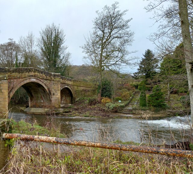
Situated in the northern part of the Yorkshire Dales National Park, Nettle Dale is characterized by its rolling green hills, lush meadows, and dense woodlands. The valley is crisscrossed by several clear streams and small rivers, adding to its charm. The landscape is dotted with vibrant wildflowers during the spring and summer months, creating a colorful carpet across the valley floor.

Nettle Dale is home to a diverse range of wildlife, including rare species of birds, mammals, and insects. Visitors may be lucky enough to spot red squirrels, roe deer, or even the elusive otter along the waterways. The valley's woodlands are also home to a variety of bird species, making it a haven for birdwatchers.

Hiking and walking trails are abundant in Nettle Dale, catering to all levels of fitness and ability. These trails meander through the valley, offering breathtaking views of the surrounding countryside and providing opportunities to explore the hidden gems of the area. Whether it's a leisurely stroll along the riverbanks or a challenging hike up to the valley's highest points, Nettle Dale offers something for everyone.

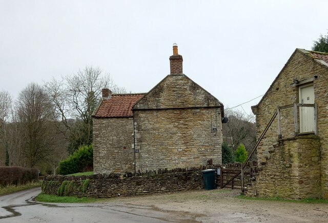
In addition to its natural beauty, Nettle Dale also boasts a rich historical and cultural heritage. There are several ancient sites and ruins scattered throughout the valley, including old stone farmhouses and prehistoric burial mounds, providing glimpses into the past.

Overall, Nettle Dale is a truly enchanting place, offering visitors a chance to immerse themselves in the beauty of Yorkshire's countryside and experience the peace and tranquility of this idyllic valley.

If you have any feedback on the listing, please let us know in the comments section below.
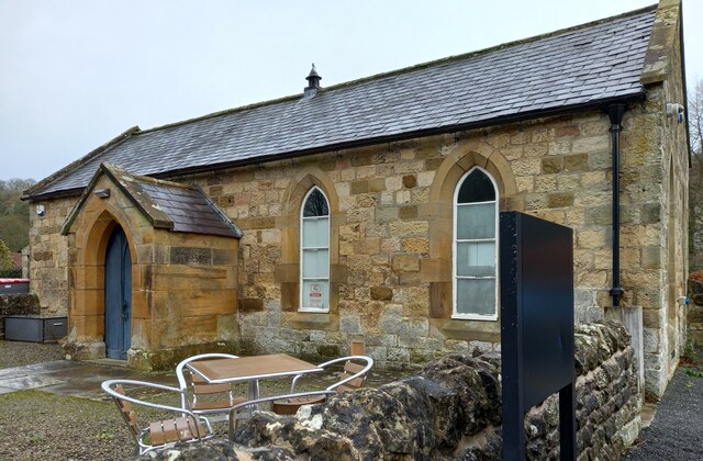
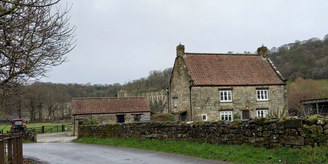
Nettle Dale Images

Images are sourced within 2km of 54.255577/-1.147176 or Grid Reference SE5584. Thanks to Geograph Open Source API. All images are credited.
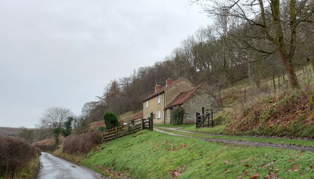
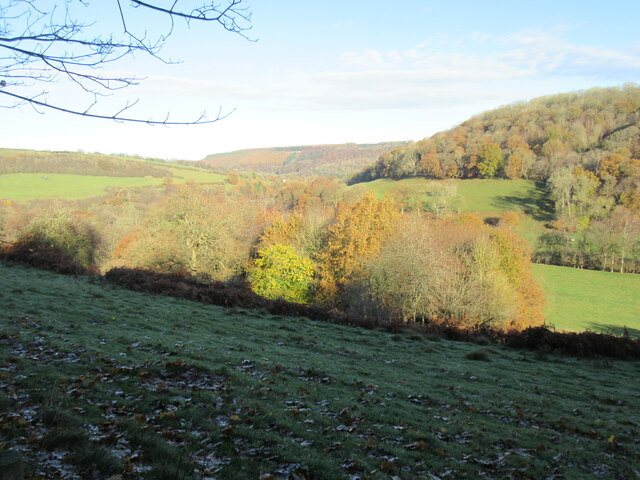
Far Hag Wood Looking NE across Ryedale.
Far Hag Wood
Looking NE across Ryedale.
Old Byland church The church in Old Byland.
Old Byland church
The church in Old Byland.
Bow Bridge Late 18th or early 19th century bridge. <span class="nowrap"><a title="https://historicengland.org.uk/listing/the-list/list-entry/1149190" rel="nofollow ugc noopener" href="https://historicengland.org.uk/listing/the-list/list-entry/1149190">Link</a><img style="margin-left:2px;" alt="External link" title="External link - shift click to open in new window" src="https://s1.geograph.org.uk/img/external.png" width="10" height="10"/></span>
Bow Bridge
Late 18th or early 19th century bridge. LinkExternal link
Footpath leading north from Clavery Ley lane
Rievaulx, old chapel The benchmark is cut into a right hand cornerstone adjacent to a wooden post. The building looks as if it may have been a chapel previously.
Rievaulx, old chapel
The benchmark is cut into a right hand cornerstone adjacent to a wooden post. The building looks as if it may have been a chapel previously.
Rievaulx, old chapel There is a benchmark cut into a right hand cornerstone adjacent to a wooden post. The building looks as if it may have been a chapel previously.
Rievaulx, old chapel
There is a benchmark cut into a right hand cornerstone adjacent to a wooden post. The building looks as if it may have been a chapel previously.
Rievaulx, Rye House There is a benchmark cut into a right cornerstone of the farmhouse. The picture shows a very clear horizontal cut line about 3 stone blocks up from ground level.
Rievaulx, Rye House
There is a benchmark cut into a right cornerstone of the farmhouse. The picture shows a very clear horizontal cut line about 3 stone blocks up from ground level.
Rievaulx, Rye House There is a benchmark cut into a right cornerstone of the gable end of the farmhouse. The cut mark is about 3 stone blocks up from ground level. Rievaulx Abbey can be seen in the background.
Rievaulx, Rye House
There is a benchmark cut into a right cornerstone of the gable end of the farmhouse. The cut mark is about 3 stone blocks up from ground level. Rievaulx Abbey can be seen in the background.
Rievaulx bridge The surveyors' bolt mark is on the north-east parapet of Rievaulx bridge, and is cut into the 2nd course of stone and at the apex of the bridge.
Rievaulx bridge
The surveyors' bolt mark is on the north-east parapet of Rievaulx bridge, and is cut into the 2nd course of stone and at the apex of the bridge.
Rievaulx bridge There is a surveyors' bolt mark on the north-east parapet of Rievaulx bridge, and is cut into the 2nd course of stone and at the centre of the bridge. This is the River Rye.
Rievaulx bridge
There is a surveyors' bolt mark on the north-east parapet of Rievaulx bridge, and is cut into the 2nd course of stone and at the centre of the bridge. This is the River Rye.
Rievaulx, Cross Green The benchmark is cut into a right hand cornerstone, to the right of the drainpipe.
Rievaulx, Cross Green
The benchmark is cut into a right hand cornerstone, to the right of the drainpipe.
Rievaulx, Cross Green There is a benchmark cut into a right hand cornerstone, on the front of the farmhouse and on the road facing wall.
Rievaulx, Cross Green
There is a benchmark cut into a right hand cornerstone, on the front of the farmhouse and on the road facing wall.
Rievaulx, Hagg Hall The benchmark is cut into the window sill of the property.
Rievaulx, Hagg Hall
The benchmark is cut into the window sill of the property.
Rievaulx, Hagg Hall There is a benchmark cut into the window sill of the property.
Rievaulx, Hagg Hall
There is a benchmark cut into the window sill of the property.
Head of Oxendale Small, steep sided offshoot of Ryedale. An inviting looking track [not a PRoW] heads down it, but doesn't reappear below on the road to Tylas Farm.
Head of Oxendale
Small, steep sided offshoot of Ryedale. An inviting looking track [not a PRoW] heads down it, but doesn't reappear below on the road to Tylas Farm.
View across Oxendale Oxendale is typical of many small but steep sided valleys that are found in the limestone hills along the southern side of the National Park.
View across Oxendale
Oxendale is typical of many small but steep sided valleys that are found in the limestone hills along the southern side of the National Park.
Tylas Barn Traditional stone built barn with a pantile roof. This is an old building which is named on the first edition OS map of 1853 as 'Tile House Barn', Tile House being the old name of the farm in the valley bottom. It's mid March and the sun is out, but cattle are still being fed within the barn and its yard.
Tylas Barn
Traditional stone built barn with a pantile roof. This is an old building which is named on the first edition OS map of 1853 as 'Tile House Barn', Tile House being the old name of the farm in the valley bottom. It's mid March and the sun is out, but cattle are still being fed within the barn and its yard.
Root crops and Ryedale A view from the plateau near Tylas Barn looking over the edge and down the dale towards Rievaulx Abbey, which can be seen centre left.
Root crops and Ryedale
A view from the plateau near Tylas Barn looking over the edge and down the dale towards Rievaulx Abbey, which can be seen centre left.
Show me another place!

Nettle Dale is located at Grid Ref: SE5584 (Lat: 54.255577, Lng: -1.147176)

Division: North Riding

Administrative County: North Yorkshire

District: Ryedale

Police Authority: North Yorkshire

What 3 Words

///fail.stem.mothering. Near Helmsley, North Yorkshire

Related Wikis

Old Byland and Scawton

Old Byland and Scawton is a civil parish in the Ryedale district, in the county of North Yorkshire, England. The parish includes the villages of Old Byland...

Scawton

Scawton is a village and former civil parish in North Yorkshire, England. The hamlet lies just east of Sutton Bank, north of the A170 road, and 5 miles...

Swiss Cottage, Rievaulx

Swiss Cottage is a Grade II listed building in the English village of Rievaulx, North Yorkshire. It dates to at least the 17th century, with earlier origins...

Rievaulx

Rievaulx (usually pronounced REE-voh) is a small village and civil parish in Rye Dale within the North York Moors National Park near Helmsley in North...

Rievaulx Abbey

Rievaulx Abbey ( ree-VOH) was a Cistercian abbey in Rievaulx, near Helmsley, in the North York Moors National Park, North Yorkshire, England. It was one...

Rievaulx Terrace

Rievaulx Terrace is a site located in the North York Moors National Park, in North Yorkshire, England, overlooking Rievaulx Abbey and owned by the National...

Cold Kirby

Cold Kirby is a village and civil parish in the Ryedale district of North Yorkshire, England. The population at the 2011 census (including Angram Grange...

Battle of Old Byland

The Battle of Old Byland (also known as the Battle of Byland Abbey, the Battle of Byland Moor and the Battle of Scotch Corner) was a significant encounter...

Related Videos

Walking Helmsley Castle to Rievaulx Abbey | with Frit Tam and Frankie Dewar

Join adventurers Frit Tam and Frankie Dewar as they explore the scenic Cleveland Way walk between Helmsley Castle and ...

Rievaulx Abbey Monastery: Video Tour | Solo Hiking

Cinematic Travel Video - Ancient Monastery Rievaulx Abbey 1131 - 1538 | North Yorkshire - UK | Solo Traveller Take a journey ...

Rievaulx Abbey - Yorkshire | Solo Hiking

Cinematic Travel Video - Ancient Monastery Rievaulx Abbey 1131 - 1538 | North Yorkshire - UK | Solo Traveller Take a journey ...

Rievaulx Abbey - North Yorkshire | Solo Traveler - Lets's explore the world together

Rievaulx Abbey - North Yorkshire Easy way to Sell Your Footage as Stock: https://wirestock.io?ref=papa.bear Get the same gear ...

Nearby Amenities

Located within 500m of 54.255577,-1.147176
Stocking House
Place: farm
Lat/Long: 54.2523091/-1.1477962
Information: guidepost
Tourism: information
Lat/Long: 54.2552794/-1.1543144
Information: guidepost
Tourism: information
Lat/Long: 54.2552012/-1.153705
Information: guidepost
Tourism: information
Lat/Long: 54.254134/-1.1480333
Information: route_marker
Tourism: information
Lat/Long: 54.2545457/-1.1485466
Ford: yes
Lat/Long: 54.2545433/-1.1481993
Ford: stepping_stones
Lat/Long: 54.2541874/-1.1481156
The data included in this document is from www.openstreetmap.org. The data is made available under ODbL.

Have you been to Nettle Dale?

Leave your review of Nettle Dale below (or comments, questions and feedback).