Calfpasture Dene

Valley in Durham

England

Calfpasture Dene

Shotton Hall, Peterlee, south frontage 18th to 19th century rebuild of earlier manor house, now used by Peterlee Town Council as offices, conference centre, function suites.
Shotton Hall, Peterlee, south frontage Credit: Peter Reynolds

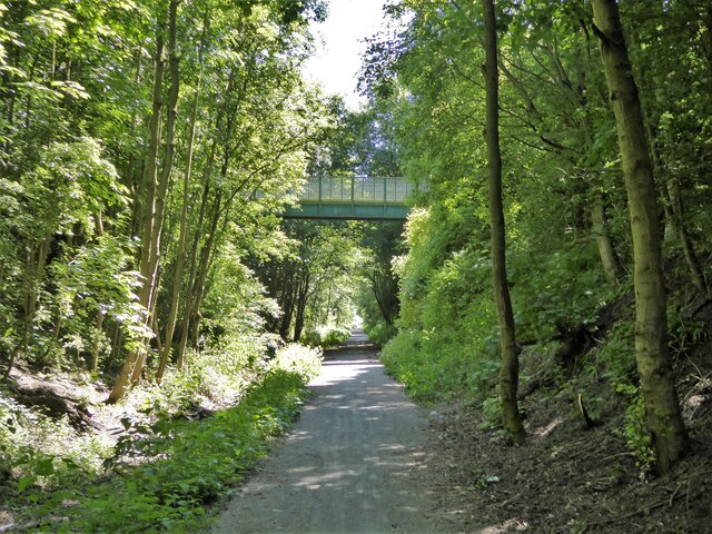
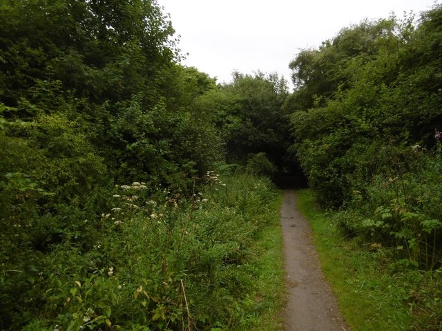
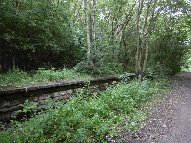
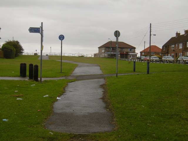
Calfpasture Dene, located in Durham, England, is a picturesque valley nestled within the Durham Dales. This tranquil and scenic area is characterized by rolling hills, lush greenery, and the winding River Wear that runs through the valley. Calfpasture Dene is a popular destination for hikers, nature lovers, and outdoor enthusiasts, offering a variety of walking and cycling trails that showcase the natural beauty of the area.

The valley is home to a diverse range of wildlife, including birds, mammals, and plant species, making it a haven for nature lovers and wildlife enthusiasts. The peaceful atmosphere of Calfpasture Dene provides a perfect escape from the hustle and bustle of city life, allowing visitors to relax and unwind in the serene surroundings.

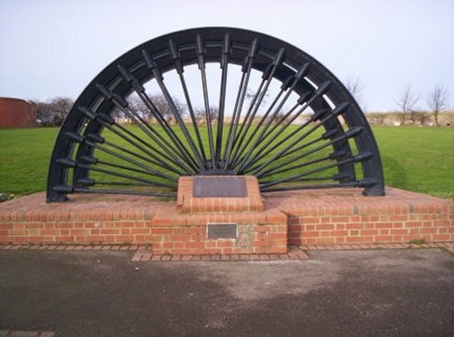
In addition to its natural beauty, Calfpasture Dene also has historical significance, with several historic sites and landmarks located within the valley. Overall, Calfpasture Dene is a peaceful and idyllic retreat that offers visitors a chance to connect with nature and enjoy the beauty of the Durham countryside.

If you have any feedback on the listing, please let us know in the comments section below.

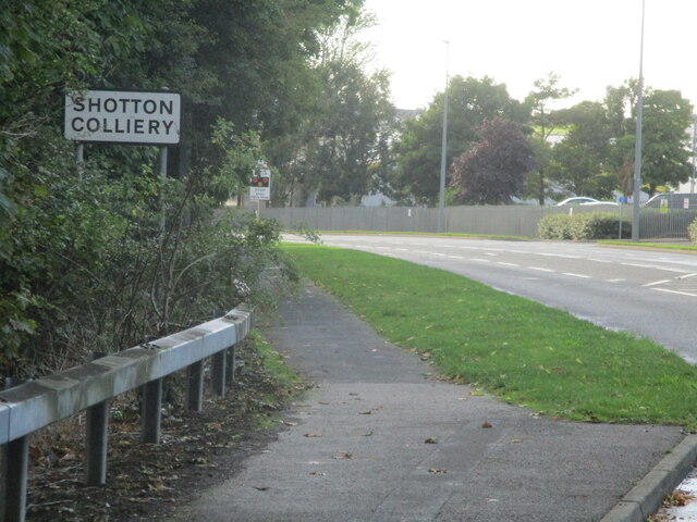
Calfpasture Dene Images

Images are sourced within 2km of 54.754404/-1.3743172 or Grid Reference NZ4040. Thanks to Geograph Open Source API. All images are credited.

Shotton Hall, Peterlee, south frontage 18th to 19th century rebuild of earlier manor house, now used by Peterlee Town Council as offices, conference centre, function suites.
Shotton Hall, Peterlee, south frontage
18th to 19th century rebuild of earlier manor house, now used by Peterlee Town Council as offices, conference centre, function suites.
North side of Shotton Hall, Peterlee
Shotton Recreation Ground Off Station Road
Shotton Recreation Ground
Off Station Road
Cycle path following route of former railway Approaching a high level footbridge that is the only link between two housing estates bisected by the former Hart to Haswell railway route
Cycle path following route of former railway
Approaching a high level footbridge that is the only link between two housing estates bisected by the former Hart to Haswell railway route
Shotton Colliery sign on Shotton road
Cutting, Shotton Colliery The Sunderland to Hartlepool Railway ran past Shotton Colliery in a long cutting.
Cutting, Shotton Colliery
The Sunderland to Hartlepool Railway ran past Shotton Colliery in a long cutting.
Shotton Bridge Station 1832-1952 on the Hartlepool Railway and Docks Railway.  It is in a deep cutting.
Shotton Bridge Station
1832-1952 on the Hartlepool Railway and Docks Railway. It is in a deep cutting.
Filled in cutting, Shotton Colliery The path emerges from the railway cutting into the light. The cutting has been filled in here.
Filled in cutting, Shotton Colliery
The path emerges from the railway cutting into the light. The cutting has been filled in here.
Hartlepool Railway and Dock Company Railway A cutting by Shotton Colliery.
Hartlepool Railway and Dock Company Railway
A cutting by Shotton Colliery.
Bridge Road: Return to the cutting There is no longer a bridge on Bridge Road, Shotton Colliery.  The cutting has been filled in.  Here the path returns back to the cutting to the south.
Bridge Road: Return to the cutting
There is no longer a bridge on Bridge Road, Shotton Colliery. The cutting has been filled in. Here the path returns back to the cutting to the south.
Footbridge over old railway cutting The railway cutting now has the Haswell to Hart cycleway and walkway passing through. The bridge connects the western and eastern parts of Shotton Colliery, the view being to the west.
Footbridge over old railway cutting
The railway cutting now has the Haswell to Hart cycleway and walkway passing through. The bridge connects the western and eastern parts of Shotton Colliery, the view being to the west.
Low walling beside Haswell to Hart route The Haswell to Hart cycle and walking route now follows the route of the old railway seen here. The low wall has the appearance of a railway platform and there's a ramp, typical of those at the end of platforms at its far end. Also, the location is just north of the road bridge carrying Station  Road.
Low walling beside Haswell to Hart route
The Haswell to Hart cycle and walking route now follows the route of the old railway seen here. The low wall has the appearance of a railway platform and there's a ramp, typical of those at the end of platforms at its far end. Also, the location is just north of the road bridge carrying Station Road.
Shotton Bridge railway station (site), County Durham Opened in 1863 by the North Eastern Railway on the line from Sunderland to Hartlepool via Haswell, this station closed to passengers in 1952.
View south east towards Thornley and Hartlepool, also Stockton. The south-bound platform was still extant to the left, when this image was taken. The platform buildings, northbound platform (to the right) and street-level building on the bridge had all long-since disappeared, and the track-bed had become a public footpath.
Shotton Bridge railway station (site), County Durham
Opened in 1863 by the North Eastern Railway on the line from Sunderland to Hartlepool via Haswell, this station closed to passengers in 1952. View south east towards Thornley and Hartlepool, also Stockton. The south-bound platform was still extant to the left, when this image was taken. The platform buildings, northbound platform (to the right) and street-level building on the bridge had all long-since disappeared, and the track-bed had become a public footpath.
Fir Tree Pub Situated in Wingate Co.Durham
Fir Tree Pub
Situated in Wingate Co.Durham
Closed filling station at Shotton Colliery There seem to be a very large number of filling stations closing up and down the country. Often they finish up as small housing estates. The Fleming public house in the background
Closed filling station at Shotton Colliery
There seem to be a very large number of filling stations closing up and down the country. Often they finish up as small housing estates. The Fleming public house in the background
Vandalised picnic site, Shotton Colliery On the Haswell to Hart Railway Path on the site of the old Thornley Station. The local youth seem to be intent on reducing all attempts at enhancing the local environment to ruin
Vandalised picnic site, Shotton Colliery
On the Haswell to Hart Railway Path on the site of the old Thornley Station. The local youth seem to be intent on reducing all attempts at enhancing the local environment to ruin
Haswell to Hart Railway Path, near Shotton Colliery Part of the National Cycle Network. A-frame access control in a vain attempt to keep motorcyclists off the path
Haswell to Hart Railway Path, near Shotton Colliery
Part of the National Cycle Network. A-frame access control in a vain attempt to keep motorcyclists off the path
Emblem of the Haswell and Hart Railway Path Seen at Bridge Road, Shotton Colliery
Emblem of the Haswell and Hart Railway Path
Seen at Bridge Road, Shotton Colliery
Show me another place!

Calfpasture Dene is located at Grid Ref: NZ4040 (Lat: 54.754404, Lng: -1.3743172)

Unitary Authority: County Durham

Police Authority: Durham

What 3 Words

///dizzy.song.music. Near Peterlee, Co. Durham

Related Wikis

Old Shotton

Old Shotton is a village in the parish of Shotton, County Durham, England, The village once lay on the route of the A19, before its bypass to the west...

Thornley railway station

Thornley railway station served the village of Thornley, County Durham, England, from 1858 to 1952 on the Hartlepool Dock and Railway. == History == The...

Shotton Hall

Shotton Hall is a Grade II listed building, formerly a mansion house, now operated by Peterlee Town Council as offices and a conference centre. == History... ==

Shotton Colliery

Shotton Colliery is a village in County Durham, England, situated north west of Peterlee. The two villages in the parish of Shotton are Old Shotton, a...

Nearby Amenities

Located within 500m of 54.754404,-1.3743172
Bus Stop
Turning Circle
Bench: yes
Naptan AtcoCode: 13003264D
Naptan Bearing: SE
Naptan CommonName: Turning Circle
Naptan Indicator: Shelter
Naptan Landmark: Turning circle shelter
Naptan NaptanCode: durapjwp
Naptan Street: Bracken Hill
Naptan Verified: no
Public Transport: platform
Shelter: yes
Source: naptan_import
Lat/Long: 54.7535596/-1.3688282
Barrier: cycle_barrier
Lat/Long: 54.7560172/-1.3700238
Barrier: block
Lat/Long: 54.7560219/-1.3698774
Barrier: stile
Foot: yes
Lat/Long: 54.7572501/-1.3762252
Barrier: stile
Foot: yes
Lat/Long: 54.7555112/-1.3760634
Barrier: stile
Foot: yes
Lat/Long: 54.7554793/-1.3760707
Barrier: stile
Foot: yes
Lat/Long: 54.7539637/-1.3760047
Barrier: stile
Foot: yes
Lat/Long: 54.7531786/-1.3759313
Crossing
Crossing: unmarked
Lat/Long: 54.7535086/-1.3688815
Bus: yes
Public Transport: stop_position
Lat/Long: 54.7535501/-1.3689117
Crossing
Crossing: unmarked
Lat/Long: 54.7535904/-1.3693691
Barrier: lift_gate
Lat/Long: 54.7547128/-1.3706685
Barrier: lift_gate
Lat/Long: 54.755149/-1.3695151
Big Paws K9
Fixme: Add tags or delete
Lat/Long: 54.7570261/-1.3738568
Generator Method: photovoltaic
Generator Output Electricity: yes
Generator Source: solar
Generator Type: solar_photovoltaic_panel
Location: roof
Power: generator
Lat/Long: 54.7553685/-1.3705766
Generator Method: photovoltaic
Generator Output Electricity: yes
Generator Source: solar
Generator Type: solar_photovoltaic_panel
Location: roof
Power: generator
Lat/Long: 54.7572057/-1.3765982
Generator Method: photovoltaic
Generator Output Electricity: yes
Generator Source: solar
Generator Type: solar_photovoltaic_panel
Location: roof
Power: generator
Lat/Long: 54.7572405/-1.3764748
Edder Acres
Addr City: Durham
Addr Postcode: DH6 2QB
Place: farm
Source Name: OS_OpenData_StreetView
Source Postcode: CodePoint Open
Lat/Long: 54.7513362/-1.3766062
The data included in this document is from www.openstreetmap.org. The data is made available under ODbL.

Have you been to Calfpasture Dene?

Leave your review of Calfpasture Dene below (or comments, questions and feedback).