Vale of Mowbray

Valley in Yorkshire Hambleton

England

Vale of Mowbray

Wensleydale Railway level crossing for farm track north of Morton-on-Swale
Wensleydale Railway level crossing for farm track north of Morton-on-Swale Credit: Luke Shaw

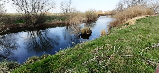
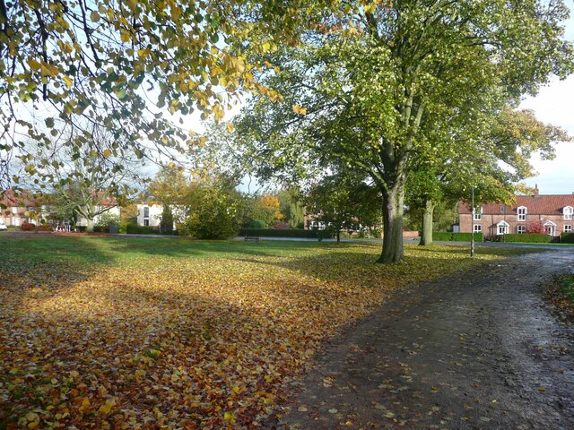
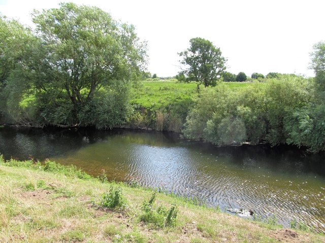
The Vale of Mowbray is a picturesque valley located in North Yorkshire, England. Situated between the Hambleton Hills to the west and the Cleveland Hills to the east, the valley is known for its stunning natural beauty and lush green landscapes.

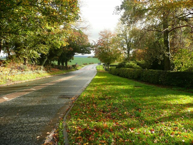
The Vale of Mowbray is home to several small villages and hamlets, including Thirsk, Northallerton, and Bedale. These charming rural communities offer a peaceful and tranquil atmosphere, making the valley a popular destination for those looking to escape the hustle and bustle of city life.

The area is also renowned for its agricultural heritage, with many farms producing high-quality produce such as beef, lamb, and dairy products. The fertile soil and mild climate of the valley make it an ideal location for farming, and the rolling hills provide a stunning backdrop to the pastoral scenery.

Visitors to the Vale of Mowbray can enjoy a range of outdoor activities, including hiking, cycling, and birdwatching. The valley is also home to several historic sites and attractions, such as the ruins of Jervaulx Abbey and the picturesque market town of Thirsk.

Overall, the Vale of Mowbray is a hidden gem in the heart of Yorkshire, offering visitors a peaceful and idyllic retreat amidst the natural beauty of the countryside.

If you have any feedback on the listing, please let us know in the comments section below.

Vale of Mowbray Images

Images are sourced within 2km of 54.319307/-1.5041363 or Grid Reference SE3291. Thanks to Geograph Open Source API. All images are credited.

Wensleydale Railway level crossing for farm track north of Morton-on-Swale
Stream heading for River Swale SW of Thrintoft
Culvert for Mill Beck under earth bank
River Swale west of Thrintoft
Milepost on NE side on A684 on the Green at Ainderby Steeple The milepost has Milestone Society National ID: YN_NALb03
Milepost on NE side on A684 on the Green at Ainderby Steeple
The milepost has Milestone Society National ID: YN_NALb03
Milepost, litter bin, bench and crocus on the village green <a href="https://www.geograph.org.uk/photo/7126031">SE3392 : Milepost on NE side on A684 on the Green at Ainderby Steeple</a> is a closeup of the milepost
Milepost, litter bin, bench and crocus on the village green
The village green, Ainderby Steeple
Hall Cottages, Ainderby Steeple
Bus shelter and mile post The mile post is unusual in that it is not fastened to a pillar of stone or concrete.
Bus shelter and mile post
The mile post is unusual in that it is not fastened to a pillar of stone or concrete.
The Wellington Heifer, Ainderby Steeple The inn sign shows a large 'beefy' heifer.
The Wellington Heifer, Ainderby Steeple
The inn sign shows a large 'beefy' heifer.
The road leaving the village, Ainderby Steeple
Old milepost This milepost on the village green on the A684 in Ainderby Steeple has had a chequered career in the last few years.   Leaning and uncared for it was removed about 2010 and still not reset in 2013.   By 2020 it was found in situ but needed painting.  In August 2023 it was seen painted white all over and later that month the black lettering had been done.   There are only two or three of this particular design in the whole of North Yorkshire.   It is Grade II listed 1150973.
Old milepost
This milepost on the village green on the A684 in Ainderby Steeple has had a chequered career in the last few years. Leaning and uncared for it was removed about 2010 and still not reset in 2013. By 2020 it was found in situ but needed painting. In August 2023 it was seen painted white all over and later that month the black lettering had been done. There are only two or three of this particular design in the whole of North Yorkshire. It is Grade II listed 1150973.
The Swirling Swale By the river south of Morton Bridge, as it meanders through the Vale of Mowbray
The Swirling Swale
By the river south of Morton Bridge, as it meanders through the Vale of Mowbray
Grassy Bank beside the River Swale The Swale south of Morton Bridge
Grassy Bank beside the River Swale
The Swale south of Morton Bridge
View across the Swale At this point the Swale meanders briefly into this grid square on its slow journey through the Vale of Mowbray. Not the easiest square to take photos in as there's no public path on this left bank, whilst much of the right bank is MOD land.
View across the Swale
At this point the Swale meanders briefly into this grid square on its slow journey through the Vale of Mowbray. Not the easiest square to take photos in as there's no public path on this left bank, whilst much of the right bank is MOD land.
Fairholme Lane A tarmacked lane that runs south from Morton on Swale to the farms of Fairholme and Far Fairholme. This is a private road but also a public bridleway.
Fairholme Lane
A tarmacked lane that runs south from Morton on Swale to the farms of Fairholme and Far Fairholme. This is a private road but also a public bridleway.
New housing, Morton on Swale I last took a photograph of this site in 2007 when it was the location for Morton Auto Services. Now it is one of three development sites in this village where new housing is filling in gaps.
New housing, Morton on Swale
I last took a photograph of this site in 2007 when it was the location for Morton Auto Services. Now it is one of three development sites in this village where new housing is filling in gaps.
River Swale South of Morton Bridge
Show me another place!

Vale of Mowbray is located at Grid Ref: SE3291 (Lat: 54.319307, Lng: -1.5041363)

Division: North Riding

Administrative County: North Yorkshire

District: Hambleton

Police Authority: North Yorkshire

What 3 Words

///upholds.hypocrite.truckload. Near Northallerton, North Yorkshire

Nearby Locations

Vale of Mowbray

Related Wikis

Morton-on-Swale

Morton-on-Swale is a large village and civil parish in the Hambleton district of North Yorkshire, England. It lies on the A684 road about 4 miles west...

Ainderby railway station

Ainderby railway station was a railway station serving the villages of Ainderby Steeple and Morton-on-Swale in North Yorkshire, England. == History... ==

Ainderby Steeple

Ainderby Steeple is a village and civil parish in North Yorkshire, England. Ainderby Steeple is situated on the A684 approximately 2.6 miles (4.2 km) south...

St Helen's Church, Ainderby Steeple

St Helen's Church, Ainderby Steeple is a Grade I listed parish church in the Church of England: 56  in Ainderby Steeple, North Yorkshire. == History... ==

Nearby Amenities

Located within 500m of 54.319307,-1.5041363
Morton-on-Swale
Alt Name: Morton upon Swale
Place: village
Source: npe
Wikidata: Q2156374
Wikipedia: en:Morton-on-Swale
Lat/Long: 54.3226271/-1.4991726
Barrier: stile
Lat/Long: 54.3156877/-1.5012913
Barrier: stile
Lat/Long: 54.3183808/-1.5010169
Barrier: stile
Lat/Long: 54.3206333/-1.5109285
Post Box
Brand: Royal Mail
Brand Wikidata: Q638098
Brand Wikipedia: en:Royal Mail
Operator: Royal Mail
Operator Wikidata: Q638098
Post Box Type: lamp
Ref: DL7 7
Lat/Long: 54.3222147/-1.5006076
Bus Stop
Bench: no
Bus: yes
Covered: no
Public Transport: platform
Shelter: no
Lat/Long: 54.321648/-1.5061073
Bus Stop
Bench: yes
Bus: yes
Covered: yes
Naptan AtcoCode: 3200YNA01628
Naptan NaptanCode: 32001628
Public Transport: platform
Lat/Long: 54.3226675/-1.4994024
R White
Shop: butcher
Lat/Long: 54.3219354/-1.501597
Bench
Bench round tree
Backrest: no
Lat/Long: 54.3216116/-1.498705
Bus Stop
Bench: no
Bus: yes
Covered: no
Naptan AtcoCode: 3200YNA90789
Naptan NaptanCode: 32090789
Public Transport: platform
Shelter: no
Lat/Long: 54.3217313/-1.5036972
Premier Express
Addr Housename: Village Store
Brand: Premier
Brand Wikidata: Q7240340
Brand Wikipedia: en:Premier Stores
Shop: convenience
Website: https://www.premier-stores.co.uk/our-stores/village-store-4
Lat/Long: 54.3222045/-1.5005483
Generator Method: photovoltaic
Generator Output Electricity: yes
Generator Source: solar
Generator Type: solar_photovoltaic_panel
Location: roof
Power: generator
Lat/Long: 54.3222401/-1.5065397
Generator Method: photovoltaic
Generator Output Electricity: yes
Generator Source: solar
Generator Type: solar_photovoltaic_panel
Location: roof
Power: generator
Lat/Long: 54.3222535/-1.5064057
Generator Method: photovoltaic
Generator Output Electricity: yes
Generator Source: solar
Generator Type: solar_photovoltaic_panel
Location: roof
Power: generator
Lat/Long: 54.3222688/-1.5062686
The data included in this document is from www.openstreetmap.org. The data is made available under ODbL.

Have you been to Vale of Mowbray?

Leave your review of Vale of Mowbray below (or comments, questions and feedback).