Bradshaw Clough

Valley in Yorkshire

England

Bradshaw Clough

Hordron, near Langsett, lots of heather
Hordron, near Langsett, lots of heather Credit: Dave Pickersgill

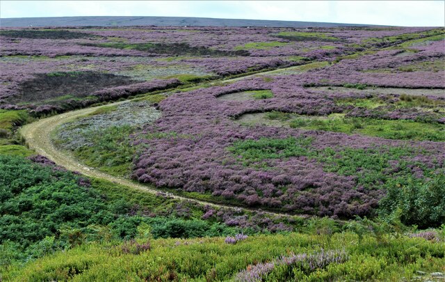
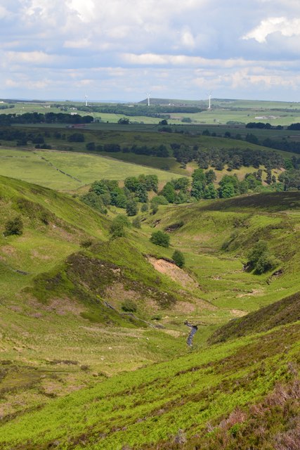
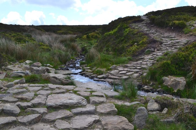
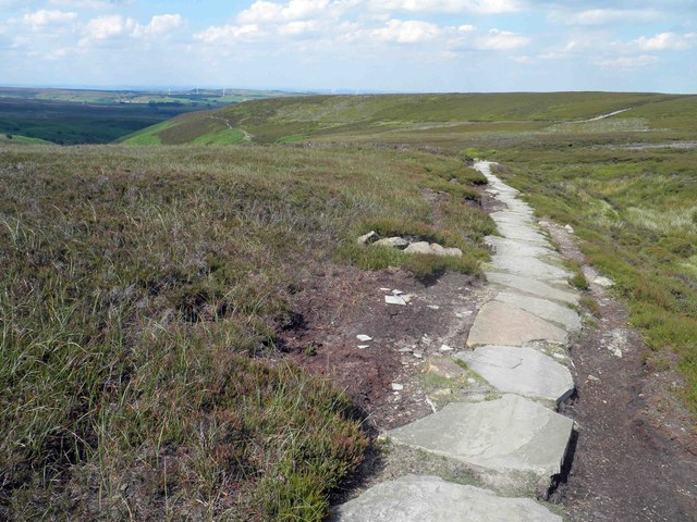
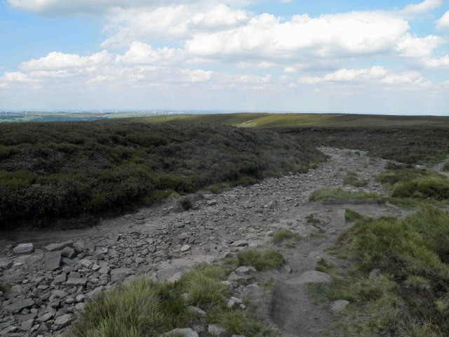
Bradshaw Clough is a picturesque valley located in Yorkshire, England. Situated in the southern part of the county, it is known for its stunning natural beauty and tranquil atmosphere. The valley is named after the Bradshaw Clough stream that flows through it, adding to the charm of the surrounding landscape.

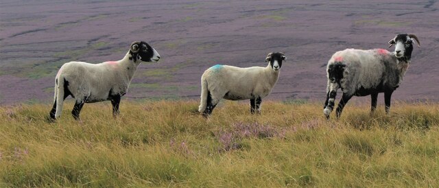
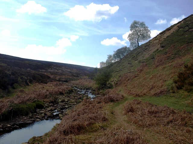
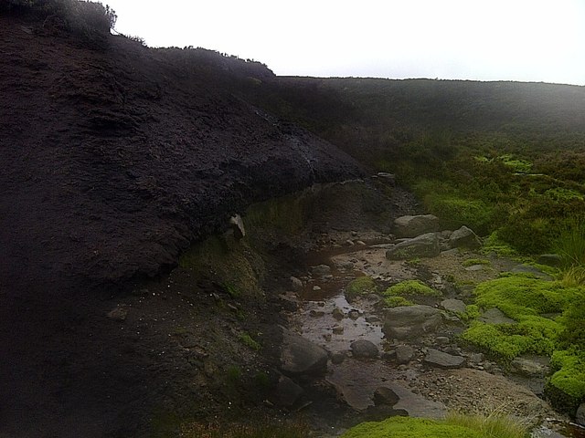
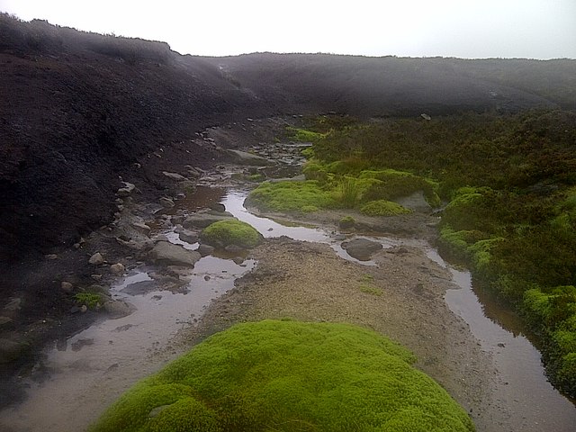
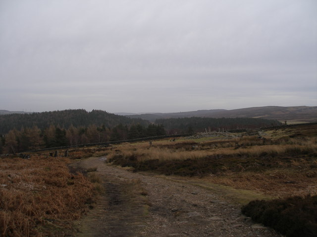
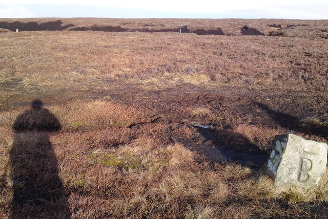
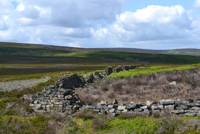
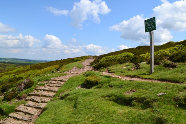
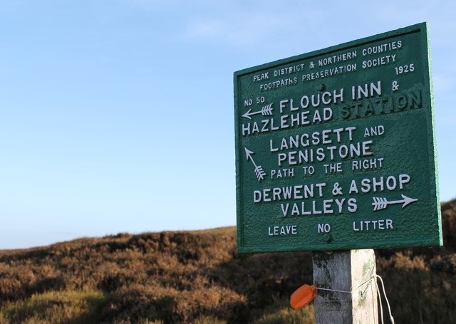
The valley is characterized by rolling hills, lush green meadows, and a variety of flora and fauna. It is home to numerous walking trails and footpaths, making it a popular destination for hikers and nature enthusiasts. The area offers breathtaking views of the surrounding countryside, with its vibrant colors changing throughout the seasons.

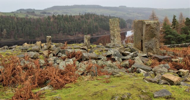
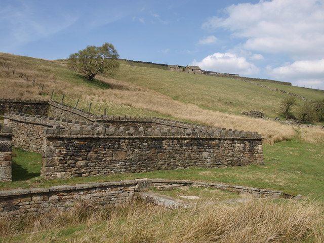
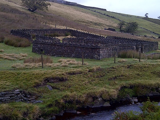
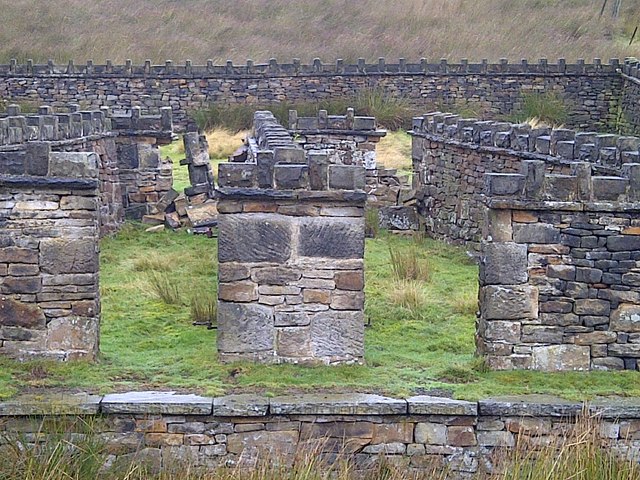
Bradshaw Clough is also notable for its historical significance. The valley is dotted with remnants of its industrial past, including old mills and abandoned farmhouses. These structures serve as a reminder of Yorkshire's rich heritage and the region's contribution to the industrial revolution.

In addition to its natural and historical attractions, the valley boasts a vibrant community. The nearby villages of Bradshaw and Clough provide amenities such as quaint pubs, small shops, and charming bed and breakfast accommodations for visitors to enjoy.

Overall, Bradshaw Clough offers a tranquil escape from the hustle and bustle of city life. With its stunning scenery, rich history, and welcoming community, it is a must-visit destination for those seeking a peaceful retreat in the heart of Yorkshire.

If you have any feedback on the listing, please let us know in the comments section below.

Bradshaw Clough Images

Images are sourced within 2km of 53.488288/-1.721314 or Grid Reference SK1899. Thanks to Geograph Open Source API. All images are credited.

Hordron, near Langsett, lots of heather
Sheep on the moors
Sheep on the moors
The ruins of North America The ruins of North America above Langsett Reservoir. In the nineteenth century, outlying farms were often named after far-away places.
The ruins of North America
The ruins of North America above Langsett Reservoir. In the nineteenth century, outlying farms were often named after far-away places.
Looking back The Little Don valley in this area is a lovely area to walk. There are paths everywhere, none of which are marked on the OS Maps. Like any area you need to know where the paths are from experience.
Looking back
The Little Don valley in this area is a lovely area to walk. There are paths everywhere, none of which are marked on the OS Maps. Like any area you need to know where the paths are from experience.
Quality Stonework The sheep pen and dip in the foreground are stunning in their construction. There is another, almost identical one near Hazlehead on by the Trans Pennine Trail in Wogden Clough (GR.SE183027). It is a shame that Hordron Farm in the background is disused and starting to decay.
Quality Stonework
The sheep pen and dip in the foreground are stunning in their construction. There is another, almost identical one near Hazlehead on by the Trans Pennine Trail in Wogden Clough (GR.SE183027). It is a shame that Hordron Farm in the background is disused and starting to decay.
Harden Grough Fair sized grough east of Outer Edge that drains off Harden Moss into Harden Clough. There is path that runs down and alongside Harden Clough but it's not shown on maps.
Harden Grough
Fair sized grough east of Outer Edge that drains off Harden Moss into Harden Clough. There is path that runs down and alongside Harden Clough but it's not shown on maps.
Sheepfold on the River Porter (Little Don River) Beautiful stonework
Sheepfold on the River Porter (Little Don River)
Beautiful stonework
Sheepfold on the River Porter (Little Don River) Beautiful stonework
Sheepfold on the River Porter (Little Don River)
Beautiful stonework
On the way to North America
Boundary stones  at top of Harden Clough These look quite old so pre-date the establishment of South Yorkshire. They seem to stand on the current boundary of Sheffield and Barnsley, although I suspect they originally marked either a parish or landowner's boundary.
Boundary stones at top of Harden Clough
These look quite old so pre-date the establishment of South Yorkshire. They seem to stand on the current boundary of Sheffield and Barnsley, although I suspect they originally marked either a parish or landowner's boundary.
Old boundary walls west of Calf Knoll
Junction of paths - Mickleden Edge
The Mickleden Valley
Cut Gate Path crosses a short ford
Path sign on Mickleden Edge Path sign on Mickleden Edge. Hazlehead Station is long closed.
Path sign on Mickleden Edge
Path sign on Mickleden Edge. Hazlehead Station is long closed.
Cut gate path paved section A rocky and at times muddy historic crossing from Penistone to the Derwent Valley.
Cut gate path paved section
A rocky and at times muddy historic crossing from Penistone to the Derwent Valley.
A dry Cut Gate bridleway near Lost Lad
Show me another place!

Bradshaw Clough is located at Grid Ref: SK1899 (Lat: 53.488288, Lng: -1.721314)

Division: West Riding

Unitary Authority: Sheffield

Police Authority: South Yorkshire

What 3 Words

///attracts.fabric.august. Near Penistone, South Yorkshire

Related Wikis

Langsett Reservoir

Langsett Reservoir is in Yorkshire, England, near the villages of Langsett and Upper Midhope, on the edge of the Peak District National Park. The reservoir...

Langsett

Langsett is a village and civil parish near Penistone in South Yorkshire. It lies near the southern edge of the Metropolitan Borough of Barnsley and on...

Upper Midhope

Upper Midhope (archaic Over Midhope) is a village in the civil parish of Bradfield within the Stocksbridge and Upper Don electoral ward in the borough...

Margery Hill

Margery Hill is a 546-metre (1,791 ft) hill on the Howden Moors in South Yorkshire, England. It lies towards the northern boundary of the Peak District...

Dunford Bridge

Dunford Bridge is a remote hamlet in the civil parish of Dunford, lying northwest of Sheffield in South Yorkshire, England, 1.3 miles (2 km) from the...

Hazlehead Bridge railway station

Hazlehead Bridge railway station was a railway station on the Sheffield, Ashton-under-Lyne and Manchester Railway's Woodhead Line. It served villages scattered...

Dunford Bridge railway station

Dunford Bridge railway station was a railway station that served the village of Dunford Bridge on the Sheffield, Ashton-under-Lyne and Manchester Railway...

Carlecotes

Carlecotes is a village in the metropolitan borough of Barnsley in South Yorkshire, England. Carlecotes is within Dunford civil parish. The village is...

Nearby Amenities

Located within 500m of 53.488288,-1.721314
The data included in this document is from www.openstreetmap.org. The data is made available under ODbL.

Have you been to Bradshaw Clough?

Leave your review of Bradshaw Clough below (or comments, questions and feedback).