Broadwater Bottom
Valley in Gloucestershire Cotswold
England
Broadwater Bottom

Broadwater Bottom is a picturesque valley located in the county of Gloucestershire, England. Nestled between the Cotswold Hills and the River Severn, this idyllic valley is renowned for its natural beauty and serene atmosphere.
The valley is characterized by rolling hills and lush green meadows, dotted with charming villages and hamlets. The landscape is dominated by the meandering River Frome, which adds to the scenic charm of the area. The river provides a source of livelihood for local fishermen and is a popular spot for recreational activities such as fishing, boating, and picnicking.
Broadwater Bottom is also home to a rich variety of flora and fauna. The valley's fertile soil supports an abundance of wildflowers, creating a vibrant tapestry of colors during the spring and summer months. The woodlands that surround the valley provide a habitat for a diverse range of animal species, including badgers, foxes, and various bird species.
The valley is steeped in history, with evidence of human habitation dating back to the Neolithic period. Archaeological sites, such as burial mounds and ancient settlements, can be found in the surrounding area. The valley also boasts several historic buildings, including traditional cottages and farmhouses, which add to the charm and character of the landscape.
Broadwater Bottom offers a tranquil retreat for visitors seeking a peaceful escape from the hustle and bustle of city life. Whether it's exploring the scenic countryside, enjoying outdoor activities, or immersing oneself in the rich history of the area, this valley has something to offer for everyone.
If you have any feedback on the listing, please let us know in the comments section below.
Broadwater Bottom Images
Images are sourced within 2km of 51.855619/-1.8033599 or Grid Reference SP1317. Thanks to Geograph Open Source API. All images are credited.


![Seven ways to go [1] The road junction is near the wonderfully named Gom&#039;s Hole, a small pond. There are 7 ways to go from the junction, three roads, two footpaths, a restricted byway and a driveway. This is the driveway which leads to Hill Barn.](https://s3.geograph.org.uk/geophotos/05/77/85/5778515_014015d1.jpg)
![Seven ways to go [2] The road junction is near the wonderfully named Gom&#039;s Hole, a small pond. There are 7 ways to go from the junction, three roads, two footpaths, a restricted byway and a driveway. This is one of the footpaths, part of the Monarch&#039;s Way long distance path, and it leads to Farmington.](https://s2.geograph.org.uk/geophotos/05/77/89/5778946_e23f0bb7.jpg)
![Seven ways to go [3] The road junction is near the wonderfully named Gom&#039;s Hole, a small pond. There are 7 ways to go from the junction, three roads, two footpaths, a restricted byway and a driveway. This is the restricted byway, part of the Sabrina Way a long distance path which runs from Great Barrington in Gloucestershire through five counties to Derbyshire, and will provide a link between the Ridgeway and the Pennine Bridleway.](https://s0.geograph.org.uk/geophotos/05/77/89/5778948_ecae430d.jpg)
![Seven ways to go [4] The road junction is near the wonderfully named Gom&#039;s Hole, a small pond. There are 7 ways to go from the junction, three roads, two footpaths, a restricted byway and a driveway. This is the road which leads to Bourton-on-the-Water.](https://s1.geograph.org.uk/geophotos/05/77/89/5778949_5ed072a2.jpg)
![Seven ways to go [5] The road junction is near the wonderfully named Gom&#039;s Hole, a small pond. There are 7 ways to go from the junction, three roads, two footpaths, a restricted byway and a driveway. This is one of the footpaths, part of the Monarch&#039;s Way long distance path, and it leads to Clapton-on-the-Hill and Bourton-on-the-Water.](https://s0.geograph.org.uk/geophotos/05/77/89/5778952_15a7c609.jpg)
![Seven ways to go [6] The road junction is near the wonderfully named Gom&#039;s Hole, a small pond. There are 7 ways to go from the junction, three roads, two footpaths, a restricted byway and a driveway. This is the road which leads to Clapton-on-the-Hill and Sherbourne.](https://s3.geograph.org.uk/geophotos/05/77/89/5778955_61ac08c0.jpg)
![Seven ways to go [7] The road junction is near the wonderfully named Gom&#039;s Hole, a small pond. There are 7 ways to go from the junction, three roads, two footpaths, a restricted byway and a driveway. This is the road which leads to Farmington.](https://s0.geograph.org.uk/geophotos/05/77/89/5778956_1ffe57da.jpg)


Broadwater Bottom is located at Grid Ref: SP1317 (Lat: 51.855619, Lng: -1.8033599)
Administrative County: Gloucestershire
District: Cotswold
Police Authority: Gloucestershire
What 3 Words
///downward.indulgent.rating. Near Northleach, Gloucestershire
Nearby Locations
Related Wikis
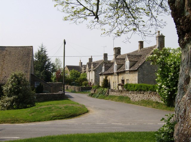
Farmington, Gloucestershire
Farmington is a village located in the county of Gloucestershire, in England. As of 2011 the village had 112 residents. It is mentioned in the Domesday...

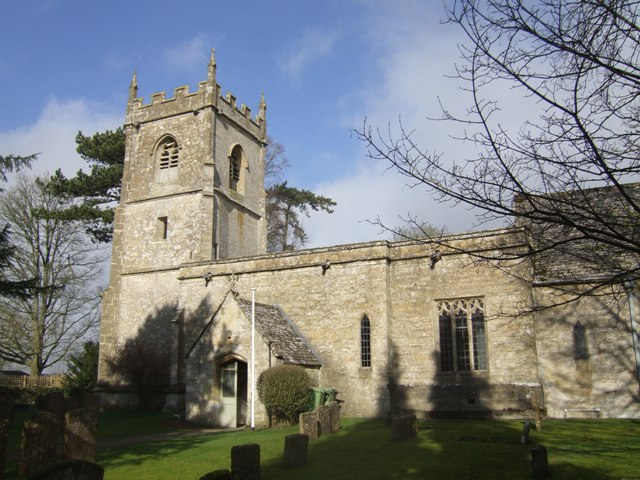
Church of St Peter, Farmington
The Anglican Church of St Peter at Farmington in the Cotswold District of Gloucestershire, England was built in the 12th century. It is a grade I listed...
Cold Aston
Cold Aston (also known as Aston Blank) is a village and civil parish in Gloucestershire, England, approximately 18 miles (29 km) to the east of Gloucester...
Church of St Andrew, Cold Aston
The Anglican St Andrew's Church at Cold Aston in the Cotswold District of Gloucestershire, England was built in the 12th century. It is a grade I listed...

Clapton, Gloucestershire
Clapton, also known as Clapton-on-the-Hill, is a small village and civil parish in the district of Cotswold, in the county of Gloucestershire, England...

Turkdean
Turkdean is a village and civil parish in Gloucestershire, England, approximately 30 km (19 mi) to the east of Gloucester. It lies in the Cotswolds, an...

Church of All Saints, Turkdean
The Anglican Church of All Saints at Turkdean in the Cotswold District of Gloucestershire, England was built in the 12th century. It is a grade I listed...

RAF Northleach
Royal Air Force Northleach or more simply RAF Northleach is a former Royal Air Force satellite airfield near the Cotswold town of Northleach, Gloucestershire...
Related Videos
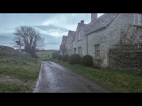
A Damp & Dark Morning Walk Through a Cotswold Village & Countryside || ENGLAND
So, today we are out and about walking in the Cotswold village of Farmington which is located in Gloucestershire, England.
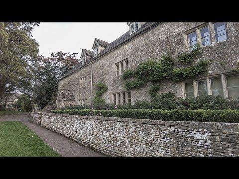
A Morning Walk and a Close Encounter of the Bird Kind in a Village | Cotswolds
So, today we are out and about walking in the Cotswold village & civil parish of Cold Aston which is located in Gloucestershire, ...
Nearby Amenities
Located within 500m of 51.855619,-1.8033599Have you been to Broadwater Bottom?
Leave your review of Broadwater Bottom below (or comments, questions and feedback).