Colsterdale

Valley in Yorkshire Harrogate

England

Colsterdale

Spruce Gill Beck Moorland stream that flows beneath Gollinglith Ridge, before entering the River Burn
Spruce Gill Beck Credit: Chris Heaton

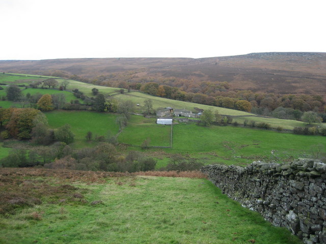
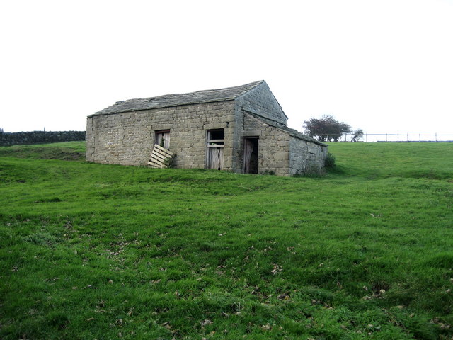
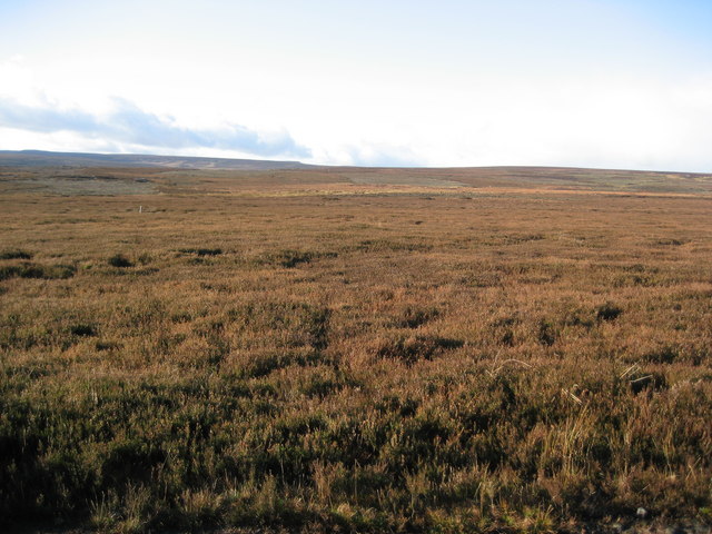
Colsterdale is a picturesque valley located in the county of Yorkshire, England. Situated in the Nidderdale Area of Outstanding Natural Beauty, this rural haven is renowned for its stunning landscapes and tranquil atmosphere. The valley is nestled between the North York Moors to the east and the Yorkshire Dales National Park to the west, making it an ideal destination for nature enthusiasts and outdoor enthusiasts alike.

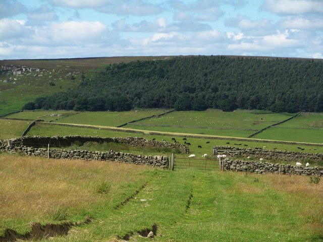
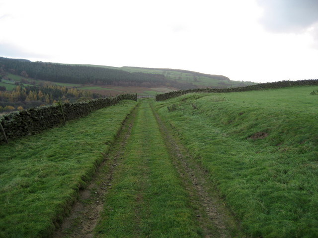
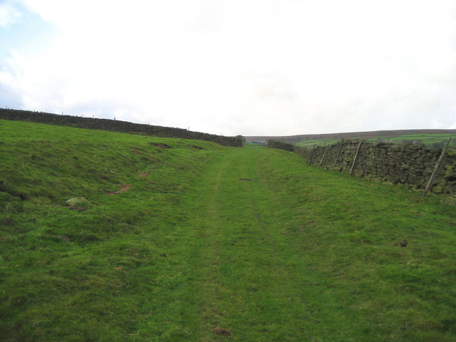
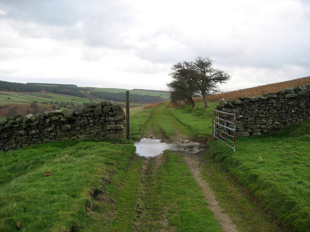
Colsterdale is characterized by its rolling hills, dense woodlands, and meandering streams. The valley is home to an abundance of wildlife, including deer, birds of prey, and the elusive red squirrel. The area is also dotted with several reservoirs, such as Gouthwaite Reservoir and Scar House Reservoir, which not only provide a scenic backdrop but also offer opportunities for fishing and water activities.

Visitors to Colsterdale can enjoy a variety of outdoor pursuits, including hiking, cycling, and horse riding. There are numerous trails and paths that crisscross the valley, providing breathtaking views at every turn. One popular route is the Nidderdale Way, a long-distance footpath that passes through Colsterdale, allowing visitors to explore the valley and its surrounding countryside.

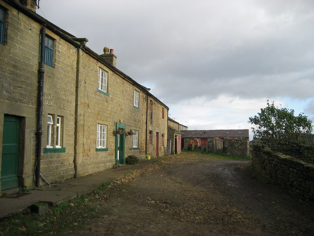
Despite its rural charm, Colsterdale is easily accessible by road, with the town of Masham located just a short drive away. Masham offers a range of amenities, including shops, pubs, and accommodation options, making it a convenient base for exploring the valley.

In conclusion, Colsterdale is a hidden gem in Yorkshire, offering visitors a chance to escape the hustle and bustle of everyday life and immerse themselves in the beauty of nature. With its stunning landscapes and diverse wildlife, this valley is a must-visit destination for anyone seeking a peaceful retreat in the heart of Yorkshire.

If you have any feedback on the listing, please let us know in the comments section below.
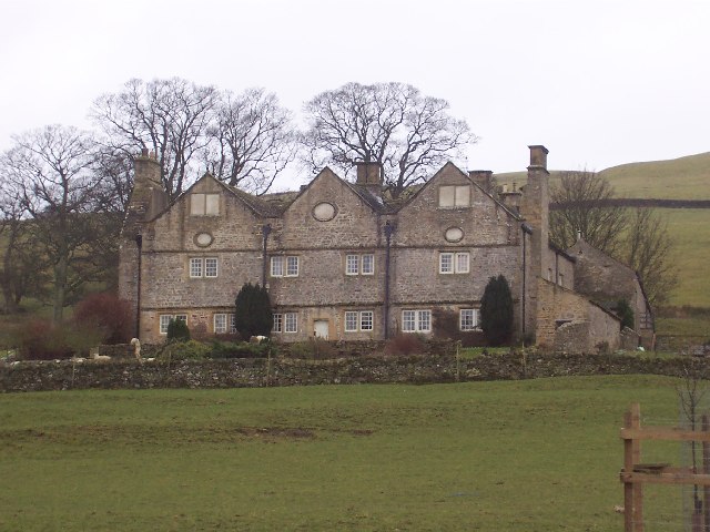
Colsterdale Images

Images are sourced within 2km of 54.224476/-1.8020767 or Grid Reference SE1380. Thanks to Geograph Open Source API. All images are credited.

Spruce Gill Beck Moorland stream that flows beneath Gollinglith Ridge, before entering the River Burn
Spruce Gill Beck
Moorland stream that flows beneath Gollinglith Ridge, before entering the River Burn
Hambleton Litch Long straight track over moorland near Gollinglith
Hambleton Litch
Long straight track over moorland near Gollinglith
Weathered Rocks Wind has eroded these rocks into peculiar shapes high above the chasm that contains Spruce Gill Beck
Weathered Rocks
Wind has eroded these rocks into peculiar shapes high above the chasm that contains Spruce Gill Beck
Marginal land at Towler Hill Rough grazing and sheep pasture close to Towler Hill farm. The view is north towards West Agra Plantation overlooking Colsterdale.
Marginal land at Towler Hill
Rough grazing and sheep pasture close to Towler Hill farm. The view is north towards West Agra Plantation overlooking Colsterdale.
The Raven Stone A folly, built at a time when the mines were less productive, by a landowner who saw he had a duty of care for his employees, which let's face it was a rare commodity in the 19thC.
The Raven Stone
A folly, built at a time when the mines were less productive, by a landowner who saw he had a duty of care for his employees, which let's face it was a rare commodity in the 19thC.
High House Farm, Colsterdale
Coal Road (East 1) Ancient track used for the transportation of coal off Colsterdale Moor
Coal Road (East 1)
Ancient track used for the transportation of coal off Colsterdale Moor
Coal Road (East 2) Ancient track used for the transportation of coal off Colsterdale Moor
Coal Road (East 2)
Ancient track used for the transportation of coal off Colsterdale Moor
Low Houses The farmstead and surrounding area of Colsterdale as seen from below the Coal Road, with Agra Moor in the background
Low Houses
The farmstead and surrounding area of Colsterdale as seen from below the Coal Road, with Agra Moor in the background
Coal Road (Central) Ancient track used for the transportation of coal.  An excellent walk along this track can be enjoyed with wonderful views over Colsterdale to the north
Coal Road (Central)
Ancient track used for the transportation of coal. An excellent walk along this track can be enjoyed with wonderful views over Colsterdale to the north
High House Farm - End of the Road The road up Colsterdale ends here at the last farm up the valley.  Beyond are endless moors
High House Farm - End of the Road
The road up Colsterdale ends here at the last farm up the valley. Beyond are endless moors
Track from Colsterdale Moor This looks down the track towards High House Farm, after its descent from Colsterdale Moor.  Originally used for transportation of coal, but now adopted by the shooting fraternity
Track from Colsterdale Moor
This looks down the track towards High House Farm, after its descent from Colsterdale Moor. Originally used for transportation of coal, but now adopted by the shooting fraternity
Stone Barn, Colsterdale One of several in the scattered community of Colsterdale
Stone Barn, Colsterdale
One of several in the scattered community of Colsterdale
Coal Road (West) Ancient track used for the transportation of coal from Colsterdale Moor
Coal Road (West)
Ancient track used for the transportation of coal from Colsterdale Moor
Slee House Gill The watercourse is hidden under autumnal bracken, however it does its function in draining excess water off Colsterdale Moor
Slee House Gill
The watercourse is hidden under autumnal bracken, however it does its function in draining excess water off Colsterdale Moor
Shooting Party Vehicles, Colsterdale Moor Came across the green welly brigade on my return from the Gin Coal Pit.  Colsterdale Moor is now open access, and although the gamekeepers were polite the shooters were vociferous in their condemnation of my presence - something like this would never have been allowed to happen if we had a Tory Government!
Shooting Party Vehicles, Colsterdale Moor
Came across the green welly brigade on my return from the Gin Coal Pit. Colsterdale Moor is now open access, and although the gamekeepers were polite the shooters were vociferous in their condemnation of my presence - something like this would never have been allowed to happen if we had a Tory Government!
Moorland towards Gollinglith Crags Hefty clumps of heather make up the moorland above the Coal Road in Colsterdale
Moorland towards Gollinglith Crags
Hefty clumps of heather make up the moorland above the Coal Road in Colsterdale
Agra Moor Wide open and windswept moorland landscape
Agra Moor
Wide open and windswept moorland landscape
Show me another place!

Colsterdale is located at Grid Ref: SE1380 (Lat: 54.224476, Lng: -1.8020767)

Division: North Riding

Administrative County: North Yorkshire

District: Harrogate

Police Authority: North Yorkshire

What 3 Words

///enough.overlooks.puppets. Near Masham, North Yorkshire

Nearby Locations

Colsterdale

Related Wikis

Colsterdale

Colsterdale is the valley of the River Burn, a tributary of the River Ure, in the Yorkshire Dales in North Yorkshire, England. It gives its name to a hamlet...

Gollinglith Foot

Gollinglith Foot (GOWN-li FOOT), historically also spelt Gownley Foot, is a hamlet in the civil parish of Healey in the Harrogate district of North Yorkshire...

Leighton, North Yorkshire

Leighton is a hamlet in the civil parish of Healey in the Harrogate district of North Yorkshire, England. It is near Leighton Reservoir that provides for...

Leighton Reservoir

Leighton Reservoir is a reservoir which drains via the River Burn to the River Ure in North Yorkshire, England. It neighbours Roundhill Reservoir and is...

Roundhill Reservoir

Roundhill Reservoir is situated near Leighton Reservoir in North Yorkshire, England. It was constructed by Harrogate Corporation early in the 20th century...

Braithwaite Hall

Braithwaite Hall is a 17th-century manor house in Coverdale in the Yorkshire Dales in England. It lies 1.8 miles (2.9 km) west of the village of East...

Healey, North Yorkshire

Healey is a small village and civil parish in the Harrogate district of North Yorkshire, England. It is situated in the valley of the River Burn, to the...

East Witton

East Witton is a village and civil parish in Wensleydale in North Yorkshire, England. It lies south of Leyburn, in the Richmondshire district. Richard...

Nearby Amenities

Located within 500m of 54.224476,-1.8020767
Building: yes
Lat/Long: 54.2243826/-1.8081345
Building: yes
Lat/Long: 54.2263144/-1.8011179
Power: pole
Lat/Long: 54.2234115/-1.8084997
Power: pole
Lat/Long: 54.223902/-1.8070365
Power: pole
Lat/Long: 54.2242175/-1.8061227
Power: pole
Lat/Long: 54.2245597/-1.8050952
Power: pole
Lat/Long: 54.2248829/-1.8041327
Power: pole
Lat/Long: 54.2249266/-1.803167
Power: pole
Lat/Long: 54.2250425/-1.8009201
Power: pole
Lat/Long: 54.2251414/-1.7994081
Power: pole
Lat/Long: 54.2254626/-1.7978733
Power: pole
Lat/Long: 54.2257725/-1.7965141
Power: pole
Lat/Long: 54.2260747/-1.7952134
The data included in this document is from www.openstreetmap.org. The data is made available under ODbL.

Have you been to Colsterdale?

Leave your review of Colsterdale below (or comments, questions and feedback).