Dam Dale

Valley in Derbyshire Derbyshire Dales

England

Dam Dale

Peak Forest Church St Charles the King and Martyr in the village of Peak Forest
Peak Forest Church Credit: George Griffin

Dale Dale is a picturesque valley located in Derbyshire, England. It is nestled within the Peak District National Park, renowned for its outstanding natural beauty and scenic landscapes. The valley is situated in the southern part of the park, approximately 8 miles north-northeast of the town of Matlock.

Dam Dale is characterized by its steep slopes, lush green meadows, and meandering river. The river, known as the Dam River, runs through the valley, adding to its charm and providing a habitat for various species of aquatic life. The valley is also home to a diverse range of flora and fauna, including wildflowers, birds, and small mammals.

In addition to its natural beauty, Dam Dale offers a range of recreational activities for visitors to enjoy. The valley is crisscrossed by numerous footpaths and walking trails, making it a popular destination for hikers and nature enthusiasts. The trails offer breathtaking views of the surrounding countryside and provide opportunities to explore the valley's unique geological features, such as limestone outcrops and rock formations.

Historically, Dam Dale has been inhabited since ancient times, and evidence of prehistoric settlements can be found in the area. The valley also played a significant role in the industrial revolution, with old mills and mine workings dotting the landscape, serving as a reminder of its industrial past.

Overall, Dam Dale is a stunning valley that offers a tranquil escape from the hustle and bustle of city life. Its natural beauty, diverse wildlife, and rich history make it a must-visit destination for those seeking to explore the beauty of Derbyshire's countryside.

If you have any feedback on the listing, please let us know in the comments section below.
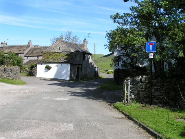
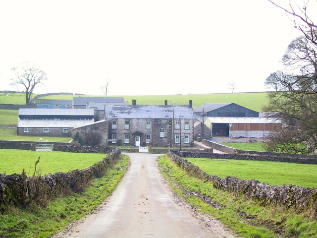
Dam Dale Images

Images are sourced within 2km of 53.298932/-1.8240958 or Grid Reference SK1178. Thanks to Geograph Open Source API. All images are credited.

Peak Forest Church St Charles the King and Martyr in the village of Peak Forest
Peak Forest Church
St Charles the King and Martyr in the village of Peak Forest
The Cop House restoration within SK1279
The Cop
House restoration within SK1279
Batham Gate Roman road, near Peak Forest The line of the Roman road is vaguely visible in snow beyond the point where the modern road swings left. In the background the A623 can be seen snaking up the hill in the northwestern corner of square <a href="https://www.geograph.org.uk/gridref/SK1278">SK1278</a>.
Batham Gate Roman road, near Peak Forest
The line of the Roman road is vaguely visible in snow beyond the point where the modern road swings left. In the background the A623 can be seen snaking up the hill in the northwestern corner of square SK1278.
Hay Dale, northern end
Hay Dale from Dale Head
Wheston House on Batham Gate Wheston House stands at a sharp bend in the lane which criss-crosses Batham Gate - the course of the old Roman road which runs straight up from near Buxton. The electricity poles behind the house march in a straight line down the course of the old road.
Wheston House on Batham Gate
Wheston House stands at a sharp bend in the lane which criss-crosses Batham Gate - the course of the old Roman road which runs straight up from near Buxton. The electricity poles behind the house march in a straight line down the course of the old road.
Limestone Way Farm Farm below Dam Cliff just off the A623 near Peak Forest.
Limestone Way Farm
Farm below Dam Cliff just off the A623 near Peak Forest.
Torr Farm Barns at Torr Farm, in the intersection between Pittlesmere Lane and the A623.
Torr Farm
Barns at Torr Farm, in the intersection between Pittlesmere Lane and the A623.
Pennine Bridleway Bridleway leading to Peak Forest, 2.25 miles distant. From Limestone way.
Pennine Bridleway
Bridleway leading to Peak Forest, 2.25 miles distant. From Limestone way.
Pot Luck Derelict barns on Potluck Hill, viewed from the gateway on Limestone Way.
Pot Luck
Derelict barns on Potluck Hill, viewed from the gateway on Limestone Way.
Sitch House Smoke curls from the chimney of Sitch House, combatting the December chill which still grips the valley even after mid-day and a morning of bright sunshine.
Sitch House
Smoke curls from the chimney of Sitch House, combatting the December chill which still grips the valley even after mid-day and a morning of bright sunshine.
Chamberknoll From the A623 (with Eldon Hill <a href="https://www.geograph.org.uk/gridref/SK115811">SK115811</a> behind).
Chamberknoll
From the A623 (with Eldon Hill SK115811 behind).
Chamber Farm From the footpath to Lower Bee Low.
Chamber Farm
From the footpath to Lower Bee Low.
Backlane Farm From below Lower Bee Low (try saying that quickly!). Part of upper Dam Dale is just visible behind the farm; the tree-capped hill to the right is Kemp's Hill.
Backlane Farm
From below Lower Bee Low (try saying that quickly!). Part of upper Dam Dale is just visible behind the farm; the tree-capped hill to the right is Kemp's Hill.
Kemp's Hill From the north-western end of the bridleway to the north.
Kemp's Hill
From the north-western end of the bridleway to the north.
Dam Dale Looking south down the dale from the footpath above Dam Dale Farm.
Dam Dale
Looking south down the dale from the footpath above Dam Dale Farm.
Lower Dam Dale From the northern edge of the square, below Loosehill Farm.
Lower Dam Dale
From the northern edge of the square, below Loosehill Farm.
Dogmanslack Farm From the footpath to the east.
Dogmanslack Farm
From the footpath to the east.
Show me another place!

Dam Dale is located at Grid Ref: SK1178 (Lat: 53.298932, Lng: -1.8240958)

Administrative County: Derbyshire

District: Derbyshire Dales

Police Authority: Derbyshire

What 3 Words

///trustees.unionists.toolbar. Near Dove Holes, Derbyshire

Nearby Locations

Loose Hill Dam Dale

Related Wikis

Hay Dale

Hay Dale is a short dry valley near Buxton, Derbyshire, in the Peak District of England. It is part of a longer valley that runs for approximately 4 miles...

Peak Forest

Peak Forest is a small village and civil parish on the main road the (A623) from Chapel-en-le-Frith to Chesterfield in Derbyshire. The population of the...

Old Dam

Old Dam is a hamlet in Derbyshire, England. It is located 3 miles (4.8 km) south-west of Castleton on the edge of the village of Peak Forest. == References ==

Peter Dale (Derbyshire)

Peter Dale is a short dry crag-sided valley near Buxton, Derbyshire, in the Peak District of England. There is a farmland plateau on either side. The northern...

Wheston

Wheston is a village and civil parish in the Derbyshire Peak District. Notable features include Wheston Hall and the Wheston Cross. The cross, which survives...

Peak Dale

Peak Dale is a small village in Derbyshire, England, 3 miles (4.8 km) northeast of Buxton and 1.3 miles (2.1 km) southeast of Dove Holes. The population...

Hargate Wall

Hargate Wall is a hamlet in Derbyshire, England, situated northeast of Buxton and now part of Wormhill. The name Hargate Wall derives from Old English...

Peak Forest railway station

Peak Forest railway station was opened in 1867 by the Midland Railway on its extension of the Manchester, Buxton, Matlock and Midlands Junction Railway...

Nearby Amenities

Located within 500m of 53.298932,-1.8240958
Ele: 291.8837891
Lat/Long: 53.3031554/-1.8239838
Barrier: stile
Material: stone
Source: survey;gps
Stile: stepover
Lat/Long: 53.2967253/-1.8202881
Barrier: entrance
Source: survey;gps
Lat/Long: 53.2981879/-1.8221733
Barrier: stile
Material: stone
Source: survey;gps
Stile: stepover
Lat/Long: 53.3000382/-1.8224984
Barrier: stile
Material: stone
Source: survey;gps
Stile: stepover
Lat/Long: 53.3010949/-1.8304579
Barrier: stile
Material: stone
Source: survey;gps
Stile: stepover
Lat/Long: 53.3020019/-1.8225445
Barrier: stile
Material: stone
Source: survey;gps
Stile: stepover
Lat/Long: 53.3027771/-1.8227681
Barrier: entrance
Source: survey;gps
Lat/Long: 53.3027813/-1.8228337
Fixme: stile of gate?
Lat/Long: 53.2989173/-1.8245672
Fixme: stile of gate?
Lat/Long: 53.2993738/-1.8247618
Fixme: stile of gate?
Lat/Long: 53.301901/-1.8234338
Fixme: stile of gate?
Lat/Long: 53.2978142/-1.82389
The data included in this document is from www.openstreetmap.org. The data is made available under ODbL.

Have you been to Dam Dale?

Leave your review of Dam Dale below (or comments, questions and feedback).