Deep Dale

Valley in Derbyshire Derbyshire Dales

England

Deep Dale

Monsal Trail Viaduct
Monsal Trail Viaduct Credit: Bob Danylec

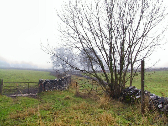
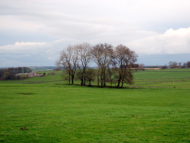
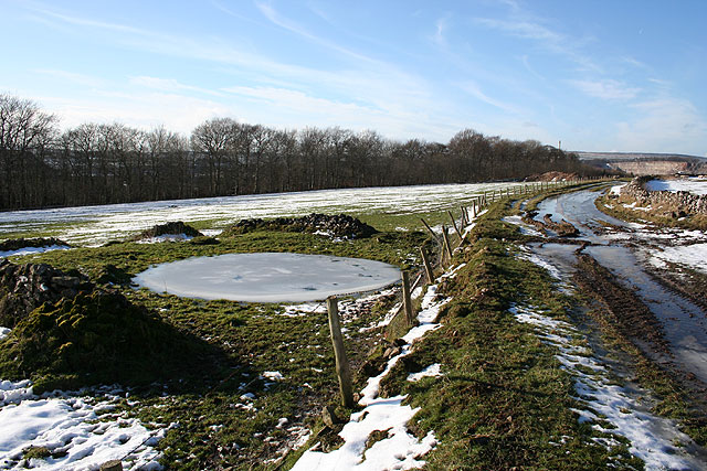
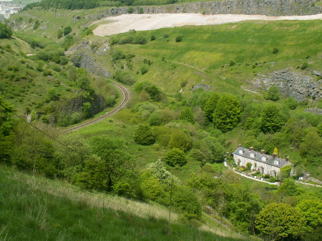
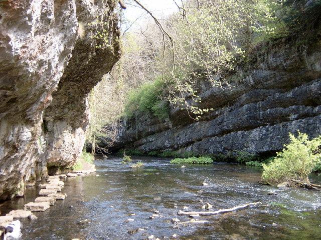
Deep Dale is a picturesque valley located in Derbyshire, England. Nestled in the heart of the Peak District National Park, it is renowned for its stunning natural beauty and tranquil surroundings. The dale stretches for approximately three miles, encompassing lush green fields, meandering streams, and rugged limestone cliffs.

The valley is a haven for nature enthusiasts, offering a diverse range of flora and fauna. Wildflowers such as bluebells, primroses, and orchids dot the landscape, creating a vibrant and colorful display during the spring and summer months. The area is also home to various bird species, including buzzards, peregrine falcons, and skylarks, making it a popular spot for birdwatching.

Deep Dale offers numerous walking and hiking trails, providing visitors with the opportunity to explore its natural wonders. The paths wind through the valley, offering breathtaking views of the surrounding peaks and valleys. The dale is also intersected by the Limestone Way, a long-distance footpath that showcases the area's unique geology.

Additionally, Deep Dale is steeped in history. The remnants of ancient settlements, such as Bronze Age burial mounds, can be found scattered throughout the valley. These archaeological sites offer a glimpse into the area's rich past and provide a fascinating insight into the lives of its former inhabitants.

Overall, Deep Dale is a captivating destination for those seeking tranquility and natural beauty. With its idyllic landscapes, diverse wildlife, and historical significance, it is a must-visit location for nature lovers and history enthusiasts alike.

If you have any feedback on the listing, please let us know in the comments section below.

Deep Dale Images

Images are sourced within 2km of 53.244604/-1.8503927 or Grid Reference SK1071. Thanks to Geograph Open Source API. All images are credited.

Monsal Trail Viaduct
Green Lane to Chelmorton This green lane leads from Old Coalpit Lane into the village of Chelmorton, across the fields of Farditch farm, behind the sewage works.
Green Lane to Chelmorton
This green lane leads from Old Coalpit Lane into the village of Chelmorton, across the fields of Farditch farm, behind the sewage works.
Railway Bridge at Wye Dale The exit from Topley Pike quarry emerges onto the A6 trunk road by the railway bridge at Wye Dale
Railway Bridge at Wye Dale
The exit from Topley Pike quarry emerges onto the A6 trunk road by the railway bridge at Wye Dale
Calton Farm The entrance to the farm is in the layby on the A5270 just before its intersection with the A6 east of Buxton.
Calton Farm
The entrance to the farm is in the layby on the A5270 just before its intersection with the A6 east of Buxton.
Blackwell mill Eight railway cottagers built in 1866 they used to have their own halt, it was said to be the smallest passenger station on British railways, it was closed in 1966. Several valleys and paths meet here.
Blackwell mill
Eight railway cottagers built in 1866 they used to have their own halt, it was said to be the smallest passenger station on British railways, it was closed in 1966. Several valleys and paths meet here.
Blackwell Mill cottagers Blackwell Mill railway cottages with the bridge crossing river Wye to the right. They used to have their own station built in 1866 closed 1966 it was the smallest on BR just one carriage long.
Blackwell Mill cottagers
Blackwell Mill railway cottages with the bridge crossing river Wye to the right. They used to have their own station built in 1866 closed 1966 it was the smallest on BR just one carriage long.
Limestone quarry Most of this square is now taken up by this vast quarry which is itself only part of a larger quarry in Great Rocks Dale. Roads and paths in this area have been diverted and even the most recent Ordnance Survey maps do not do justice to the size of this quarry.  This photo was taken near to the northern rim of the quarry and I can see no way in which a picture can be taken from within the square without permission of the quarry owners.
Limestone quarry
Most of this square is now taken up by this vast quarry which is itself only part of a larger quarry in Great Rocks Dale. Roads and paths in this area have been diverted and even the most recent Ordnance Survey maps do not do justice to the size of this quarry. This photo was taken near to the northern rim of the quarry and I can see no way in which a picture can be taken from within the square without permission of the quarry owners.
A  fair copse! Large exposed fields on the top of this limestone country are broken up only occasionally by clumps of trees.  This contrasts with the deep valleys cut into this limestone which support extensive areas of woodland.
A fair copse!
Large exposed fields on the top of this limestone country are broken up only occasionally by clumps of trees. This contrasts with the deep valleys cut into this limestone which support extensive areas of woodland.
Frozen dewpond above Great Rocks Dale Taken from farm track (not a right of way and not marked on the 1:50000 OS map) northwest of Mosley Farm. The track and dewpond are marked on the OS 1:25000 map. Great Rocks Dale is to the left and part of Tunstead Quarry, including its chimney, is visible to the right of the picture.
Frozen dewpond above Great Rocks Dale
Taken from farm track (not a right of way and not marked on the 1:50000 OS map) northwest of Mosley Farm. The track and dewpond are marked on the OS 1:25000 map. Great Rocks Dale is to the left and part of Tunstead Quarry, including its chimney, is visible to the right of the picture.
Old Moor Quarry At this point the workings of Old Moor Quarry interrupt a farm track and further progress is prevented. This square contains no official rights-of-way, though I suspect previously existing rights-of-way may have been extinguished (temporarily or permanently) due to quarrying interests.
Old Moor Quarry
At this point the workings of Old Moor Quarry interrupt a farm track and further progress is prevented. This square contains no official rights-of-way, though I suspect previously existing rights-of-way may have been extinguished (temporarily or permanently) due to quarrying interests.
Farm track above Great Rocks Dale Although not currently a right-of-way I suspect this may have been at one point. It leads to Mosley Farm from Old Moor, with Great Rocks Dale concealed by trees to the right. There are no rights-of-way in this square.
Farm track above Great Rocks Dale
Although not currently a right-of-way I suspect this may have been at one point. It leads to Mosley Farm from Old Moor, with Great Rocks Dale concealed by trees to the right. There are no rights-of-way in this square.
Farm track above Mosley Farm Abandoned farm equipment by a metalled track to the northwest of Mosley Farm; not a right-of-way.
Farm track above Mosley Farm
Abandoned farm equipment by a metalled track to the northwest of Mosley Farm; not a right-of-way.
Chee Dale from Mosley Farm Showing some of the limestone tors on the southern side of Chee Dale.
Chee Dale from Mosley Farm
Showing some of the limestone tors on the southern side of Chee Dale.
Pennine Bridleway, above Chee Dale Mountain biker just west of Mosley Farm steeling himself for the steep drop to the River Wye and Chee Dale.
Pennine Bridleway, above Chee Dale
Mountain biker just west of Mosley Farm steeling himself for the steep drop to the River Wye and Chee Dale.
Pennine Bridleway, Chee Dale Just starting the steep ascent from the Wye valley on the north side of the dale towards the first of several exposed hairpin bends that lead to Mosley Farm at the top of the dale.
Pennine Bridleway, Chee Dale
Just starting the steep ascent from the Wye valley on the north side of the dale towards the first of several exposed hairpin bends that lead to Mosley Farm at the top of the dale.
Pennine Bridleway, Blackwell Cottages These former railway cottages nestle in the steep sided Chee Dale on the line of the Pennine Bridleway national trail. The bridge in the foreground carries the bridleway across the River Wye.
Pennine Bridleway, Blackwell Cottages
These former railway cottages nestle in the steep sided Chee Dale on the line of the Pennine Bridleway national trail. The bridge in the foreground carries the bridleway across the River Wye.
Pennine Bridleway, Chee Dale This is a steep 1:5 descent through the Nature Reserve on the southern side of Chee Dale. It is the first real taste of a Derbyshire dale since leaving the start of the Pennine Bridleway at Middleton Top.
Pennine Bridleway, Chee Dale
This is a steep 1:5 descent through the Nature Reserve on the southern side of Chee Dale. It is the first real taste of a Derbyshire dale since leaving the start of the Pennine Bridleway at Middleton Top.
Milking time on the A6 All of the cattle in sight eventually went to milking, at their own pace.
Milking time on the A6
All of the cattle in sight eventually went to milking, at their own pace.
Show me another place!

Deep Dale is located at Grid Ref: SK1071 (Lat: 53.244604, Lng: -1.8503927)

Administrative County: Derbyshire

District: Derbyshire Dales

Police Authority: Derbyshire

What 3 Words

///tonsils.mingles.surveyed. Near Buxton, Derbyshire

Nearby Locations

Deep Dale

Related Wikis

King Sterndale

King Sterndale is a village and civil parish in Derbyshire, England. It is located in the Peak District, 4 miles east of Buxton. It has a population of...

Wye Valley, Derbyshire

The Wye Valley is the limestone valley of the River Wye in the White Peak of Derbyshire, England. The source of the River Wye is west of Buxton on Axe...

Green Fairfield

Green Fairfield (Old English Green, beautiful open-land). is a civil parish in Derbyshire, England. The population of the civil parish (including Tunstead...

Deep Dale

Deep Dale is a short steep-sided gorge near Buxton, Derbyshire, in the Peak District of England. It is distinct from another Deep Dale, near Sheldon, 4...

Blackwell Mill

Blackwell Mill is a location in Derbyshire, near to the village of Blackwell near Buxton, but not part of it. There was once a corn mill on the River Wye...

Chee Dale Halt railway station

Chee Dale Halt railway station was a timber-built railway halt located on the Peak Forest Junction to Buxton Junction spur of a triangle of the former...

Calton Hill, Derbyshire

Calton Hill is a Site of Special Scientific Interest in Derbyshire, England, showing Olivine Diorite magma chamber.It is the site of an extinct volcano...

Chee Dale

Chee Dale is a steep-sided gorge on the River Wye near Buxton, Derbyshire, in the Peak District of England. The Wye valley continues upstream towards Buxton...

Nearby Amenities

Located within 500m of 53.244604,-1.8503927
Barrier: stile
Material: stone
Source: survey;gps
Stile: stepover
Lat/Long: 53.2424932/-1.8476565
Barrier: stile
Material: stone
Source: survey;gps
Stile: stepover
Lat/Long: 53.2443664/-1.8462097
Deep Dale
Place: locality
Lat/Long: 53.2440329/-1.851413
Power: pole
Lat/Long: 53.2406206/-1.8515074
Power: pole
Lat/Long: 53.2422065/-1.8563703
Power: pole
Lat/Long: 53.2428983/-1.8560001
Power: pole
Lat/Long: 53.2436671/-1.8555683
Power: pole
Lat/Long: 53.2448067/-1.8559143
Power: pole
Lat/Long: 53.2459462/-1.8562147
Power: pole
Lat/Long: 53.2470521/-1.8565527
Power: pole
Lat/Long: 53.2413702/-1.8513143
Power: pole
Lat/Long: 53.242314/-1.8453813
Power: pole
Lat/Long: 53.2423156/-1.8464354
Power: pole
Lat/Long: 53.2423589/-1.8487716
Power: pole
Lat/Long: 53.2425307/-1.8499517
Power: pole
Lat/Long: 53.2426752/-1.8509629
Power: pole
Lat/Long: 53.2428116/-1.8521136
Power: pole
Lat/Long: 53.243261/-1.8555227
Power: pole
Lat/Long: 53.2433942/-1.856491
Power: pole
Lat/Long: 53.243558/-1.8576846
Power: pole
Lat/Long: 53.2421631/-1.8562442
Power: pole
Lat/Long: 53.2429641/-1.8558124
Power: pole
Lat/Long: 53.2437201/-1.8554154
Power: pole
Lat/Long: 53.2446975/-1.85574
Power: pole
Lat/Long: 53.2457905/-1.856027
Power: pole
Lat/Long: 53.2470232/-1.856432
The data included in this document is from www.openstreetmap.org. The data is made available under ODbL.

Have you been to Deep Dale?

Leave your review of Deep Dale below (or comments, questions and feedback).