Birchen Orchard Clough

Valley in Derbyshire High Peak

England

Birchen Orchard Clough

Wreckage of B-29 Superfortress Wreckage of the B-29 Superfortress Overexposed which crashed on 3rd Nov 1948
Wreckage of B-29 Superfortress Credit: Shaun Ferguson

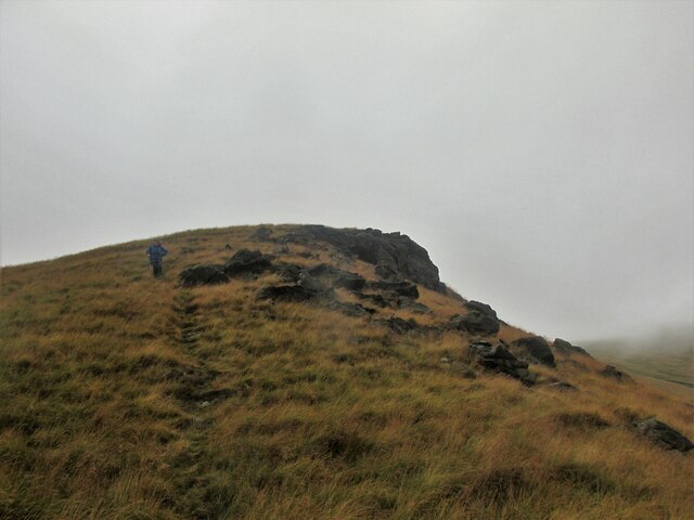
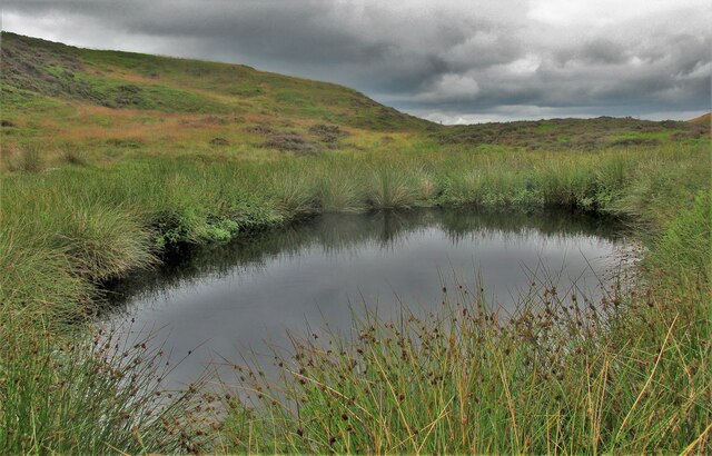
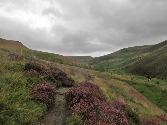
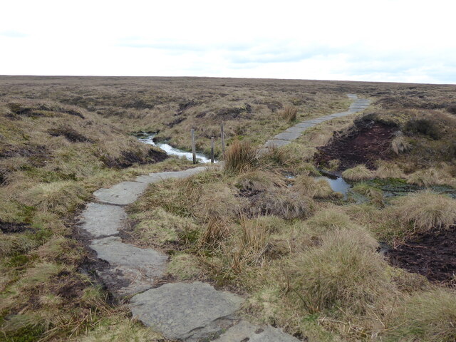
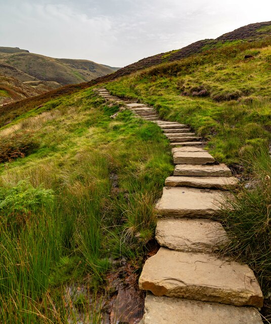
Birchen Orchard Clough is a picturesque valley located in Derbyshire, England. Nestled within the Peak District National Park, this enchanting landscape is renowned for its breathtaking beauty and diverse natural features.

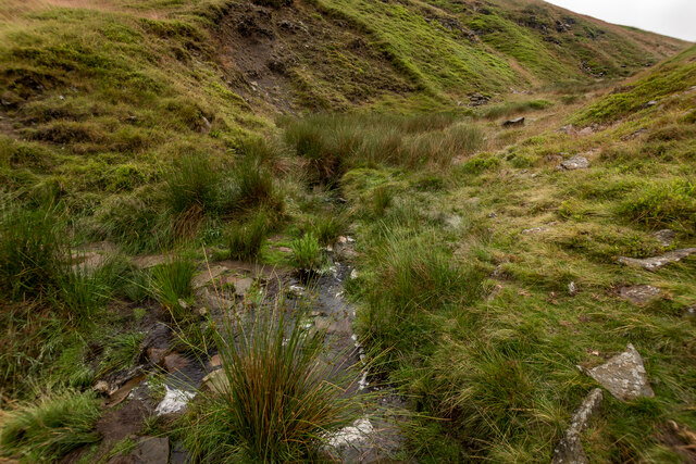
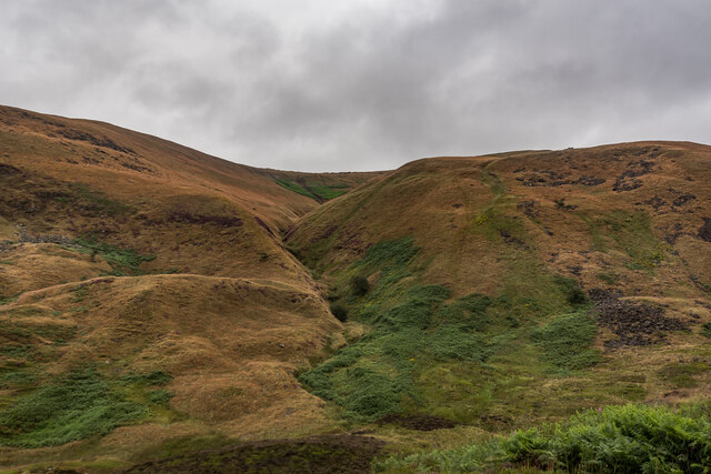
The valley is characterized by its lush greenery, rolling hills, and meandering streams. It is home to a variety of plant and animal species, making it a haven for nature enthusiasts and wildlife lovers. The area boasts a rich biodiversity, with rare flora and fauna that thrive in this pristine habitat.

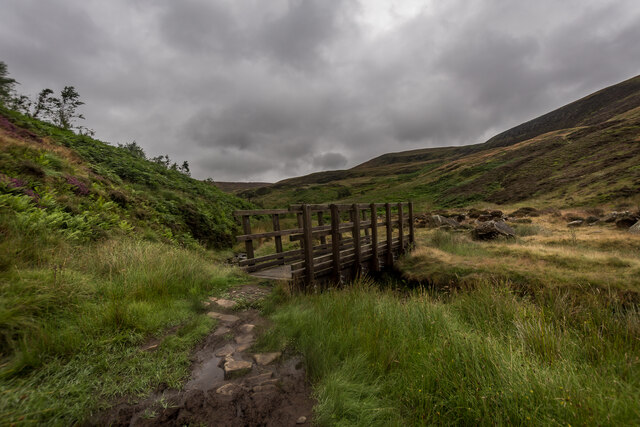
Visitors to Birchen Orchard Clough can enjoy a range of outdoor activities, such as hiking, cycling, and picnicking. The valley offers numerous walking trails, allowing visitors to explore its hidden gems and discover its hidden treasures. The tranquil atmosphere and stunning views make it an ideal spot for those seeking solace and relaxation amidst nature.

The valley is also steeped in history, with ancient ruins and archaeological sites scattered throughout the area. These remnants of the past provide a glimpse into the region's fascinating past and offer insights into the lives of those who once inhabited this land.

Birchen Orchard Clough is a popular destination for both locals and tourists alike. Its natural beauty and serene ambiance make it an idyllic place to escape the hustle and bustle of everyday life. Whether you are a nature enthusiast, history buff, or simply looking for a peaceful retreat, this valley is sure to captivate and inspire all who visit.

If you have any feedback on the listing, please let us know in the comments section below.

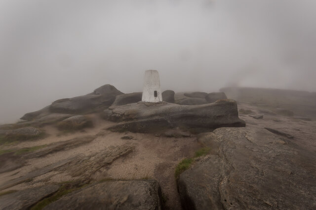
Birchen Orchard Clough Images

Images are sourced within 2km of 53.438788/-1.8850883 or Grid Reference SK0793. Thanks to Geograph Open Source API. All images are credited.

Wreckage of B-29 Superfortress Wreckage of the B-29 Superfortress Overexposed which crashed on 3rd Nov 1948
Wreckage of B-29 Superfortress
Wreckage of the B-29 Superfortress Overexposed which crashed on 3rd Nov 1948
Trig Point Higher Shelf Stones trig point
Trig Point
Higher Shelf Stones trig point
Boeing RB-29A Wreckage, Higher Shelf Boeing 'RB-29A 44-61999 was part of the 16th Photographic Reconnaissance Squadron, 91st Reconnaissance Group, 311th Air Division in the Strategic Air Command of USAF. The aircraft bore the name Over Exposed after it was flown in July 1946 by the 509th Composite Group during Operation Crossroads to photograph nuclear testing at Bikini Atoll, including the dropping of an atomic bomb by B-29 Superfortress Dave's Dream. 

Centre of the image is one of the 4 engines. To the right is the nose wheel and to the left is one of the landing legs.

<span class="nowrap"><a title="https://en.wikipedia.org/wiki/Bleaklow_Bomber" rel="nofollow ugc noopener" href="https://en.wikipedia.org/wiki/Bleaklow_Bomber">Link</a><img style="margin-left:2px;" alt="External link" title="External link - shift click to open in new window" src="https://s1.geograph.org.uk/img/external.png" width="10" height="10"/></span>
Boeing RB-29A Wreckage, Higher Shelf
Boeing 'RB-29A 44-61999 was part of the 16th Photographic Reconnaissance Squadron, 91st Reconnaissance Group, 311th Air Division in the Strategic Air Command of USAF. The aircraft bore the name Over Exposed after it was flown in July 1946 by the 509th Composite Group during Operation Crossroads to photograph nuclear testing at Bikini Atoll, including the dropping of an atomic bomb by B-29 Superfortress Dave's Dream. Centre of the image is one of the 4 engines. To the right is the nose wheel and to the left is one of the landing legs. LinkExternal link
Sheep Escort, Pennine Way, Devils Dike
Higher Shelfstones Trigpoint TP3826 Very wet and Misty day on the high ground. Just up from the B29 crash site.

<span class="nowrap"><a title="http://trigpointing.uk/trig/3826" rel="nofollow ugc noopener" href="http://trigpointing.uk/trig/3826">Link</a><img style="margin-left:2px;" alt="External link" title="External link - shift click to open in new window" src="https://s1.geograph.org.uk/img/external.png" width="10" height="10"/></span>
Higher Shelfstones Trigpoint TP3826
Very wet and Misty day on the high ground. Just up from the B29 crash site. LinkExternal link
Urchin Clough Ford, Doctor's Gate path
Foot Bridge over Shelf Brook, Doctor's Gate Path Doctors Gate Path is an Old Roman Road.
Foot Bridge over Shelf Brook, Doctor's Gate Path
Doctors Gate Path is an Old Roman Road.
Ashton Clough From Doctor's Gate Path
Lower Shelf Stones Dropping down to the Doctor's Gate path.
Lower Shelf Stones
Dropping down to the Doctor's Gate path.
Small pool near the Doctor's Gate path A lovely spot, hidden from the main path.
Small pool near the Doctor's Gate path
A lovely spot, hidden from the main path.
Path alongside Shelf Brook
The Pennine Way near Featherbed Moss
The Pennine Way near the Snake Pass
The Pennine Way from the A57, Snake Pass
The Pennine Way near Devil's Dike
Doctor's Gate The Doctor's Gate path alongside Shelf Brook.
Doctor's Gate
The Doctor's Gate path alongside Shelf Brook.
Shelf Moor Path on Shelf Moor.
Shelf Moor
Path on Shelf Moor.
Doctor's Gate The Doctor's Gate path, newly improved.
Doctor's Gate
The Doctor's Gate path, newly improved.
Show me another place!

Birchen Orchard Clough is located at Grid Ref: SK0793 (Lat: 53.438788, Lng: -1.8850883)

Administrative County: Derbyshire

District: High Peak

Police Authority: Derbyshire

What 3 Words

///burns.weekday.blanking. Near Glossop, Derbyshire

Related Wikis

Snake Pass

Snake Pass is a hill pass in the Derbyshire section of the Peak District, crossing the Pennines between Glossop and the Ladybower Reservoir at Ashopton...
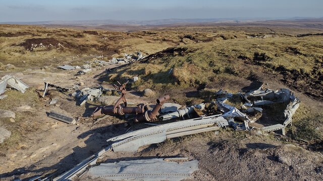
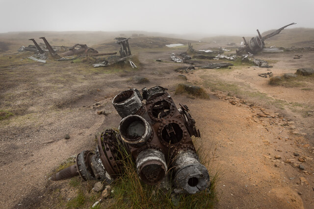
Bleaklow Bomber

The Bleaklow Bomber was a US Air Force (USAF) Boeing RB-29A Superfortress that crashed near Higher Shelf Stones on Bleaklow in the Peak District in 1948...
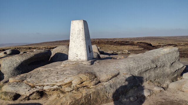
Featherbed Top

Featherbed Top is an open, flat-topped hill, 544 metres (1,785 ft) high, in the Peak District in the county of Derbyshire in England. == Description... ==

Hurst Reservoir

Hurst Reservoir is a former, now disused, reservoir near Glossop, north Derbyshire. == History == In 1837, 50 local millowners and gentlemen, known as...

Mossy Lea Reservoir

Mossy Lea Reservoir is a disused reservoir near Glossop, north Derbyshire. In 1837, 50 local millowners and gentlemen, known as the "Glossop Commissioners...
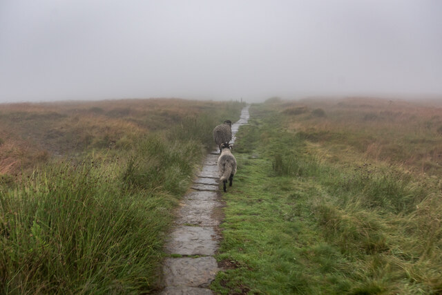
Bleaklow

Bleaklow is a high, largely peat-covered, gritstone moorland in the Derbyshire High Peak near the town of Glossop. It is north of Kinder Scout, across...

Mill Hill (Derbyshire)

Mill Hill is an open, flat-topped hill, 1,785 feet (544 m) above sea level, in the Peak District in the county of Derbyshire in England. == Location... ==

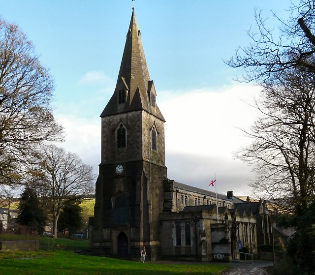
All Saints' Church, Glossop

All Saints’ Church, Glossop, is a Grade II listed parish church in the Church of England: 218  in Glossop, Derbyshire, England. == History == The first...

Nearby Amenities

Located within 500m of 53.438788,-1.8850883
Ford: yes
Lat/Long: 53.4431492/-1.8868908
Coldharbour Moor
Place: locality
Source: OSODSV
Lat/Long: 53.4351948/-1.8844451
The data included in this document is from www.openstreetmap.org. The data is made available under ODbL.

Have you been to Birchen Orchard Clough?

Leave your review of Birchen Orchard Clough below (or comments, questions and feedback).