Flag Head Chine

Valley in Dorset

England

Flag Head Chine

Groyne at Branksome Dene Chine, Bournemouth A rock groyne and marker on the beach at Branksome Dene Chine, near Bournemouth.  Visible in the distance are Old Harry Rocks and the Purbeck Hills.
Groyne at Branksome Dene Chine, Bournemouth Credit: Malc McDonald

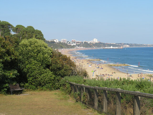
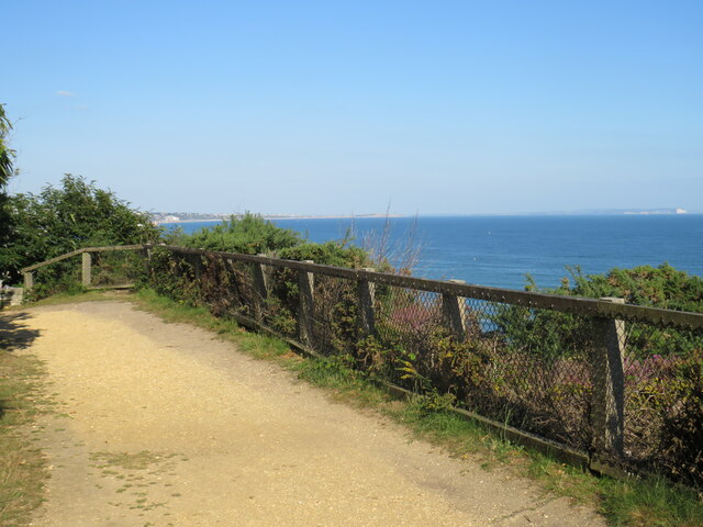
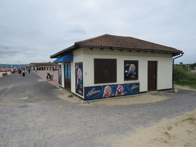
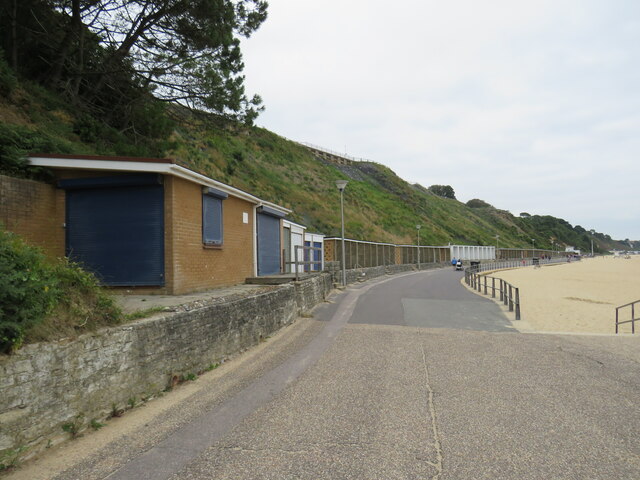
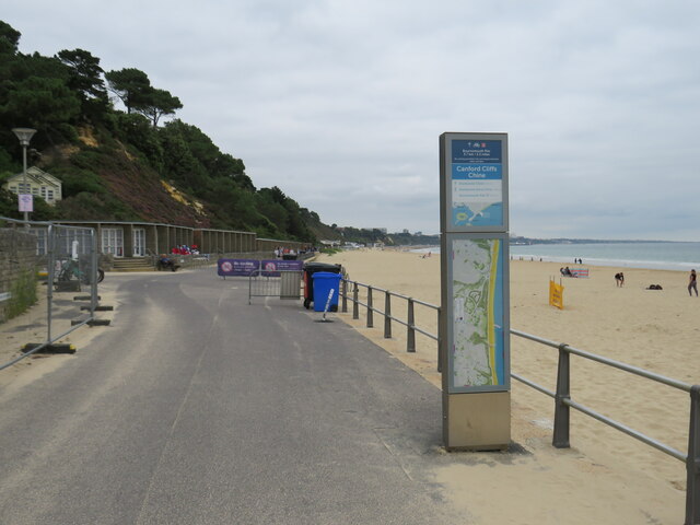
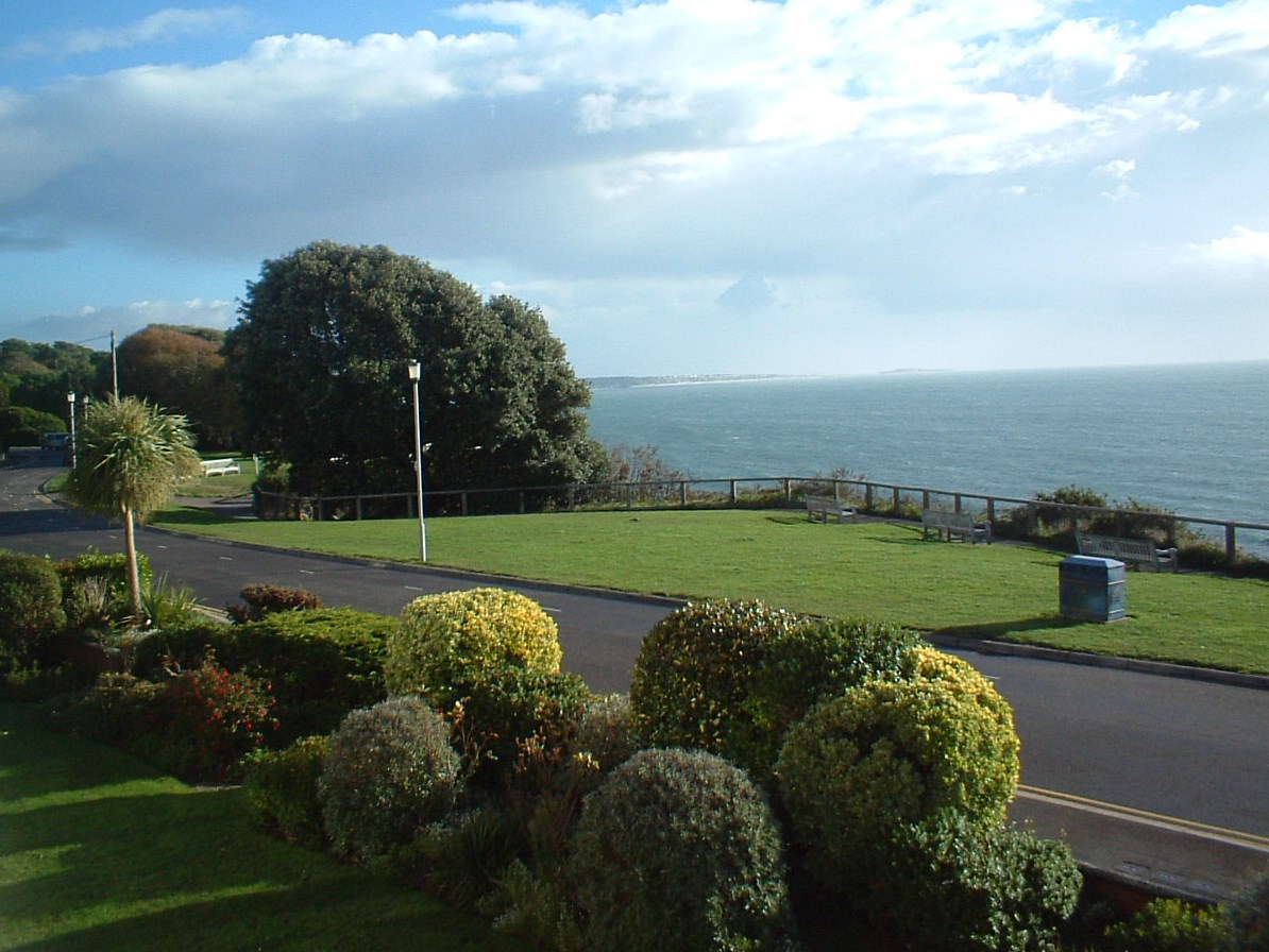
Flag Head Chine is a picturesque valley located in Dorset, England. Situated on the Jurassic Coast, this natural wonder is renowned for its stunning cliffs, rock formations, and pristine beaches. The chine, which is a local term for a steep-sided ravine, is a popular destination for nature lovers, geologists, and hikers.

The dramatic cliffs of Flag Head Chine showcase layers of sedimentary rocks, providing a glimpse into the Earth's history. Geologists are particularly fascinated by the visible rock formations, as they offer valuable insights into the region's geological past.

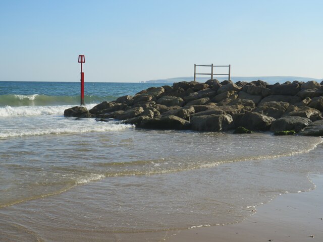
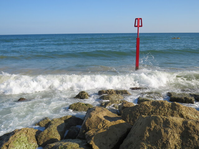
At the bottom of the chine, visitors can discover a secluded pebble beach, a hidden gem that adds to the charm of this location. The beach is a great spot for relaxation, picnics, and even fossil hunting. Many visitors are captivated by the tranquility of the beach and the breathtaking views of the surrounding cliffs.

Flag Head Chine is also home to a diverse range of flora and fauna, making it an attractive destination for wildlife enthusiasts. The chine's unique ecosystem supports a variety of plant species, including rare flowers and shrubs that thrive in this coastal environment. Additionally, numerous bird species can be spotted in the area, making it a haven for birdwatchers.

Overall, Flag Head Chine is a remarkable natural site that showcases the beauty and geological significance of the Jurassic Coast. Its stunning cliffs, secluded beach, and rich biodiversity make it a must-visit location for those seeking a peaceful and educational experience amidst the wonders of nature.

If you have any feedback on the listing, please let us know in the comments section below.

Flag Head Chine Images

Images are sourced within 2km of 50.698874/-1.9257954 or Grid Reference SZ0588. Thanks to Geograph Open Source API. All images are credited.

Groyne at Branksome Dene Chine, Bournemouth A rock groyne and marker on the beach at Branksome Dene Chine, near Bournemouth.  Visible in the distance are Old Harry Rocks and the Purbeck Hills.
Groyne at Branksome Dene Chine, Bournemouth
A rock groyne and marker on the beach at Branksome Dene Chine, near Bournemouth. Visible in the distance are Old Harry Rocks and the Purbeck Hills.
Groyne marker at Branksome Dene Chine, Bournemouth The red post marks the end of a groyne on the beach at Branksome Dene Chine, near Bournemouth.
Groyne marker at Branksome Dene Chine, Bournemouth
The red post marks the end of a groyne on the beach at Branksome Dene Chine, near Bournemouth.
Overcliff at Branksome Dene, near Bournemouth A bench on the overcliff at Branksome Dene, near Bournemouth.  In the background, the coastline stretches to Bournemouth Pier and beyond.
Overcliff at Branksome Dene, near Bournemouth
A bench on the overcliff at Branksome Dene, near Bournemouth. In the background, the coastline stretches to Bournemouth Pier and beyond.
Overcliff path at Branksome Chine, near Bournemouth A path on the overcliff at Branksome Chine, near Bournemouth.

This image was taken on a relatively clear day with views along the coastline to Hengistbury Head (in the distance in the centre of the image) and across to chalk cliffs at The Needles, at the westernmost tip of the Isle of Wight (visible to the right).
Overcliff path at Branksome Chine, near Bournemouth
A path on the overcliff at Branksome Chine, near Bournemouth. This image was taken on a relatively clear day with views along the coastline to Hengistbury Head (in the distance in the centre of the image) and across to chalk cliffs at The Needles, at the westernmost tip of the Isle of Wight (visible to the right).
Pinecliff Gardens, Branksome Chine, near Bournemouth Pinecliff Gardens look out over the beach and coastline at Branksome Chine, near Bournemouth.
Pinecliff Gardens, Branksome Chine, near Bournemouth
Pinecliff Gardens look out over the beach and coastline at Branksome Chine, near Bournemouth.
Path alongside Poole Harbour, Sandbanks, near Poole Joggers exercising on a path alongside Poole Harbour.
Path alongside Poole Harbour, Sandbanks, near Poole
Joggers exercising on a path alongside Poole Harbour.
Beach at Sandbanks, near Poole A view of the beach at Sandbanks, near Poole, taken on a dull day in August 2021.  The hut to the left of the image houses RNLI lifeguards who watch over the beach.
Beach at Sandbanks, near Poole
A view of the beach at Sandbanks, near Poole, taken on a dull day in August 2021. The hut to the left of the image houses RNLI lifeguards who watch over the beach.
Ice cream hut, Sandbanks beach, near Poole An ice cream seller's kiosk on the seafront at Sandbanks, near Poole.  The kiosk was closed on the day this image was taken.
Ice cream hut, Sandbanks beach, near Poole
An ice cream seller's kiosk on the seafront at Sandbanks, near Poole. The kiosk was closed on the day this image was taken.
Low tide at Poole Harbour Seaweed exposed at low tide on Poole Harbour.
Low tide at Poole Harbour
Seaweed exposed at low tide on Poole Harbour.
Shore Road, Sandbanks Shore Road at Sandbanks, near Poole.

This road is on the route of National Cycle Network route 2.
Shore Road, Sandbanks
Shore Road at Sandbanks, near Poole. This road is on the route of National Cycle Network route 2.
Seafront promenade at Poole Head, near Sandbanks The start of the seafront promenade which stretches for around 10 miles along the coastline through Bournemouth.

The promenade forms part of the route of National Cycle Network route 2.  However, during the peak summer holiday months of July and August when the beaches and seafront are at their busiest, cycling is prohibited between 10:00 and 18:00.  During those times, cyclists must use an alternative route.
Seafront promenade at Poole Head, near Sandbanks
The start of the seafront promenade which stretches for around 10 miles along the coastline through Bournemouth. The promenade forms part of the route of National Cycle Network route 2. However, during the peak summer holiday months of July and August when the beaches and seafront are at their busiest, cycling is prohibited between 10:00 and 18:00. During those times, cyclists must use an alternative route.
Promenade near Sandbanks, near Poole An image taken near the start of the seafront promenade which stretches for around 10 miles along the coastline through Bournemouth.

The promenade forms part of the route of National Cycle Network route 2.  However, during the peak summer holiday months of July and August when the beaches and seafront are at their busiest, cycling is prohibited between 10:00 and 18:00.  During those times, cyclists must use an alternative route.
Promenade near Sandbanks, near Poole
An image taken near the start of the seafront promenade which stretches for around 10 miles along the coastline through Bournemouth. The promenade forms part of the route of National Cycle Network route 2. However, during the peak summer holiday months of July and August when the beaches and seafront are at their busiest, cycling is prohibited between 10:00 and 18:00. During those times, cyclists must use an alternative route.
Beach huts at Flag Head Chine, near Poole Two storeys of beach huts on the coastline at Flag Head Chine, near Poole.

The seafront promenade stretches for around 10 miles along the coastline through Bournemouth.  The promenade forms part of the route of National Cycle Network route 2.  However, during the peak summer holiday months of July and August when the beaches and seafront are at their busiest, cycling is prohibited between 10:00 and 18:00.  During those times, cyclists must use an alternative route.
Beach huts at Flag Head Chine, near Poole
Two storeys of beach huts on the coastline at Flag Head Chine, near Poole. The seafront promenade stretches for around 10 miles along the coastline through Bournemouth. The promenade forms part of the route of National Cycle Network route 2. However, during the peak summer holiday months of July and August when the beaches and seafront are at their busiest, cycling is prohibited between 10:00 and 18:00. During those times, cyclists must use an alternative route.
Beach hut at Flag Head Chine, near Poole A two-storey beach hut at Flag Head Chine, on the seafront near Poole.
Beach hut at Flag Head Chine, near Poole
A two-storey beach hut at Flag Head Chine, on the seafront near Poole.
Promenade at Flag Head Chine, near Poole A view of the seafront promenade which stretches for around 10 miles along the coastline through Bournemouth.

The promenade forms part of the route of National Cycle Network route 2.  However, during the peak summer holiday months of July and August when the beaches and seafront are at their busiest, cycling is prohibited between 10:00 and 18:00.  During those times, cyclists must use an alternative route.
Promenade at Flag Head Chine, near Poole
A view of the seafront promenade which stretches for around 10 miles along the coastline through Bournemouth. The promenade forms part of the route of National Cycle Network route 2. However, during the peak summer holiday months of July and August when the beaches and seafront are at their busiest, cycling is prohibited between 10:00 and 18:00. During those times, cyclists must use an alternative route.
Promenade near Canford Cliffs, Poole This seafront promenade stretches for around 10 miles along the coastline through Bournemouth.  At its western end, it lies within the Borough of Poole.

The promenade forms part of the route of National Cycle Network route 2.  However, during the peak summer holiday months of July and August when the beaches and seafront are at their busiest, cycling is prohibited between 10:00 and 18:00.  During those times, cyclists must use an alternative route.
Promenade near Canford Cliffs, Poole
This seafront promenade stretches for around 10 miles along the coastline through Bournemouth. At its western end, it lies within the Borough of Poole. The promenade forms part of the route of National Cycle Network route 2. However, during the peak summer holiday months of July and August when the beaches and seafront are at their busiest, cycling is prohibited between 10:00 and 18:00. During those times, cyclists must use an alternative route.
Promenade at Canford Cliffs Chine, near Poole The seafront promenade stretches for around 10 miles along the coastline through Bournemouth.

The promenade forms part of the route of National Cycle Network route 2.  However, during the peak summer holiday months of July and August when the beaches and seafront are at their busiest, cycling is prohibited between 10:00 and 18:00.  During those times, cyclists must use an alternative route.
Promenade at Canford Cliffs Chine, near Poole
The seafront promenade stretches for around 10 miles along the coastline through Bournemouth. The promenade forms part of the route of National Cycle Network route 2. However, during the peak summer holiday months of July and August when the beaches and seafront are at their busiest, cycling is prohibited between 10:00 and 18:00. During those times, cyclists must use an alternative route.
Promenade at Canford Cliffs Chine, near Poole The seafront promenade stretches for around 10 miles along the coastline through Bournemouth.

The promenade forms part of the route of National Cycle Network route 2.  However, during the peak summer holiday months of July and August when the beaches and seafront are at their busiest, cycling is prohibited between 10:00 and 18:00.  During those times, cyclists must use an alternative route.

On the beach, RNLI lifeguards keep watch from their hut.
Promenade at Canford Cliffs Chine, near Poole
The seafront promenade stretches for around 10 miles along the coastline through Bournemouth. The promenade forms part of the route of National Cycle Network route 2. However, during the peak summer holiday months of July and August when the beaches and seafront are at their busiest, cycling is prohibited between 10:00 and 18:00. During those times, cyclists must use an alternative route. On the beach, RNLI lifeguards keep watch from their hut.
Show me another place!

Flag Head Chine is located at Grid Ref: SZ0588 (Lat: 50.698874, Lng: -1.9257954)

Unitary Authority: Bournemouth, Christchurch and Poole

Police Authority: Dorset

What 3 Words

///view.buyers.lame. Near Parkstone, Dorset

Related Wikis

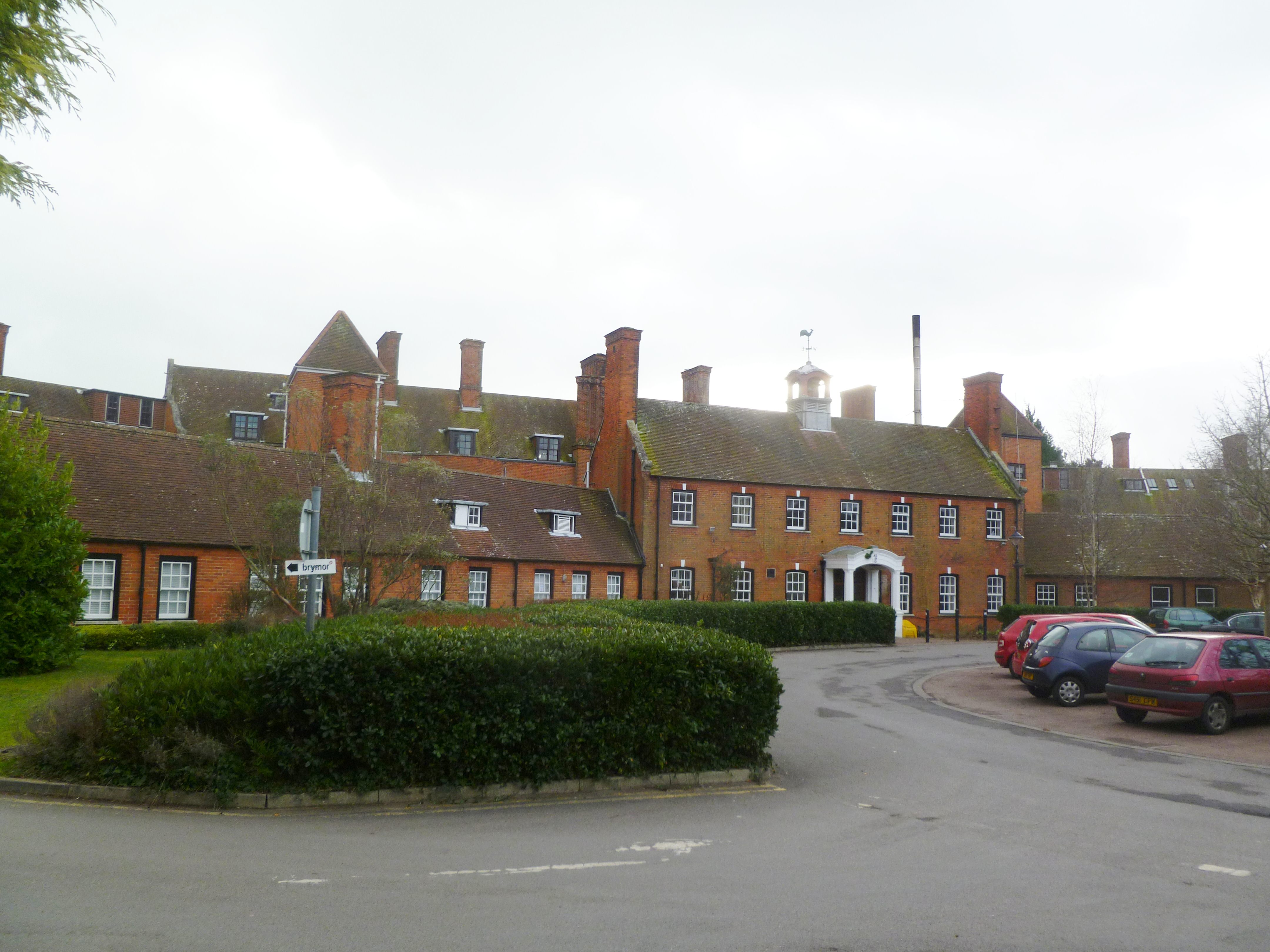
St Ann's Hospital, Dorset

St Ann's Hospital is a psychiatric hospital located in the Canford Cliffs area of Poole, Dorset. It is managed by Dorset HealthCare University NHS Foundation...
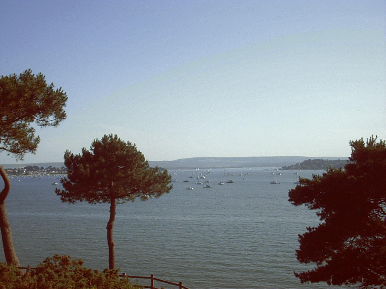
Canford Cliffs

Canford Cliffs is a suburb of Poole in Dorset, England. The neighbourhood lies on the English Channel coast midway between Poole and Bournemouth. To the...

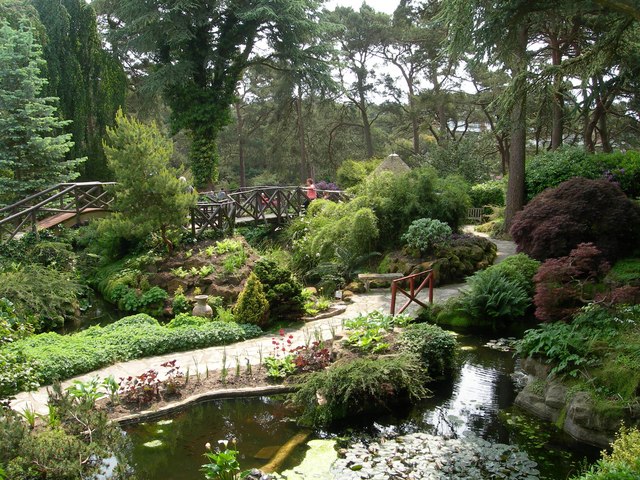
Compton Acres (garden)

Compton Acres is a large privately owned garden in Poole, Dorset, England. It was founded in 1920 by Thomas William Simpson, an entrepreneur who had become...

Lilliput, Dorset

Lilliput is a district of Poole, Dorset. It borders on Sandbanks, Canford Cliffs, Lower Parkstone, and Whitecliff and has a shoreline within Poole Harbour...

Nearby Amenities

Located within 500m of 50.698874,-1.9257954
Source: PGS
Lat/Long: 50.6960787/-1.9266183
Source: www.npemap.org.uk
Uk Postcode Centroid: BH13
Lat/Long: 50.70083/-1.925327
Post Box
Collection Times: Mo-Fr 17:30; Sa 11:45
Operator: Royal Mail
Operator Wikidata: Q638098
Post Box Type: pillar
Ref: BH13 129D
Ref GB Uprn: 10015465506
Royal Cypher: EVIIR
Royal Cypher Wikidata: Q33102324
Lat/Long: 50.6990622/-1.9245613
Post Box
Collection Times: Mo-Fr 17:00; Sa 12:00
Operator: Royal Mail
Operator Wikidata: Q638098
Post Box Type: pillar
Ref: BH13 240
Ref GB Uprn: 10015379743
Royal Cypher: EIIR
Royal Cypher Wikidata: Q33102113
Lat/Long: 50.6968166/-1.9315901
Noexit: yes
Lat/Long: 50.6958391/-1.9294073
Hospital
St Ann's Hospital Grounds
Source: OS_OpenData_Streetview
Lat/Long: 50.6987442/-1.9277079
Crossing
Crossing: unmarked
Crossing Island: no
Kerb: lowered
Tactile Paving: yes
Lat/Long: 50.7002002/-1.9250026
Crossing
Crossing: unmarked
Crossing Island: no
Kerb: lowered
Tactile Paving: yes
Lat/Long: 50.7009211/-1.9261887
Crossing
Crossing: uncontrolled
Crossing Island: yes
Crossing Markings: zebra
Crossing Ref: zebra
Kerb: lowered
Tactile Paving: yes
Lat/Long: 50.6968268/-1.9317764
Noexit: yes
Lat/Long: 50.6960378/-1.9306801
Bicycle Parking
Bicycle Parking: stands
Capacity: 10
Lat/Long: 50.6978582/-1.9255631
Bicycle Parking
Bicycle Parking: stands
Capacity: 10
Lat/Long: 50.7011478/-1.9202007
Crossing
Crossing: unmarked
Crossing Island: no
Crossing Markings: no
Informal: yes
Kerb: normal
Tactile Paving: no
Lat/Long: 50.6967121/-1.9315724
Noexit: yes
Lat/Long: 50.6963396/-1.930335
Noexit: yes
Lat/Long: 50.6968391/-1.9308097
Public Toilets
Lat/Long: 50.7002462/-1.9216835
Post Box
Collection Times: Mo-Fr 17:30; Sa 11:45
Operator: Royal Mail
Operator Wikidata: Q638098
Post Box Type: pillar
Ref: BH13 128D
Ref GB Uprn: 10015443410
Royal Cypher: EVIIR
Royal Cypher Wikidata: Q33102324
Lat/Long: 50.7024424/-1.922673
Bench
Lat/Long: 50.7000469/-1.922864
Bench
Lat/Long: 50.6998365/-1.9232228
Bench
Lat/Long: 50.7002523/-1.9225856
Bench
Lat/Long: 50.7007304/-1.9220004
Bench
Lat/Long: 50.7007015/-1.9221104
Bench
Lat/Long: 50.7003825/-1.9223346
Bench
Lat/Long: 50.7003443/-1.9224166
Bench
Lat/Long: 50.7007118/-1.9218824
Bench
Lat/Long: 50.7006863/-1.9219602
Bench
Lat/Long: 50.700202/-1.922662
Bench
Lat/Long: 50.7001091/-1.9227719
Bench
Lat/Long: 50.7003043/-1.9224905
Bench
Lat/Long: 50.6998993/-1.9231155
Barrier: bollard
Lat/Long: 50.7028956/-1.9243207
Parking Entrance
Access: private
Parking: underground
Lat/Long: 50.7031546/-1.9250347
Source: PGS
Lat/Long: 50.6956698/-1.9271774
Post Box
Collection Times: Mo-Fr 09:00; Sa 07:00
Operator: Royal Mail
Operator Wikidata: Q638098
Post Box Type: pillar
Ref: BH13 196D
Ref GB Uprn: 10015416085
Royal Cypher: GR
Royal Cypher Wikidata: Q33102273
Lat/Long: 50.6998024/-1.9285291
Post Box
Collection Times: Mo-Fr 09:00; Sa 07:00
Operator: Royal Mail
Operator Wikidata: Q638098
Post Box Type: pillar
Ref: BH13 233D
Ref GB Uprn: 10015310517
Royal Cypher: GR
Royal Cypher Wikidata: Q33102273
Lat/Long: 50.7029737/-1.92548
Noexit: yes
Lat/Long: 50.6974617/-1.931165
Noexit: yes
Lat/Long: 50.6973275/-1.9315352
Noexit: yes
Lat/Long: 50.6972094/-1.9312549
Crossing
Crossing: unmarked
Crossing Island: no
Crossing Markings: no
Kerb: lowered
Tactile Paving: yes
Lat/Long: 50.6978104/-1.9323795
Noexit: yes
Lat/Long: 50.6960486/-1.9312012
Bus Stop
Shore Road
Bench: yes
Bin: no
Bus: yes
Bus Bay: yes
Kerb: raised
Lit: yes
Naptan AtcoCode: 1280POA11771
Naptan Bearing: N
Naptan CommonName: Shore Road
Naptan Indicator: opp
Naptan NaptanCode: plegtjg
Naptan PlusbusZoneRef: BOMO
Naptan Street: Banks Road
Naptan Verified: no
Passenger Information Display: no
Public Transport: platform
Shelter: yes
Tactile Paving: no
Lat/Long: 50.6966377/-1.9318818
Crossing
Crossing: unmarked
Crossing Island: no
Crossing Markings: no
Kerb: normal
Tactile Paving: no
Lat/Long: 50.6994911/-1.931676
Crossing
Crossing: unmarked
Crossing Island: no
Kerb: lowered
Tactile Paving: yes
Lat/Long: 50.7027065/-1.9256349
Crossing
Crossing: unmarked
Crossing Island: no
Kerb: lowered
Tactile Paving: yes
Lat/Long: 50.7000228/-1.9281127
Crossing
Crossing: unmarked
Crossing Island: no
Kerb: lowered
Tactile Paving: yes
Lat/Long: 50.7021532/-1.9224164
Crossing
Crossing: unmarked
Crossing Island: no
Kerb: lowered
Tactile Paving: no
Lat/Long: 50.7024763/-1.9224492
Barrier: swing_gate
Foot: yes
Motor Vehicle: private
Lat/Long: 50.7008/-1.9262888
Crossing
Crossing: unmarked
Crossing Island: no
Kerb: lowered
Tactile Paving: no
Lat/Long: 50.702292/-1.9223499
Bench
Lat/Long: 50.7006697/-1.9218309
Bench
Lat/Long: 50.7004229/-1.9222661
Crossing
Crossing: unmarked
Crossing Island: no
Kerb: lowered
Tactile Paving: no
Lat/Long: 50.7011819/-1.9252279
Crossing
Crossing: unmarked
Crossing Island: no
Kerb: lowered
Tactile Paving: no
Lat/Long: 50.7010642/-1.9252655
Parking Entrance
Access: private
Parking: underground
Lat/Long: 50.7012426/-1.9253889
Noexit: yes
Lat/Long: 50.6996686/-1.9245728
Turning Loop
Lat/Long: 50.6989024/-1.925128
Bus Stop
The Circle
Bus: yes
Bus Bay: no
Naptan AtcoCode: 1280POA05708
Naptan Bearing: S
Naptan CommonName: The Circle
Naptan Indicator: S-bound
Naptan NaptanCode: plejtap
Naptan PlusbusZoneRef: BOMO
Naptan Street: Cliff Drive
Naptan Verified: no
Public Transport: platform
Lat/Long: 50.7025668/-1.9223781
Noexit: yes
Lat/Long: 50.701982/-1.9228656
Noexit: yes
Lat/Long: 50.7018737/-1.9231714
Parking Entrance
Access: private
Parking: underground
Lat/Long: 50.7017866/-1.9219476
Noexit: yes
Lat/Long: 50.7017858/-1.9215533
Noexit: yes
Lat/Long: 50.7002946/-1.9232786
Noexit: yes
Lat/Long: 50.7006985/-1.9229534
Noexit: yes
Lat/Long: 50.6997544/-1.9243576
Noexit: yes
Lat/Long: 50.6998011/-1.924318
Noexit: yes
Lat/Long: 50.6999222/-1.9241564
Noexit: yes
Lat/Long: 50.7000092/-1.9239921
Noexit: yes
Lat/Long: 50.7001502/-1.9235992
Noexit: yes
Lat/Long: 50.7002781/-1.9234027
Noexit: yes
Lat/Long: 50.700535/-1.9230869
Noexit: yes
Lat/Long: 50.7010829/-1.9223835
Noexit: yes
Lat/Long: 50.7014252/-1.9217303
Parking Entrance
Access: private
Parking: underground
Lat/Long: 50.7022852/-1.9254955
Noexit: yes
Lat/Long: 50.7017004/-1.9254895
Parking Entrance
Access: private
Parking: underground
Lat/Long: 50.702549/-1.9253466
Noexit: yes
Lat/Long: 50.7028887/-1.9247351
Bus Stop
Haven Road
Bench: no
Bin: no
Bus: yes
Bus Bay: no
Kerb: normal
Lit: no
Naptan AtcoCode: 1280POA11887
Naptan Bearing: S
Naptan CommonName: Haven Road
Naptan Indicator: S-bound
Naptan NaptanCode: plegwtg
Naptan PlusbusZoneRef: BOMO
Naptan Street: Haven Road
Naptan Verified: no
Public Transport: platform
Shelter: no
Tactile Paving: no
Lat/Long: 50.7029541/-1.9253641
Bus Stop
Haven Road
Bench: no
Bin: no
Bus: yes
Bus Bay: no
Kerb: normal
Lit: no
Naptan AtcoCode: 1280POA11886
Naptan Bearing: N
Naptan CommonName: Haven Road
Naptan Indicator: N-bound
Naptan NaptanCode: plegwtd
Naptan PlusbusZoneRef: BOMO
Naptan Street: Haven Road
Naptan Verified: no
Public Transport: platform
Shelter: no
Tactile Paving: no
Lat/Long: 50.7033499/-1.9253292
Parking Entrance
Access: private
Parking: underground
Lat/Long: 50.6999141/-1.9295838
Crossing
Crossing: unmarked
Crossing Island: yes
Crossing Markings: no
Kerb: lowered
Tactile Paving: yes
Lat/Long: 50.7004842/-1.9270547
Bus Stop
St Ann's Hospital
Bench: no
Bin: no
Bus: yes
Bus Bay: no
Kerb: normal
Lit: no
Naptan AtcoCode: 1280POA11885
Naptan Bearing: SW
Naptan CommonName: St. Anns Hospital
Naptan Indicator: SW-bound
Naptan NaptanCode: plegwgw
Naptan PlusbusZoneRef: BOMO
Naptan Street: Haven Road
Naptan Verified: no
Public Transport: platform
Shelter: no
Tactile Paving: no
Lat/Long: 50.7000201/-1.9278188
Bus Stop
St Ann's Hospital
Bench: yes
Bin: yes
Bus: yes
Bus Bay: no
Kerb: raised
Lit: yes
Naptan AtcoCode: 1280POA11884
Naptan Bearing: NE
Naptan CommonName: St. Anns Hospital
Naptan Indicator: NE-bound
Naptan NaptanCode: plegwja
Naptan PlusbusZoneRef: BOMO
Naptan Street: Haven Road
Naptan Verified: no
Public Transport: platform
Shelter: yes
Tactile Paving: no
Lat/Long: 50.6999239/-1.928279
Bicycle Rental
Canford Cliffs
Bicycle Rental: dropoff_point
Capacity: 7
Email: support@beryl.cc
Fee: yes
Name Signed: no
Network: Beryl - Bournemouth Poole Christchurch
Official Name: Canford Cliffs
Operator: Beryl
Operator Wikidata: Q106575369
Payment App: yes
Payment App Android: cc.beryl.basis
Payment App Ios: 1386768364
Payment Cash: no
Payment Credit Cards: no
Payment Cryptocurrencies: no
Payment Debit Cards: no
Payment Electronic Purses: no
Phone: +44 20 3003 5044
Ref Gbfs: beryl_bcp:145
Rental: city_bike
Website: https://beryl.cc/scheme/bournemouth-christchurch-and-poole
Lat/Long: 50.7010994/-1.9202451
Bus Stop
The Circle
Bus: yes
Naptan AtcoCode: 1280POA05707
Naptan Bearing: N
Naptan CommonName: The Circle
Naptan Indicator: N-bound
Naptan NaptanCode: plejtam
Naptan PlusbusZoneRef: BOMO
Naptan Street: Cliff Drive
Naptan Verified: no
Public Transport: platform
Lat/Long: 50.7027002/-1.922476
Bicycle Rental
Haven Road
Bicycle Rental: dropoff_point
Capacity: 6
Email: support@beryl.cc
Fee: yes
Name Signed: no
Network: Beryl - Bournemouth Poole Christchurch
Official Name: Haven Road
Operator: Beryl
Operator Wikidata: Q106575369
Payment App: yes
Payment App Android: cc.beryl.basis
Payment App Ios: 1386768364
Payment Cash: no
Payment Credit Cards: no
Payment Cryptocurrencies: no
Payment Debit Cards: no
Payment Electronic Purses: no
Phone: +44 20 3003 5044
Ref Gbfs: beryl_bcp:2137
Rental: city_bike
Website: https://beryl.cc/scheme/bournemouth-christchurch-and-poole
Lat/Long: 50.700041/-1.927798
Drinking Water
Fee: no
Lat/Long: 50.6979633/-1.9256285
Restaurant
Ocean Palace
Cuisine: asian
Lat/Long: 50.6990589/-1.9307296
Restaurant
Amalfi View
Cuisine: italian
Lat/Long: 50.6990165/-1.93065
Street Lamp
Lat/Long: 50.6976826/-1.9325336
Street Lamp
Lat/Long: 50.6973332/-1.9322276
Barrier: kerb
Kerb: lowered
Tactile Paving: yes
Lat/Long: 50.6968092/-1.9318738
Barrier: kerb
Kerb: lowered
Tactile Paving: yes
Lat/Long: 50.6968452/-1.9316786
Bench
Lat/Long: 50.6963709/-1.9315952
Bench
Lat/Long: 50.6964444/-1.9316087
Street Lamp
Lat/Long: 50.6969582/-1.9320242
Barrier: kerb
Kerb: lowered
Lat/Long: 50.6978741/-1.9324303
Barrier: kerb
Kerb: lowered
Lat/Long: 50.6977696/-1.9323478
Direction: 170
Generator Method: photovoltaic
Generator Output Electricity: yes
Generator Source: solar
Generator Type: solar_photovoltaic_panel
Location: roof
Power: generator
Lat/Long: 50.7009916/-1.9315252
The data included in this document is from www.openstreetmap.org. The data is made available under ODbL.

Have you been to Flag Head Chine?

Leave your review of Flag Head Chine below (or comments, questions and feedback).