Nan Scar
Valley in Yorkshire
England
Nan Scar

Nan Scar is a picturesque valley located in Yorkshire, England. Situated amidst the stunning landscapes of the Yorkshire Dales National Park, this valley is known for its natural beauty and tranquility. The name "Nan Scar" comes from the Old Norse language, meaning "narrow cleft," which perfectly describes the narrow and deep gorge that characterizes the valley.
The valley is surrounded by steep, rocky hillsides covered in lush greenery, creating a captivating sight for visitors. The River Wharfe flows through Nan Scar, adding to its charm and providing a serene atmosphere. The river's crystal-clear waters are a popular spot for trout fishing and offer a refreshing escape during warm summer days.
Nan Scar is also renowned for its diverse wildlife. The valley provides a habitat for various bird species, including peregrine falcons and dipper birds, which can often be spotted along the riverbanks. Additionally, the valley is home to a variety of flora, ranging from wildflowers to ancient oak trees, contributing to its rich biodiversity.
For outdoor enthusiasts, Nan Scar offers numerous opportunities for hiking and exploring. The valley is crisscrossed by several well-maintained trails that cater to different fitness levels, allowing visitors to immerse themselves in the natural wonders of the area. The breathtaking views from the hilltops and the peaceful ambiance make Nan Scar a popular destination for nature lovers and photographers alike.
In conclusion, Nan Scar, Yorkshire, is a captivating valley nestled within the Yorkshire Dales National Park. Its stunning landscapes, diverse wildlife, and opportunities for outdoor activities make it a must-visit destination for those seeking tranquility and natural beauty.
If you have any feedback on the listing, please let us know in the comments section below.
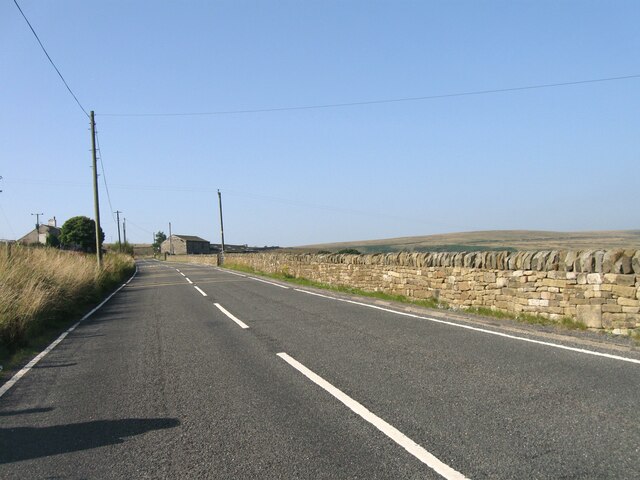
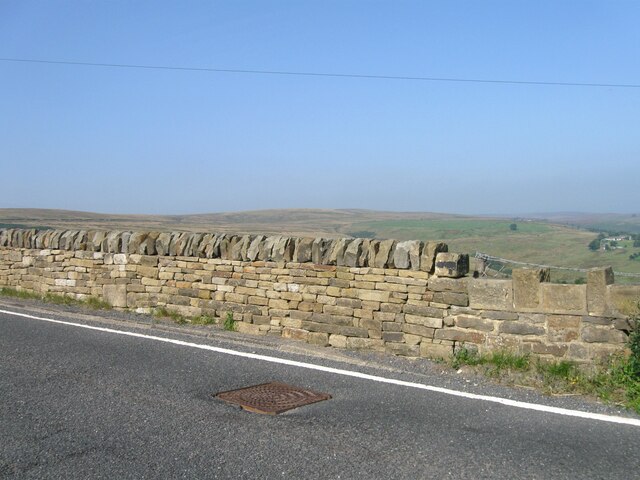
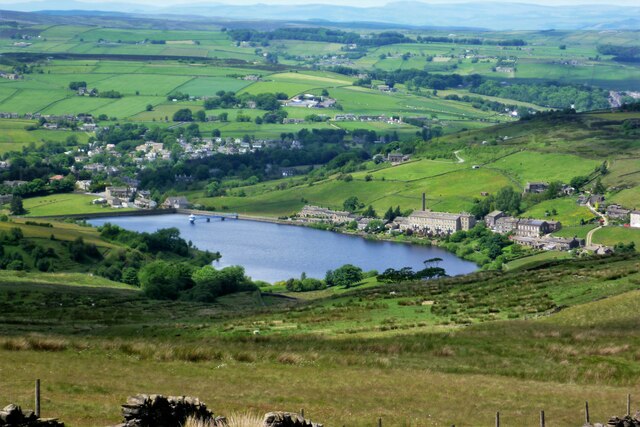
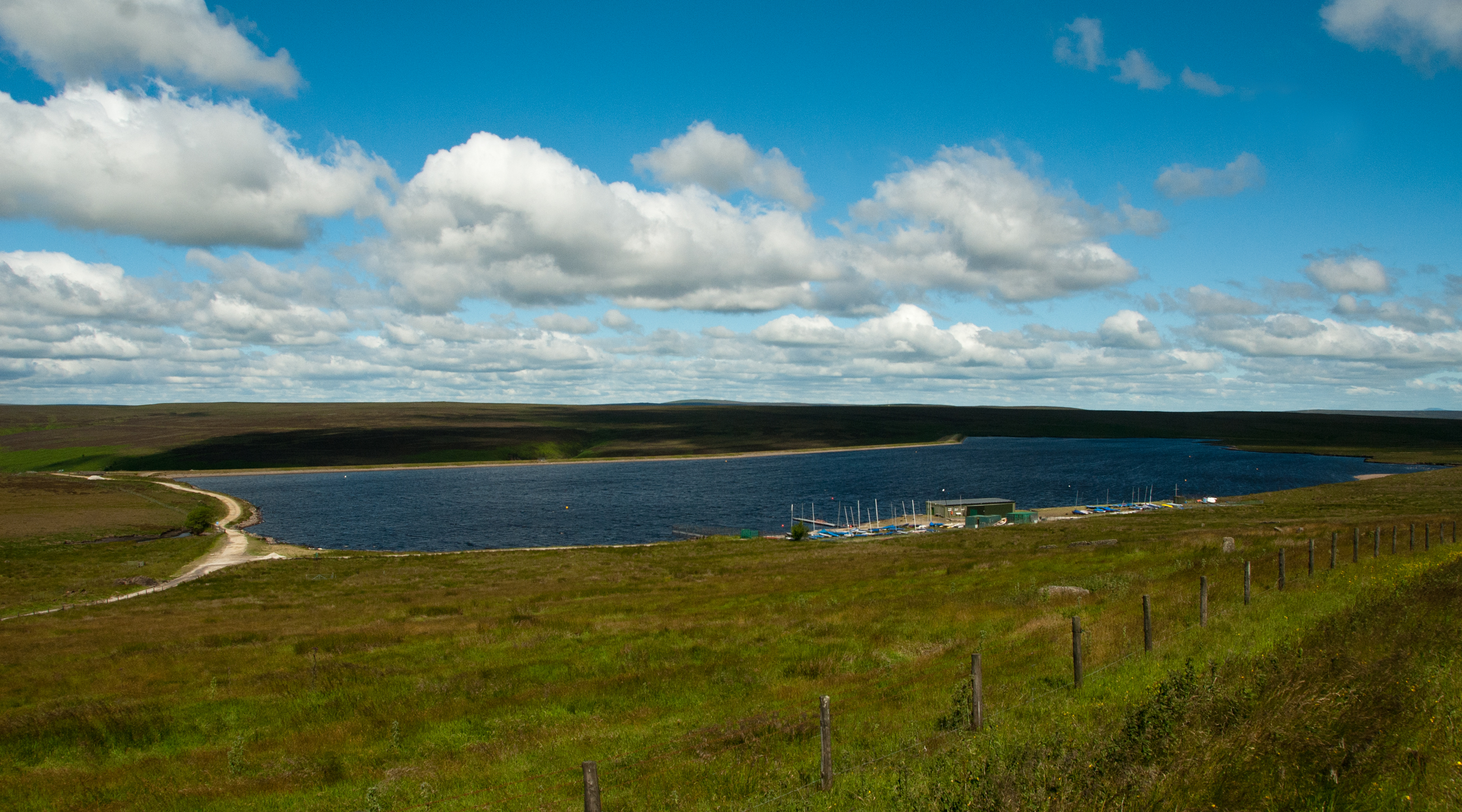
Nan Scar Images
Images are sourced within 2km of 53.799051/-1.9426048 or Grid Reference SE0333. Thanks to Geograph Open Source API. All images are credited.


Nan Scar is located at Grid Ref: SE0333 (Lat: 53.799051, Lng: -1.9426048)
Division: West Riding
Unitary Authority: Bradford
Police Authority: West Yorkshire
What 3 Words
///politics.lessening.shares. Near Oxenhope, West Yorkshire
Nearby Locations
Related Wikis

Worth Valley
Worth Valley is a ward in the City of Bradford Metropolitan District Council, West Yorkshire. The population of the ward taken at the 2011 Census was 14...

Oxenhope
Oxenhope is a village and civil parish near Keighley in the metropolitan borough of Bradford, West Yorkshire, England. It was historically part of the...

Oxenhope railway station
Oxenhope railway station serves the village of Oxenhope, near Haworth, and within the City of Bradford Metropolitan District of West Yorkshire, England...
Warley Moor Reservoir
Warley Moor Reservoir, also known as Fly Flatts Reservoir, is a drinking water reservoir in West Yorkshire, England, owned and operated by Yorkshire Water...

Ovenden Moor Wind Farm
Ovenden Moor Wind Farm is a wind powered electricity generating site in England. Ovenden Moor is located north of Halifax and west of Bradford in West...

Denholme
Denholme is a town and civil parish in the Bradford Metropolitan Borough, West Yorkshire, England. It is 8 miles (13 km) west of Bradford, 7 miles (11...

RAF Manywells Height
Royal Air Force Manywells Height (also known as Royal Flying Corps Manywells Height, Royal Flying Corps Cullingworth and Royal Air Force Cullingworth)...

Haworth Pottery
The Haworth Pottery was established by Anne Shaw in 1971 in Haworth, West Yorkshire, England. The pottery was initially supported by a loan from the Council...
Related Videos

I hiked the first day of snow in England 2023 | Haworth, England | A Winter Virtual Hiking Adventure
It's that time of year when the temperature drops and the trails turn white and crunchy! I headed off at sunrise this morning for a ...
Keighley and Worth Valley Railway (KWVR) | Steam and Diesel May Bank Holiday Weekend
Bank holiday weekend 27th and 28th May 2023 Steam and Diesel trains Thanks for watching Please Like and Subscribe ...


Tour Yorkshire's Hidden Gem - Holiday Home near HAWORTH, Yorkshire
In this travel vlog I show you around our beautiful holiday home near the village of Haworth in West Yorkshire. If you're looking for ...
Nearby Amenities
Located within 500m of 53.799051,-1.9426048Have you been to Nan Scar?
Leave your review of Nan Scar below (or comments, questions and feedback).