Lenton

Settlement in Lincolnshire South Kesteven

England

Lenton

St Peter's Church, Lenton: Notice Not an unusual sight, this, but a sign of social change. You will find other examples in churches, and on Geograph.

The campaign to end "pew renting" or reserved seating, in parish churches went hand in hand with a desire to find room for the increasing 19th century population.  The Incorporated Church Building Society gave 14,356 grants to enlarge and improve churches between 1818 and 1982, almost all of them conditional upon the provision of "free seating" (essentially first-come-first-seated)

See <span class="nowrap"><a title="https://www.nationalchurchestrust.org/news/celebrating-200th-anniversary-incorporated-church-building-society-st-pauls-cathedral" rel="nofollow ugc noopener" href="https://www.nationalchurchestrust.org/news/celebrating-200th-anniversary-incorporated-church-building-society-st-pauls-cathedral">Link</a><img style="margin-left:2px;" alt="External link" title="External link - shift click to open in new window" src="https://s1.geograph.org.uk/img/external.png" width="10" height="10"/></span> and "Free Seats for All" by Gill Hedley (<span class="nowrap"><a title="https://www.history.org.uk/historian/resource/9428/free-seats-for-all" rel="nofollow ugc noopener" href="https://www.history.org.uk/historian/resource/9428/free-seats-for-all">Link</a><img style="margin-left:2px;" alt="External link" title="External link - shift click to open in new window" src="https://s1.geograph.org.uk/img/external.png" width="10" height="10"/></span>  ), and this academic report on pew renting: <span class="nowrap"><a title="https://etheses.bham.ac.uk/id/eprint/2864/1/Bennett_11_PhD.pdf" rel="nofollow ugc noopener" href="https://etheses.bham.ac.uk/id/eprint/2864/1/Bennett_11_PhD.pdf">Link</a><img style="margin-left:2px;" alt="External link" title="External link - shift click to open in new window" src="https://s1.geograph.org.uk/img/external.png" width="10" height="10"/></span> .
St Peter's Church, Lenton: Notice Credit: Bob Harvey

Lenton is a small village located in the district of North Kesteven, Lincolnshire, England. Situated approximately 7 miles north of the city of Lincoln, Lenton is a rural community with a population of around 200 residents.

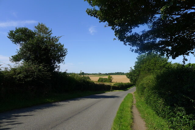
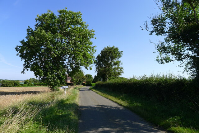
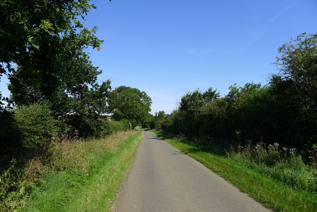
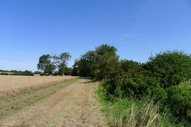
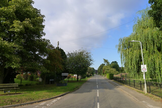
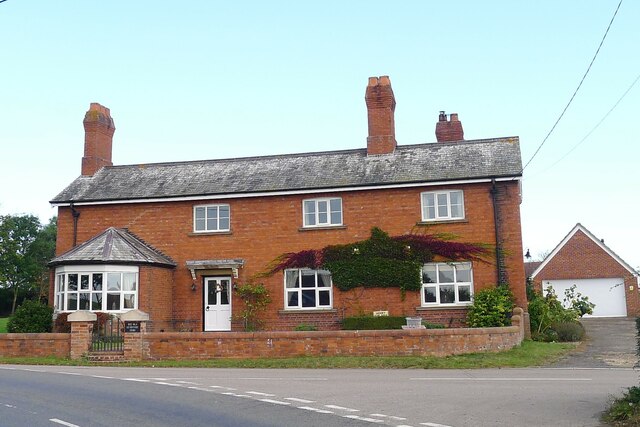
The village is known for its picturesque countryside, characterized by rolling hills, farmlands, and charming cottages. Lenton offers a peaceful and tranquil environment, making it an ideal location for those seeking a rural retreat away from the hustle and bustle of city life.

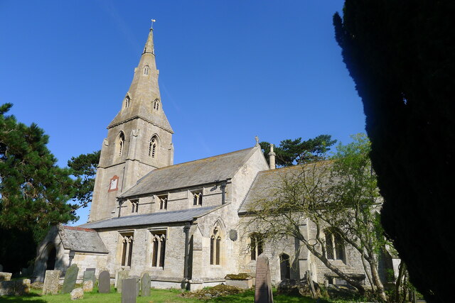
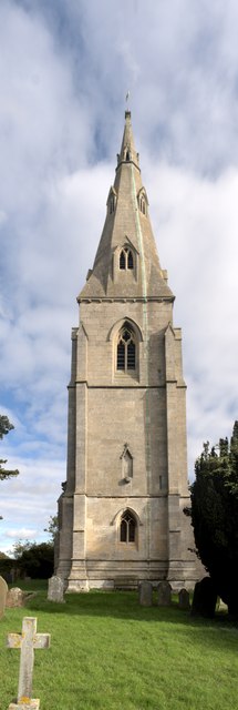
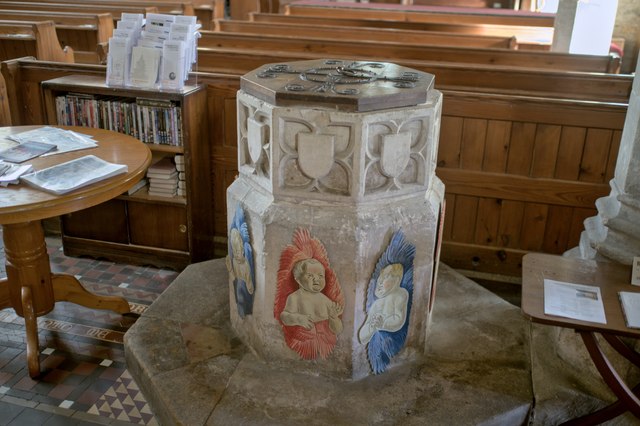
Lenton is rich in history and boasts several notable landmarks. One of the prominent features is the St. Peter's Church, a Grade II listed building that dates back to the 12th century. This historic church exhibits stunning architectural details and attracts visitors interested in its cultural heritage.

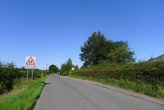
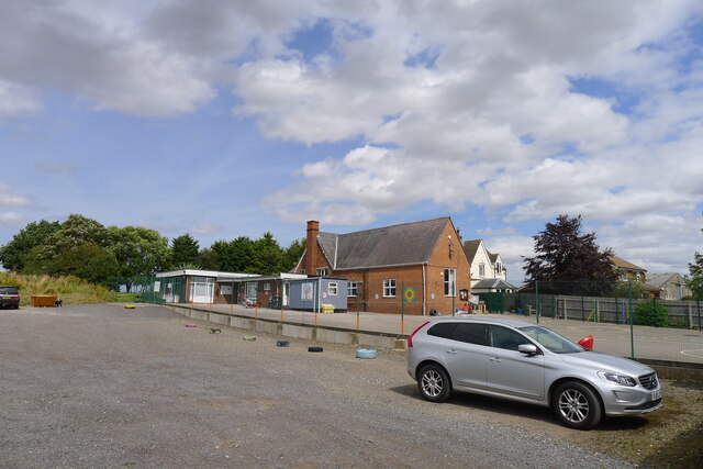
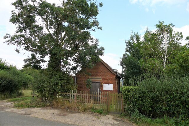
Despite its small size, Lenton offers a sense of community through various local amenities. The village has a primary school, providing education for children in the area. Additionally, there is a village hall that serves as a hub for social gatherings and community events.

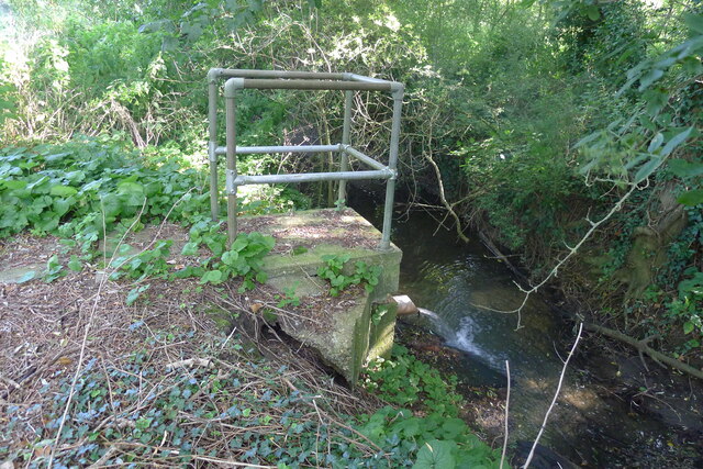
For those who enjoy outdoor activities, Lenton is surrounded by beautiful countryside, offering opportunities for walking, cycling, and exploring nature. The nearby Lincolnshire Wolds Area of Outstanding Natural Beauty provides stunning landscapes and scenic trails, making it a popular destination for outdoor enthusiasts.

In summary, Lenton is a quaint village in Lincolnshire, known for its rural charm, historic landmarks, and proximity to the picturesque Lincolnshire Wolds. It offers a peaceful and close-knit community, making it an appealing place to live or visit for those seeking a tranquil countryside experience.

If you have any feedback on the listing, please let us know in the comments section below.
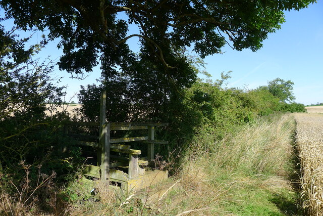
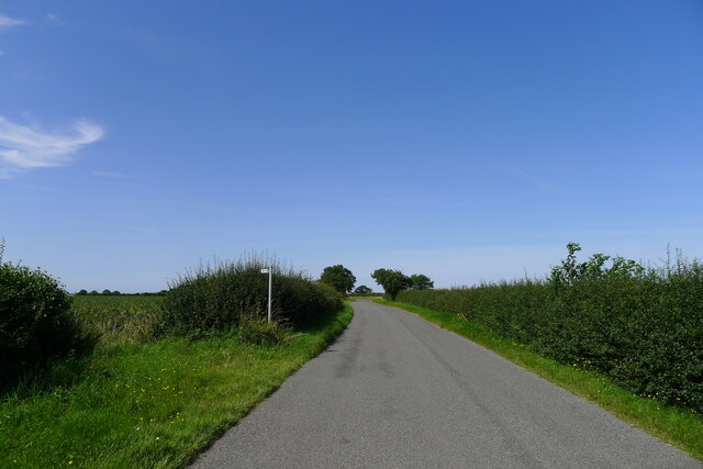
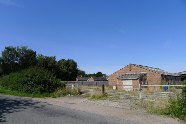
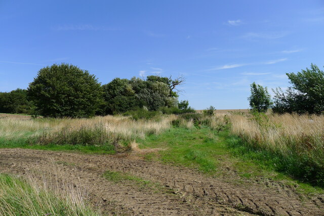
Lenton Images

Images are sourced within 2km of 52.860892/-0.478378 or Grid Reference TF0230. Thanks to Geograph Open Source API. All images are credited.

St Peter's Church, Lenton: Notice Not an unusual sight, this, but a sign of social change. You will find other examples in churches, and on Geograph.

The campaign to end "pew renting" or reserved seating, in parish churches went hand in hand with a desire to find room for the increasing 19th century population.  The Incorporated Church Building Society gave 14,356 grants to enlarge and improve churches between 1818 and 1982, almost all of them conditional upon the provision of "free seating" (essentially first-come-first-seated)

See <span class="nowrap"><a title="https://www.nationalchurchestrust.org/news/celebrating-200th-anniversary-incorporated-church-building-society-st-pauls-cathedral" rel="nofollow ugc noopener" href="https://www.nationalchurchestrust.org/news/celebrating-200th-anniversary-incorporated-church-building-society-st-pauls-cathedral">Link</a><img style="margin-left:2px;" alt="External link" title="External link - shift click to open in new window" src="https://s1.geograph.org.uk/img/external.png" width="10" height="10"/></span> and "Free Seats for All" by Gill Hedley (<span class="nowrap"><a title="https://www.history.org.uk/historian/resource/9428/free-seats-for-all" rel="nofollow ugc noopener" href="https://www.history.org.uk/historian/resource/9428/free-seats-for-all">Link</a><img style="margin-left:2px;" alt="External link" title="External link - shift click to open in new window" src="https://s1.geograph.org.uk/img/external.png" width="10" height="10"/></span>  ), and this academic report on pew renting: <span class="nowrap"><a title="https://etheses.bham.ac.uk/id/eprint/2864/1/Bennett_11_PhD.pdf" rel="nofollow ugc noopener" href="https://etheses.bham.ac.uk/id/eprint/2864/1/Bennett_11_PhD.pdf">Link</a><img style="margin-left:2px;" alt="External link" title="External link - shift click to open in new window" src="https://s1.geograph.org.uk/img/external.png" width="10" height="10"/></span> .
St Peter's Church, Lenton: Notice
Not an unusual sight, this, but a sign of social change. You will find other examples in churches, and on Geograph. The campaign to end "pew renting" or reserved seating, in parish churches went hand in hand with a desire to find room for the increasing 19th century population. The Incorporated Church Building Society gave 14,356 grants to enlarge and improve churches between 1818 and 1982, almost all of them conditional upon the provision of "free seating" (essentially first-come-first-seated) See LinkExternal link and "Free Seats for All" by Gill Hedley (LinkExternal link ), and this academic report on pew renting: LinkExternal link .
Entering Ingoldsby past Ingoldsby Academy
Ingoldsby Academy Primary school with nursery facility
Ingoldsby Academy
Primary school with nursery facility
Sewage works outfall into the East Glen River Work was being undertaken at the sewage works, which might explain the high flow from the outfall
Sewage works outfall into the East Glen River
Work was being undertaken at the sewage works, which might explain the high flow from the outfall
Ingoldsby Road leaving Lenton
Church of St Peter, Lenton Listed Grade I, from the 13th century <span class="nowrap"><a title="https://historicengland.org.uk/listing/the-list/list-entry/1253206" rel="nofollow ugc noopener" href="https://historicengland.org.uk/listing/the-list/list-entry/1253206">Link</a><img style="margin-left:2px;" alt="External link" title="External link - shift click to open in new window" src="https://s1.geograph.org.uk/img/external.png" width="10" height="10"/></span>
Church of St Peter, Lenton
Listed Grade I, from the 13th century LinkExternal link
Leaving Lenton and entering Hanby
King Street leading through Hanby After last appearing as a visible road outside Hanthorpe, almost 6 miles to the south-east <a href="https://www.geograph.org.uk/photo/5681655">TF0823 : Clipsey Gap Lane, part of King street</a>, the Roman road 'King Street' reappears on its route north-west towards Ancaster.
King Street leading through Hanby
After last appearing as a visible road outside Hanthorpe, almost 6 miles to the south-east TF0823 : Clipsey Gap Lane, part of King street, the Roman road 'King Street' reappears on its route north-west towards Ancaster.
Wheat field by the East Glen River The river - barely a trickle in this headwater - is hidden amongst the shrubs on the right.
Wheat field by the East Glen River
The river - barely a trickle in this headwater - is hidden amongst the shrubs on the right.
Footbridge over the East Glen River Carrying the footpath from Hanby to Ingoldsby. The bridge is quite substantial, whereas the path is poorly marked.
Footbridge over the East Glen River
Carrying the footpath from Hanby to Ingoldsby. The bridge is quite substantial, whereas the path is poorly marked.
Footpath to Lenton The Roman road, King Street, is believed to have run across here (see OS map), but there is no visible sign of it in the neighbouring fields.
Footpath to Lenton
The Roman road, King Street, is believed to have run across here (see OS map), but there is no visible sign of it in the neighbouring fields.
Grange Farm
Grange Farm
End of Bridleway The bridleway from Keisby Road ends here, behind a poultry farm slurry pond, at the site of the former RAF Folkingham Airfield.
End of Bridleway
The bridleway from Keisby Road ends here, behind a poultry farm slurry pond, at the site of the former RAF Folkingham Airfield.
Entering Ingoldsby on Main Street Ingoldsby =  ‘Farmstead or village of a man called Ingjaldr’ <span class="nowrap"><a title="https://www.oxfordreference.com/view/10.1093/acref/9780199609086.001.0001/acref-9780199609086" rel="nofollow ugc noopener" href="https://www.oxfordreference.com/view/10.1093/acref/9780199609086.001.0001/acref-9780199609086">Link</a><img style="margin-left:2px;" alt="External link" title="External link - shift click to open in new window" src="https://s1.geograph.org.uk/img/external.png" width="10" height="10"/></span>
Entering Ingoldsby on Main Street
Ingoldsby = ‘Farmstead or village of a man called Ingjaldr’ LinkExternal link
The Old Heathcote Arms, Ingoldsby Originally built as farmer's cottages. It was converted to a pub by a member of the Heathcote family about 1811; then became an Everards pub; closed (when?), leaving the village 'dry'; and now produces honey <span class="nowrap"><a title="https://theheathcotearms.co.uk/history" rel="nofollow ugc noopener" href="https://theheathcotearms.co.uk/history">Link</a><img style="margin-left:2px;" alt="External link" title="External link - shift click to open in new window" src="https://s1.geograph.org.uk/img/external.png" width="10" height="10"/></span> <span class="nowrap"><a title="https://www.heathcotehoney.co.uk/" rel="nofollow ugc noopener" href="https://www.heathcotehoney.co.uk/">Link</a><img style="margin-left:2px;" alt="External link" title="External link - shift click to open in new window" src="https://s1.geograph.org.uk/img/external.png" width="10" height="10"/></span>
The Old Heathcote Arms, Ingoldsby
Originally built as farmer's cottages. It was converted to a pub by a member of the Heathcote family about 1811; then became an Everards pub; closed (when?), leaving the village 'dry'; and now produces honey LinkExternal link LinkExternal link
Ingoldsby telephone exchange on Humby Road Network ID: EMINGOL, <span class="nowrap"><a title="https://telephone-exchange.co.uk/Ingoldsby-EMINGOL.html" rel="nofollow ugc noopener" href="https://telephone-exchange.co.uk/Ingoldsby-EMINGOL.html">Link</a><img style="margin-left:2px;" alt="External link" title="External link - shift click to open in new window" src="https://s1.geograph.org.uk/img/external.png" width="10" height="10"/></span>
Ingoldsby telephone exchange on Humby Road
Network ID: EMINGOL, LinkExternal link
St Peter's Church, Lenton: the tower The tower of the church dates from the 14th century, and is typical of the period.

This is a grade I listed building: <span class="nowrap"><a title="https://historicengland.org.uk/listing/the-list/list-entry/1253206?section=official-list-entry" rel="nofollow ugc noopener" href="https://historicengland.org.uk/listing/the-list/list-entry/1253206?section=official-list-entry">Link</a><img style="margin-left:2px;" alt="External link" title="External link - shift click to open in new window" src="https://s1.geograph.org.uk/img/external.png" width="10" height="10"/></span> .
St Peter's Church, Lenton: the tower
The tower of the church dates from the 14th century, and is typical of the period. This is a grade I listed building: LinkExternal link .
St Peter's Church, Lenton: the font Angels round the font.  These are part of the Millennium art project created by  the late Roger Heaton.  It has been erected again for the 24th anniversary.

The octagonal font is 15th century.  The church is grade I listed - see <span class="nowrap"><a title="https://historicengland.org.uk/listing/the-list/list-entry/1253206?section=official-list-entry" rel="nofollow ugc noopener" href="https://historicengland.org.uk/listing/the-list/list-entry/1253206?section=official-list-entry">Link</a><img style="margin-left:2px;" alt="External link" title="External link - shift click to open in new window" src="https://s1.geograph.org.uk/img/external.png" width="10" height="10"/></span> .
St Peter's Church, Lenton: the font
Angels round the font. These are part of the Millennium art project created by the late Roger Heaton. It has been erected again for the 24th anniversary. The octagonal font is 15th century. The church is grade I listed - see LinkExternal link .
Show me another place!

Lenton is located at Grid Ref: TF0230 (Lat: 52.860892, Lng: -0.478378)

Division: Parts of Kesteven

Administrative County: Lincolnshire

District: South Kesteven

Police Authority: Lincolnshire

What 3 Words

///reclaimed.loops.prettiest. Near Corby Glen, Lincolnshire

Nearby Locations

Lenton

Related Wikis

Lenton, Keisby and Osgodby

Lenton, Keisby and Osgodby is a civil parish in South Kesteven, Lincolnshire, England. The population of the civil parish at the 2011 census was 187....

Lenton, Lincolnshire

Lenton is a hamlet in the district of South Kesteven, Lincolnshire, England. It is situated approximately 7 miles (11 km) south-east from Grantham, and...

Ingoldsby

Ingoldsby is a small village in the South Kesteven district of Lincolnshire, England. It is situated 7 miles (11 km) south-east from the market town of...

Hanby, Lincolnshire

Hanby is a hamlet in the South Kesteven district of Lincolnshire, England. It is situated between Lenton and Ropsley Heath, on the line of the Roman...

Keisby

Keisby is a small hamlet in the district of South Kesteven, in Lincolnshire, England. It is situated 6 miles (10 km) north-west from Bourne and 9 miles...
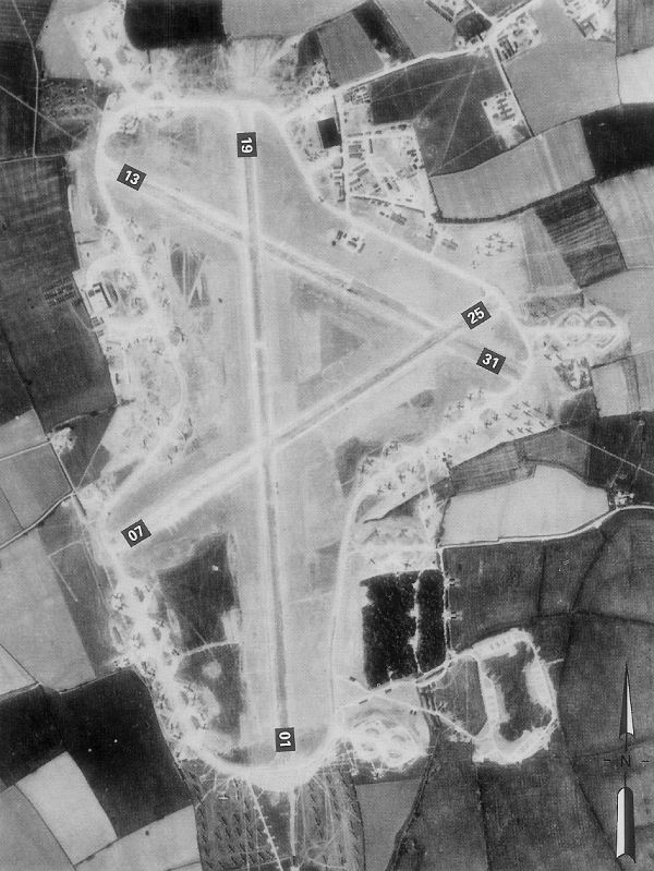
RAF Folkingham

Royal Air Force Folkingham or RAF Folkingham is a former Royal Air Force station located south west of Folkingham, Lincolnshire and about 29 miles (47...

Little Humby

Little Humby or Humby is a hamlet in the South Kesteven district of Lincolnshire, England. It lies in the civil parish of Ropsley and Humby, 5 miles (8...

Irnham

Irnham is a village and civil parish in South Kesteven, Lincolnshire, England. It is situated approximately 10 miles (16 km) south-east from Grantham...

Nearby Amenities

Located within 500m of 52.860892,-0.478378
Lenton
Is In: Lincolnshire, England, UK
Place: hamlet
Lat/Long: 52.8607764/-0.4785524
Bus Stop
St Peter's Church
Naptan AtcoCode: 270000008956
Naptan Bearing: NE
Naptan CommonName: St Peter's Church
Naptan Indicator: opp
Naptan Landmark: St Peter's Church
Naptan NaptanCode: lingwjmt
Naptan Street: Ingoldsby Road
Naptan Verified: no
Source: naptan_import
Lat/Long: 52.8607948/-0.4786993
Bus Stop
St Peter's Church
Naptan AtcoCode: 2700LLC01539
Naptan Bearing: SW
Naptan CommonName: St Peter's Church
Naptan Indicator: adj
Naptan Landmark: St Peter's Church
Naptan NaptanCode: linamapd
Naptan Street: Ingoldsby Road
Naptan Verified: no
Source: naptan_import
Lat/Long: 52.8608279/-0.4784753
New House Farm
Place: farm
Source: Bing
Lat/Long: 52.8609091/-0.4711339
Church Farm
Place: farm
Source: Bing
Lat/Long: 52.8604419/-0.4778724
Hill Top Farm
Place: farm
Source: Bing
Lat/Long: 52.8598045/-0.4798664
Manor Farm
Place: farm
Source: Bing
Lat/Long: 52.8610894/-0.4728957
Telephone
Booth: K6
Covered: booth
Operator: BT
Phone: +44 1476 585300
Lat/Long: 52.8609587/-0.4782677
Post Box
Post Box Type: lamp
Lat/Long: 52.8608251/-0.4785017
The data included in this document is from www.openstreetmap.org. The data is made available under ODbL.

Have you been to Lenton?

Leave your review of Lenton below (or comments, questions and feedback).