Glen Ugie

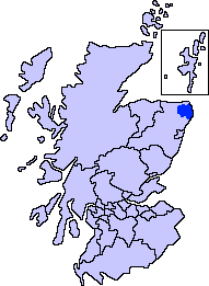
Valley in Aberdeenshire

Scotland

Glen Ugie

Hillcrest Junction Junction on a quiet back road
Hillcrest Junction Credit: Ralph Greig

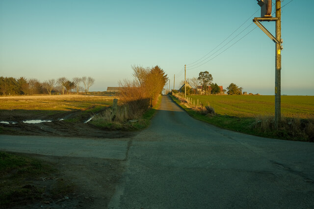
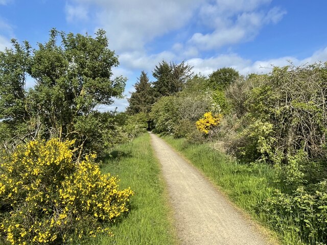
Glen Ugie is a picturesque valley located in Aberdeenshire, Scotland. Nestled within the stunning Scottish Highlands, this valley is known for its breathtaking natural beauty and rich history. The valley stretches approximately 10 miles from the village of New Byth to the village of Strichen.

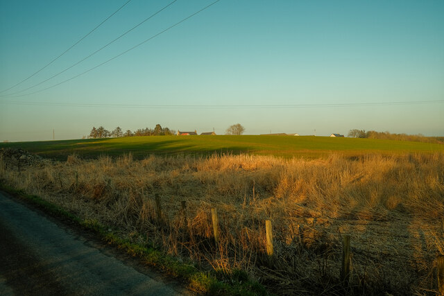
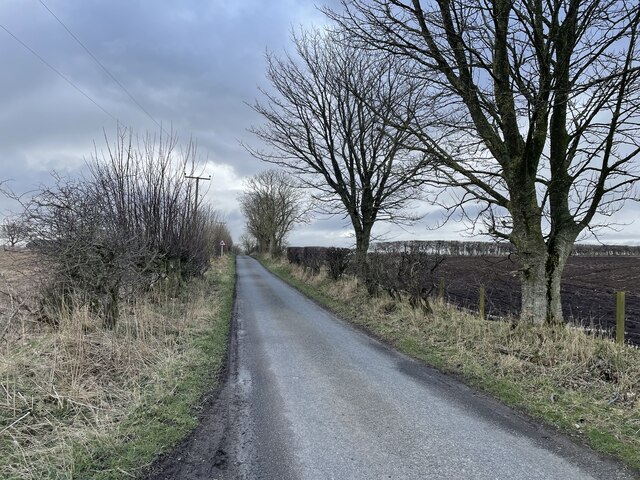
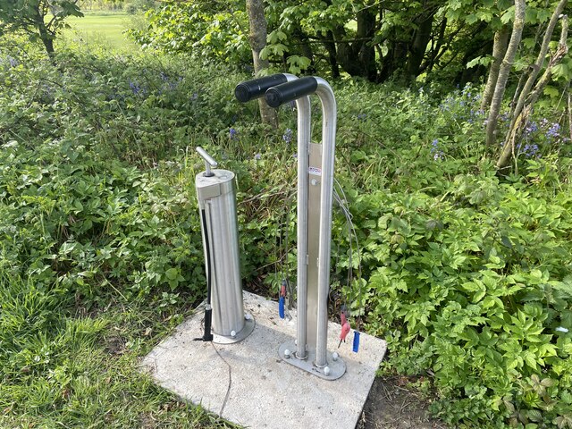
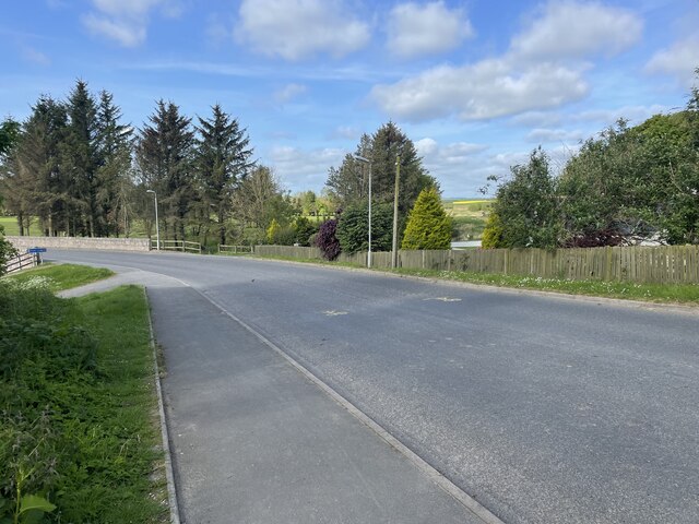
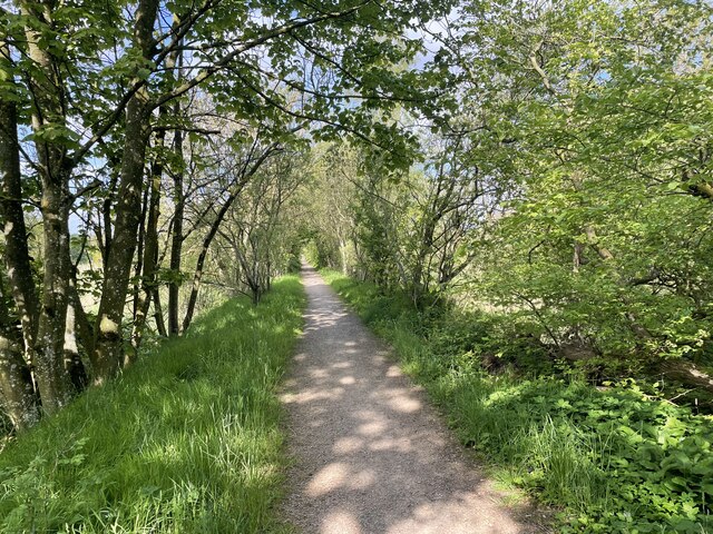
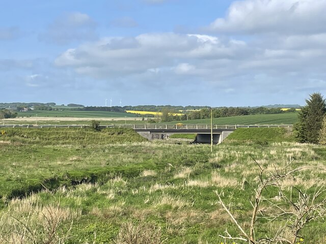
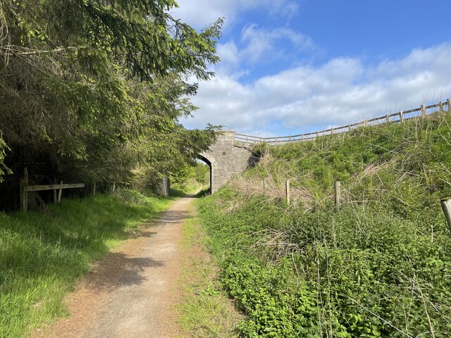
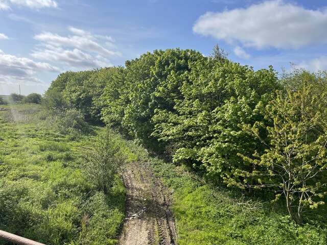
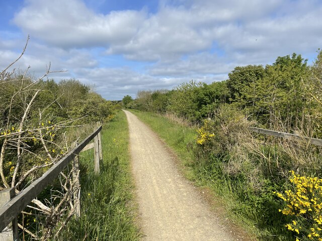
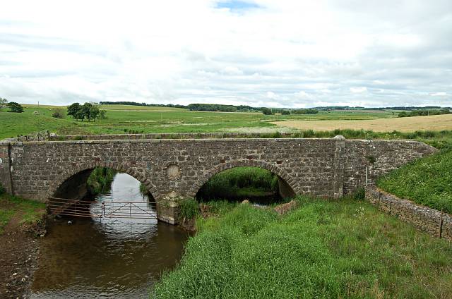
The landscape of Glen Ugie is characterized by rolling hills, verdant meadows, and meandering streams. The Ugie River, which flows through the valley, adds to the charm of the area with its crystal-clear waters. The valley is surrounded by lush forests, offering a haven for wildlife and providing opportunities for outdoor activities such as hiking, birdwatching, and fishing.

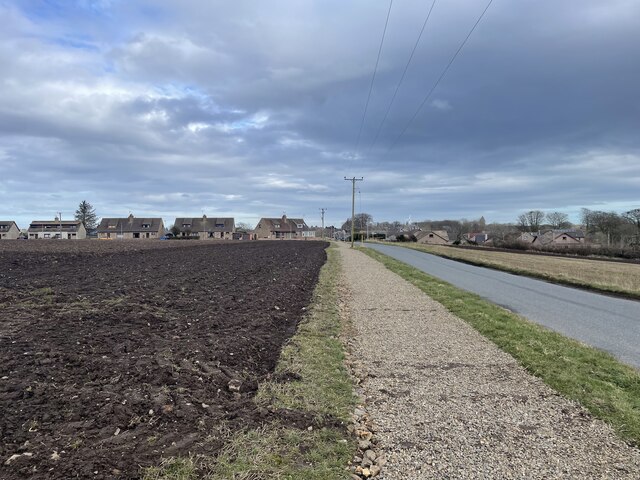
The history of Glen Ugie dates back centuries, with evidence of prehistoric settlements and ancient burial sites found in the area. During the 18th and 19th centuries, the valley was a hub for agriculture and industry, particularly in the form of farming and textile production. The remnants of old mills and farmsteads can still be seen today, adding to the historical charm of the valley.

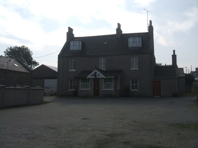
The small villages within Glen Ugie, including New Byth and Strichen, offer a glimpse into traditional Scottish rural life. The locals are known for their warm hospitality and strong community spirit. Visitors to the area can explore the village streets, visit local pubs and cafes, and perhaps even attend one of the lively community events that take place throughout the year.

In summary, Glen Ugie is a captivating valley in Aberdeenshire, Scotland, renowned for its natural beauty, historical significance, and welcoming community.

If you have any feedback on the listing, please let us know in the comments section below.

Glen Ugie Images

Images are sourced within 2km of 57.522996/-1.961518 or Grid Reference NK0248. Thanks to Geograph Open Source API. All images are credited.

Hillcrest Junction Junction on a quiet back road
Hillcrest Junction
Junction on a quiet back road
Hillcrest Farm Looking from the old railway towards the Hillcrest
Hillcrest Farm
Looking from the old railway towards the Hillcrest
Car Park for the windmill walk
Windmill walk avenue of trees
Road through Inverquhomery
Fields of Auchtydonald
Into Longside
Into Longside
The Longside Bypass
The Longside Bypass
Cycle repair station The Formartine and Buchan Way is a long-distance trail in Scotland, extending from Dyce north to Peterhead and Fraserburgh in the Buchan and Formartine districts of Aberdeenshire in Scotland. It follows the track of a former railway line, the Formartine and Buchan Railway, and is open to walkers, cyclists and horse riders.The railway closed in 1979 (Fraserburgh) and 1970 (Maud-Peterhead). The walkway opened in the early 1990s, and is managed by Aberdeenshire Council. It is listed as one of Scotland's Great Trails by NatureScot
64 km (40 mi) to Fraserburgh, plus 21 km (13 mi) spur to Peterhead.
Cycle repair station
The Formartine and Buchan Way is a long-distance trail in Scotland, extending from Dyce north to Peterhead and Fraserburgh in the Buchan and Formartine districts of Aberdeenshire in Scotland. It follows the track of a former railway line, the Formartine and Buchan Railway, and is open to walkers, cyclists and horse riders.The railway closed in 1979 (Fraserburgh) and 1970 (Maud-Peterhead). The walkway opened in the early 1990s, and is managed by Aberdeenshire Council. It is listed as one of Scotland's Great Trails by NatureScot 64 km (40 mi) to Fraserburgh, plus 21 km (13 mi) spur to Peterhead.
Road into Longside The Formartine and Buchan Way is a long-distance trail in Scotland, extending from Dyce north to Peterhead and Fraserburgh in the Buchan and Formartine districts of Aberdeenshire in Scotland. It follows the track of a former railway line, the Formartine and Buchan Railway, and is open to walkers, cyclists and horse riders.The railway closed in 1979 (Fraserburgh) and 1970 (Maud-Peterhead). The walkway opened in the early 1990s, and is managed by Aberdeenshire Council. It is listed as one of Scotland's Great Trails by NatureScot
64 km (40 mi) to Fraserburgh, plus 21 km (13 mi) spur to Peterhead.
Road into Longside
The Formartine and Buchan Way is a long-distance trail in Scotland, extending from Dyce north to Peterhead and Fraserburgh in the Buchan and Formartine districts of Aberdeenshire in Scotland. It follows the track of a former railway line, the Formartine and Buchan Railway, and is open to walkers, cyclists and horse riders.The railway closed in 1979 (Fraserburgh) and 1970 (Maud-Peterhead). The walkway opened in the early 1990s, and is managed by Aberdeenshire Council. It is listed as one of Scotland's Great Trails by NatureScot 64 km (40 mi) to Fraserburgh, plus 21 km (13 mi) spur to Peterhead.
F&B Way The Formartine and Buchan Way is a long-distance trail in Scotland, extending from Dyce north to Peterhead and Fraserburgh in the Buchan and Formartine districts of Aberdeenshire in Scotland. It follows the track of a former railway line, the Formartine and Buchan Railway, and is open to walkers, cyclists and horse riders.The railway closed in 1979 (Fraserburgh) and 1970 (Maud-Peterhead). The walkway opened in the early 1990s, and is managed by Aberdeenshire Council. It is listed as one of Scotland's Great Trails by NatureScot
64 km (40 mi) to Fraserburgh, plus 21 km (13 mi) spur to Peterhead.
F&B Way
The Formartine and Buchan Way is a long-distance trail in Scotland, extending from Dyce north to Peterhead and Fraserburgh in the Buchan and Formartine districts of Aberdeenshire in Scotland. It follows the track of a former railway line, the Formartine and Buchan Railway, and is open to walkers, cyclists and horse riders.The railway closed in 1979 (Fraserburgh) and 1970 (Maud-Peterhead). The walkway opened in the early 1990s, and is managed by Aberdeenshire Council. It is listed as one of Scotland's Great Trails by NatureScot 64 km (40 mi) to Fraserburgh, plus 21 km (13 mi) spur to Peterhead.
A950 Road Bridge
A950 Road Bridge
The F&B Way
The F&B Way
Glen Ugie Bridge The Formartine and Buchan Way is a long-distance trail in Scotland, extending from Dyce north to Peterhead and Fraserburgh in the Buchan and Formartine districts of Aberdeenshire in Scotland. It follows the track of a former railway line, the Formartine and Buchan Railway, and is open to walkers, cyclists and horse riders.The railway closed in 1979 (Fraserburgh) and 1970 (Maud-Peterhead). The walkway opened in the early 1990s, and is managed by Aberdeenshire Council. It is listed as one of Scotland's Great Trails by NatureScot
64 km (40 mi) to Fraserburgh, plus 21 km (13 mi) spur to Peterhead.
Glen Ugie Bridge
The Formartine and Buchan Way is a long-distance trail in Scotland, extending from Dyce north to Peterhead and Fraserburgh in the Buchan and Formartine districts of Aberdeenshire in Scotland. It follows the track of a former railway line, the Formartine and Buchan Railway, and is open to walkers, cyclists and horse riders.The railway closed in 1979 (Fraserburgh) and 1970 (Maud-Peterhead). The walkway opened in the early 1990s, and is managed by Aberdeenshire Council. It is listed as one of Scotland's Great Trails by NatureScot 64 km (40 mi) to Fraserburgh, plus 21 km (13 mi) spur to Peterhead.
Old Access Road The Formartine and Buchan Way is a long-distance trail in Scotland, extending from Dyce north to Peterhead and Fraserburgh in the Buchan and Formartine districts of Aberdeenshire in Scotland. It follows the track of a former railway line, the Formartine and Buchan Railway, and is open to walkers, cyclists and horse riders.The railway closed in 1979 (Fraserburgh) and 1970 (Maud-Peterhead). The walkway opened in the early 1990s, and is managed by Aberdeenshire Council. It is listed as one of Scotland's Great Trails by NatureScot
64 km (40 mi) to Fraserburgh, plus 21 km (13 mi) spur to Peterhead.
Old Access Road
The Formartine and Buchan Way is a long-distance trail in Scotland, extending from Dyce north to Peterhead and Fraserburgh in the Buchan and Formartine districts of Aberdeenshire in Scotland. It follows the track of a former railway line, the Formartine and Buchan Railway, and is open to walkers, cyclists and horse riders.The railway closed in 1979 (Fraserburgh) and 1970 (Maud-Peterhead). The walkway opened in the early 1990s, and is managed by Aberdeenshire Council. It is listed as one of Scotland's Great Trails by NatureScot 64 km (40 mi) to Fraserburgh, plus 21 km (13 mi) spur to Peterhead.
The F&B Way The Formartine and Buchan Way is a long-distance trail in Scotland, extending from Dyce north to Peterhead and Fraserburgh in the Buchan and Formartine districts of Aberdeenshire in Scotland. It follows the track of a former railway line, the Formartine and Buchan Railway, and is open to walkers, cyclists and horse riders.The railway closed in 1979 (Fraserburgh) and 1970 (Maud-Peterhead). The walkway opened in the early 1990s, and is managed by Aberdeenshire Council. It is listed as one of Scotland's Great Trails by NatureScot
64 km (40 mi) to Fraserburgh, plus 21 km (13 mi) spur to Peterhead.
The F&B Way
The Formartine and Buchan Way is a long-distance trail in Scotland, extending from Dyce north to Peterhead and Fraserburgh in the Buchan and Formartine districts of Aberdeenshire in Scotland. It follows the track of a former railway line, the Formartine and Buchan Railway, and is open to walkers, cyclists and horse riders.The railway closed in 1979 (Fraserburgh) and 1970 (Maud-Peterhead). The walkway opened in the early 1990s, and is managed by Aberdeenshire Council. It is listed as one of Scotland's Great Trails by NatureScot 64 km (40 mi) to Fraserburgh, plus 21 km (13 mi) spur to Peterhead.
The South Ugie Looking up stream on the South Ugie near Ugiebank by Longside.
The South Ugie
Looking up stream on the South Ugie near Ugiebank by Longside.
Bruce Arms Hotel, Longside currently closed. pile of rubble at right of building is the old 'lean-to' Public Bar. Never luxurious. Village trade lost to prosperous Football Social Club and Golf Club.
Bruce Arms Hotel, Longside
currently closed. pile of rubble at right of building is the old 'lean-to' Public Bar. Never luxurious. Village trade lost to prosperous Football Social Club and Golf Club.
Show me another place!

Glen Ugie is located at Grid Ref: NK0248 (Lat: 57.522996, Lng: -1.961518)

Unitary Authority: Aberdeenshire

Police Authority: North East

What 3 Words

///entitles.employer.rapport. Near Mintlaw, Aberdeenshire

Nearby Locations

Glen Ugie

Related Wikis

Longside railway station

Longside railway station was a railway station in Longside, Aberdeenshire. == History == The station was opened on 3 July 1862. On the north side was the...

Longside

Longside is a village located in Aberdeenshire, Scotland, consisting of a single main street. It lies seven miles inland from Peterhead and two miles from...

Buchan

Buchan is a coastal district in the north-east of Scotland, bounded by the Ythan and Deveron rivers. It was one of the original provinces of the Kingdom...

Mintlaw

Mintlaw (literally meaning a smooth, flat place) is a large village in Aberdeenshire, Scotland lying along the A952 road and is geographically a route...

Mintlaw Academy

Mintlaw Academy is a secondary school in Aberdeenshire, Scotland. == History == The school opened in 1981 with about 600 enrolled students and a capacity...

Mintlaw railway station

Mintlaw railway station was a railway station in Mintlaw, Aberdeenshire (Scotland). == History == The 29 mile long railway from Dyce to Mintlaw opened...

South Ugie Water

The South Ugie Water is a tributary of the Ugie Water in northeastern Aberdeenshire, Scotland. To the south of the Ugie Water are a number of prehistoric...

Aden Country Park

Aden Country Park is located in Mintlaw, Aberdeenshire, Scotland, first mentioned in the 10th-century Book of Deer. The park has a caravan area with camping...

Nearby Amenities

Located within 500m of 57.522996,-1.961518
Power: pole
Lat/Long: 57.5213035/-1.954327
Power: pole
Lat/Long: 57.5219115/-1.9543922
Power: pole
Lat/Long: 57.5226551/-1.9544675
Power: pole
Lat/Long: 57.5221761/-1.964554
Power: pole
Lat/Long: 57.5228443/-1.9646396
Power: pole
Lat/Long: 57.5233538/-1.9646742
Power: pole
Lat/Long: 57.5235889/-1.963939
Power: pole
Lat/Long: 57.5238415/-1.9630328
Power: pole
Lat/Long: 57.5237289/-1.9622569
Power: pole
Lat/Long: 57.5238207/-1.9613059
Power: pole
Lat/Long: 57.5239596/-1.9599659
Power: pole
Lat/Long: 57.5240471/-1.9590495
Power: pole
Lat/Long: 57.5240897/-1.9586341
Power: pole
Lat/Long: 57.524186/-1.9576831
Power: pole
Lat/Long: 57.5243215/-1.9564246
Power: pole
Lat/Long: 57.5235638/-1.962487
The data included in this document is from www.openstreetmap.org. The data is made available under ODbL.

Have you been to Glen Ugie?

Leave your review of Glen Ugie below (or comments, questions and feedback).