Deercote Valley

Valley in Staffordshire Stafford

England

Deercote Valley

Lock Cottage with balloon Looking north from Colwich Lock, Little Haywood, in Staffordshire
Lock Cottage with balloon Credit: Roger Kidd

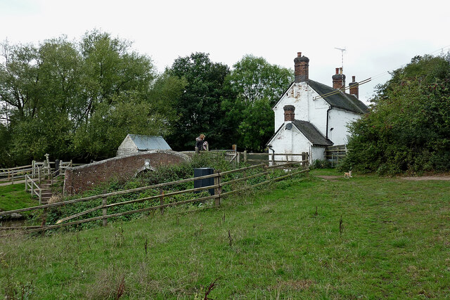
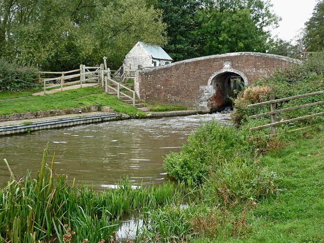
Deercote Valley is an enchanting area located in the county of Staffordshire, England. Nestled amidst the rolling countryside, this picturesque valley is known for its natural beauty and serene atmosphere. Spanning over 500 acres, Deercote Valley is a haven for wildlife and offers visitors a unique opportunity to immerse themselves in nature.

The valley derives its name from the abundance of deer that can be spotted roaming freely throughout the area. These majestic creatures, along with many other species of birds and animals, have made Deercote Valley their home, creating a thriving ecosystem. Wildlife enthusiasts will be delighted by the diverse range of flora and fauna found here.

Visitors to Deercote Valley can explore a network of well-maintained trails that wind through lush woodlands, meadows, and babbling brooks. The valley is particularly popular with hikers, joggers, and nature lovers, who can enjoy the tranquility and breathtaking views that the area has to offer. There are also designated picnic areas where families and friends can relax and enjoy a meal surrounded by nature's beauty.

In addition to its natural charm, Deercote Valley is steeped in history. The valley is home to several archaeological sites, including ancient burial mounds and remnants of prehistoric settlements. These historical features provide a fascinating glimpse into the valley's past and the lives of its earliest inhabitants.

Deercote Valley is easily accessible, with ample parking and well-marked paths. Whether you are seeking a peaceful escape from the hustle and bustle of everyday life or an opportunity to connect with nature, Deercote Valley is a must-visit destination in Staffordshire.

If you have any feedback on the listing, please let us know in the comments section below.

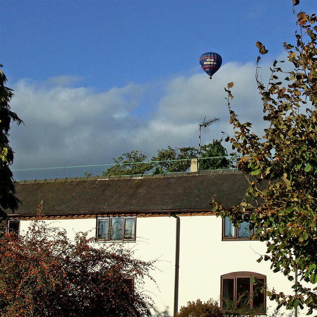
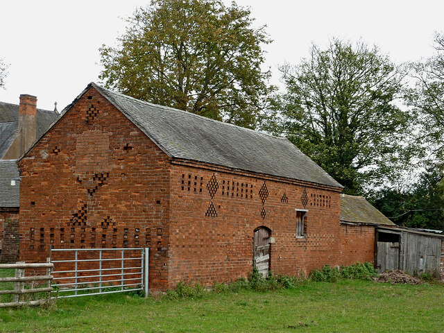
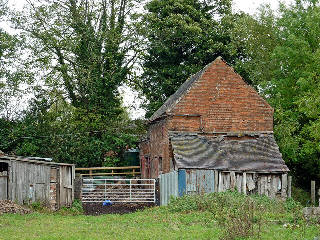
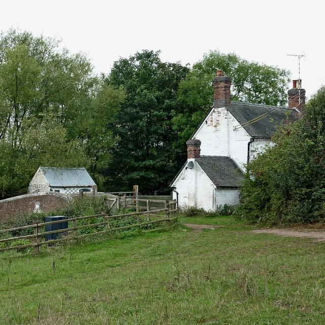
Deercote Valley Images

Images are sourced within 2km of 52.773152/-1.9784794 or Grid Reference SK0119. Thanks to Geograph Open Source API. All images are credited.

Lock Cottage with balloon Looking north from Colwich Lock, Little Haywood, in Staffordshire
Lock Cottage with balloon
Looking north from Colwich Lock, Little Haywood, in Staffordshire
Canalside barns in Colwich, Staffordshire Seen from the towpath of the Trent and Mersey Canal.
Canalside barns in Colwich, Staffordshire
Seen from the towpath of the Trent and Mersey Canal.
Old barn in Colwich, Staffordshire Seen from the towpath of the Trent and Mersey Canal.
Old barn in Colwich, Staffordshire
Seen from the towpath of the Trent and Mersey Canal.
Barn with dilapidated shed in Colwich, Staffordshire Seen from the towpath of the Trent and Mersey Canal.
Barn with dilapidated shed in Colwich, Staffordshire
Seen from the towpath of the Trent and Mersey Canal.
Ford at the Wolseley Centre Footbridges are available nearby. The Wolseley Centre is the HQ of the Staffordshire Wildlife Trust, with extensive grounds, two lakes and a cafe and gift shop.
Ford at the Wolseley Centre
Footbridges are available nearby. The Wolseley Centre is the HQ of the Staffordshire Wildlife Trust, with extensive grounds, two lakes and a cafe and gift shop.
Swan Lake, the Wolseley Centre Despite the name of the lake, it's Canada geese that are flying in. The Wolseley Centre is the HQ of the Staffordshire Wildlife Trust, with extensive grounds, two lakes and a cafe and gift shop.
Swan Lake, the Wolseley Centre
Despite the name of the lake, it's Canada geese that are flying in. The Wolseley Centre is the HQ of the Staffordshire Wildlife Trust, with extensive grounds, two lakes and a cafe and gift shop.
Path in the 'Wet Meadow', the Wolseley Centre The Wolseley Centre is the HQ of the Staffordshire Wildlife Trust, with extensive grounds, two lakes, a cafe and a gift shop.
Path in the 'Wet Meadow', the Wolseley Centre
The Wolseley Centre is the HQ of the Staffordshire Wildlife Trust, with extensive grounds, two lakes, a cafe and a gift shop.
Footbridge at the Wolseley Centre Funded by a Rotary Club. The Wolseley Centre is the HQ of the Staffordshire Wildlife Trust, with extensive grounds, two lakes, a cafe and a gift shop.
Footbridge at the Wolseley Centre
Funded by a Rotary Club. The Wolseley Centre is the HQ of the Staffordshire Wildlife Trust, with extensive grounds, two lakes, a cafe and a gift shop.
Canada geese on Swan Lake, the Wolseley Centre The Wolseley Centre is the HQ of the Staffordshire Wildlife Trust, with extensive grounds, two lakes, a cafe and a gift shop.
Canada geese on Swan Lake, the Wolseley Centre
The Wolseley Centre is the HQ of the Staffordshire Wildlife Trust, with extensive grounds, two lakes, a cafe and a gift shop.
The fernery at the Wolseley Centre A plaque reads 'Planted in memory of Margaret Kingston (1934 - 2011) from dionations given to Friends of Cannock Chase in her memory'. The Wolseley Centre is the HQ of the Staffordshire Wildlife Trust, with extensive grounds, two lakes, a cafe and a gift shop.
The fernery at the Wolseley Centre
A plaque reads 'Planted in memory of Margaret Kingston (1934 - 2011) from dionations given to Friends of Cannock Chase in her memory'. The Wolseley Centre is the HQ of the Staffordshire Wildlife Trust, with extensive grounds, two lakes, a cafe and a gift shop.
Spider's web artwork at the Wolseley Centre The Wolseley Centre is the HQ of the Staffordshire Wildlife Trust, with extensive grounds, two lakes, a cafe and a gift shop.
Spider's web artwork at the Wolseley Centre
The Wolseley Centre is the HQ of the Staffordshire Wildlife Trust, with extensive grounds, two lakes, a cafe and a gift shop.
Half-buried structure at the Wolseley Centre Possibly the remains of an ice house? The Wolseley Centre is the HQ of the Staffordshire Wildlife Trust, with extensive grounds, two lakes, a cafe and a gift shop.
Half-buried structure at the Wolseley Centre
Possibly the remains of an ice house? The Wolseley Centre is the HQ of the Staffordshire Wildlife Trust, with extensive grounds, two lakes, a cafe and a gift shop.
Cottage by Colwich Lock in Staffordshire Colwich Lock (No 21) is on the Trent and Mersey Canal near Little Haywood. A public footpath crosses the bridge here.
Cottage by Colwich Lock in Staffordshire
Colwich Lock (No 21) is on the Trent and Mersey Canal near Little Haywood. A public footpath crosses the bridge here.
Cottage and canal bridge near Colwich in Staffordshire Colwich Lock (No 21) is on the Trent and Mersey Canal near Little Haywood. A public footpath crosses the bridge here.
Cottage and canal bridge near Colwich in Staffordshire
Colwich Lock (No 21) is on the Trent and Mersey Canal near Little Haywood. A public footpath crosses the bridge here.
Colwich Bridge near Little Haywood in Staffordshire Bridge No 72 across the Trent and Mersey Canal is immediately below Colwich Lock.
Notice the turbulence in the water below the bridge. The lock paddles have bee raised, and water is gushing through. A narrowboat will emerge very soon.

<a href="https://www.geograph.org.uk/photo/2662653">SK0021 : Colwich Bridge near Little Haywood in Staffordshire</a>

The Trent and Mersey Canal is 93.5 miles in length from Derwent Mouth to Preston Brook. The first sod was cut by Josiah Wedgwood in July 1766 at Middleport (Stoke-on-Trent). The eastern section between Derwent Mouth and Shugborough (the junction with the Staffordshire and Worcestershire Canal) was already operational by 1770 and the whole canal through to Preston Brook, where it linked with the Bridgewater Canal was open for business by 1777. James Brindley was the engineer until his death in 1772.
Colwich Bridge near Little Haywood in Staffordshire
Bridge No 72 across the Trent and Mersey Canal is immediately below Colwich Lock. Notice the turbulence in the water below the bridge. The lock paddles have bee raised, and water is gushing through. A narrowboat will emerge very soon. SK0021 : Colwich Bridge near Little Haywood in Staffordshire The Trent and Mersey Canal is 93.5 miles in length from Derwent Mouth to Preston Brook. The first sod was cut by Josiah Wedgwood in July 1766 at Middleport (Stoke-on-Trent). The eastern section between Derwent Mouth and Shugborough (the junction with the Staffordshire and Worcestershire Canal) was already operational by 1770 and the whole canal through to Preston Brook, where it linked with the Bridgewater Canal was open for business by 1777. James Brindley was the engineer until his death in 1772.
Canal south-east of Colwich in Staffordshire This is the Trent and Mersey Canal approaching Wolseley Bridge, No 70.
Canal south-east of Colwich in Staffordshire
This is the Trent and Mersey Canal approaching Wolseley Bridge, No 70.
Canal south-east of Colwich in Staffordshire This is the Trent and Mersey Canal approaching Wolseley Bridge, No 70.
Canal south-east of Colwich in Staffordshire
This is the Trent and Mersey Canal approaching Wolseley Bridge, No 70.
Wolseley Bridge near Colwich in Staffordshire Wolseley Bridge is No 70 across the Trent and Mersey Canal. It carries the A51 between Stone and Rugeley.
Wolseley Bridge near Colwich in Staffordshire
Wolseley Bridge is No 70 across the Trent and Mersey Canal. It carries the A51 between Stone and Rugeley.
Show me another place!

Deercote Valley is located at Grid Ref: SK0119 (Lat: 52.773152, Lng: -1.9784794)

Administrative County: Staffordshire

District: Stafford

Police Authority: Staffordshire

What 3 Words

///passwords.rank.shuttling. Near Colwich, Staffordshire

Related Wikis

Wolseley Hall

Wolseley Hall was a stately home near the village of Colwich, in Staffordshire, England. It was demolished in 1966; the former gardens are now a nature...

Wolseley Centre

The Wolseley Centre is a visitor centre and nature reserve of the Staffordshire Wildlife Trust, in Staffordshire, England, about 2 miles (3 km) north-west...

Etchinghill, Staffordshire

Etchinghill, also known as Etching Hill, was once a singular village, until it was engulfed by the simultaneous growth of Rugeley, Staffordshire. It is...

Colwich, Staffordshire

Colwich is a civil parish and village in Staffordshire, England. It is situated off the A51 road, about 3 miles (5 km) north-west of Rugeley and 7 miles...

Colwich Junction

Colwich Junction is a rail junction near the village of Little Haywood, in the county of Staffordshire, England. It is the junction between two routes...

Colwich rail crash

The Colwich rail crash occurred on the evening of Friday 19 September 1986 at Colwich Junction, Staffordshire, England. It was significant in that it...

Colwich railway station

Colwich railway station is a disused railway station in Colwich, Staffordshire, England. The former station is adjacent to Colwich Junction, where the...

St Mary's Abbey, Colwich

Saint Mary's Abbey in Colwich, Staffordshire was a monastery of Roman Catholic nuns of the English Benedictine Congregation, founded in 1623 at Cambrai...

Have you been to Deercote Valley?

Leave your review of Deercote Valley below (or comments, questions and feedback).