Barrows Green

Settlement in Westmorland South Lakeland

England

Barrows Green

Sedgwick Hall Bridge Detail of the north face of Sedgwick Hall Bridge on the disused Lancaster Canal. The wicket gate caters for walkers using the former towpath which is a public footpath.
There is an Ordnance Survey benchmark visible on one of the voussoirs of the arch (photograph <a href="https://www.geograph.org.uk/photo/7097464">SD5186 : Benchmark, Sedgwick Hall Bridge</a>).
<a href="https://www.geograph.org.uk/photo/6578468">SD5186 : Sedgwick Hall Bridge</a> is a photograph of the bridge from the south.
Sedgwick Hall Bridge Credit: Adrian Taylor

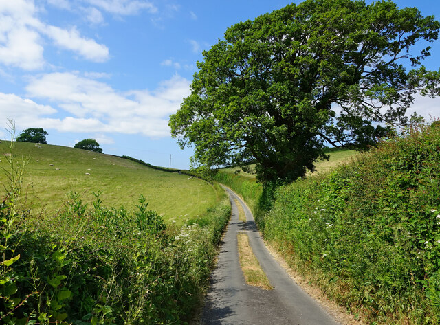
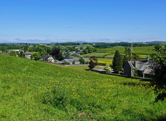
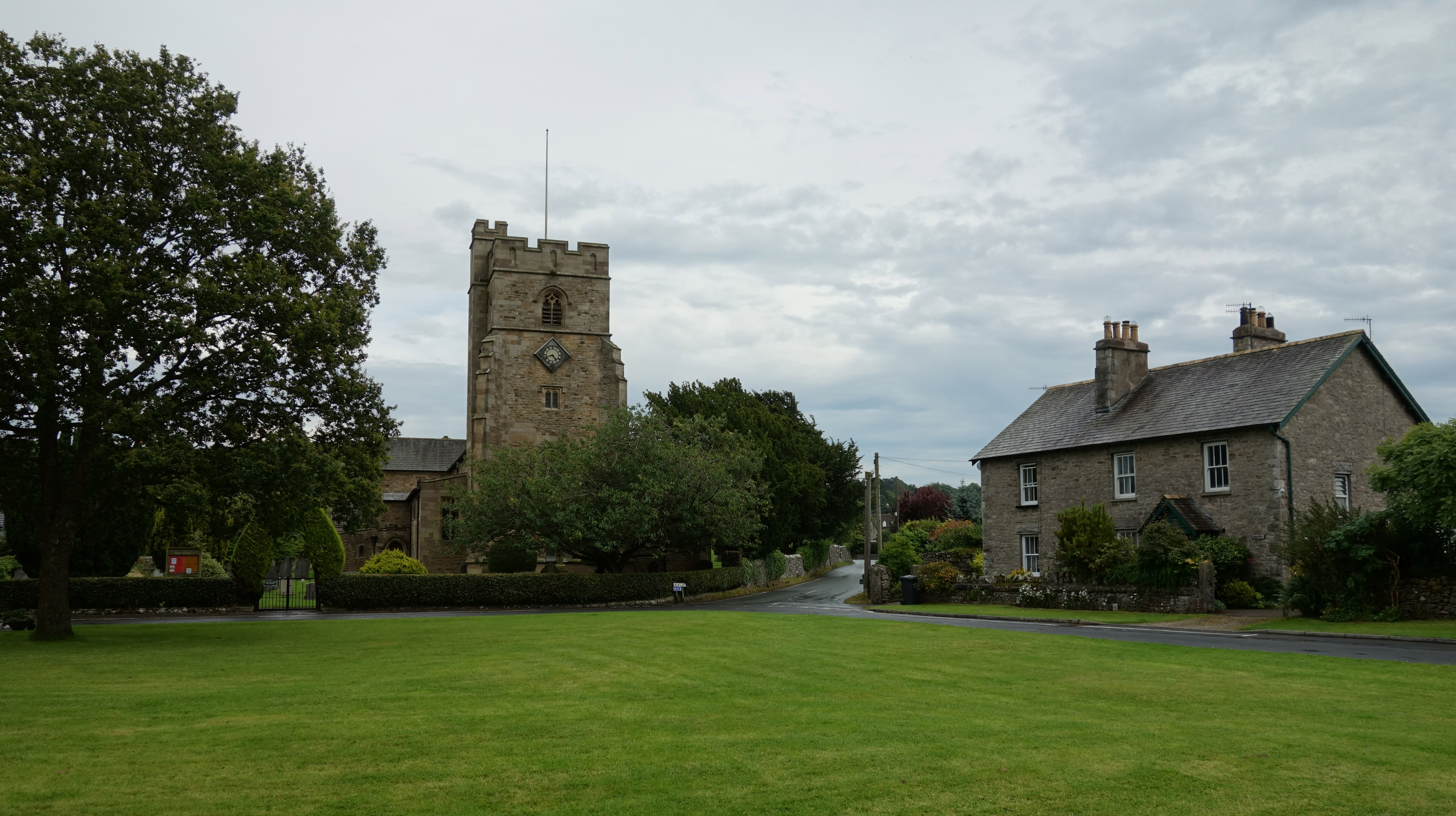
Barrows Green is a small village located in the county of Westmorland, England. Situated in the northern part of the country, it lies approximately 5 miles east of Kendal and 15 miles south of Penrith. The village is nestled in the picturesque countryside of the Lake District National Park, offering residents and visitors stunning views of rolling hills and idyllic landscapes.

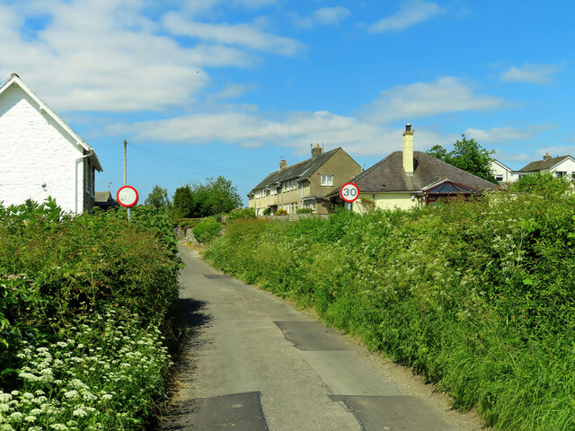
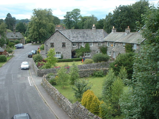
Despite its modest size, Barrows Green has a close-knit community that prides itself on its friendly and welcoming atmosphere. The village is predominantly residential, with a mix of traditional stone cottages and newer housing developments. Its peaceful and tranquil environment makes it an ideal place for those seeking a retreat from the bustling city life.

Although it lacks major amenities, Barrows Green benefits from its proximity to nearby towns and villages, providing easy access to essential services such as shops, schools, and healthcare facilities. The village is well-connected to the surrounding areas via a network of roads, making it convenient for residents to commute or explore the wider region.

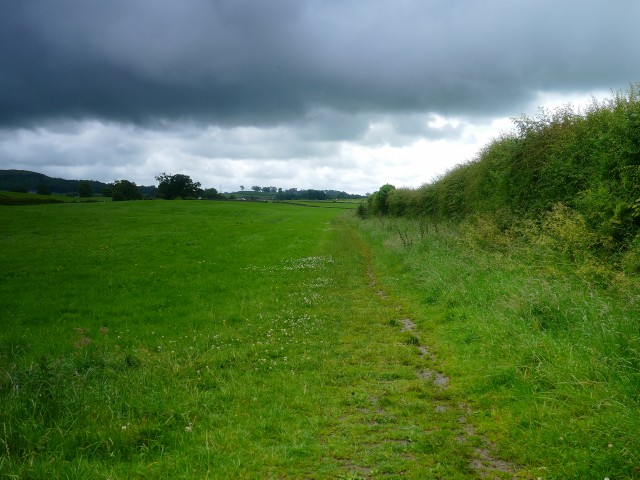
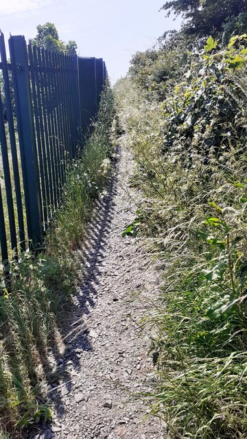
Nature enthusiasts will find plenty of opportunities to enjoy outdoor activities in Barrows Green and its surroundings. The village is surrounded by an abundance of walking and cycling trails, allowing residents to immerse themselves in the breathtaking natural beauty of the Lake District. Additionally, the nearby Lake Windermere offers opportunities for boating, fishing, and other water-based activities.

In summary, Barrows Green is a charming village in Westmorland, offering residents and visitors a peaceful and picturesque setting amidst the stunning landscapes of the Lake District.

If you have any feedback on the listing, please let us know in the comments section below.

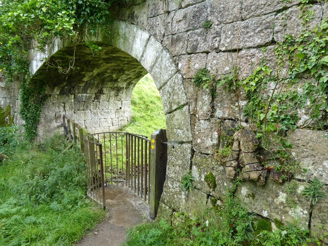
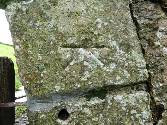
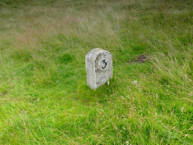
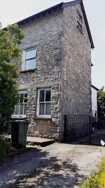
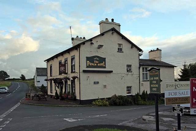
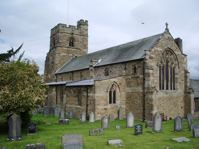
Barrows Green Images

Images are sourced within 2km of 54.285861/-2.732689 or Grid Reference SD5288. Thanks to Geograph Open Source API. All images are credited.

Sedgwick Hall Bridge Detail of the north face of Sedgwick Hall Bridge on the disused Lancaster Canal. The wicket gate caters for walkers using the former towpath which is a public footpath.
There is an Ordnance Survey benchmark visible on one of the voussoirs of the arch (photograph <a href="https://www.geograph.org.uk/photo/7097464">SD5186 : Benchmark, Sedgwick Hall Bridge</a>).
<a href="https://www.geograph.org.uk/photo/6578468">SD5186 : Sedgwick Hall Bridge</a> is a photograph of the bridge from the south.
Sedgwick Hall Bridge
Detail of the north face of Sedgwick Hall Bridge on the disused Lancaster Canal. The wicket gate caters for walkers using the former towpath which is a public footpath. There is an Ordnance Survey benchmark visible on one of the voussoirs of the arch (photograph SD5186 : Benchmark, Sedgwick Hall Bridge). SD5186 : Sedgwick Hall Bridge is a photograph of the bridge from the south.
Benchmark, Sedgwick Hall Bridge Detail of the Ordnance Survey 1GL Bolt benchmark on the north face of the arch of Sedgwick Hall Bridge. The benchmark marks a height of 46.0004 m above sea level (Ordnance Datum Newlyn) last verified in 1952 (location photograph <a href="https://www.geograph.org.uk/photo/7097453">SD5186 : Sedgwick Hall Bridge</a>).
Benchmark, Sedgwick Hall Bridge
Detail of the Ordnance Survey 1GL Bolt benchmark on the north face of the arch of Sedgwick Hall Bridge. The benchmark marks a height of 46.0004 m above sea level (Ordnance Datum Newlyn) last verified in 1952 (location photograph SD5186 : Sedgwick Hall Bridge).
Old Milestone Marker 03-54 F (between bridges 181-180), Lancaster Canal Old Milestone located by the side of the dry section of the Lancaster Canal.
This milestone is 54 miles from the centre of Preston and 3 miles from Kendal.

Inscription reads:-
24 :: 3
(Miles from Lancaster and Kendal respectively)

Milestone Society National ID: LAN-54
Old Milestone Marker 03-54 F (between bridges 181-180), Lancaster Canal
Old Milestone located by the side of the dry section of the Lancaster Canal. This milestone is 54 miles from the centre of Preston and 3 miles from Kendal. Inscription reads:- 24 :: 3 (Miles from Lancaster and Kendal respectively) Milestone Society National ID: LAN-54
Old Milestone Marker 04-53 F (between bridges 178-177), Lancaster Canal Old Milestone located by the side of the dry section of the Lancaster Canal.
This milestone is 53 miles from the centre of Preston and 4 miles from Kendal.

Inscription reads:-
23 :: 4
(Miles from Lancaster and Kendal respectively)

Milestone Society National ID: LAN-53
Old Milestone Marker 04-53 F (between bridges 178-177), Lancaster Canal
Old Milestone located by the side of the dry section of the Lancaster Canal. This milestone is 53 miles from the centre of Preston and 4 miles from Kendal. Inscription reads:- 23 :: 4 (Miles from Lancaster and Kendal respectively) Milestone Society National ID: LAN-53
Milestone Marker 02-55 (between bridges 183-182), Lancaster Canal - Site of missing Natland Hall Milestone Of the 56 milestones on the Lancaster Canal five are missing.
This is the site of one of them.  This section of the canal has been filled in.

If the milestone was there the inscription would be 25 :: 2
It would be located 55 miles from the Centre of Preston and 2 miles from Kendal.

Any information about this milestone would be appreciated, please.
Milestone Marker 02-55 (between bridges 183-182), Lancaster Canal - Site of missing Natland Hall Milestone
Of the 56 milestones on the Lancaster Canal five are missing. This is the site of one of them. This section of the canal has been filled in. If the milestone was there the inscription would be 25 :: 2 It would be located 55 miles from the Centre of Preston and 2 miles from Kendal. Any information about this milestone would be appreciated, please.
Half Milestone between Milestones 02-55 and 03-54, Lancaster Canal There are at least ten stones on the upper reaches of the Lancaster Canal that are half way between two milestones. They appear to have been carved into a similar shape and size.  These have been confirmed as very likely to be half milestones by the Lancashire Canal Trust and the Milestone Society.


Approx distance to Milestone 02-55 is 0.492 miles up the canal and down the canal 0.527 miles to Milestone 03-54.

There are also winch points, but those have a different cross section and have been uploaded as winch points.

If you know of any other stones (please check my profile for those I have seen), or know more information about what they are I would be very grateful to hear from you.
Half Milestone between Milestones 02-55 and 03-54, Lancaster Canal
There are at least ten stones on the upper reaches of the Lancaster Canal that are half way between two milestones. They appear to have been carved into a similar shape and size. These have been confirmed as very likely to be half milestones by the Lancashire Canal Trust and the Milestone Society. Approx distance to Milestone 02-55 is 0.492 miles up the canal and down the canal 0.527 miles to Milestone 03-54. There are also winch points, but those have a different cross section and have been uploaded as winch points. If you know of any other stones (please check my profile for those I have seen), or know more information about what they are I would be very grateful to hear from you.
Winch point between Milestones 02-55 and 13-44, Lancaster Canal Winch point by the side of the Lancaster Canal.

If you know of any others (see my profile for those I have seen) I would be very grateful to hear from you.
Winch point between Milestones 02-55 and 13-44, Lancaster Canal
Winch point by the side of the Lancaster Canal. If you know of any others (see my profile for those I have seen) I would be very grateful to hear from you.
Approaching Sedgwick The first view of the village coming from Wellheads Lane.
Approaching Sedgwick
The first view of the village coming from Wellheads Lane.
On Wellheads Lane Heading for Sedgwick village on a lovely early-June afternoon.
On Wellheads Lane
Heading for Sedgwick village on a lovely early-June afternoon.
Carex Farm Located on the edge of Sedgwick village.
Carex Farm
Located on the edge of Sedgwick village.
Arable fields near Sedgwick The land looked very dry on this early-June visit.
Arable fields near Sedgwick
The land looked very dry on this early-June visit.
In St Thomas graveyard A quiet corner of the graveyard located on the edge of the square.
In St Thomas graveyard
A quiet corner of the graveyard located on the edge of the square.
Towards Shyreakes Part of this scattered community viewed from Cycle Route 6. St Thomas church is shown on the right.
Towards Shyreakes
Part of this scattered community viewed from Cycle Route 6. St Thomas church is shown on the right.
Footpath to Stainton This is where the footpath crosses National Cycle Route 6.
Footpath to Stainton
This is where the footpath crosses National Cycle Route 6.
Junction at Crosscrake National Cycle Route 6 crosses Route 70 here.
Junction at Crosscrake
National Cycle Route 6 crosses Route 70 here.
Footpath to Natland from Burton Road (A65) The path runs beside the West Coast Main Line railway
Footpath to Natland from Burton Road (A65)
The path runs beside the West Coast Main Line railway
Benchmark on NE face of former shop Helm Garth on NW side of Helmsdale Road Ordnance Survey cut mark benchmark levelled at 94.575m above Newlyn Datum verified 1970.
Benchmark on NE face of former shop Helm Garth on NW side of Helmsdale Road
Ordnance Survey cut mark benchmark levelled at 94.575m above Newlyn Datum verified 1970.
Semi detached house (former shop) on NW side of Helmsdale Road There is an Ordnance Survey benchmark <a href="https://www.geograph.org.uk/photo/7519005">SD5289 : Benchmark on NE face of former shop Helm Garth on NW side of Helmsdale Road</a>  on the side of the house at its rear corner
Semi detached house (former shop) on NW side of Helmsdale Road
There is an Ordnance Survey benchmark SD5289 : Benchmark on NE face of former shop Helm Garth on NW side of Helmsdale Road on the side of the house at its rear corner
Show me another place!

Barrows Green is located at Grid Ref: SD5288 (Lat: 54.285861, Lng: -2.732689)

Administrative County: Cumbria

District: South Lakeland

Police Authority: Cumbria

What 3 Words

///vocab.pinch.gossiped. Near Kendal, Cumbria

Nearby Locations

Barrows Green

Related Wikis

Barrows Green, Cumbria

Barrows Green is a village in Cumbria, England. == External links == Media related to Barrows Green, Cumbria at Wikimedia Commons

Crosscrake

Crosscrake is a village in Cumbria, just off the M6 Junction 36 in North West of England. It is located just South of Kendal on the A6, between the villages/hamlets...

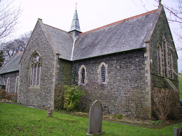
St Thomas' Church, Crosscrake

St Thomas' Church is in the village of Crosscrake, Cumbria, England. It is an active Anglican parish church in the Deanery of Kendal, the Archdeaconry...

Sedgwick, Cumbria

Sedgwick is a village and civil parish in Cumbria, England, 4.5 miles (7.2 km) south of Kendal. In the 2001 census the parish had a population of 380,...

Natland

Natland is a village and civil parish about two miles (3 km) south of Kendal in the South Lakeland district of Cumbria, England, close to the village of...

St Mark's Church, Natland

St Mark's Church is in the village of Natland, Cumbria, England. It is an active Anglican parish church in the deanery of Kendal, the archdeaconry of Westmorland...

Lakeland Maze Farm Park

Lakeland Maze Farm Park is an outdoor attraction and maze located near Kendal in England, UK. == History == The first maze was created in 2005. In 2021...

Halfpenny, Cumbria

Halfpenny is a hamlet in the civil parish of Stainton, in the South Lakeland district, in the county of Cumbria, England. It is located roughly two and...

Nearby Amenities

Located within 500m of 54.285861,-2.732689
Bus Stop
The Punch Bowl
Bus: yes
Naptan AtcoCode: 090079652733
Naptan Bearing: N
Naptan BusStopType: CUS
Naptan CommonName: Punch Bowl PH
Naptan Indicator: o/s
Naptan Landmark: Punch Bowl Pub
Naptan NaptanCode: cumdmgdm
Naptan Street: A65(T)
Naptan Verified: no
Public Transport: platform
Shelter: yes
Source: naptan_import
Lat/Long: 54.2869623/-2.7295073
Bus Stop
The Punch Bowl
Bus: yes
Naptan AtcoCode: 090079653325
Naptan Bearing: S
Naptan BusStopType: CUS
Naptan CommonName: The Punch Bowl
Naptan Indicator: opp
Naptan Landmark: the Punch Bowl Pub
Naptan NaptanCode: cumdmgdp
Naptan Street: A65(T)
Naptan Verified: no
Public Transport: platform
Source: naptan_import
Lat/Long: 54.2867246/-2.7292963
Power: tower
Lat/Long: 54.2873465/-2.7313686
Power: tower
Lat/Long: 54.2901208/-2.7324522
Power: tower
Lat/Long: 54.2840366/-2.7300329
Post Box
Post Box Type: lamp
Ref: LA8 12
Royal Cypher: EIIR
Royal Cypher Wikidata: Q33102113
Source: survey
Lat/Long: 54.2869354/-2.7295378
Telephone
Booth: KX100
Covered: booth
Source: survey
Lat/Long: 54.2868867/-2.7292181
Power: pole
Lat/Long: 54.2821419/-2.7312527
Power: pole
Lat/Long: 54.2831789/-2.7314814
Power: pole
Lat/Long: 54.2840379/-2.7316631
Power: pole
Lat/Long: 54.2851451/-2.7319063
Power: pole
Lat/Long: 54.2863162/-2.7321544
Power: pole
Lat/Long: 54.2874706/-2.7324007
Power: pole
Lat/Long: 54.2886498/-2.7326807
Power: pole
Lat/Long: 54.2890832/-2.7332212
Power: pole
Lat/Long: 54.2896108/-2.7358033
Give Way
Direction: forward
Lat/Long: 54.2868327/-2.7294652
Give Way
Direction: backward
Lat/Long: 54.2868402/-2.7293442
Give Way
Direction: forward
Lat/Long: 54.2887315/-2.7384236
Power: pole
Lat/Long: 54.2817127/-2.7302596
Power: pole
Lat/Long: 54.2875956/-2.7307116
Power: pole
Lat/Long: 54.2881045/-2.7306878
Power: pole
Lat/Long: 54.2888766/-2.7306621
Power: pole
Lat/Long: 54.2899672/-2.730929
The Punch Bowl
Bus: yes
Public Transport: stop_position
Lat/Long: 54.2869654/-2.7294029
The Punch Bowl
Bus: yes
Public Transport: stop_position
Lat/Long: 54.2867338/-2.7293953
Power: pole
Lat/Long: 54.2864687/-2.7308185
Power: pole
Lat/Long: 54.2868818/-2.730713
Power: pole
Lat/Long: 54.2870642/-2.7301895
Power: pole
Lat/Long: 54.2874269/-2.7299114
Power: pole
Lat/Long: 54.2878377/-2.7298328
Power: pole
Lat/Long: 54.2881567/-2.7297829
Power: pole
Lat/Long: 54.2885541/-2.7296967
Power: pole
Lat/Long: 54.2889739/-2.7297408
Power: pole
Lat/Long: 54.2893846/-2.7297676
Power: pole
Lat/Long: 54.286762/-2.727617
Power: pole
Lat/Long: 54.2871163/-2.7277742
Power: pole
Lat/Long: 54.2877213/-2.7273677
Power: pole
Lat/Long: 54.2882961/-2.7268231
Power: pole
Lat/Long: 54.2868907/-2.7329279
Power: pole
Lat/Long: 54.2863008/-2.73367
Power: pole
Lat/Long: 54.2857243/-2.7343719
Power: pole
Lat/Long: 54.2851814/-2.7350354
Power: pole
Lat/Long: 54.2844314/-2.7359386
Power: pole
Lat/Long: 54.2836187/-2.7358216
Power: pole
Lat/Long: 54.2828406/-2.7356951
Power: pole
Lat/Long: 54.2818443/-2.7355416
Power: pole
Lat/Long: 54.2819842/-2.7338292
Power: pole
Lat/Long: 54.2821208/-2.7321436
The data included in this document is from www.openstreetmap.org. The data is made available under ODbL.

Have you been to Barrows Green?

Leave your review of Barrows Green below (or comments, questions and feedback).