Cowstone Gill Bottom

Valley in Yorkshire Richmondshire

England

Cowstone Gill Bottom

Near Walden Beck Looking up the dale.
Near Walden Beck Credit: T Eyre

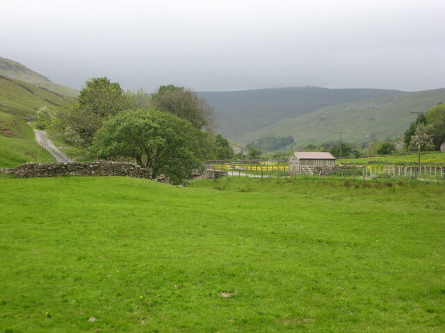
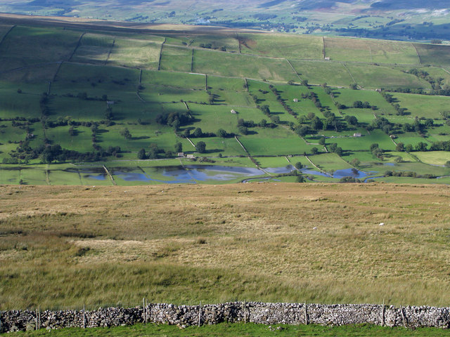
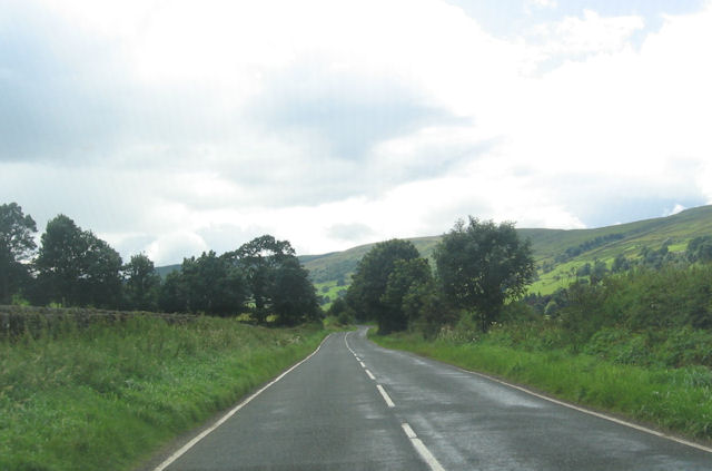
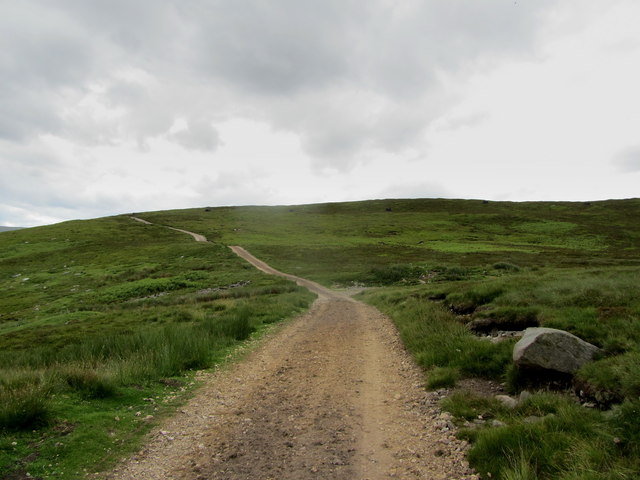
Cowstone Gill Bottom is a picturesque valley located in the region of Yorkshire, England. Nestled amidst the rolling hills and lush greenery, this valley offers a stunning natural landscape that attracts visitors from near and far.

The valley is named after the small stream that runs through it, known as Cowstone Gill. The gill meanders its way through the valley, creating a serene and peaceful atmosphere. The gurgling sound of the water coupled with the tranquil surroundings make it a perfect spot for relaxation and contemplation.

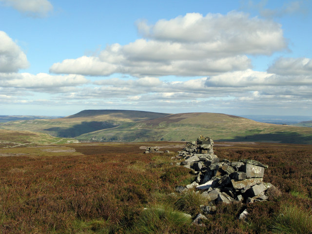
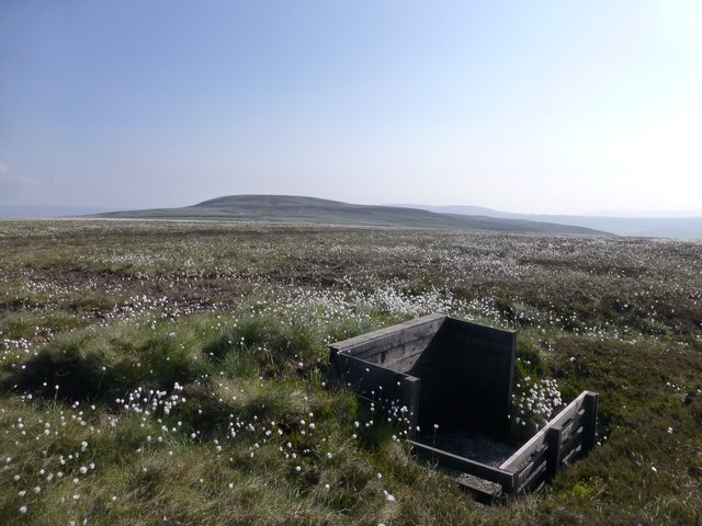
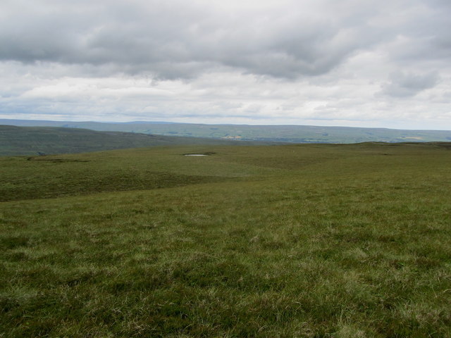
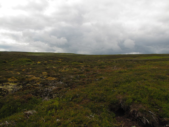
Surrounded by towering hills on either side, Cowstone Gill Bottom provides breathtaking views of the surrounding countryside. The hills are covered in a patchwork of vibrant green fields and dotted with sheep, adding to the quintessential Yorkshire charm.

The valley is also home to a diverse range of flora and fauna, with wildflowers blooming in abundance during the spring and summer months. It is not uncommon to spot various bird species, such as red kites and buzzards, soaring high above the valley.

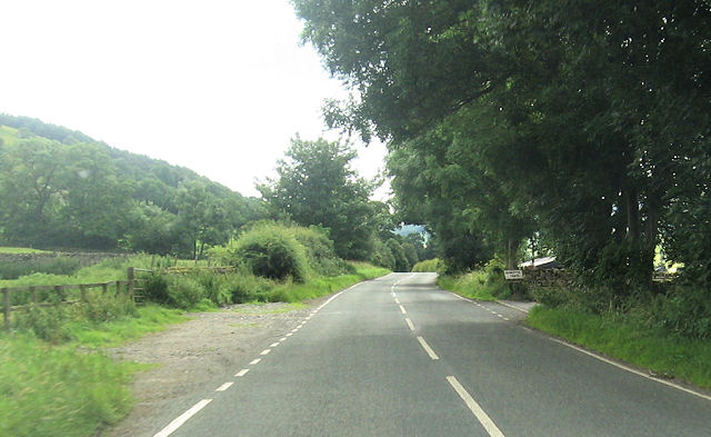
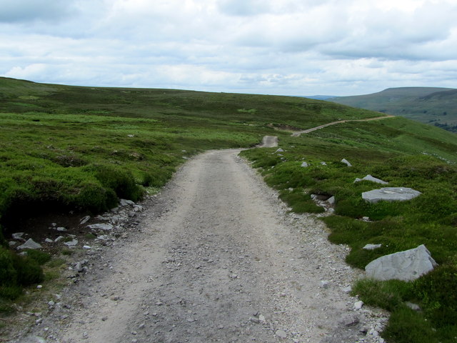
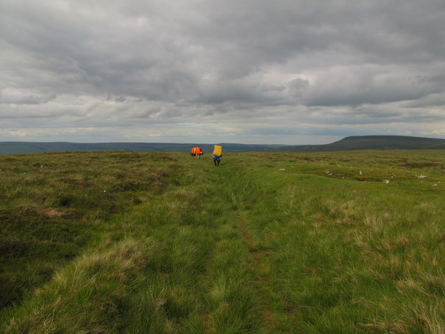
For outdoor enthusiasts, Cowstone Gill Bottom offers a multitude of hiking and walking trails. These trails take visitors through the valley and up the hills, providing opportunities to explore the beauty of the surrounding landscape.

Overall, Cowstone Gill Bottom is a hidden gem in the heart of Yorkshire, offering a peaceful retreat for nature lovers and adventure seekers alike. Its stunning natural beauty and tranquil atmosphere make it a must-visit destination for anyone exploring the region.

If you have any feedback on the listing, please let us know in the comments section below.

Cowstone Gill Bottom Images

Images are sourced within 2km of 54.242126/-2.0152331 or Grid Reference SD9982. Thanks to Geograph Open Source API. All images are credited.

Near Walden Beck Looking up the dale.
Near Walden Beck
Looking up the dale.
Roughly grassed enclosure below Wasset Fell Road Wasset Fell road descends to Newbiggin from the high ridge on the south-east side of Bishopdale. The view here is from the road at Floutgate Scar over fields to the valley bottom where flooding testifies to the extent of recent rain.
Roughly grassed enclosure below Wasset Fell Road
Wasset Fell road descends to Newbiggin from the high ridge on the south-east side of Bishopdale. The view here is from the road at Floutgate Scar over fields to the valley bottom where flooding testifies to the extent of recent rain.
Ruined wall north-east of Naughtberry Hill A ruined wall crossing the heather moor with Pen Hill seen distantly across Waldendale.
Ruined wall north-east of Naughtberry Hill
A ruined wall crossing the heather moor with Pen Hill seen distantly across Waldendale.
Howesyke Farm entrance from B6160
B6160 just west of West Lane House
Grouse butt beneath Naughtberry Hill One of a long line of grouse butts on the slopes beneath Naughtberry Hill. The line of butts shown on the 25K OS map have now been abandoned and these newer ones lead in a line from the fence down to the shooting hut (SD 979 812)
Grouse butt beneath Naughtberry Hill
One of a long line of grouse butts on the slopes beneath Naughtberry Hill. The line of butts shown on the 25K OS map have now been abandoned and these newer ones lead in a line from the fence down to the shooting hut (SD 979 812)
On Bishopdale Edge Bleak moorland on the northern flanks of Naughtberry Hill - looking across an un-named miniature tarn towards distant Wensleydale.
On Bishopdale Edge
Bleak moorland on the northern flanks of Naughtberry Hill - looking across an un-named miniature tarn towards distant Wensleydale.
Shooting Track on Wild Gath (1) Looking north east along a track that gives access to grouse shooting activities on the moors below Naughtberry Hill
Shooting Track on Wild Gath (1)
Looking north east along a track that gives access to grouse shooting activities on the moors below Naughtberry Hill
Shooting Track on Wild Gath (2) Looking south west along the shooting track on Wild Gath
Shooting Track on Wild Gath (2)
Looking south west along the shooting track on Wild Gath
Shooting Track above Walden Track elevated high above the dale called Walden.
Shooting Track above Walden
Track elevated high above the dale called Walden.
Lone walker on Track
Open Moorland on Naughtberry Hill
Track along Wild Gath
Track to Mile Stone Hill
Baxton Edge
Baxton Edge
Ruins of Shooting Hut
Wasset Fell Road
Wasset Fell Road
Floutgate Scar
Floutgate Scar
Show me another place!

Cowstone Gill Bottom is located at Grid Ref: SD9982 (Lat: 54.242126, Lng: -2.0152331)

Division: North Riding

Administrative County: North Yorkshire

District: Richmondshire

Police Authority: North Yorkshire

What 3 Words

///shades.nicely.moth. Near Leyburn, North Yorkshire

Nearby Locations

Cowstone Gill Bottom

Related Wikis

Burton-cum-Walden

Burton-cum-Walden is a civil parish in North Yorkshire, England, in the Yorkshire Dales National Park. It had a population of 303 according to the 2011...

Walden, North Yorkshire

Walden is a dale and hamlet in the Yorkshire Dales, North Yorkshire, England. The dale is a side dale of Wensleydale, sometimes known as Waldendale or...

Walden Head

Walden Head is a hamlet in the Yorkshire Dales, North Yorkshire. It lies 5 miles (8 km) of Aysgarth and to the north is a similar village Walden. The village...

Smelter Farmhouse

Smelter Farmhouse is a historic building in Bishopdale, North Yorkshire, a valley in England. Smelter is the second farm from the top of Bishopdale. The...

Nearby Amenities

Located within 500m of 54.242126,-2.0152331
old shafts
Historic: mine
Source: NPE
Lat/Long: 54.2449382/-2.0154224
Historic: mine_shaft
Mineral: lead
Source: NPE
Lat/Long: 54.2404493/-2.0116459
Historic: mine_shaft
Mineral: lead
Source: NPE
Lat/Long: 54.2407753/-2.0113454
Historic: mine_shaft
Mineral: lead
Source: NPE
Lat/Long: 54.2402487/-2.0110021
Historic: mine_shaft
Mineral: lead
Source: NPE
Lat/Long: 54.2405496/-2.0107446
Historic: mine_shaft
Mineral: lead
Source: NPE
Lat/Long: 54.2402737/-2.0101438
Historic: mine_shaft
Mineral: lead
Source: NPE
Lat/Long: 54.2399477/-2.0106159
Historic: mine_shaft
Mineral: lead
Source: NPE
Lat/Long: 54.2398976/-2.0099292
Historic: mine_shaft
Mineral: lead
Source: NPE
Lat/Long: 54.2395214/-2.0095859
Historic: mine_shaft
Source: NPE
Lat/Long: 54.2441859/-2.0146499
Historic: mine_shaft
Source: NPE
Lat/Long: 54.2445119/-2.0143924
Historic: mine_shaft
Source: NPE
Lat/Long: 54.2447627/-2.0148216
Historic: mine_shaft
Source: NPE
Lat/Long: 54.2450636/-2.0146928
Historic: mine_shaft
Source: NPE
Lat/Long: 54.2450636/-2.0142637
Historic: mine_shaft
Source: NPE
Lat/Long: 54.2454397/-2.0140491
Historic: mine_shaft
Source: NPE
Lat/Long: 54.2454397/-2.013105
Historic: mine_shaft
Source: NPE
Lat/Long: 54.2456905/-2.0127187
Historic: mine_shaft
Source: NPE
Lat/Long: 54.245841/-2.0122467
Historic: mine_shaft
Source: NPE
Lat/Long: 54.2452642/-2.0116029
Historic: mine_shaft
Source: NPE
Lat/Long: 54.2451388/-2.0121608
Historic: mine_shaft
Source: NPE
Lat/Long: 54.2449884/-2.0127187
Historic: mine_shaft
Source: NPE
Lat/Long: 54.245189/-2.0128046
Historic: mine_shaft
Source: NPE
Lat/Long: 54.2454397/-2.0122896
Historic: mine_shaft
Source: NPE
Lat/Long: 54.2456153/-2.0119033
Lady Wasset Well
Natural: spring
Source: NPE
Lat/Long: 54.2463425/-2.0150362
Cowstone Gill Bottom
Place: locality
Source: os_25k_firstseries
Lat/Long: 54.2420309/-2.01974
The data included in this document is from www.openstreetmap.org. The data is made available under ODbL.

Have you been to Cowstone Gill Bottom?

Leave your review of Cowstone Gill Bottom below (or comments, questions and feedback).