Waterfall Gill

Valley in Yorkshire Craven

England

Waterfall Gill

Grouse Butt on Brown Bank
Grouse Butt on Brown Bank Credit: Tim Cook

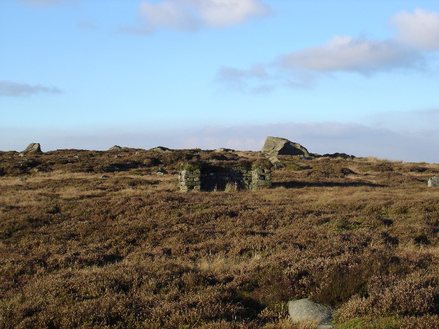
Waterfall Gill, located in Yorkshire, England, is a picturesque valley renowned for its stunning natural beauty and the mesmerizing waterfall that cascades down its rocky slopes. Nestled amidst the rolling hills of the Yorkshire Dales National Park, this hidden gem attracts nature enthusiasts and hikers alike.

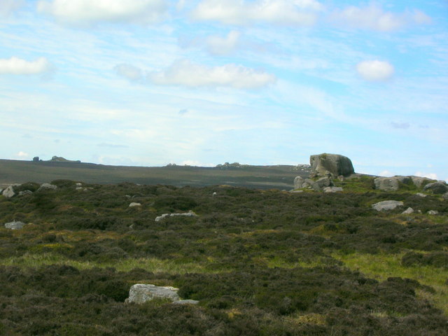
The valley is characterized by its lush greenery, with a rich variety of flora and fauna that thrive in the area. Walking along the well-maintained trails, visitors are treated to breathtaking views of the surrounding countryside, dotted with charming stone cottages and grazing sheep.

At the heart of Waterfall Gill lies the main attraction - the waterfall itself. Surrounded by moss-covered rocks, the cascading water creates a soothing symphony that resonates throughout the valley. During the rainy season, the waterfall swells in size, providing a more dramatic spectacle for visitors to enjoy.

Exploring the valley, visitors will encounter an abundance of wildlife. From vibrant butterflies fluttering among the wildflowers to squirrels scurrying through the trees, the area is a haven for nature lovers and photographers seeking to capture the beauty of Yorkshire's countryside.

Waterfall Gill is also home to a variety of walking routes, catering to all levels of fitness and interest. Whether embarking on a leisurely stroll or a challenging hike, visitors can select from a range of trails that meander through the valley's stunning landscapes, offering panoramic views and opportunities to spot local wildlife.

In conclusion, Waterfall Gill in Yorkshire is a tranquil and enchanting valley that showcases the natural splendor of the Yorkshire Dales. With its captivating waterfall, diverse flora and fauna, and scenic walking routes, it is a must-visit destination for anyone seeking to immerse themselves in the beauty of nature.

If you have any feedback on the listing, please let us know in the comments section below.

Waterfall Gill Images

Images are sourced within 2km of 54.006663/-2.0189294 or Grid Reference SD9856. Thanks to Geograph Open Source API. All images are credited.

Grouse Butt on Brown Bank
The peak of Bilton Ings Bilton Ings is 433m above sea level
The peak of Bilton Ings
Bilton Ings is 433m above sea level
Lonely Sign on Brown Bank On Barden Moor, I am following a long track from Halton Heights towards Rylstone.  The path to the left leads to Embsay, descending passed the Crag about a mile to the south of here.
Lonely Sign on Brown Bank
On Barden Moor, I am following a long track from Halton Heights towards Rylstone. The path to the left leads to Embsay, descending passed the Crag about a mile to the south of here.
Bridleway over Barden Moor From Brown Bank looking west along the track to Rylstone.
Bridleway over Barden Moor
From Brown Bank looking west along the track to Rylstone.
Stone Ridge Quarries The relatively shallow disused gritstone quarries have only left a minor scar on the moor.
Stone Ridge Quarries
The relatively shallow disused gritstone quarries have only left a minor scar on the moor.
Tributary to Waterfall Gill draining Bilton Ings Taken on a misty, moisty afternoon.
Tributary to Waterfall Gill draining Bilton Ings
Taken on a misty, moisty afternoon.
Track at Brown Bank on Barden Moor
A litter of rocks on the summit with the obelisk on Watt Crag on the horizon <a href="https://www.geograph.org.uk/photo/1822641">SD9958 : The Cracoe Obelisk - a highly visible War Memorial</a>
A litter of rocks on the summit with the obelisk on Watt Crag on the horizon
An unnamed top near Stone Ridge Plain
Brown Bank, Barden Moor
Wayshaw Bogs Not a good place to be. Despite the lack of much recent rain, this place was very wet and squelchy underfoot, making progress difficult.
Wayshaw Bogs
Not a good place to be. Despite the lack of much recent rain, this place was very wet and squelchy underfoot, making progress difficult.
Path on Embsay Moor Permissive path that leads north from Embsay to climb up onto Barden Moor, seen here on Stone Ridge. It is faint on the ground in places, but easy enough to follow without getting lost on this large expanse of wilderness.
Path on Embsay Moor
Permissive path that leads north from Embsay to climb up onto Barden Moor, seen here on Stone Ridge. It is faint on the ground in places, but easy enough to follow without getting lost on this large expanse of wilderness.
Soggy Path on Bilton Ings The path from Embsay onto Barden Moor hits a wet patch on Bilton Ings
Soggy Path on Bilton Ings
The path from Embsay onto Barden Moor hits a wet patch on Bilton Ings
Bridleway on Barden Moor This excellent track runs across Barden Moor from Halton Heights to Rylstone
Bridleway on Barden Moor
This excellent track runs across Barden Moor from Halton Heights to Rylstone
Shelter from the wind above Lumb Gill Head
Track junction near North Earls Upper Barden Reservoir beyond
Track junction near North Earls
Upper Barden Reservoir beyond
A Wall Shelter A wall shelter beside a rocky high point at 433 metres which is 2 metres lower than the nearby Brown Bank.
A Wall Shelter
A wall shelter beside a rocky high point at 433 metres which is 2 metres lower than the nearby Brown Bank.
Pile of stones on Brown Bank
Show me another place!

Waterfall Gill is located at Grid Ref: SD9856 (Lat: 54.006663, Lng: -2.0189294)

Division: West Riding

Administrative County: North Yorkshire

District: Craven

Police Authority: North Yorkshire

What 3 Words

///crafts.bins.singles. Near Embsay, North Yorkshire

Related Wikis

Great Britain

Great Britain is an island in the North Atlantic Ocean off the north-west coast of continental Europe, consisting of England, Scotland and Wales. With...

Yorkshire dialect

The Yorkshire dialect (also known as Broad Yorkshire, Tyke, Yorkie, or Yorkshire English) is a dialect of English, or continuum of dialects, spoken in...

Yorkshire

Yorkshire ( YORK-shər, -⁠sheer) is a historic county in Northern England and the largest by area size in the United Kingdom. Because of its large area...

Cracoe

Cracoe is a small village and civil parish in the Craven district of North Yorkshire, England. It is situated near to Rylstone and about 6 miles south...
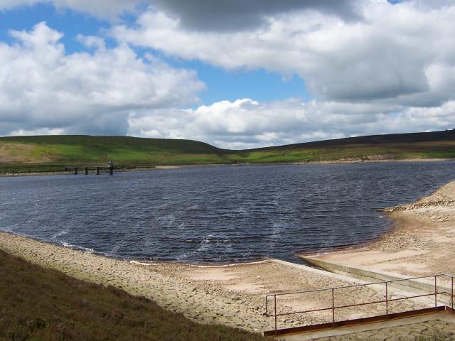
Embsay Reservoir

Embsay Reservoir is located above the village of Embsay, near Skipton in the Yorkshire Dales in North Yorkshire, England. It is owned by Yorkshire Water...

St Peter's Church, Rylstone

St Peter's Church is in the village of Rylstone, North Yorkshire, England. It is an active Anglican parish church in the deanery of Skipton, the archdeaconry...

Upper Barden Reservoir

Upper Barden Reservoir is an upland fresh water reservoir, one of two reservoirs that collect water from Barden Moor, and dam Barden Beck, a tributary...

Rylstone

Rylstone is a village and civil parish in the Craven district of North Yorkshire, England. It is situated very near to Cracoe and about 6 miles south west...

Nearby Amenities

Located within 500m of 54.006663,-2.0189294
Watkinson Well
Natural: spring
Source: OS-historic-25k-OSM_Limited
Lat/Long: 54.00444/-2.0130518
Clifford's Tower
Alt Name: New Hall
Historic: archaeological_site
Source: OS 1:25k
Lat/Long: 54.0049096/-2.0257162
Ford: yes
Lat/Long: 54.0068457/-2.0233794
Archaeological Site: mineral_extraction
Historic: mine_shaft
Mineral: coal
Note: not verified
Source: EsriWorldImageryClarity
Lat/Long: 54.0082039/-2.0143178
Archaeological Site: mineral_extraction
Historic: mine_shaft
Mineral: coal
Note: verified from OS Yorkshire CLI.SW
Source: EsriWorldImageryClarity
Lat/Long: 54.0094428/-2.013835
Archaeological Site: mineral_extraction
Historic: mine_shaft
Mineral: coal
Note: not verified
Source: EsriWorldImageryClarity
Lat/Long: 54.0080714/-2.0147416
Archaeological Site: mineral_extraction
Historic: mine_shaft
Mineral: coal
Note: not verified
Source: EsriWorldImageryClarity
Lat/Long: 54.0079799/-2.0144358
Archaeological Site: mineral_extraction
Historic: mine_shaft
Mineral: coal
Note: not verified
Source: EsriWorldImageryClarity
Lat/Long: 54.0074534/-2.015278
Archaeological Site: mineral_extraction
Historic: mine_shaft
Mineral: coal
Note: not verified
Source: EsriWorldImageryClarity
Lat/Long: 54.0072895/-2.0154658
Archaeological Site: mineral_extraction
Historic: mine_shaft
Mineral: coal
Note: not verified
Source: EsriWorldImageryClarity
Lat/Long: 54.0072108/-2.0155141
Archaeological Site: mineral_extraction
Historic: mine_shaft
Mineral: coal
Note: not verified
Source: EsriWorldImageryClarity
Lat/Long: 54.0081154/-2.0144305
Boiling Well
Natural: spring
Source: OS-historic-25k-OSM_Limited
Lat/Long: 54.0102566/-2.01936
Natural: spring
Source: OS-historic-25k-OSM_Limited
Lat/Long: 54.0024084/-2.0193821
Archaeological Site: mineral_extraction
Historic: mine_shaft
Mineral: coal
Note: verified from OS Yorkshire CLI.SW
Source: Maxar-Standard
Source Mineral: OS Yorkshire CLI.SW, publ 1909
Lat/Long: 54.0092679/-2.0141622
Archaeological Site: mineral_extraction
Historic: mine_shaft
Mineral: coal
Note: verified from OS Yorkshire CLI.SW
Source: Maxar-Standard
Source Mineral: OS Yorkshire CLI.SW, publ 1909
Lat/Long: 54.0091387/-2.0141729
Archaeological Site: mineral_extraction
Historic: mine_shaft
Mineral: coal
Note: verified from OS Yorkshire CLI.SW
Source: Maxar-Standard
Source Mineral: OS Yorkshire CLI.SW, publ 1909
Lat/Long: 54.0092569/-2.0139825
Fixme: exact location relative to path may be wrong
Natural: waterfall
Source: OS Yorkshire CLI.SW, publ 1909
Lat/Long: 54.0066372/-2.022907
Waterfall Gill Head
Place: locality
Source: OS Yorkshire CLI.SW, publ 1909
Lat/Long: 54.0088597/-2.013379
The data included in this document is from www.openstreetmap.org. The data is made available under ODbL.

Have you been to Waterfall Gill?

Leave your review of Waterfall Gill below (or comments, questions and feedback).