Netherghyll Bottom

Valley in Yorkshire Craven

England

Netherghyll Bottom

Binns Lane, looking east The lane is a private road serving five farms, and has a surprisingly good tarmac surface for a route of this nature.  It's also a public footpath. This is taken at the bottom of the drive to West Closes Farm.
Binns Lane, looking east Credit: Stephen Craven

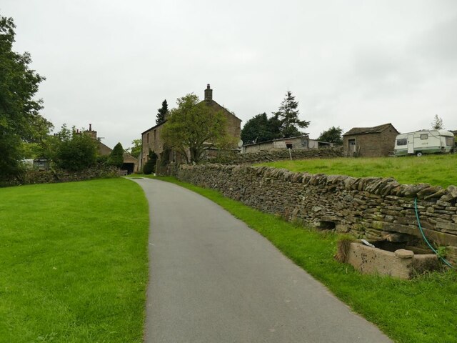
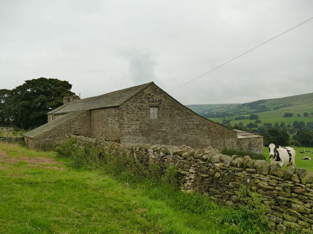
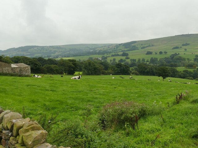
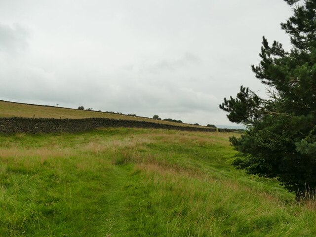
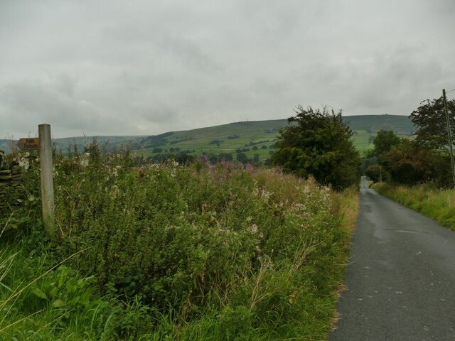
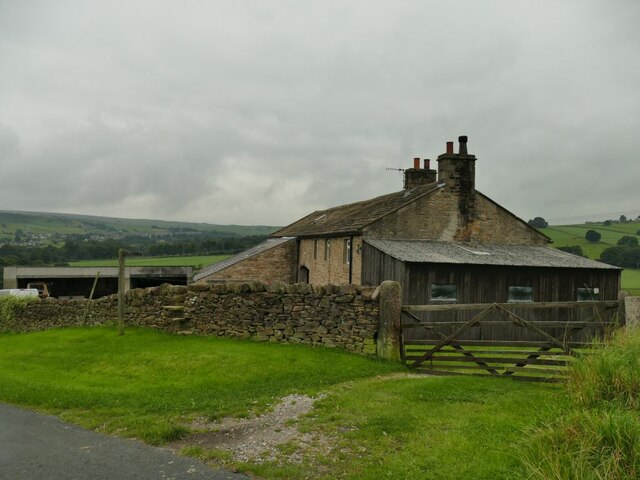
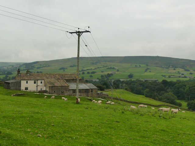
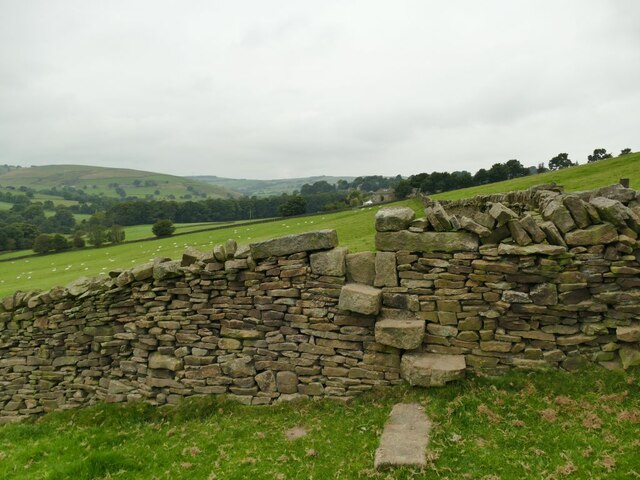
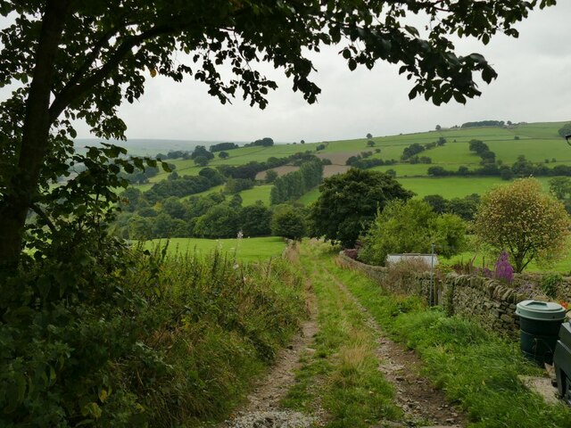
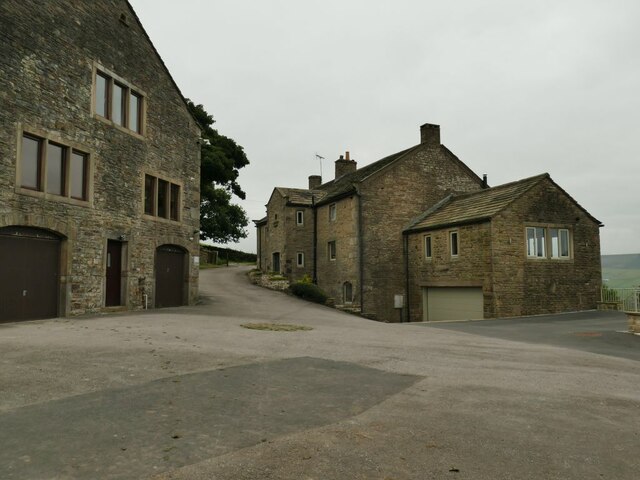
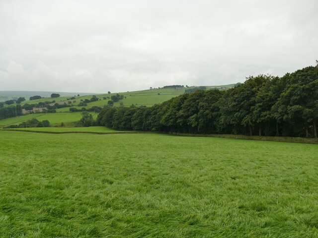
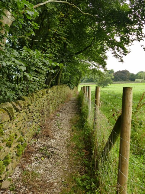
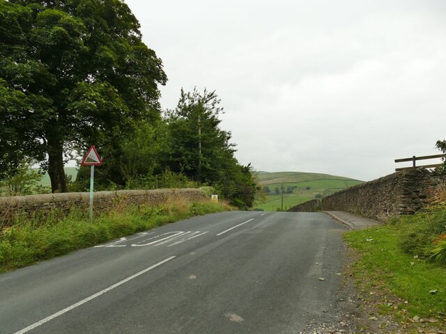
Netherghyll Bottom is a picturesque valley located in Yorkshire, England. The valley is known for its stunning natural beauty, with rolling hills, lush greenery, and meandering streams running through the landscape. Surrounded by quaint villages and farmland, Netherghyll Bottom offers a peaceful and tranquil escape from the hustle and bustle of city life.

The valley is a popular destination for hikers and nature enthusiasts, with a network of scenic walking trails that allow visitors to explore the area's diverse flora and fauna. Birdwatchers will also be delighted by the variety of bird species that call Netherghyll Bottom home.

In addition to its natural beauty, Netherghyll Bottom also has a rich history, with ancient ruins and archaeological sites scattered throughout the valley. The area has been inhabited for centuries, and evidence of its past can be seen in the remnants of old stone buildings and walls.

Overall, Netherghyll Bottom is a hidden gem in Yorkshire, offering visitors a chance to connect with nature and immerse themselves in the region's history and culture.

If you have any feedback on the listing, please let us know in the comments section below.

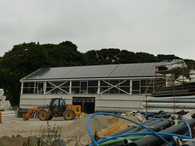
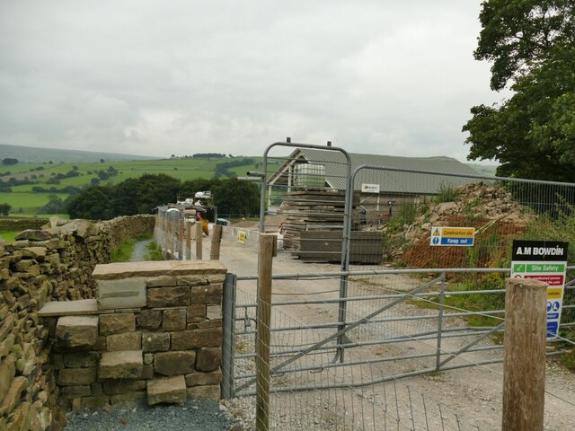
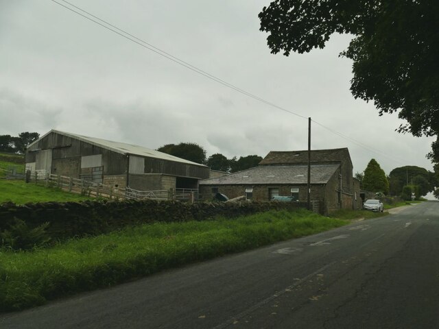
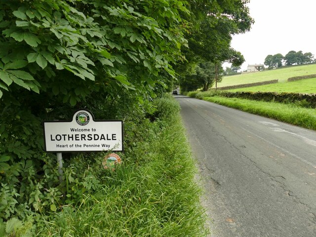
Netherghyll Bottom Images

Images are sourced within 2km of 53.916524/-2.0265156 or Grid Reference SD9846. Thanks to Geograph Open Source API. All images are credited.

Binns Lane, looking east The lane is a private road serving five farms, and has a surprisingly good tarmac surface for a route of this nature.  It's also a public footpath. This is taken at the bottom of the drive to West Closes Farm.
Binns Lane, looking east
The lane is a private road serving five farms, and has a surprisingly good tarmac surface for a route of this nature. It's also a public footpath. This is taken at the bottom of the drive to West Closes Farm.
Approaching West Closes Farm The lane is a private road serving five farms, of which this is the last.  It's also a public footpath. The main farmhouse is grade II listed but not seen in this view, and was the home of a well known 19th century organ builder, John Laycock (source: <span class="nowrap"><a title="http://www.farnhill.co.uk/History_Docs/Kildwick%20Organ%20grave%20-%20issue%203.pdf" rel="nofollow ugc noopener" href="http://www.farnhill.co.uk/History_Docs/Kildwick%20Organ%20grave%20-%20issue%203.pdf">Link</a><img style="margin-left:2px;" alt="External link" title="External link - shift click to open in new window" src="https://s1.geograph.org.uk/img/external.png" width="10" height="10"/></span> ).
Approaching West Closes Farm
The lane is a private road serving five farms, of which this is the last. It's also a public footpath. The main farmhouse is grade II listed but not seen in this view, and was the home of a well known 19th century organ builder, John Laycock (source: LinkExternal link ).
Cook House Farm This is a view from behind the farm to the west.  The map shows the public footpath passing in front (south) of the property, but as I approached from the east, looking for a stile or gate, the owner and his dog came out and directed me round the back instead.

The farm was the birthplace of a well-known organ builder, John Laycock who later lived at nearby West Closes.(source: <span class="nowrap"><a title="http://www.farnhill.co.uk/History_Docs/Kildwick%20Organ%20grave%20-%20issue%203.pdf" rel="nofollow ugc noopener" href="http://www.farnhill.co.uk/History_Docs/Kildwick%20Organ%20grave%20-%20issue%203.pdf">Link</a><img style="margin-left:2px;" alt="External link" title="External link - shift click to open in new window" src="https://s1.geograph.org.uk/img/external.png" width="10" height="10"/></span> )
Cook House Farm
This is a view from behind the farm to the west. The map shows the public footpath passing in front (south) of the property, but as I approached from the east, looking for a stile or gate, the owner and his dog came out and directed me round the back instead. The farm was the birthplace of a well-known organ builder, John Laycock who later lived at nearby West Closes.(source: LinkExternal link )
Cows at Birks Farm The field is the one immediately below Cook House <a href="https://www.geograph.org.uk/photo/6954338">SD9844 : Cook House Farm</a> but I get the impression that the latter is no longer a working farm, and the cattle probably belong to Birks Farm lower down the hill.
Cows at Birks Farm
The field is the one immediately below Cook House SD9844 : Cook House Farm but I get the impression that the latter is no longer a working farm, and the cattle probably belong to Birks Farm lower down the hill.
Top of the field above West Closes Farm The footpath dodges round the top of a conifer plantation and briefly enters this grid square in doing so.
Top of the field above West Closes Farm
The footpath dodges round the top of a conifer plantation and briefly enters this grid square in doing so.
Leys Lane Looking downhill towards Birks Bridge, with to the left the start of a public footpath to Cross Hills.
Leys Lane
Looking downhill towards Birks Bridge, with to the left the start of a public footpath to Cross Hills.
Near Leys Farm The farm is on Leys Lane between Glusburn and Lothersdale.
Near Leys Farm
The farm is on Leys Lane between Glusburn and Lothersdale.
Sheep at Near Leys Farm
A typical stile in Lothersdale Between West Close Farm and reaching the road into Lothersdale village I must have crossed at least ten stiles like this, with through stones in a dry stone wall.
A typical stile in Lothersdale
Between West Close Farm and reaching the road into Lothersdale village I must have crossed at least ten stiles like this, with through stones in a dry stone wall.
Norwood Lane below Leys House Below Leys House the lane is unsurfaced.
Norwood Lane below Leys House
Below Leys House the lane is unsurfaced.
Leys House, Norwood Lane A farmhouse and outbuildings now converted into several dwellings.
Leys House, Norwood Lane
A farmhouse and outbuildings now converted into several dwellings.
Wooded clough in Lothersdale The Sedgwick Beck flows in a deep wooded clough for several hundred metres.
Wooded clough in Lothersdale
The Sedgwick Beck flows in a deep wooded clough for several hundred metres.
Path above a wooded clough The Sedgwick Beck flows in a deep wooded clough for several hundred metres downhill (left) of this point.
Path above a wooded clough
The Sedgwick Beck flows in a deep wooded clough for several hundred metres downhill (left) of this point.
New building opposite Ashfield Farm It's not clear yet what the building's function will be, but the architect has taken advantage of the south facing aspect to include solar panels.
New building opposite Ashfield Farm
It's not clear yet what the building's function will be, but the architect has taken advantage of the south facing aspect to include solar panels.
New stile, old style A stile on a public footpath next to a new gate leading into a development site <a href="https://www.geograph.org.uk/photo/6954458">SD9745 : New building opposite Ashfield Farm</a> but in keeping with local tradition.
New stile, old style
A stile on a public footpath next to a new gate leading into a development site SD9745 : New building opposite Ashfield Farm but in keeping with local tradition.
Ashfield Farm, Lothersdale Buildings on Stansfield Brow.
Ashfield Farm, Lothersdale
Buildings on Stansfield Brow.
Sign entering Lothersdale on Stansfield Brow The village calls itself as the 'heart of the Pennine Way'.  The long distance path passes through the village (but not on this road).
Sign entering Lothersdale on Stansfield Brow
The village calls itself as the 'heart of the Pennine Way'. The long distance path passes through the village (but not on this road).
Gradient sign at the top of Stansfield Brow From this point the road descends about fifty metres into the village.
Gradient sign at the top of Stansfield Brow
From this point the road descends about fifty metres into the village.
Show me another place!

Netherghyll Bottom is located at Grid Ref: SD9846 (Lat: 53.916524, Lng: -2.0265156)

Division: West Riding

Administrative County: North Yorkshire

District: Craven

Police Authority: North Yorkshire

What 3 Words

///marker.dumps.loses. Near Glusburn, North Yorkshire

Related Wikis

Cononley

Cononley ( or ) is a village and civil parish in the Craven district of North Yorkshire, England. Historically part of the West Riding of Yorkshire, Cononley...

Aire View

Aire View is a linear settlement in the civil parish of Cononley, North Yorkshire, England. It lies 5 miles (8 km) north-west from Keighley and less than...

Cononley railway station

Cononley railway station serves the village of Cononley in North Yorkshire, England. The station, and all trains serving it, are operated by Northern....

Staincliffe Wapentake

Staincliffe, also known as Staincliff, was a wapentake of the West Riding of Yorkshire, England. The wapentake was named from a place called Staincliffe...

Nearby Amenities

Located within 500m of 53.916524,-2.0265156
Place: farm
Lat/Long: 53.9162073/-2.0237741
Joy's Level Portal
Description: Former lead mine adit reused joining smelt mill flue to chimney
Man Made: adit
Lat/Long: 53.9127091/-2.0254291
Generator Method: photovoltaic
Generator Output Electricity: yes
Generator Source: solar
Generator Type: solar_photovoltaic_panel
Location: roof
Power: generator
Lat/Long: 53.9185089/-2.021383
Power: pole
Lat/Long: 53.9148261/-2.0203686
Power: pole
Lat/Long: 53.9147455/-2.0213047
Power: pole
Lat/Long: 53.9146713/-2.0204625
Power: pole
Lat/Long: 53.9145797/-2.0214227
Power: pole
Lat/Long: 53.9142432/-2.0225439
Power: pole
Lat/Long: 53.9139635/-2.0234692
Power: pole
Lat/Long: 53.9137013/-2.0243356
Power: pole
Lat/Long: 53.913281/-2.0253494
Power: pole
Lat/Long: 53.9129003/-2.0262131
Power: pole
Lat/Long: 53.912499/-2.0271948
Power: pole
Lat/Long: 53.9146697/-2.0221925
Power: pole
Lat/Long: 53.9145639/-2.023378
Power: pole
Lat/Long: 53.9143853/-2.0253119
Power: pole
Lat/Long: 53.9143158/-2.0262158
Power: pole
Lat/Long: 53.9142495/-2.0270178
Power: pole
Lat/Long: 53.9138751/-2.0280021
Power: pole
Lat/Long: 53.9132605/-2.0296651
The data included in this document is from www.openstreetmap.org. The data is made available under ODbL.

Have you been to Netherghyll Bottom?

Leave your review of Netherghyll Bottom below (or comments, questions and feedback).