Mere Valley

Valley in Staffordshire Stafford

England

Mere Valley

'Turn right along the track' The Heart of England Way at Brocton Field, Cannock Chase. The quote comes from Staffordshire County Council's 'Cannock Chase Circular Walk'.
'Turn right along the track' Credit: Christine Johnstone

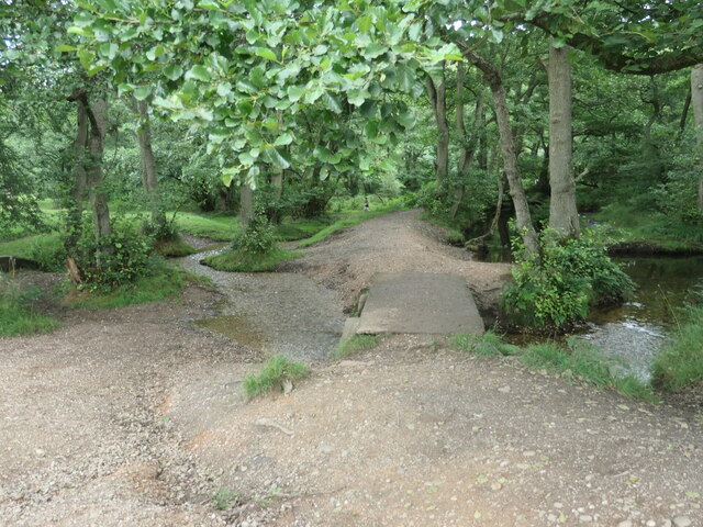
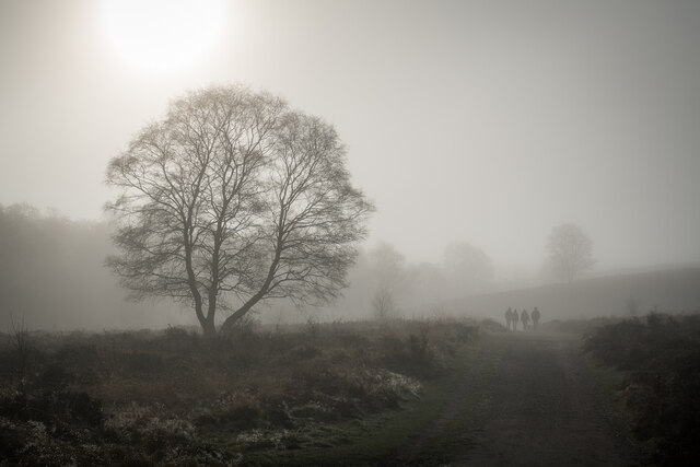
Mere Valley is a beautiful and picturesque valley located in Staffordshire, England. It is situated near the village of Stone and is an area of outstanding natural beauty. The valley is named after the Mere Brook, which runs through it, adding to its charm and tranquility.

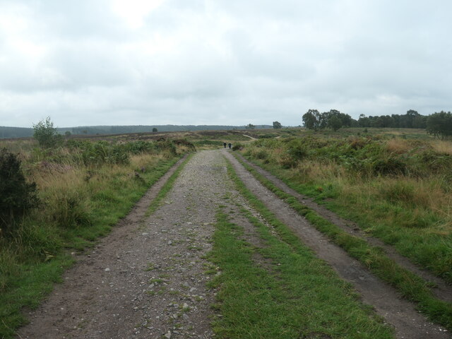
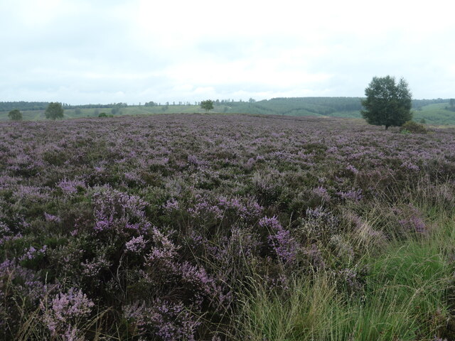
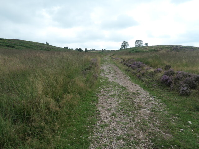
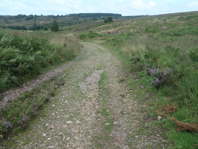
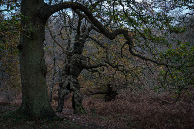
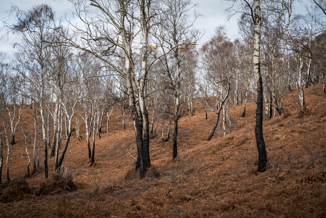
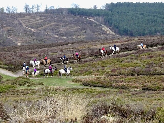
The valley is characterized by rolling hills, lush green fields, and dense woodlands. It offers breathtaking views of the surrounding countryside, making it a popular destination for nature lovers and hikers. The Mere Valley is also home to a wide variety of wildlife, including deer, foxes, and numerous bird species, making it a haven for wildlife enthusiasts and photographers.

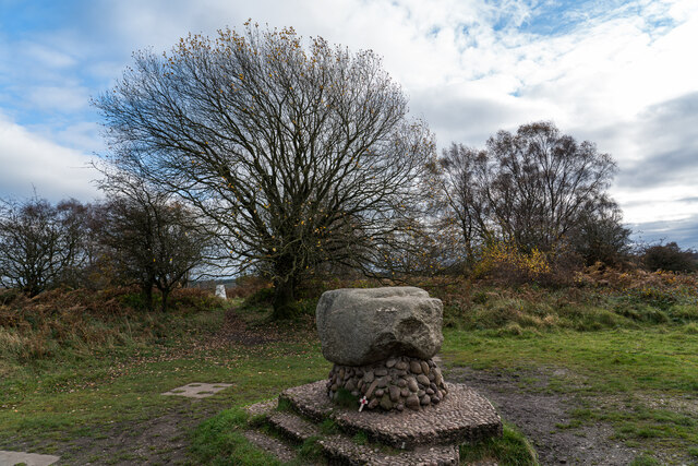
The area has a rich history, with evidence of human habitation dating back to prehistoric times. There are several archaeological sites within the valley, including ancient burial mounds and Roman remains, providing a glimpse into the past.

The Mere Valley is also renowned for its recreational activities. The Mere, a large lake located in the valley, offers opportunities for fishing, boating, and water sports. There are also several walking and cycling trails that crisscross the valley, allowing visitors to explore the stunning countryside at their own pace.

In addition to its natural beauty, the Mere Valley is home to a number of quaint villages and charming pubs, where visitors can enjoy traditional English cuisine and experience the warm hospitality of the locals.

Overall, Mere Valley in Staffordshire is a hidden gem, offering a unique blend of natural beauty, history, and recreational activities, making it an ideal destination for those seeking a peaceful and rejuvenating experience in the heart of England.

If you have any feedback on the listing, please let us know in the comments section below.

Mere Valley Images

Images are sourced within 2km of 52.776222/-2.0365875 or Grid Reference SJ9719. Thanks to Geograph Open Source API. All images are credited.

'Turn right along the track' The Heart of England Way at Brocton Field, Cannock Chase. The quote comes from Staffordshire County Council's 'Cannock Chase Circular Walk'.
'Turn right along the track'
The Heart of England Way at Brocton Field, Cannock Chase. The quote comes from Staffordshire County Council's 'Cannock Chase Circular Walk'.
Flowering heather, Cannock Chase The heathland west of Sher Brook.
Flowering heather, Cannock Chase
The heathland west of Sher Brook.
Sher Brook, looking downstream [locally north] The brook is a civil parish boundary here, between Brocton and Rugeley.
Sher Brook, looking downstream [locally north]
The brook is a civil parish boundary here, between Brocton and Rugeley.
'Cross the footbridge over Sher Brook' A parish boundary on Cannock Chase. The quote comes from Staffordshire County Council's 'Cannock Chase Circular Walk'.
'Cross the footbridge over Sher Brook'
A parish boundary on Cannock Chase. The quote comes from Staffordshire County Council's 'Cannock Chase Circular Walk'.
'Ascend the hill following ... the Staffordshire Way' The western side of Sherbrook valley, Cannock Chase. The quote comes from Staffordshire County Council's 'Cannock Chase Circular Walk'.
'Ascend the hill following ... the Staffordshire Way'
The western side of Sherbrook valley, Cannock Chase. The quote comes from Staffordshire County Council's 'Cannock Chase Circular Walk'.
Staffordshire Way, Cannock Chase Descending Sherbrook Banks.
Staffordshire Way, Cannock Chase
Descending Sherbrook Banks.
Groot Tree, Brockton Coppice, Cannock Chase Old Oak Tree, maybe 500+ years old.
Groot Tree, Brockton Coppice, Cannock Chase
Old Oak Tree, maybe 500+ years old.
Glacial Boulder and Trigpoint, Cannock Chase Set upon a pedestal of Triassic pebbles, the boulder is of Granite which is out of place here on the Moorlands of South Staffordshire, there being no granite outcrops anywhere in the Midlands. The boulder has been matched however, to the intrusive rock outcrop at Cniffel in Dumfries & Galloway, which is over 170 miles (280km) away from the Chase in the Southern Uplands of Scotland. This granite 'erratic' is marked on the OS map as the "Glacial Boulder", which gives some idea how it got here. The boulder was ripped from its parent mountain sometime during the last Ice-Age, and was transported by glacial action to its present location, the journey perhaps taking ten-thousand years during which the edges of the rock were worn down, giving its present rounded appearance.
Glacial Boulder and Trigpoint, Cannock Chase
Set upon a pedestal of Triassic pebbles, the boulder is of Granite which is out of place here on the Moorlands of South Staffordshire, there being no granite outcrops anywhere in the Midlands. The boulder has been matched however, to the intrusive rock outcrop at Cniffel in Dumfries & Galloway, which is over 170 miles (280km) away from the Chase in the Southern Uplands of Scotland. This granite 'erratic' is marked on the OS map as the "Glacial Boulder", which gives some idea how it got here. The boulder was ripped from its parent mountain sometime during the last Ice-Age, and was transported by glacial action to its present location, the journey perhaps taking ten-thousand years during which the edges of the rock were worn down, giving its present rounded appearance.
Silver Burnt Trees, Cannock Chase Looks like there has been a fire early this year or last.
Silver Burnt Trees, Cannock Chase
Looks like there has been a fire early this year or last.
Misty Staffordshire Way, Brocton, Cannock Chase The staffs way looking pretty in the mist and sun.
Misty Staffordshire Way, Brocton, Cannock Chase
The staffs way looking pretty in the mist and sun.
Horse riding on Sherbrook Banks
Southern end of the bridleway The track from Walton on the Hill, which runs in a generally southeasterly direction, emerges here onto Sawpit Lane at Brocton.
Southern end of the bridleway
The track from Walton on the Hill, which runs in a generally southeasterly direction, emerges here onto Sawpit Lane at Brocton.
Dovecot at Brocton Hall In the grounds of Brocton Hall, which is now the golf club, this 18th century former dovecot was Grade II listed <span class="nowrap"><a title="https://britishlistedbuildings.co.uk/101116692-dovecote-at-brocton-hall-brocton#.Yle9wOjMI2w" rel="nofollow ugc noopener" href="https://britishlistedbuildings.co.uk/101116692-dovecote-at-brocton-hall-brocton#.Yle9wOjMI2w">Link</a><img style="margin-left:2px;" alt="External link" title="External link - shift click to open in new window" src="https://s1.geograph.org.uk/img/external.png" width="10" height="10"/></span> & <span class="nowrap"><a title="https://historicengland.org.uk/listing/the-list/list-entry/1116692" rel="nofollow ugc noopener" href="https://historicengland.org.uk/listing/the-list/list-entry/1116692">Link</a><img style="margin-left:2px;" alt="External link" title="External link - shift click to open in new window" src="https://s1.geograph.org.uk/img/external.png" width="10" height="10"/></span> in 1968.
Dovecot at Brocton Hall
In the grounds of Brocton Hall, which is now the golf club, this 18th century former dovecot was Grade II listed LinkExternal link & LinkExternal link in 1968.
Brocton Hall Originally the 18th century hall had a third floor, but this was lost to a fire around the start of WWII, and was never rebuilt. The hall is now the clubhouse of the golf club, and attracted a Grade II listing <span class="nowrap"><a title="https://britishlistedbuildings.co.uk/101116688-brocton-hall-brocton#.Yle__ujMI2w" rel="nofollow ugc noopener" href="https://britishlistedbuildings.co.uk/101116688-brocton-hall-brocton#.Yle__ujMI2w">Link</a><img style="margin-left:2px;" alt="External link" title="External link - shift click to open in new window" src="https://s1.geograph.org.uk/img/external.png" width="10" height="10"/></span> & <span class="nowrap"><a title="https://historicengland.org.uk/listing/the-list/list-entry/1116688" rel="nofollow ugc noopener" href="https://historicengland.org.uk/listing/the-list/list-entry/1116688">Link</a><img style="margin-left:2px;" alt="External link" title="External link - shift click to open in new window" src="https://s1.geograph.org.uk/img/external.png" width="10" height="10"/></span> in 1953.
Brocton Hall
Originally the 18th century hall had a third floor, but this was lost to a fire around the start of WWII, and was never rebuilt. The hall is now the clubhouse of the golf club, and attracted a Grade II listing LinkExternal link & LinkExternal link in 1953.
Ruins of a medieval building behind Brocton Hall Tucked away, attached to the wall of the large rear kitchen garden of <a href="https://www.geograph.org.uk/photo/7146661">SJ9619 : Brocton Hall</a>, these stone arches are the remains of an unknown building that once lay somewhere nearby. Despite the lack of detail, they were Grade II listed <span class="nowrap"><a title="https://britishlistedbuildings.co.uk/101116745-ruins-to-north-west-of-brocton-hall-brocton#.YlfBVujMI2w" rel="nofollow ugc noopener" href="https://britishlistedbuildings.co.uk/101116745-ruins-to-north-west-of-brocton-hall-brocton#.YlfBVujMI2w">Link</a><img style="margin-left:2px;" alt="External link" title="External link - shift click to open in new window" src="https://s1.geograph.org.uk/img/external.png" width="10" height="10"/></span> & <span class="nowrap"><a title="https://historicengland.org.uk/listing/the-list/list-entry/1116745" rel="nofollow ugc noopener" href="https://historicengland.org.uk/listing/the-list/list-entry/1116745">Link</a><img style="margin-left:2px;" alt="External link" title="External link - shift click to open in new window" src="https://s1.geograph.org.uk/img/external.png" width="10" height="10"/></span> in 1968.
Ruins of a medieval building behind Brocton Hall
Tucked away, attached to the wall of the large rear kitchen garden of SJ9619 : Brocton Hall, these stone arches are the remains of an unknown building that once lay somewhere nearby. Despite the lack of detail, they were Grade II listed LinkExternal link & LinkExternal link in 1968.
Filling station on the Cannock Road, A34, at Newtown Petrol at this point in time was for sale at £1.239 per litre, with diesel a few pence more than that.
Filling station on the Cannock Road, A34, at Newtown
Petrol at this point in time was for sale at £1.239 per litre, with diesel a few pence more than that.
Freda's Grave, Brockton, Cannock Chase A marble memorial for the mascot of the New Zealand Rifle Brigade, Freda was a Harlequin Great Dane dog who died on Cannock Chase in 1918.  

The Grave was replaced in 1964 after being vandalised and again in 2001.
Freda's Grave, Brockton, Cannock Chase
A marble memorial for the mascot of the New Zealand Rifle Brigade, Freda was a Harlequin Great Dane dog who died on Cannock Chase in 1918. The Grave was replaced in 1964 after being vandalised and again in 2001.
Path over Brocton Field The path is heading north-north-west. Only at larger scales of OS mapping does the name Brocton Field appear quite at this location; at smaller scales the name appears rather to the south. The location is close to a trig point and to an erratic boulder which is mounted on a plinth of smaller rocks.
Path over Brocton Field
The path is heading north-north-west. Only at larger scales of OS mapping does the name Brocton Field appear quite at this location; at smaller scales the name appears rather to the south. The location is close to a trig point and to an erratic boulder which is mounted on a plinth of smaller rocks.
Show me another place!

Mere Valley is located at Grid Ref: SJ9719 (Lat: 52.776222, Lng: -2.0365875)

Administrative County: Staffordshire

District: Stafford

Police Authority: Staffordshire

What 3 Words

///dorms.irritated.mild. Near Colwich, Staffordshire

Related Wikis

Brocton, Staffordshire

Brocton is a village and civil parish in the English county of Staffordshire. It is within the borough of Stafford. The village describes itself as the...

Milford, Staffordshire

Milford is a village in the county of Staffordshire, England. It lies at the edge of Cannock Chase, on the A513 road between Stafford and Rugeley. Just...

Milford and Brocton railway station

Milford and Brocton railway station served the villages of Milford and Brocton in Staffordshire, England from 1877 to 1950 on the Trent Valley line....
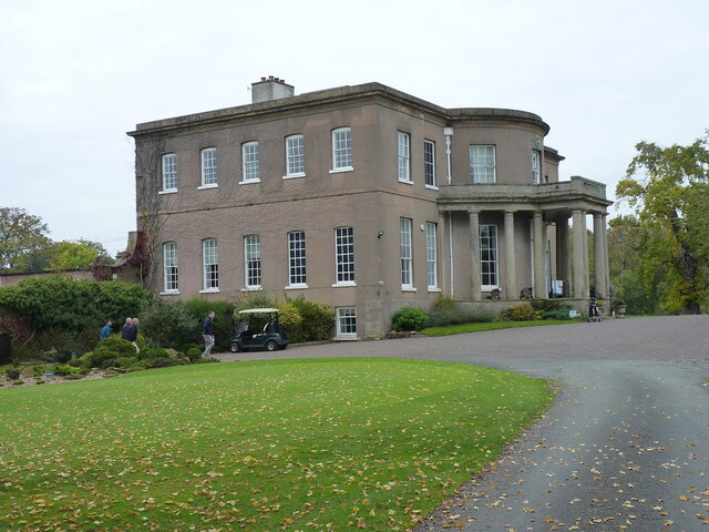
Milford Hall

Milford Hall is a privately owned 18th-century English country house at Milford, near Stafford. It is the family seat of the Levett Haszard family and...

Shugborough Tunnel

The Shugborough Tunnel is a 777-yard (710 m) railway tunnel on the Trent Valley line running under part of the Shugborough Estate in Colwich, Staffordshire...

Walton-on-the-Hill, Staffordshire

Walton-on-the-Hill is a village in the Borough of Stafford in Staffordshire, England. It is about 5 km east of the centre of Stafford, and lies on the...

Walton High School, Stafford

Walton High School is a large mixed secondary school and sixth form serving a community in the southern part of Stafford, England.There are approximately...

Berkswich

Berkswich ( BAHK-switch) is a civil parish in the borough of Stafford in Staffordshire, England. According to the 2001 census it had a population of 1...

Nearby Amenities

Located within 500m of 52.776222,-2.0365875
Bus Stop
Broc Hill Way
Bus: yes
Naptan AtcoCode: 3800C744602
Naptan Bearing: S
Naptan CommonName: Broc Hill Way
Naptan Indicator: Adj
Naptan Landmark: Broc Hill Way
Naptan Street: Pool Lane
Naptan Verified: no
Public Transport: platform
Source: naptan_import
Lat/Long: 52.779449/-2.0416741
Deer Hill
Power: substation
Ref: 861493
Lat/Long: 52.7759806/-2.0420271
Sundial
Historic: Millennium Sculpture
Inscription: Berkswich Millennium Sundial
Lat/Long: 52.7772092/-2.0381378
Historic: monument
Lat/Long: 52.7773128/-2.0409085
The data included in this document is from www.openstreetmap.org. The data is made available under ODbL.

Have you been to Mere Valley?

Leave your review of Mere Valley below (or comments, questions and feedback).