West Moor Bottom

Valley in Yorkshire Richmondshire

England

West Moor Bottom

North towards Citron Seat From the Gilmonby road, a bridleway heads south as a good track, and where it splits, the branch to Citron Seat (the small dark-topped hill right on centre in this view) continues very clear, though, like the southern branch, it ends very abruptly at no particularly obvious destination (just at a change of local authority administering the definitive rights of way map). The southern branch passes through this view just at the foot of the slope, though you'd hardly know it. Since it terminates abruptly at the boundary wall and fails to enter the Yorkshire Dales National park, its original destination is unclear, but somewhere in upper Arkengarthdale seems likely, perhaps joining the public footpath which also started life as a bridleway until it hit the National Park frontier. One suspects some severe laxity in recording the rights of way after the 1949 Countryside Act.
North towards Citron Seat Credit: Andy Waddington

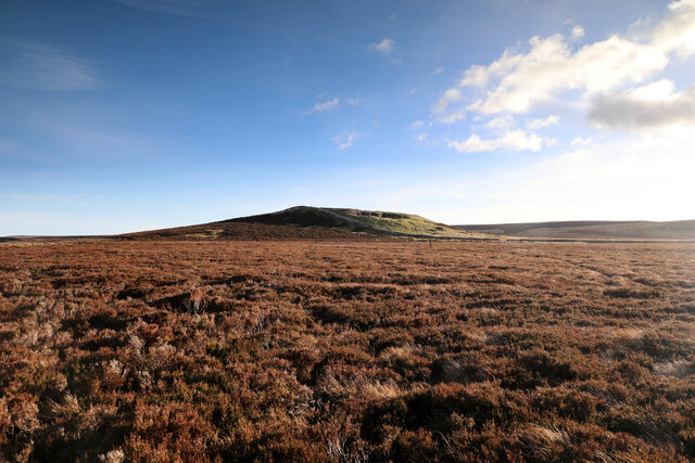
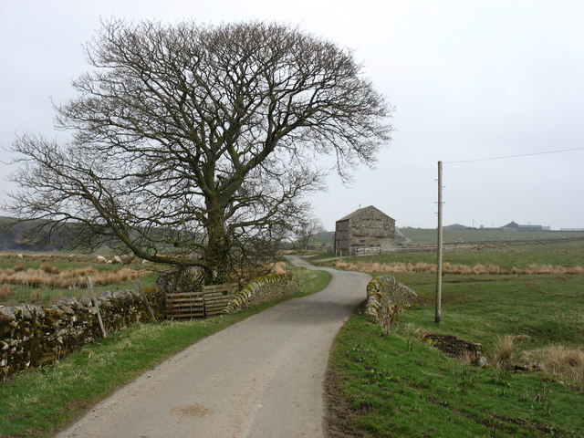
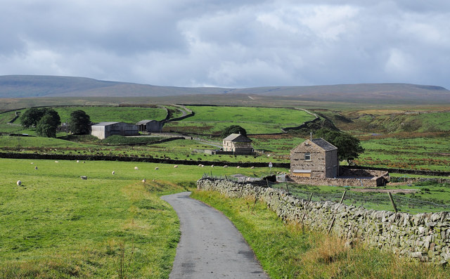
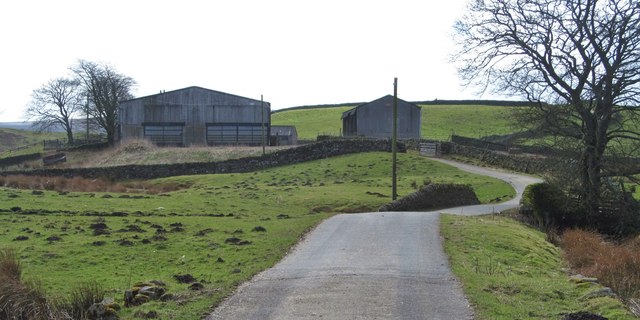
West Moor Bottom is a picturesque valley located in the county of Yorkshire, England. Nestled between rolling hills and lush green meadows, this idyllic rural area offers visitors a serene and tranquil escape from the hustle and bustle of city life.

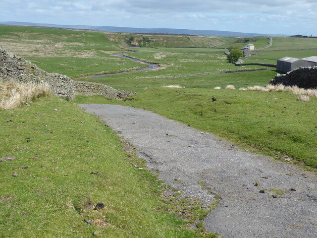
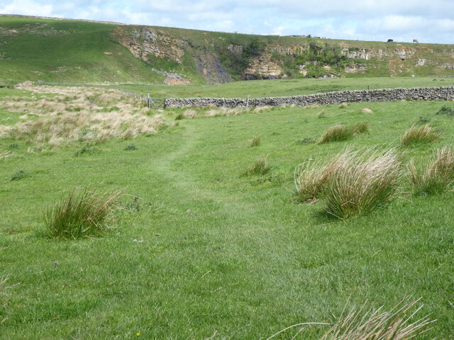
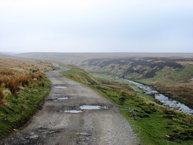
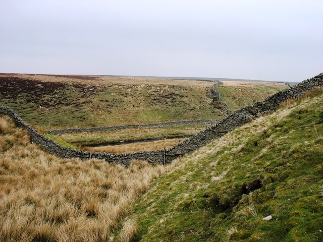
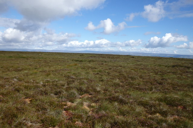
The valley is known for its breathtaking natural beauty, with its meandering streams, charming stone bridges, and vibrant flora and fauna. West Moor Bottom is surrounded by an array of diverse wildlife, including deer, rabbits, and various species of birds, making it a haven for nature enthusiasts and birdwatchers.

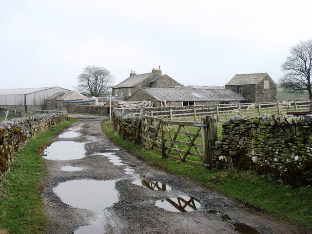
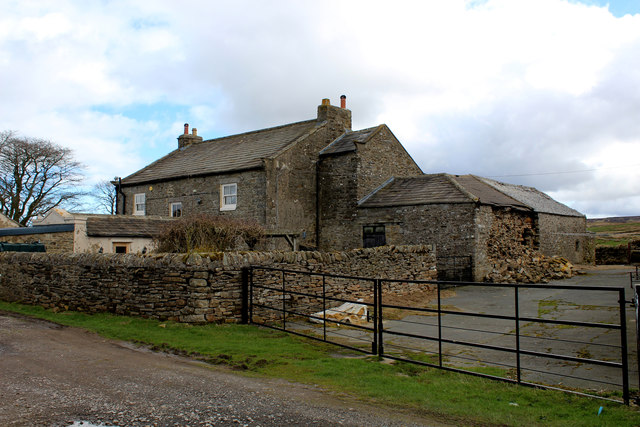
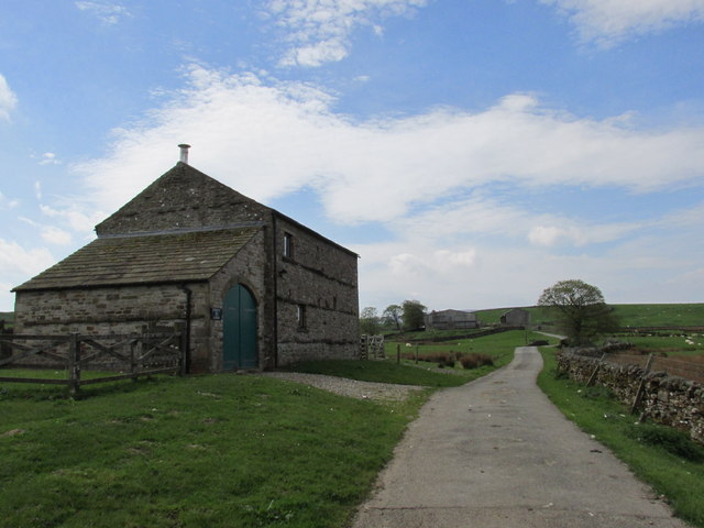
The valley is also home to several quaint villages and hamlets, each exuding their own distinct charm. The local architecture is predominantly traditional, with stone cottages and farmhouses dotting the landscape. These villages offer visitors a glimpse into Yorkshire's rich cultural heritage and rural way of life.

West Moor Bottom is a haven for outdoor activities, with numerous walking trails and cycling routes to explore. The valley's rolling hills and verdant meadows provide the perfect backdrop for hiking and picnicking, while its streams and rivers offer opportunities for fishing and boating.

The area has a close-knit community, with residents known for their warm hospitality and welcoming nature. Visitors can experience the region's unique charm by staying in one of the cozy bed and breakfasts or self-catering cottages that are scattered throughout the valley.

In conclusion, West Moor Bottom is a hidden gem in Yorkshire, offering visitors a chance to immerse themselves in the region's natural beauty and rural charm. Whether it's exploring the picturesque villages, embarking on outdoor adventures, or simply enjoying the tranquility of the countryside, this valley has something to offer for everyone.

If you have any feedback on the listing, please let us know in the comments section below.

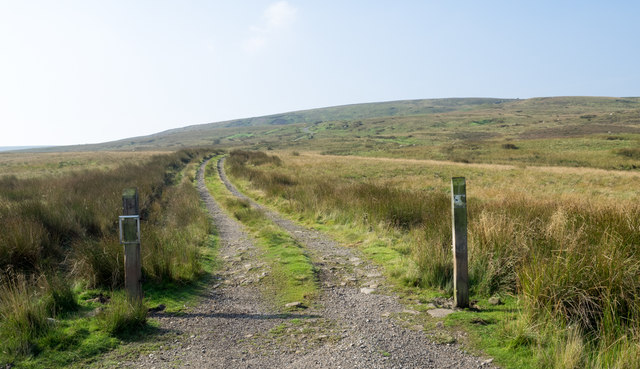
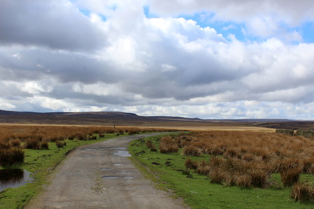
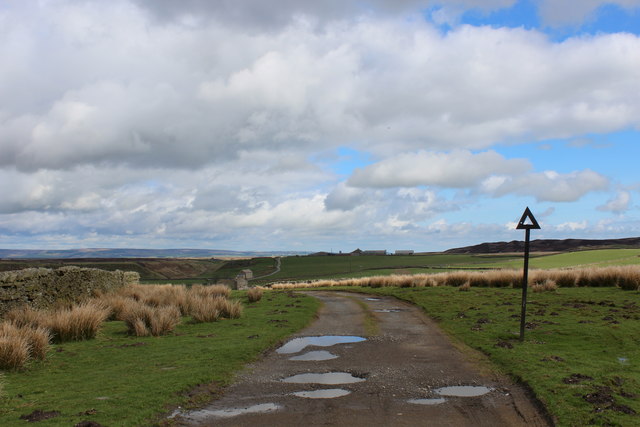
West Moor Bottom Images

Images are sourced within 2km of 54.472028/-2.0619501 or Grid Reference NY9608. Thanks to Geograph Open Source API. All images are credited.

North towards Citron Seat From the Gilmonby road, a bridleway heads south as a good track, and where it splits, the branch to Citron Seat (the small dark-topped hill right on centre in this view) continues very clear, though, like the southern branch, it ends very abruptly at no particularly obvious destination (just at a change of local authority administering the definitive rights of way map). The southern branch passes through this view just at the foot of the slope, though you'd hardly know it. Since it terminates abruptly at the boundary wall and fails to enter the Yorkshire Dales National park, its original destination is unclear, but somewhere in upper Arkengarthdale seems likely, perhaps joining the public footpath which also started life as a bridleway until it hit the National Park frontier. One suspects some severe laxity in recording the rights of way after the 1949 Countryside Act.
North towards Citron Seat
From the Gilmonby road, a bridleway heads south as a good track, and where it splits, the branch to Citron Seat (the small dark-topped hill right on centre in this view) continues very clear, though, like the southern branch, it ends very abruptly at no particularly obvious destination (just at a change of local authority administering the definitive rights of way map). The southern branch passes through this view just at the foot of the slope, though you'd hardly know it. Since it terminates abruptly at the boundary wall and fails to enter the Yorkshire Dales National park, its original destination is unclear, but somewhere in upper Arkengarthdale seems likely, perhaps joining the public footpath which also started life as a bridleway until it hit the National Park frontier. One suspects some severe laxity in recording the rights of way after the 1949 Countryside Act.
Tarnhow Hill Although apparently a very minor eminence on the map, Tarnhow Hill seems quite prominent across the otherwise rather flat bit of moorland above Bleakhow Edge (itself a rather over-grandiose name for a short steep slope with a few sandstone boulders). There's a small crag or perhaps a quarry, which I would have guessed was formed in the Little Limestone, but BGS sheet 41 (Kirkby Stephen) shows it as Richmond Chert, a little above the limestone. It also shows Tarnhow Hill covered in drift with no actual bedrock showing, which is clearly not the case, so I withhold judgement on which bed is outcropping, as I suspect that the mappers, like myself today, may not have trekked over to the hill and examined it in detail. The drystone wall which crosses its shoulder, marks the post-1974 border between North Yorkshire and County Durham (prior to that, the boundary was along the River Tees, further north) and is also the frontier of the Yorkshire Dales National Park. A number of rights of way either change status to lesser rights, or terminate abruptly on that border, suggesting that within the Park (in 1949 it was all the North Riding) recording of existing paths was far more lax than outside on the definitive map. Given the time it took for the 1949 Act to result in these definitive maps, it is possible that the discrepancy lay between the post-1974 county authorities.
Tarnhow Hill
Although apparently a very minor eminence on the map, Tarnhow Hill seems quite prominent across the otherwise rather flat bit of moorland above Bleakhow Edge (itself a rather over-grandiose name for a short steep slope with a few sandstone boulders). There's a small crag or perhaps a quarry, which I would have guessed was formed in the Little Limestone, but BGS sheet 41 (Kirkby Stephen) shows it as Richmond Chert, a little above the limestone. It also shows Tarnhow Hill covered in drift with no actual bedrock showing, which is clearly not the case, so I withhold judgement on which bed is outcropping, as I suspect that the mappers, like myself today, may not have trekked over to the hill and examined it in detail. The drystone wall which crosses its shoulder, marks the post-1974 border between North Yorkshire and County Durham (prior to that, the boundary was along the River Tees, further north) and is also the frontier of the Yorkshire Dales National Park. A number of rights of way either change status to lesser rights, or terminate abruptly on that border, suggesting that within the Park (in 1949 it was all the North Riding) recording of existing paths was far more lax than outside on the definitive map. Given the time it took for the 1949 Act to result in these definitive maps, it is possible that the discrepancy lay between the post-1974 county authorities.
The Pennine Way on Sleightholme Moor Road
The Pennine Way near Sleightholme Farm
The Pennine Way near Jack Shields Bridge
Sleightholme Farm The Pennine Way passes along this track.
Sleightholme Farm
The Pennine Way passes along this track.
Kingdom Lodge, Sleightholme Bar Gap Farm is on the horizon to the right. The lane runs to Gilmonby and Bowes.
Kingdom Lodge, Sleightholme
Bar Gap Farm is on the horizon to the right. The lane runs to Gilmonby and Bowes.
Sleightholme Farm For northbound Pennine Way walkers this comes as a welcome relief - being the first sign of civilisation since the long trek from Tan Hill Inn.
Sleightholme Farm
For northbound Pennine Way walkers this comes as a welcome relief - being the first sign of civilisation since the long trek from Tan Hill Inn.
Buildings at Sleightholme The most distant is Sleightholme Farm, the two nearer buildings are both barn conversions; the middle one is Kingdom Lodge, the nearer barn is a recent development.
Buildings at Sleightholme
The most distant is Sleightholme Farm, the two nearer buildings are both barn conversions; the middle one is Kingdom Lodge, the nearer barn is a recent development.
Kingdom Lodge. On the road to Sleightholme Farm.
Kingdom Lodge.
On the road to Sleightholme Farm.
Sleightholme Farm The farm marks the end of the narrow road which crosses the moor from Bowes, although there is a track continuing towards the Tan Hill road. This is considered to be unsuitable for motor vehicles, but a certain geograph contributor did drive it many years ago in a VW Beetle.
Sleightholme Farm
The farm marks the end of the narrow road which crosses the moor from Bowes, although there is a track continuing towards the Tan Hill road. This is considered to be unsuitable for motor vehicles, but a certain geograph contributor did drive it many years ago in a VW Beetle.
Sleightholme A scattering of buildings within an area of improved land at the remote settlement of Sleightholme. Sleightholme Beck is to the right, whilst in the distance rise the fells above Arkengarthdale.
Sleightholme
A scattering of buildings within an area of improved land at the remote settlement of Sleightholme. Sleightholme Beck is to the right, whilst in the distance rise the fells above Arkengarthdale.
The track beside Sleightholme Beck The Pennine Way follows this track for about 2 kilometres.
The track beside Sleightholme Beck
The Pennine Way follows this track for about 2 kilometres.
Sleightholme Beck Seen from the Pennine Way.
Sleightholme Beck
Seen from the Pennine Way.
On Cleasby Hill Near the top
On Cleasby Hill
Near the top
Estate road rising towards Leading Stead Leading Stead is an ill-defined upland location named on OS maps as part of Arkengarthdale Moor - another of them! The estate road climbs only a short way up the slope which is on the south side of Arkengarthdale.
Estate road rising towards Leading Stead
Leading Stead is an ill-defined upland location named on OS maps as part of Arkengarthdale Moor - another of them! The estate road climbs only a short way up the slope which is on the south side of Arkengarthdale.
Pennine Way leading away from Sleightholme Farm For southbound Pennine Way walkers the prospect of a long tramp of gradual ascent over Sleightholme Moor lies ahead.
Reward is bestowed when Tan Hill Inn is finally reached.
Pennine Way leading away from Sleightholme Farm
For southbound Pennine Way walkers the prospect of a long tramp of gradual ascent over Sleightholme Moor lies ahead. Reward is bestowed when Tan Hill Inn is finally reached.
Pennine Way heading North East to Sleightholme Farm The farm is just out of sight at the bottom of this incline.
The ancient and redundant road sign indicates this track was once open for vehicular access - and still navigable with a robust 4x4.
Pennine Way heading North East to Sleightholme Farm
The farm is just out of sight at the bottom of this incline. The ancient and redundant road sign indicates this track was once open for vehicular access - and still navigable with a robust 4x4.
Show me another place!

West Moor Bottom is located at Grid Ref: NY9608 (Lat: 54.472028, Lng: -2.0619501)

Division: North Riding

Administrative County: North Yorkshire

District: Richmondshire

Police Authority: North Yorkshire

What 3 Words

///mimics.professed.reflected. Near Bowes, Co. Durham

Related Wikis

Sleightholme

Sleightholme is a secluded hamlet on a dead end road in County Durham, England. It lies beside Sleightholme Beck, a tributary of the River Greta. The...

Walney to Wear and Whitby Cycle Route

The Walney to Wear and Whitby Cycle Route (or W2W) is the name of a cross-country cycle route in Northern England. It runs from Walney Island in Cumbria...

National Cycle Route 70

National Cycle Network (NCN) Route 70 is a Sustrans National Route that runs from Walney Island in Cumbria to Sunderland. The route is fully open and signed...

Sleightholme Beck Gorge – The Troughs

Sleightholme Beck Gorge – The Troughs is a Site of Special Scientific Interest in the County Durham district of south-west County Durham, England. The...

Nearby Amenities

Located within 500m of 54.472028,-2.0619501
Scabba Wath
Place: locality
Lat/Long: 54.4704048/-2.0649272
Mudbeck Head
Place: locality
Lat/Long: 54.4745544/-2.0597892
Mudbeck Hill
Place: locality
Lat/Long: 54.4730956/-2.058888
West Moon Bottom
Place: locality
Lat/Long: 54.4714631/-2.0614349
The data included in this document is from www.openstreetmap.org. The data is made available under ODbL.

Have you been to West Moor Bottom?

Leave your review of West Moor Bottom below (or comments, questions and feedback).