Bier Cleugh

Valley in Northumberland

England

Bier Cleugh

A blocked forestry track above Sting Burn Dating from Storm Arwen (26/27 November 2021), this section of little-used forestry track north-east of Memmer Kirk was impassable on bike, and would be rather tricky on foot.

This photograph was taken during the Coronavirus (COVID-19) pandemic of 2020/21/22.
A blocked forestry track above Sting Burn Credit: James T M Towill

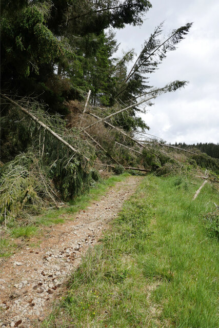
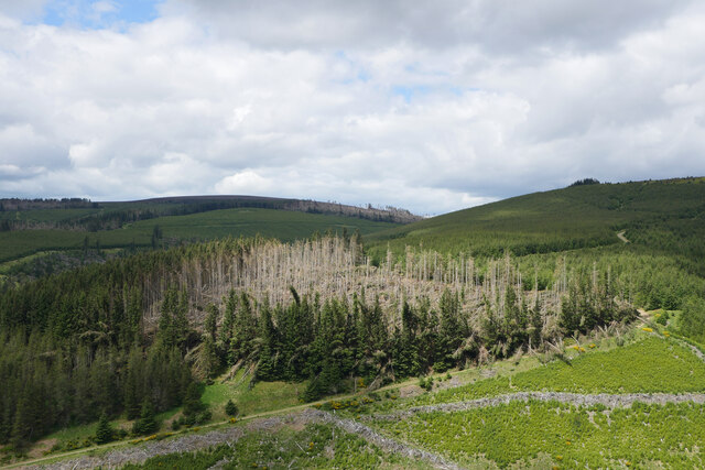
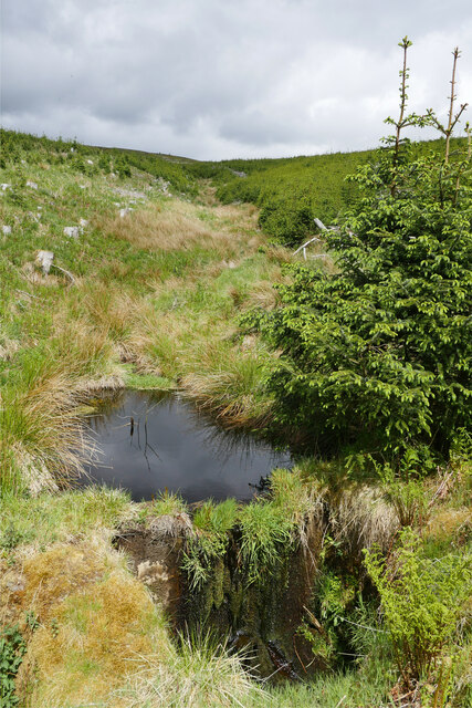
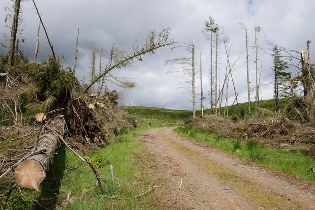
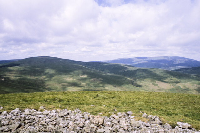
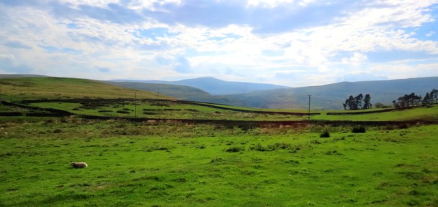
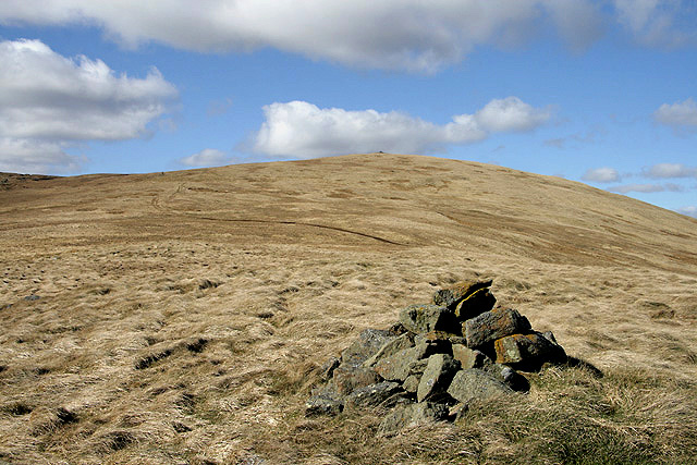
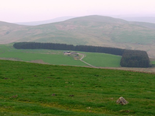
Bier Cleugh, located in Northumberland, is a picturesque valley nestled in the heart of the North Pennines Area of Outstanding Natural Beauty in England. This enchanting valley stretches for about 2 miles and is surrounded by rolling hills and lush green meadows.

Bier Cleugh is renowned for its stunning natural landscapes and diverse wildlife. The valley is home to a variety of bird species, including curlews, lapwings, and skylarks, making it a haven for birdwatchers and nature enthusiasts. The meandering Bier Burn flows through the valley, adding to its charm and tranquility.

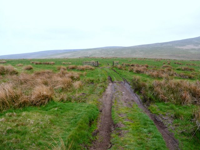
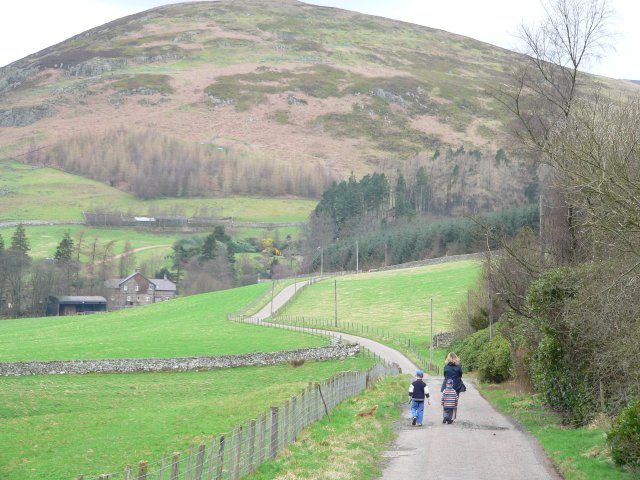
The valley offers numerous walking and hiking trails, allowing visitors to explore its idyllic surroundings. The breathtaking views of the surrounding hills and moorlands make it a popular destination for photographers and artists seeking inspiration.

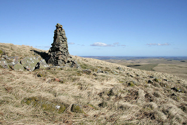
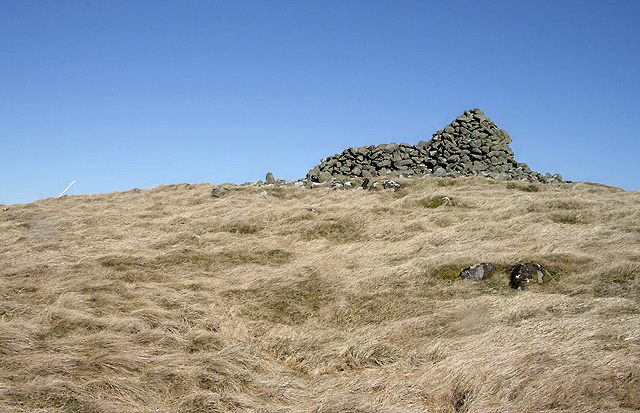
Bier Cleugh is also rich in historical significance. Evidence of ancient settlements and stone circles can be found in the surrounding areas, highlighting the valley's long history. The remnants of old lead mines are also visible, reminding visitors of the region's industrial heritage.

Although Bier Cleugh is a secluded and peaceful location, it is well-connected to nearby towns and villages. The nearby market town of Allendale provides amenities such as shops, cafes, and accommodations for visitors.

Overall, Bier Cleugh offers a peaceful retreat for those seeking natural beauty, wildlife, and a glimpse into Northumberland's rich history.

If you have any feedback on the listing, please let us know in the comments section below.

Bier Cleugh Images

Images are sourced within 2km of 55.409779/-2.0899482 or Grid Reference NT9412. Thanks to Geograph Open Source API. All images are credited.

A blocked forestry track above Sting Burn Dating from Storm Arwen (26/27 November 2021), this section of little-used forestry track north-east of Memmer Kirk was impassable on bike, and would be rather tricky on foot.

This photograph was taken during the Coronavirus (COVID-19) pandemic of 2020/21/22.
A blocked forestry track above Sting Burn
Dating from Storm Arwen (26/27 November 2021), this section of little-used forestry track north-east of Memmer Kirk was impassable on bike, and would be rather tricky on foot. This photograph was taken during the Coronavirus (COVID-19) pandemic of 2020/21/22.
Illuminating the destruction A patch of glorious sunlight illuminates an area of Kidland Forest badly damaged by Storm Arwen (26/27 November 2021).  Earlier, I had tried to bike up the track shown here, only to be stopped by the many trees blocking my way.

This photograph was taken during the Coronavirus (COVID-19) pandemic of 2020/21/22.
Illuminating the destruction
A patch of glorious sunlight illuminates an area of Kidland Forest badly damaged by Storm Arwen (26/27 November 2021). Earlier, I had tried to bike up the track shown here, only to be stopped by the many trees blocking my way. This photograph was taken during the Coronavirus (COVID-19) pandemic of 2020/21/22.
Cushat Law from Kidland Forest A view to Cushat Law across the valley of the Sting Burn, with Cushat Cleugh being the named cleft to the left of shot.  Once more, the destruction caused by Storm Arwen (26/27 November 2021) is evident in the mature stand in the middle distance.

This photograph was taken during the Coronavirus (COVID-19) pandemic of 2020/21/22.
Cushat Law from Kidland Forest
A view to Cushat Law across the valley of the Sting Burn, with Cushat Cleugh being the named cleft to the left of shot. Once more, the destruction caused by Storm Arwen (26/27 November 2021) is evident in the mature stand in the middle distance. This photograph was taken during the Coronavirus (COVID-19) pandemic of 2020/21/22.
A small dam on the Sting Burn This small dam was beside the forestry track near Sting Head, perhaps to regulate the flow of water and prevent damage to the embankment of the track under which the burn passes?

This photograph was taken during the Coronavirus (COVID-19) pandemic of 2020/21/22.
A small dam on the Sting Burn
This small dam was beside the forestry track near Sting Head, perhaps to regulate the flow of water and prevent damage to the embankment of the track under which the burn passes? This photograph was taken during the Coronavirus (COVID-19) pandemic of 2020/21/22.
Storm Arwen's destruction near Sting Head Yet more evidence of the destruction caused in Kidland Forest by Storm Arwen (26/27 November 2021).

This photograph was taken during the Coronavirus (COVID-19) pandemic of 2020/21/22.
Storm Arwen's destruction near Sting Head
Yet more evidence of the destruction caused in Kidland Forest by Storm Arwen (26/27 November 2021). This photograph was taken during the Coronavirus (COVID-19) pandemic of 2020/21/22.
Rocks and grass on Hogdon Law There's a mass of stones at the summit of Hogdon Law, many of them gathered into a cairn which is behind the camera position.
Beyond the stones are two of Northumberland's highest hills: to the right and most distant is The Cheviot, to the left and cloud-shadowed is Cushat Law.
Rocks and grass on Hogdon Law
There's a mass of stones at the summit of Hogdon Law, many of them gathered into a cairn which is behind the camera position. Beyond the stones are two of Northumberland's highest hills: to the right and most distant is The Cheviot, to the left and cloud-shadowed is Cushat Law.
The Cheviots from Hartside I am at the point where the road to Lynhope and Lynhope Spout ends at Hartside and looking south west across border country to the Cheviot Hills, Kidland Forest and upper Coquetdale.
The Cheviots from Hartside
I am at the point where the road to Lynhope and Lynhope Spout ends at Hartside and looking south west across border country to the Cheviot Hills, Kidland Forest and upper Coquetdale.
A cairn on Hogdon Law This 2m high cairn is at the 490m contour on the southeast side of the hill.
A cairn on Hogdon Law
This 2m high cairn is at the 490m contour on the southeast side of the hill.
The summit cairn on Hogdon Law This is a sizable cairn with a stone shelter wall.
The summit cairn on Hogdon Law
This is a sizable cairn with a stone shelter wall.
Hushie Cairn on Hogdon Law This small cairn is at the 420m contour on the southeast side of the hill. This is a view towards the summit of Hogdon Law.
Hushie Cairn on Hogdon Law
This small cairn is at the 420m contour on the southeast side of the hill. This is a view towards the summit of Hogdon Law.
Ewartly Shank from High Knowes The hill behind the farm is Little Dod <a href="https://www.geograph.org.uk/gridref/NT9514">NT9514</a>
Ewartly Shank from High Knowes
The hill behind the farm is Little Dod NT9514
Track below Hogdon Law Provides the farmer with four-wheeled drive access to the summit of Hogdon Law and beyond.
Track below Hogdon Law
Provides the farmer with four-wheeled drive access to the summit of Hogdon Law and beyond.
Boundary Stone on Cushat Law This boundary stone lies a short distance from the summit of Cushat Law and is one of a series of stones which stand alongside the fence which heads downhill towards Sting Head. In the distance both Shill Moor and Dunmoor Hill can be seen. For a selection of free to download walking routes in the area visit <span class="nowrap"><a title="www.cheviotwalks.co.uk" rel="nofollow ugc noopener" href="http://www.cheviotwalks.co.uk">Link</a><img style="margin-left:2px;" alt="External link" title="External link - shift click to open in new window" src="https://s1.geograph.org.uk/img/external.png" width="10" height="10"/></span>
Boundary Stone on Cushat Law
This boundary stone lies a short distance from the summit of Cushat Law and is one of a series of stones which stand alongside the fence which heads downhill towards Sting Head. In the distance both Shill Moor and Dunmoor Hill can be seen. For a selection of free to download walking routes in the area visit LinkExternal link
Cairn at Sting Head This cairn stands on a small grass-covered mound at Sting Head on the edge of the Kidland Forest close to where two separate burns bearing the name 'Sting' flow in opposite directions. The conical hill in the distance is Hogdon Law. For a selection of free to download walking routes in the area visit <span class="nowrap"><a title="www.cheviotwalks.co.uk" rel="nofollow ugc noopener" href="http://www.cheviotwalks.co.uk">Link</a><img style="margin-left:2px;" alt="External link" title="External link - shift click to open in new window" src="https://s1.geograph.org.uk/img/external.png" width="10" height="10"/></span>
Cairn at Sting Head
This cairn stands on a small grass-covered mound at Sting Head on the edge of the Kidland Forest close to where two separate burns bearing the name 'Sting' flow in opposite directions. The conical hill in the distance is Hogdon Law. For a selection of free to download walking routes in the area visit LinkExternal link
Rock on north eastern slopes of Hogdon Law This small rock lies in an ocean of grass on a trackless descent towards Green Knowe seen in the distance just in front of the shelter belt of trees surrounding the remote dwelling of Ewartly Shank. This was once called Shank House and is reached via a single track road from Alnham. For a selection of detailed free to download walking routes in the area visit <span class="nowrap"><a title="www.cheviotwalks.co.uk" rel="nofollow ugc noopener" href="http://www.cheviotwalks.co.uk">Link</a><img style="margin-left:2px;" alt="External link" title="External link - shift click to open in new window" src="https://s1.geograph.org.uk/img/external.png" width="10" height="10"/></span>
Rock on north eastern slopes of Hogdon Law
This small rock lies in an ocean of grass on a trackless descent towards Green Knowe seen in the distance just in front of the shelter belt of trees surrounding the remote dwelling of Ewartly Shank. This was once called Shank House and is reached via a single track road from Alnham. For a selection of detailed free to download walking routes in the area visit LinkExternal link
Boundary Stone near Cushat Law summit This is one of a number of boundary stones which lie along the fence line between the summit of Cushat Law and Sting Head. For a selection of free to download walking routes in the area visit <span class="nowrap"><a title="www.cheviotwalks.co.uk" rel="nofollow ugc noopener" href="http://www.cheviotwalks.co.uk">Link</a><img style="margin-left:2px;" alt="External link" title="External link - shift click to open in new window" src="https://s1.geograph.org.uk/img/external.png" width="10" height="10"/></span>
Boundary Stone near Cushat Law summit
This is one of a number of boundary stones which lie along the fence line between the summit of Cushat Law and Sting Head. For a selection of free to download walking routes in the area visit LinkExternal link
Salter's Road on north side of Shank Burn Salter's Road is a hill track crossing the Cheviot Hills. It's seen here in a badly rutted and very muddy state just north of its crossing of the Shank Burn near to the farm at Ewartly Shank.
Salter's Road on north side of Shank Burn
Salter's Road is a hill track crossing the Cheviot Hills. It's seen here in a badly rutted and very muddy state just north of its crossing of the Shank Burn near to the farm at Ewartly Shank.
Ewartly Shank Ewartly Shank is an isolated farm in the Cheviot Hills at the end of a public road. A hill track, Salter's Road continues north-west from the buildings from which this photo was taken.
Ewartly Shank
Ewartly Shank is an isolated farm in the Cheviot Hills at the end of a public road. A hill track, Salter's Road continues north-west from the buildings from which this photo was taken.
Show me another place!

Bier Cleugh is located at Grid Ref: NT9412 (Lat: 55.409779, Lng: -2.0899482)

Unitary Authority: Northumberland

Police Authority: Northumbria

What 3 Words

///solves.whizzing.recapture. Near Whittingham, Northumberland

Nearby Locations

Hogdon Law Bier Cleugh

Related Wikis

Kidland

Kidland is a former civil parish, now in the parish of Alwinton in Northumberland, England, about 2 miles (3 km) northwest of Alwinton village. In 1951...

Linhope

Linhope is a small village in Northumberland, England. It is located in the Cheviots on the River Breamish, and within Northumberland National Park. Linhope...

Biddlestone Chapel

Biddlestone Chapel is a redundant Roman Catholic chapel in Biddlestone, Northumberland, England. It is recorded in the National Heritage List for England...

Biddlestone Hall

Biddlestone Hall was a large country house at Biddlestone in Northumberland. == History == The Georgian style mansion was built for the Selby family about...

Have you been to Bier Cleugh?

Leave your review of Bier Cleugh below (or comments, questions and feedback).