Berwick Coombe

Valley in Wiltshire

England

Berwick Coombe

Old Milestone on Whitesheet Hill, Berwick St John Parish Carved stone post by the UC road, in parish of Berwick St John (Salisbury District), Whitesheet Hill, top of hill at junction of bridleway and footpath, in field, 12m from track, on South side of road. Erected by the Whitesheet turnpike trust in the 18th century. See 9:50 minutes into this video <span class="nowrap"><a title="https://m.youtube.com/watch?v=GmOhltFV5pc" rel="nofollow ugc noopener" href="https://m.youtube.com/watch?v=GmOhltFV5pc">Link</a><img style="margin-left:2px;" alt="External link" title="External link - shift click to open in new window" src="https://s1.geograph.org.uk/img/external.png" width="10" height="10"/></span>

Inscription reads:- : XCVII / Miles from / Hide (sic) Park Corner / XIV / From Salisbury / 1756 :
Carved benchmark front lower.

Scheduled Monument. List Entry Number: 1005703

Milestone Society National ID: WI_SAOSH14
Old Milestone on Whitesheet Hill, Berwick St John Parish Credit: Katherine Grugeon

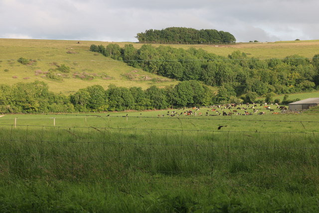
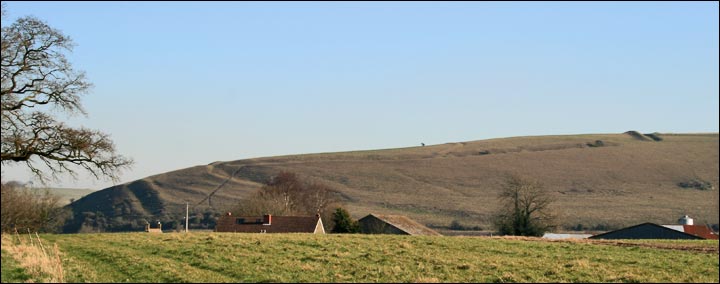
Berwick Coombe is a picturesque valley located in Wiltshire, England. The valley is characterized by its lush greenery, rolling hills, and peaceful atmosphere, making it a popular destination for hikers, nature lovers, and those seeking a tranquil retreat.

The valley is home to a variety of wildlife, including birds, deer, and other small mammals, making it a haven for nature enthusiasts. The landscape is dotted with meadows, woodlands, and streams, creating a diverse and vibrant ecosystem.

Berwick Coombe is also known for its historical significance, with evidence of ancient settlements and archaeological sites dating back thousands of years. The valley has been inhabited by humans since prehistoric times, and remnants of past civilizations can still be found scattered throughout the area.

Visitors to Berwick Coombe can enjoy a range of outdoor activities, such as hiking, birdwatching, and picnicking. The valley offers stunning views of the surrounding countryside, providing a peaceful and idyllic setting for those looking to escape the hustle and bustle of modern life.

If you have any feedback on the listing, please let us know in the comments section below.

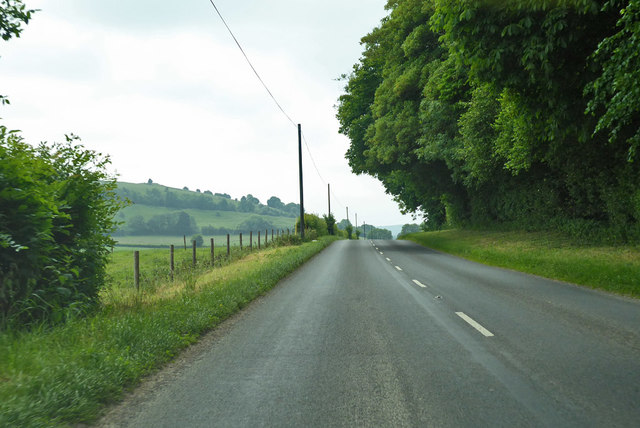
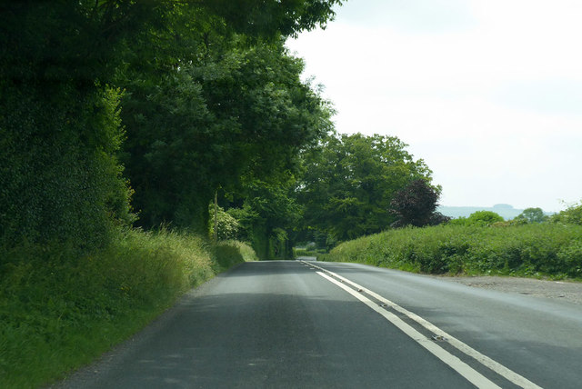
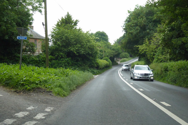
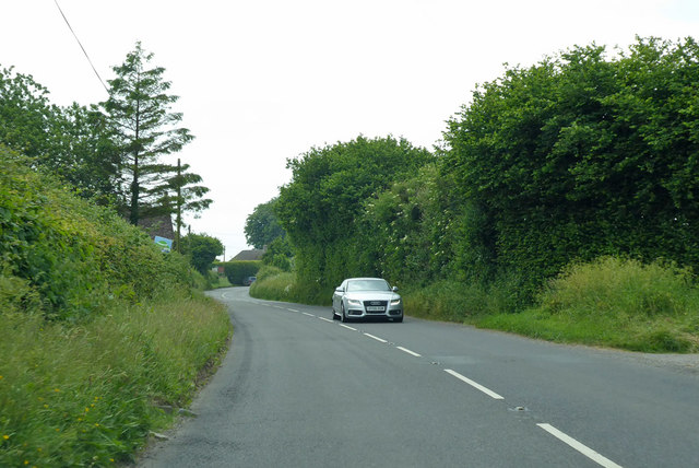
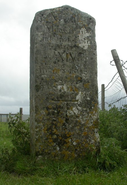
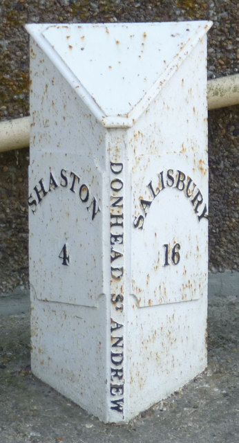
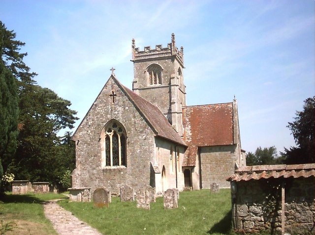
Berwick Coombe Images

Images are sourced within 2km of 51.00989/-2.0825784 or Grid Reference ST9423. Thanks to Geograph Open Source API. All images are credited.

Old Milestone on Whitesheet Hill, Berwick St John Parish Carved stone post by the UC road, in parish of Berwick St John (Salisbury District), Whitesheet Hill, top of hill at junction of bridleway and footpath, in field, 12m from track, on South side of road. Erected by the Whitesheet turnpike trust in the 18th century. See 9:50 minutes into this video <span class="nowrap"><a title="https://m.youtube.com/watch?v=GmOhltFV5pc" rel="nofollow ugc noopener" href="https://m.youtube.com/watch?v=GmOhltFV5pc">Link</a><img style="margin-left:2px;" alt="External link" title="External link - shift click to open in new window" src="https://s1.geograph.org.uk/img/external.png" width="10" height="10"/></span>

Inscription reads:- : XCVII / Miles from / Hide (sic) Park Corner / XIV / From Salisbury / 1756 :
Carved benchmark front lower.

Scheduled Monument. List Entry Number: 1005703

Milestone Society National ID: WI_SAOSH14
Old Milestone on Whitesheet Hill, Berwick St John Parish
Carved stone post by the UC road, in parish of Berwick St John (Salisbury District), Whitesheet Hill, top of hill at junction of bridleway and footpath, in field, 12m from track, on South side of road. Erected by the Whitesheet turnpike trust in the 18th century. See 9:50 minutes into this video LinkExternal link Inscription reads:- : XCVII / Miles from / Hide (sic) Park Corner / XIV / From Salisbury / 1756 : Carved benchmark front lower. Scheduled Monument. List Entry Number: 1005703 Milestone Society National ID: WI_SAOSH14
Berwick St John The historic Talbot Inn is one of many attractive stone buildings in this village.
Berwick St John
The historic Talbot Inn is one of many attractive stone buildings in this village.
A30 heading west
A30 heading west
A30 heading west One of the least busy sections of the A30.
A30 heading west
One of the least busy sections of the A30.
A30 heading west The left turn goes to Berwick St John.  The blue sign shows the way the Ed and Camilla's wedding.
A30 heading west
The left turn goes to Berwick St John. The blue sign shows the way the Ed and Camilla's wedding.
A30 heading west Nearing Whitesand Cross.
A30 heading west
Nearing Whitesand Cross.
Old Milestone by the A30, Privett Copse, Ansty Parish Carved stone post by the A30, in parish of ANSTY (SALISBURY District), Ansty, At end of Privett Copse, South of road bend on verge, on North West side of road. Sarum Shaston triangle, erected by the Whitesheet turnpike trust in the 18th century. 

Inscription reads:-
: To / Sarum / XV : : To / Shaston / V :  
Carved benchmark and rivet on top.

Grade II listed. List Entry Number: 1183999
<span class="nowrap"><a title="https://historicengland.org.uk/listing/the-list/list-entry/1183999" rel="nofollow ugc noopener" href="https://historicengland.org.uk/listing/the-list/list-entry/1183999">Link</a><img style="margin-left:2px;" alt="External link" title="External link - shift click to open in new window" src="https://s1.geograph.org.uk/img/external.png" width="10" height="10"/></span>

Milestone Society National ID: WI_SHSA05.
Old Milestone by the A30, Privett Copse, Ansty Parish
Carved stone post by the A30, in parish of ANSTY (SALISBURY District), Ansty, At end of Privett Copse, South of road bend on verge, on North West side of road. Sarum Shaston triangle, erected by the Whitesheet turnpike trust in the 18th century. Inscription reads:- : To / Sarum / XV : : To / Shaston / V : Carved benchmark and rivet on top. Grade II listed. List Entry Number: 1183999 LinkExternal link Milestone Society National ID: WI_SHSA05.
Old Milestone on Whitesheet Hill, Berwick St John Parish Carved stone post by the UC road, in parish of Berwick St John (Salisbury District), Whitesheet Hill, top of hill at junction of bridleway and footpath, in field, 12m from track, on South side of road. Erected by the Whitesheet turnpike trust in the 18th century. See 9:50 minutes into this video <span class="nowrap"><a title="https://m.youtube.com/watch?v=GmOhltFV5pc" rel="nofollow ugc noopener" href="https://m.youtube.com/watch?v=GmOhltFV5pc">Link</a><img style="margin-left:2px;" alt="External link" title="External link - shift click to open in new window" src="https://s1.geograph.org.uk/img/external.png" width="10" height="10"/></span>.

Inscription reads:- : XCVII / Miles from / Hide (sic) Park Corner / XIV / From Salisbury / 1756 :
Carved benchmark front lower.

Scheduled Monument. List Entry Number: 1005703

Milestone Society National ID: WI_SAOSH14
Old Milestone on Whitesheet Hill, Berwick St John Parish
Carved stone post by the UC road, in parish of Berwick St John (Salisbury District), Whitesheet Hill, top of hill at junction of bridleway and footpath, in field, 12m from track, on South side of road. Erected by the Whitesheet turnpike trust in the 18th century. See 9:50 minutes into this video LinkExternal link. Inscription reads:- : XCVII / Miles from / Hide (sic) Park Corner / XIV / From Salisbury / 1756 : Carved benchmark front lower. Scheduled Monument. List Entry Number: 1005703 Milestone Society National ID: WI_SAOSH14
Old Milepost by the A30, Whitesand Cross, Donhead St Andrew Cast iron post by the A30, in parish of DONHEAD ST ANDREW (SALISBURY District), Whitesand Cross; 100m East of crossroads by No. 150, on concrete plinth, on South side of road. Cockey iron casting, erected by the Whitesheet turnpike trust in the 19th century. 

Inscription reads:-
: SHASTON / 4 : : DONHEAD ST MARY : : SALISBURY / 16 :

Grade II listed.
List Entry Number: 1200764 <span class="nowrap"><a title="https://historicengland.org.uk/listing/the-list/list-entry/1200764" rel="nofollow ugc noopener" href="https://historicengland.org.uk/listing/the-list/list-entry/1200764">Link</a><img style="margin-left:2px;" alt="External link" title="External link - shift click to open in new window" src="https://s1.geograph.org.uk/img/external.png" width="10" height="10"/></span>

Milestone Society National ID: WI_SHSA04.
Old Milepost by the A30, Whitesand Cross, Donhead St Andrew
Cast iron post by the A30, in parish of DONHEAD ST ANDREW (SALISBURY District), Whitesand Cross; 100m East of crossroads by No. 150, on concrete plinth, on South side of road. Cockey iron casting, erected by the Whitesheet turnpike trust in the 19th century. Inscription reads:- : SHASTON / 4 : : DONHEAD ST MARY : : SALISBURY / 16 : Grade II listed. List Entry Number: 1200764 LinkExternal link Milestone Society National ID: WI_SHSA04.
White Sheet Hill, Donhead St Andrew
The A30, Donhead St Andrew White Sheet Hill is on the right
The A30, Donhead St Andrew
White Sheet Hill is on the right
White Sheet Hill, Donhead St Andrew The cows live at Horwood Dairy Farm
White Sheet Hill, Donhead St Andrew
The cows live at Horwood Dairy Farm
Grassland by the A30 near Ansty
Brook Hill by Whitesand Cross
The A30 near Donhead St Andrew
White Sheet Hill near Ansty
Rolling downland north of Norrington Farm
White Sheet Hill, seen from the A30 There is a large lay-by on the north side of the A30 at this point giving a close view of the downs.
White Sheet Hill, seen from the A30
There is a large lay-by on the north side of the A30 at this point giving a close view of the downs.
Show me another place!

Berwick Coombe is located at Grid Ref: ST9423 (Lat: 51.00989, Lng: -2.0825784)

Unitary Authority: Wiltshire

Police Authority: Wiltshire

What 3 Words

///desktops.shame.education. Near Ansty, Wiltshire

Nearby Locations

Berwick Coombe

Related Wikis

Berwick St John

Berwick St John is a village and civil parish in southwest Wiltshire, England, about 5 miles (8 km) east of Shaftesbury in Dorset. The parish includes...

Gallows Hill SSSI, Wiltshire

Gallows Hill SSSI is a Site of Special Scientific Interest on the north side of the Ebble Valley in south Wiltshire, England. Its chalk grassland and scrub...

Ferne House

Ferne House is a country house in the parish of Donhead St Andrew in Wiltshire, England, owned by Viscount Rothermere.There has been a settlement on the...

Winklebury Hill

Winkelbury Hill (grid reference ST952216) is a 62.95 hectare biological Site of Special Scientific Interest in Berwick St John parish, south-west Wiltshire...

Have you been to Berwick Coombe?

Leave your review of Berwick Coombe below (or comments, questions and feedback).