Bankfield Clough

Valley in Lancashire

England

Bankfield Clough

Inscribed stone on the south side of Twirl Hill Road, Hartshead Inscribed stone on the south side of Twirl Hill Road. In the former Ashton under Lyne parish to 1894 and Hartshead parish from 1894 to 1974. This stone is thought to be the collection place for the northern part of the ancient parish of Ashton-under-Lyne and is situated at a place called Twirl Hill between the hamlets of Alt Hill and Hartshead, just below the local viewpoint of Hartshead Pike. The practice of paying tithes was abandoned in the 1830’s. The “Tythe Stone” inscription is thought to have been made by local man John Coulthard in 1840 to ensure its preservation. See also <span class="nowrap"><a title="http://www.marland.org/places/marlandplaces-twarlhill.htm" rel="nofollow ugc noopener" href="http://www.marland.org/places/marlandplaces-twarlhill.htm">Link</a><img style="margin-left:2px;" alt="External link" title="External link - shift click to open in new window" src="https://s1.geograph.org.uk/img/external.png" width="10" height="10"/></span>

Milestone Society National ID: LA_HARTS01cm
Inscribed stone on the south side of Twirl Hill Road, Hartshead Credit: D Garside

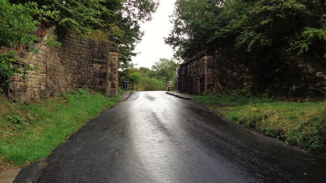
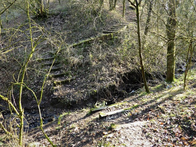
Bankfield Clough is a picturesque valley located in Lancashire, England. Situated in the Rossendale district, this charming valley offers a serene and idyllic natural environment for locals and tourists alike.

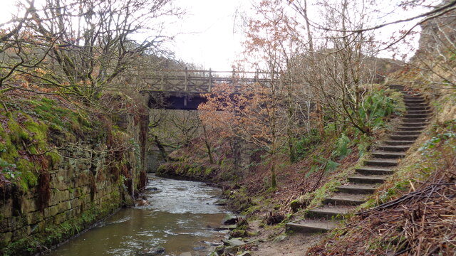
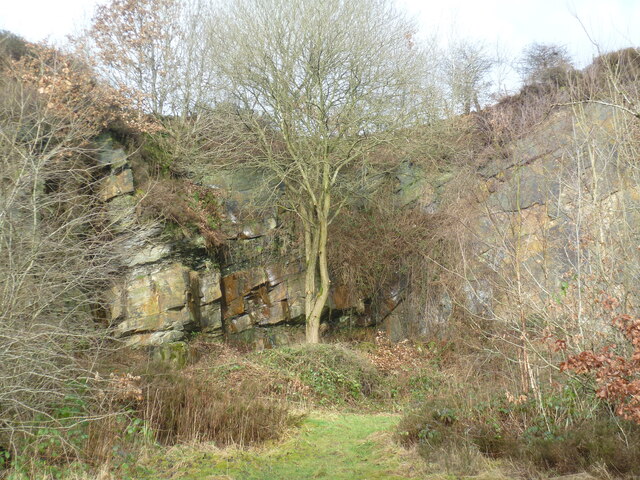
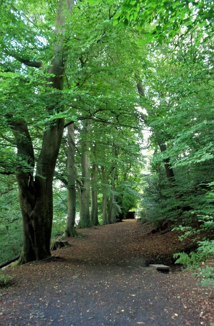
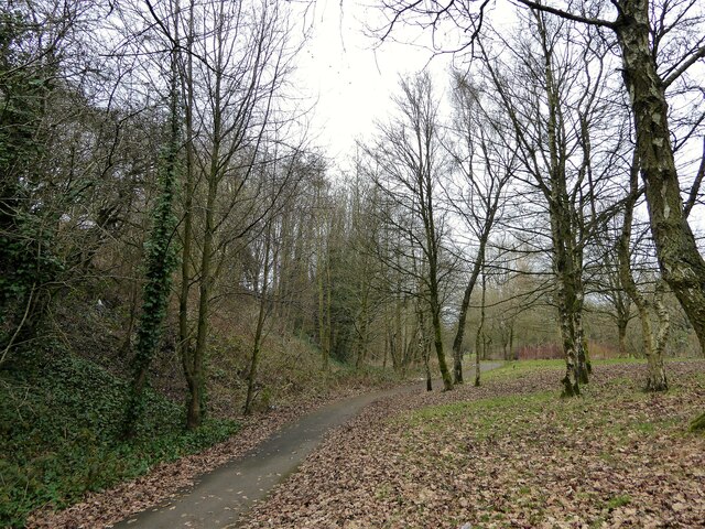
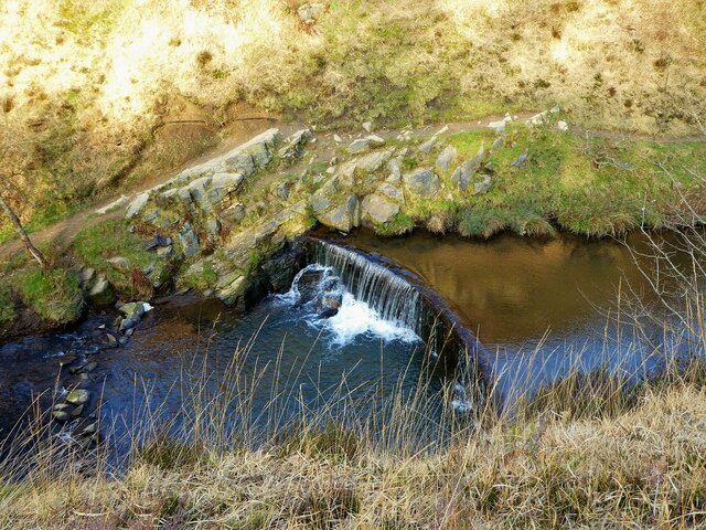
The valley is characterized by its lush greenery, rolling hills, and a meandering stream that runs through its center. The landscape is dotted with a variety of trees, including oak, beech, and birch, which create a stunning array of colors during the changing seasons.

Bankfield Clough is a haven for wildlife enthusiasts, as it is home to a diverse range of animal species. Visitors can often spot deer grazing in the fields, rabbits darting across the meadows, and a variety of bird species soaring overhead. The valley is also known for its rich flora, with an abundance of wildflowers and ferns adorning the forest floor.

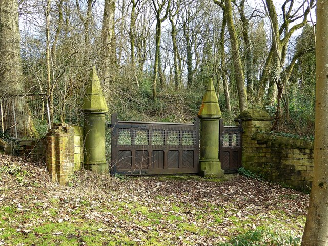
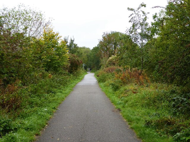
For those seeking outdoor activities, Bankfield Clough offers several walking trails that allow visitors to explore the beauty of the valley. These paths wind through the hills, providing breathtaking views of the surrounding countryside. The valley is also a popular spot for picnics, with designated areas offering picnic tables and benches.

Bankfield Clough is a true hidden gem in Lancashire, offering a tranquil escape from the hustle and bustle of everyday life. Its natural beauty, diverse wildlife, and recreational opportunities make it a must-visit destination for nature lovers and outdoor enthusiasts.

If you have any feedback on the listing, please let us know in the comments section below.

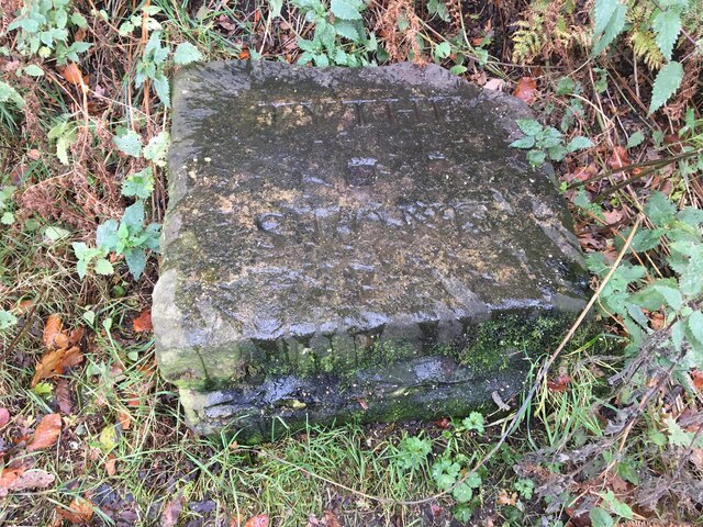
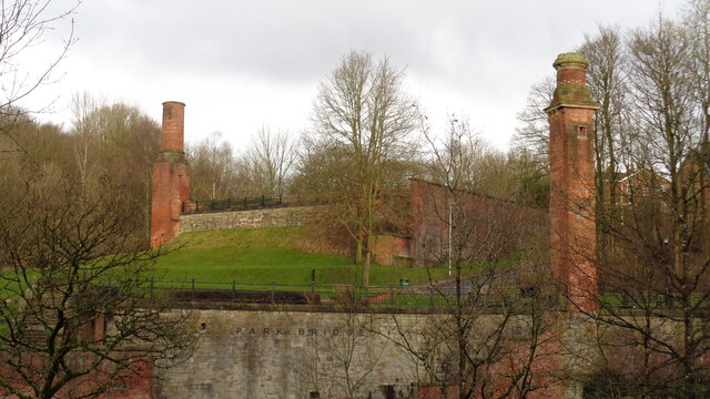
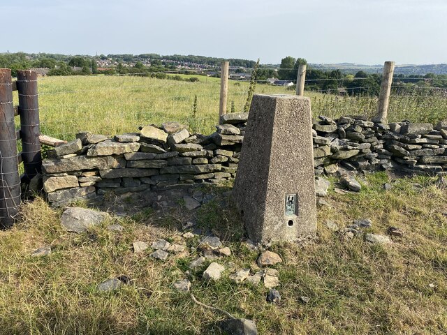
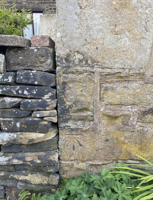
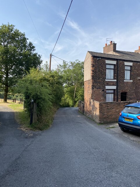
Bankfield Clough Images

Images are sourced within 2km of 53.516771/-2.0951985 or Grid Reference SD9302. Thanks to Geograph Open Source API. All images are credited.

Inscribed stone on the south side of Twirl Hill Road, Hartshead Inscribed stone on the south side of Twirl Hill Road. In the former Ashton under Lyne parish to 1894 and Hartshead parish from 1894 to 1974. This stone is thought to be the collection place for the northern part of the ancient parish of Ashton-under-Lyne and is situated at a place called Twirl Hill between the hamlets of Alt Hill and Hartshead, just below the local viewpoint of Hartshead Pike. The practice of paying tithes was abandoned in the 1830’s. The “Tythe Stone” inscription is thought to have been made by local man John Coulthard in 1840 to ensure its preservation. See also <span class="nowrap"><a title="http://www.marland.org/places/marlandplaces-twarlhill.htm" rel="nofollow ugc noopener" href="http://www.marland.org/places/marlandplaces-twarlhill.htm">Link</a><img style="margin-left:2px;" alt="External link" title="External link - shift click to open in new window" src="https://s1.geograph.org.uk/img/external.png" width="10" height="10"/></span>

Milestone Society National ID: LA_HARTS01cm
Inscribed stone on the south side of Twirl Hill Road, Hartshead
Inscribed stone on the south side of Twirl Hill Road. In the former Ashton under Lyne parish to 1894 and Hartshead parish from 1894 to 1974. This stone is thought to be the collection place for the northern part of the ancient parish of Ashton-under-Lyne and is situated at a place called Twirl Hill between the hamlets of Alt Hill and Hartshead, just below the local viewpoint of Hartshead Pike. The practice of paying tithes was abandoned in the 1830’s. The “Tythe Stone” inscription is thought to have been made by local man John Coulthard in 1840 to ensure its preservation. See also LinkExternal link Milestone Society National ID: LA_HARTS01cm
Park Bridge Heritage Centre View from Alt Hill Road of the chimneys of the ironworks roller shop to the left and cotton mill to the right
Park Bridge Heritage Centre
View from Alt Hill Road of the chimneys of the ironworks roller shop to the left and cotton mill to the right
Old Tramway Bridge Over the River Medlock at the Park Bridge industrial heritage site
Old Tramway Bridge
Over the River Medlock at the Park Bridge industrial heritage site
Old Quarry On the Park Bridge industrial heritage site
Old Quarry
On the Park Bridge industrial heritage site
The Rock Trig Point Flush Bracket S2786
OS Cut Mark - Park Bridge, Keverlow Farm <span class="nowrap"><a title="https://www.bench-marks.org.uk/bm60764" rel="nofollow ugc noopener" href="https://www.bench-marks.org.uk/bm60764">Link</a><img style="margin-left:2px;" alt="External link" title="External link - shift click to open in new window" src="https://s1.geograph.org.uk/img/external.png" width="10" height="10"/></span>
OS Cut Mark - Park Bridge, Keverlow Farm
Mill Brow
Mill Brow
Broad Track from Valley Bridge A former carriage drive from the now demolished Riversvale Hall?
Broad Track from Valley Bridge
A former carriage drive from the now demolished Riversvale Hall?
Railway Bridge Abutments On Alt Hill Lane for the former Oldham and Ashton railway route
Railway Bridge Abutments
On Alt Hill Lane for the former Oldham and Ashton railway route
Cycle route following line of former railway This is the route from Ashton to Oldham and is here close to Alexandra Park, Oldham
Cycle route following line of former railway
This is the route from Ashton to Oldham and is here close to Alexandra Park, Oldham
Carriage drive gates to Dean House At Park Bridge
Carriage drive gates to Dean House
At Park Bridge
Weir on River Medlock This had a mill race that served the industrial complex at Park Bridge. The Medlock is in a narrow steep sided valley at this point.
Weir on River Medlock
This had a mill race that served the industrial complex at Park Bridge. The Medlock is in a narrow steep sided valley at this point.
Steps on the Medlock Trail Steps down from the Abbey Hills Road embankment to the River Medlock
Steps on the Medlock Trail
Steps down from the Abbey Hills Road embankment to the River Medlock
Missing footbridge on Oldham Way Presumably there was a bridge between the sets of steps in Rowton Clough on the named trail
Missing footbridge on Oldham Way
Presumably there was a bridge between the sets of steps in Rowton Clough on the named trail
Cycle path following route of former railway On the embankment across Downshaw Clough. The railway connected Ashton-under-Lyne and Oldham.
Cycle path following route of former railway
On the embankment across Downshaw Clough. The railway connected Ashton-under-Lyne and Oldham.
Cycle path following route of former railway On the embankment across Holden Clough. The railway connected Ashton-under-Lyne with Oldham.
Cycle path following route of former railway
On the embankment across Holden Clough. The railway connected Ashton-under-Lyne with Oldham.
New housing estate off Lees Road These houses are on Smallshaw Way
New housing estate off Lees Road
These houses are on Smallshaw Way
Shri Swaminarayan Mandir Temple On Lees Road
Shri Swaminarayan Mandir Temple
On Lees Road
Show me another place!

Bankfield Clough is located at Grid Ref: SD9302 (Lat: 53.516771, Lng: -2.0951985)

Unitary Authority: Oldham

Police Authority: Greater Manchester

What 3 Words

///agrees.trader.weep. Near Oldham, Manchester

Related Wikis

Park Bridge railway station

Park Bridge Railway Station was a railway station on the Oldham, Ashton-under-Lyne and Guide Bridge Junction Railway (OA&GB) that served the village of...

Fairbottom Bobs

Fairbottom Bobs is a Newcomen-type beam engine that was used in the 18th century as a pumping engine to drain a colliery near Ashton-under-Lyne. It is...

Fitton Hill

Fitton Hill is a large housing estate in the town of Oldham in Greater Manchester, contiguous with Hathershaw and Bardsley. Lying 2 miles south of Oldham...

Bardsley, Greater Manchester

Bardsley is a suburban area of Oldham, in Greater Manchester, England. It lies on undulating land by the River Medlock, on Oldham's southern boundary with...

Nearby Amenities

Located within 500m of 53.516771,-2.0951985
Park Bridge
Place: hamlet
Source: npe
Wikidata: Q7137651
Lat/Long: 53.5181589/-2.0938846
Give Way
Direction: forward
Lat/Long: 53.513891/-2.0925934
Bus Stop
Fitton Hill, Rosary Road / near Springwood Hall Road
Bus: yes
Naptan AtcoCode: 1800ED04531
Naptan Bearing: NE
Naptan CommonName: Rosary Road/Springwood Hall Road
Naptan Indicator: Opp Comm Centre
Naptan Landmark: HOUSE 94
Naptan NaptanCode: manamajm
Naptan PlusbusZoneRef: MNCRPIC
Naptan ShortCommonName: Springw'd Hall Rd
Naptan Street: ROSARY ROAD
Naptan Verified: no
Network: TfGM
Operator: TfGM
Public Transport: platform
Source: naptan_import
Lat/Long: 53.5192157/-2.100524
Bus Stop
Fitton Hill, Rosary Road / opposite Springwood Hall Road
Bus: yes
Naptan AtcoCode: 1800ED28521
Naptan Bearing: SW
Naptan CommonName: Rosary Road/Education Centre
Naptan Indicator: Education Ctre
Naptan Landmark: HOUSE 103
Naptan NaptanCode: manatjmg
Naptan PlusbusZoneRef: MNCRPIC
Naptan ShortCommonName: Education Centre
Naptan Street: ROSARY ROAD
Naptan Verified: no
Network: TfGM
Operator: TfGM
Public Transport: platform
Source: naptan_import
Lat/Long: 53.519315/-2.1000567
Barrier: kissing_gate
Lat/Long: 53.5174985/-2.0900677
Barrier: cycle_barrier
Bicycle: designated
Foot: designated
Horse: designated
Motor Vehicle: no
Lat/Long: 53.5201465/-2.0923555
Information: guidepost
Tourism: information
Lat/Long: 53.5176354/-2.0902469
Noexit: yes
Lat/Long: 53.5150738/-2.101068
Tourism: viewpoint
Lat/Long: 53.518583/-2.0940167
Barrier: cycle_barrier
Bicycle: dismount
Foot: yes
Horse: yes
Lat/Long: 53.5140036/-2.0928048
Barrier: cycle_barrier
Bicycle: dismount
Foot: yes
Horse: yes
Lat/Long: 53.5138283/-2.0928842
Barrier: cycle_barrier
Bicycle: dismount
Foot: yes
Horse: yes
Lat/Long: 53.5171135/-2.0899052
Barrier: cycle_barrier
Bicycle: dismount
Foot: yes
Horse: yes
Lat/Long: 53.5171212/-2.0897583
Man Made: chimney
Lat/Long: 53.5184944/-2.0927768
Power: pole
Lat/Long: 53.5135147/-2.0901192
Man Made: chimney
Lat/Long: 53.5189667/-2.0932257
Park Bridge
Alt Name: Parkbridge
Historic Railway: station
Railway: site
Wikidata: Q7137653
Wikipedia: en:Park Bridge railway station
Lat/Long: 53.5165626/-2.0930418
Noexit: yes
Lat/Long: 53.5150103/-2.1015936
Noexit: yes
Lat/Long: 53.5153234/-2.1022669
Noexit: yes
Lat/Long: 53.515425/-2.1005989
Barrier: kissing_gate
Lat/Long: 53.5183853/-2.0934566
Barrier: kissing_gate
Lat/Long: 53.5188989/-2.0934344
Noexit: yes
Lat/Long: 53.5154045/-2.1013864
Addr City: Oldham
Addr Housename: Bank Top Farm Cottage
Addr Postcode: OL8 2TG
Addr Street: Keb Lane
Lat/Long: 53.5154131/-2.1011979
Addr City: Oldham
Addr Housename: Maridon Barn
Addr Postcode: OL8 2TG
Addr Street: Keb Lane
Lat/Long: 53.5152383/-2.1010415
Bank Top Barn Cottages
Addr City: Oldham
Addr Housename: Bank Top Barn Cottages
Addr Postcode: OL8 2TG
Addr Street: Keb Lane
Tourism: chalet
Lat/Long: 53.5151423/-2.1013701
The data included in this document is from www.openstreetmap.org. The data is made available under ODbL.

Have you been to Bankfield Clough?

Leave your review of Bankfield Clough below (or comments, questions and feedback).