Barrowford

Settlement in Lancashire Pendle

England

Barrowford

Back of Alice Nutter Statue The commemorative statue by David Palmer, to mark the 400th anniversary of the Pendle Witch Trials. Alice Nutter is in chains but this cloak on her back looks like an instrument of torture
Back of Alice Nutter Statue Credit: Kevin Waterhouse

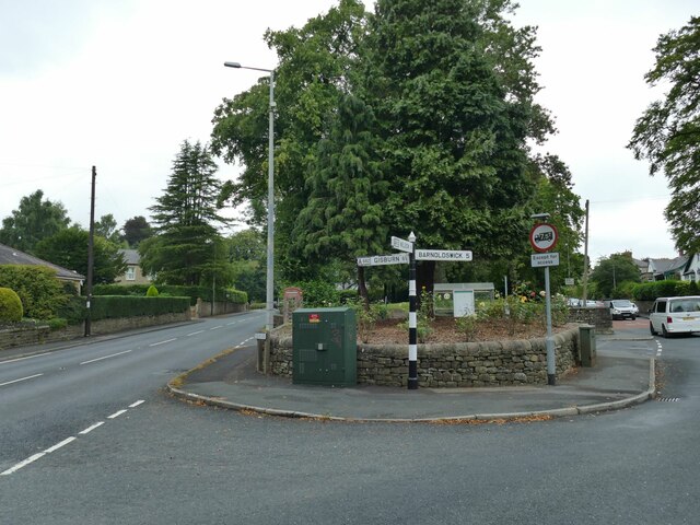
Barrowford is a village located in the county of Lancashire, England. Situated near the Forest of Bowland, it is part of the borough of Pendle and lies approximately 3 miles north of the town of Nelson. The village is nestled in a picturesque setting, surrounded by rolling hills and charming countryside.

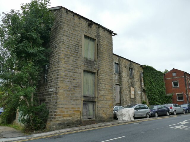
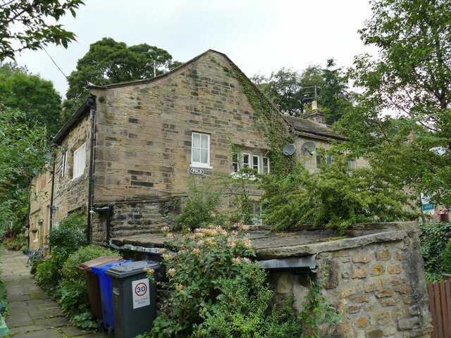
With a population of around 6,000 residents, Barrowford has a close-knit community feel. The village is known for its rich history, dating back to the 13th century. It was once an important center for the textile industry during the Industrial Revolution and remnants of this heritage can still be seen in some of the old mills and buildings that have been preserved.

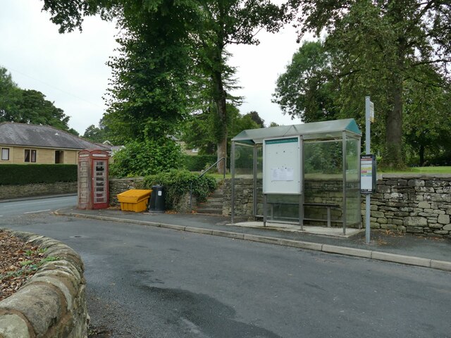
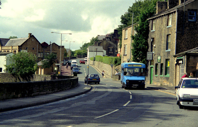
Barrowford offers a range of amenities and services to cater to its residents' needs. There are several local shops, including a supermarket, as well as a variety of restaurants, cafes, and pubs. The village also has a primary school, a library, and a community center that hosts various events and activities throughout the year.

For outdoor enthusiasts, Barrowford boasts several green spaces and parks, such as Barrowford Park and Pendle Heritage Centre, which provide opportunities for leisurely walks and picnics. The nearby Pendle Hill is a popular destination for hikers and offers stunning panoramic views of the surrounding countryside.

Overall, Barrowford is a charming village with a rich history and a strong sense of community. Its idyllic location and range of amenities make it an attractive place to live or visit for those seeking a peaceful and picturesque setting in Lancashire.

If you have any feedback on the listing, please let us know in the comments section below.
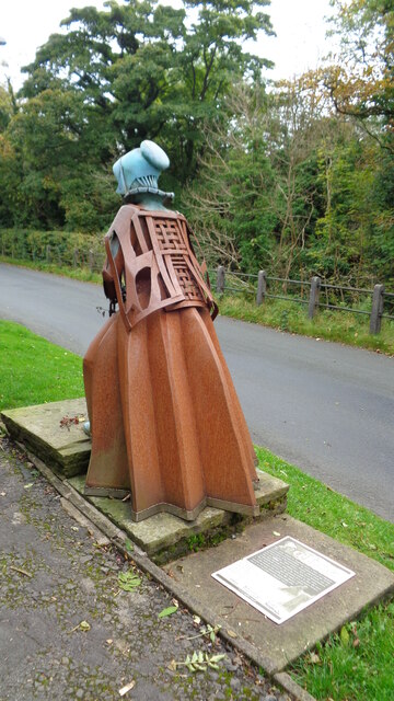
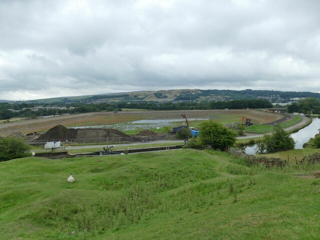
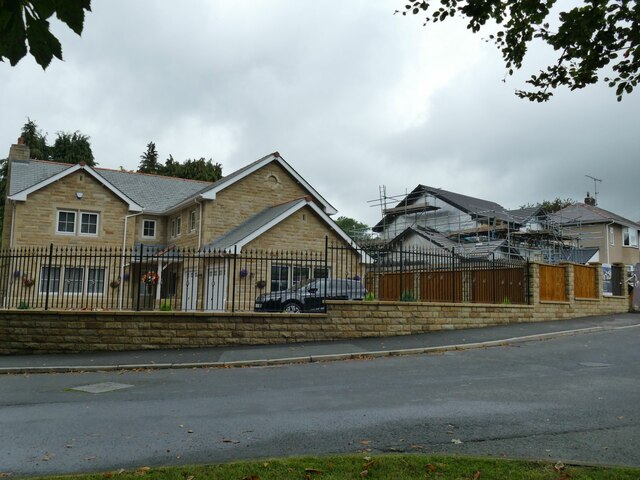
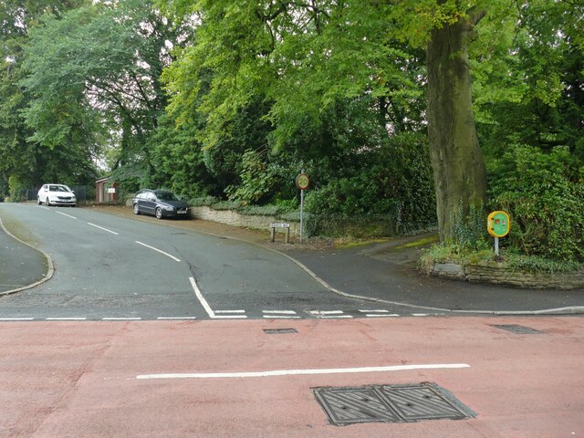
Barrowford Images

Images are sourced within 2km of 53.852878/-2.215622 or Grid Reference SD8539. Thanks to Geograph Open Source API. All images are credited.
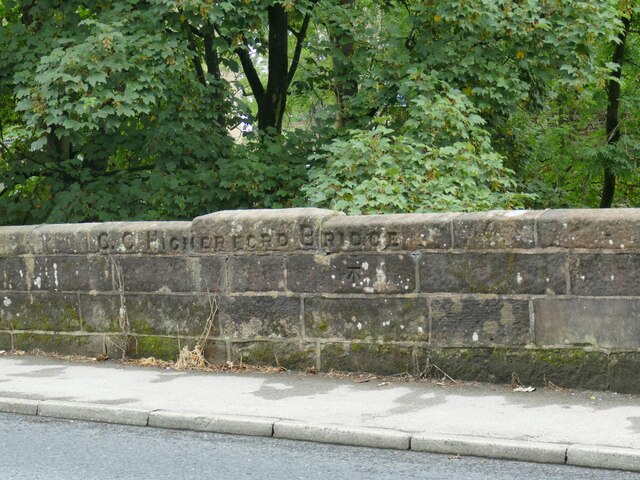
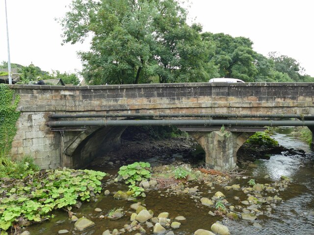
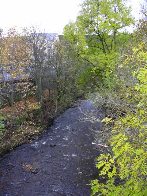
Back of Alice Nutter Statue The commemorative statue by David Palmer, to mark the 400th anniversary of the Pendle Witch Trials. Alice Nutter is in chains but this cloak on her back looks like an instrument of torture
Back of Alice Nutter Statue
The commemorative statue by David Palmer, to mark the 400th anniversary of the Pendle Witch Trials. Alice Nutter is in chains but this cloak on her back looks like an instrument of torture
Barrowford Reservoir, drained The reservoir, which serves the Leeds and Liverpool Canal rather than public water supply, was not empty because of the 2022 drought, but because it had been deliberately drained down in autumn 2021 for a year-long contract to stabilise the embankment. A short section of the canal nearby was also drained for maintenance at the same time.
Barrowford Reservoir, drained
The reservoir, which serves the Leeds and Liverpool Canal rather than public water supply, was not empty because of the 2022 drought, but because it had been deliberately drained down in autumn 2021 for a year-long contract to stabilise the embankment. A short section of the canal nearby was also drained for maintenance at the same time.
Caspers Fold, Francis Avenue, Higherford The house bears a datestone of 2000.
Caspers Fold, Francis Avenue, Higherford
The house bears a datestone of 2000.
Defibrillator on the corner of Francis Avenue These devices are normally found on the wall of public buildings, but here is one on a post by the street in an area of housing.
Defibrillator on the corner of Francis Avenue
These devices are normally found on the wall of public buildings, but here is one on a post by the street in an area of housing.
Bus shelter and old phone box Located at the junction of Barnoldswick Road and Gisburn Road in Higherford.  The phone box appears disused. Street furniture here also includes a grit bin and litter bin.
Bus shelter and old phone box
Located at the junction of Barnoldswick Road and Gisburn Road in Higherford. The phone box appears disused. Street furniture here also includes a grit bin and litter bin.
Road sign in Higherford Located at the junction of Barnoldswick Road and Gisburn Road; the sign also points to Nelson in the opposite direction. Milestone Society National ID: LA_SD8640
Road sign in Higherford
Located at the junction of Barnoldswick Road and Gisburn Road; the sign also points to Nelson in the opposite direction. Milestone Society National ID: LA_SD8640
Old mill, Gisburn Road, Higherford The 1912 map shows this as a corn mill. It's probably too high above the river to have been water powered. Now in private hands, a 2015 proposal for 'brownfield' development on the site was not approved. <a href="https://www.geograph.org.uk/photo/506484">SD8640 : Old mill on Gisburn Road, Barrowford</a> shows it from the other direction.
Old mill, Gisburn Road, Higherford
The 1912 map shows this as a corn mill. It's probably too high above the river to have been water powered. Now in private hands, a 2015 proposal for 'brownfield' development on the site was not approved. SD8640 : Old mill on Gisburn Road, Barrowford shows it from the other direction.
Former Catholic church, Gisburn Road, Higherford The name on the sign board is 'Parish of the Good Shepherd' but other contributors name the building itself as St Peter & St Paul's. A local website says that it was built from 1897, the first service registers being from 1902, but closed for worship in 2019. It appears no new use has been found yet.
Former Catholic church, Gisburn Road, Higherford
The name on the sign board is 'Parish of the Good Shepherd' but other contributors name the building itself as St Peter & St Paul's. A local website says that it was built from 1897, the first service registers being from 1902, but closed for worship in 2019. It appears no new use has been found yet.
Detail of Gisburn Road bridge, Higherford An inscription 'C C Higherford Bridge' and an OS cut benchmark (shown on the 1912 map as 437.9ft). It was built in 1807. See <a href="https://www.geograph.org.uk/photo/4956971">SD8640 : Higherford Bridge and Mill</a> for a side view of the bridge.
Detail of Gisburn Road bridge, Higherford
An inscription 'C C Higherford Bridge' and an OS cut benchmark (shown on the 1912 map as 437.9ft). It was built in 1807. See SD8640 : Higherford Bridge and Mill for a side view of the bridge.
Former cotton mill, Higherford Listed grade II (List entry 1271499) where it is dated to 'c.1844, incorporating elements of an earlier C19 mill, with further additions of 1882, and C20 alterations'. The main weaving shed seen in <a href="https://www.geograph.org.uk/photo/4957250">SD8640 : Grimshaw's (Higherford) Mill</a> is claimed to be the oldest surviving example of its kind. Note the iron beam and high level doorway, presumably for loading bales of cotton from road vehicles.
Former cotton mill, Higherford
Listed grade II (List entry 1271499) where it is dated to 'c.1844, incorporating elements of an earlier C19 mill, with further additions of 1882, and C20 alterations'. The main weaving shed seen in SD8640 : Grimshaw's (Higherford) Mill is claimed to be the oldest surviving example of its kind. Note the iron beam and high level doorway, presumably for loading bales of cotton from road vehicles.
Listed cottages, Foreside, Higherford Listed grade II (List entry 1073432) where the oldest is dated to 1755.
Listed cottages, Foreside, Higherford
Listed grade II (List entry 1073432) where the oldest is dated to 1755.
Crowtree Cottage, Foreside, Higherford Listed grade II (List entry 1273168) where it is dated to the mid-18th century. The large number of windows at first floor level suggests it was used for weaving.
Crowtree Cottage, Foreside, Higherford
Listed grade II (List entry 1273168) where it is dated to the mid-18th century. The large number of windows at first floor level suggests it was used for weaving.
Th' Owd Brig at Higherford This is described by Margaret Slack (Ref.1) as 'One of the most attractive packhorse bridges in [the Pennines] ...standing on the direct line of the Roman Road from Castercliffe to Ribchester. It was crossed by teams of packhorses bringing coal from near Gisburn and ... lime from Lothersdale.' She adds that the date of the bridge is not known with certainty, but probably late 16th century. 

The bridge crosses Pendle Water, draining the steep eastern scarp of that great hill, and subject to flash flooding; Slack relates a story that a bell used to hang from the bridge that rang a warning when water approached flood level.

Listed grade II *(List entry 1273194) and a Scheduled Monument. Originally it would have had no, or very low, parapets to allow ponies with low-hanging panniers to cross; the present parapets were added in 1815.

(1) 'The Bridges of Lancashire and Yorkshire', Margaret Slack, 1986.
Th' Owd Brig at Higherford
This is described by Margaret Slack (Ref.1) as 'One of the most attractive packhorse bridges in [the Pennines] ...standing on the direct line of the Roman Road from Castercliffe to Ribchester. It was crossed by teams of packhorses bringing coal from near Gisburn and ... lime from Lothersdale.' She adds that the date of the bridge is not known with certainty, but probably late 16th century. The bridge crosses Pendle Water, draining the steep eastern scarp of that great hill, and subject to flash flooding; Slack relates a story that a bell used to hang from the bridge that rang a warning when water approached flood level. Listed grade II *(List entry 1273194) and a Scheduled Monument. Originally it would have had no, or very low, parapets to allow ponies with low-hanging panniers to cross; the present parapets were added in 1815. (1) 'The Bridges of Lancashire and Yorkshire', Margaret Slack, 1986.
Gisburn Road bridge, Higherford This road bridge over Pendle Water was erected in 1807 to supersede the old packhorse bridge, which still stands but closed to motor traffic <a href="https://www.geograph.org.uk/photo/7265480">SD8640 : Th' Owd Brig at Higherford</a>.
Gisburn Road bridge, Higherford
This road bridge over Pendle Water was erected in 1807 to supersede the old packhorse bridge, which still stands but closed to motor traffic SD8640 : Th' Owd Brig at Higherford.
The Old Bridge Inn, Higherford Actually close to the 'new' bridge, not the old one <a href="https://www.geograph.org.uk/photo/7265480">SD8640 : Th' Owd Brig at Higherford</a>.
The Old Bridge Inn, Higherford
Actually close to the 'new' bridge, not the old one SD8640 : Th' Owd Brig at Higherford.
Former Methodist Sunday School, Higherford Dated 1834, in residential use since 1972 (source: <span class="nowrap"><a title="https://www.flickr.com/photos/rossendalewadey/5885068439" rel="nofollow ugc noopener" href="https://www.flickr.com/photos/rossendalewadey/5885068439">Link</a><img style="margin-left:2px;" alt="External link" title="External link - shift click to open in new window" src="https://s1.geograph.org.uk/img/external.png" width="10" height="10"/></span> ). An early 20th century map shows a tram terminus outside; the tramway from Nelson opened in the early years of the century and closed in 1934.
Former Methodist Sunday School, Higherford
Dated 1834, in residential use since 1972 (source: LinkExternal link ). An early 20th century map shows a tram terminus outside; the tramway from Nelson opened in the early years of the century and closed in 1934.
Former Methodist Sunday School, Higherford - datestone Wesleyan Methodist Sunday School Built by Subscription AD 1834. See <a href="https://www.geograph.org.uk/photo/7265486">SD8640 : Former Methodist Sunday School, Higherford</a> for context.
Former Methodist Sunday School, Higherford - datestone
Wesleyan Methodist Sunday School Built by Subscription AD 1834. See SD8640 : Former Methodist Sunday School, Higherford for context.
Fold, Gisburn Road, Higherford Mid-18th century stone cottages, grade II listed (list entry 1073435).
Fold, Gisburn Road, Higherford
Mid-18th century stone cottages, grade II listed (list entry 1073435).
Show me another place!

Barrowford is located at Grid Ref: SD8539 (Lat: 53.852878, Lng: -2.215622)

Administrative County: Lancashire

District: Pendle

Police Authority: Lancashire

What 3 Words

///medium.wolf.confusion. Near Barrowford, Lancashire

Related Wikis

Barrowford

Barrowford () is a village and civil parish in the Pendle district of Lancashire, England, north of Nelson, near the Forest of Bowland Area of Outstanding...

Colne Water

Colne Water is a river in eastern Lancashire. It is approximately 5.0 miles (7.987 km) long and has a catchment area excluding its major tributaries (the...

Nelson power station

Nelson power station supplied electricity to the town of Nelson, Lancashire and the surrounding area from 1892 to 1960. The power station was owned and...
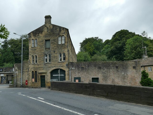
Higherford

Higherford is a village in the Pendle district of Lancashire, England. Although it is a village in its own right and shown on maps, it is sometimes confused...

Nearby Amenities

Located within 500m of 53.852878,-2.215622
Crossing
Lat/Long: 53.8537595/-2.2135502
Barrowford
Place: village
Source: npe
Lat/Long: 53.8509322/-2.2170285
Mini Roundabout
Lat/Long: 53.8535634/-2.213967
Restaurant
Zio
Addr City: Nelson
Addr Housename: 4 The Fountains
Addr Postcode: BB9 8LQ
Addr Street: Gisburn Road
Cuisine: italian
Fhrs Id: 185674
Source Addr: FHRS Open Data
Lat/Long: 53.8505505/-2.2163843
Bargain Booze
Addr City: Nelson
Addr Housenumber: 68-70
Addr Postcode: BB9 8NG
Addr Street: Gisburn Road
Fhrs Id: 726955
Shop: alcohol
Source Addr: FHRS Open Data
Lat/Long: 53.8503196/-2.2164914
Spar
Addr City: Nelson
Addr Housename: Unit 1 The Fountains
Addr Postcode: BB9 8LQ
Addr Street: Gisburn Road
Brand: Spar
Brand Wikidata: Q610492
Fhrs Id: 185876
Shop: convenience
Source Addr: FHRS Open Data
Lat/Long: 53.8508259/-2.2162285
Morrisons Local
Fixme: survey exact location and building shape please, new
Shop: convenience
Start Date: 2014
Lat/Long: 53.8510137/-2.2157788
Bus Stop
Wilton Street
Public Transport: platform
Lat/Long: 53.8486371/-2.2173705
Bus Stop
Rushton Street
Public Transport: platform
Lat/Long: 53.8507731/-2.2164566
Bus Stop
Rushton Street
Public Transport: platform
Lat/Long: 53.8506275/-2.2166457
Bus Stop
Church Street
Naptan AtcoCode: 2500DCL5746
Naptan NaptanCode: landmpmg
Public Transport: platform
Lat/Long: 53.8522497/-2.215925
Bus Stop
Church Street
Naptan AtcoCode: 2500LAA07256
Naptan NaptanCode: lanjadjt
Public Transport: platform
Lat/Long: 53.8520318/-2.2157979
Bus Stop
White Bear
Bus: yes
Naptan AtcoCode: 25001028
Naptan NaptanCode: lanadgtj
Network: Transdev Blazefield
Operator: Transdev
Public Transport: stop
Lat/Long: 53.8532993/-2.2149435
Bus Stop
Park Street
Alt Name: Park Street, Barrowford
Naptan AtcoCode: 2500DCL5756
Naptan NaptanCode: landmptw
Public Transport: platform
Lat/Long: 53.8539875/-2.2131619
Bus Stop
Bank Fold
Naptan AtcoCode: 2500DCL5757
Naptan NaptanCode: landmpwa
Public Transport: platform
Lat/Long: 53.855476/-2.2104706
Bus Stop
Bank Fold
Naptan AtcoCode: 2500DCL5758
Naptan NaptanCode: landmpwd
Public Transport: platform
Lat/Long: 53.8559952/-2.2104464
Bus Stop
Higher Causeway
Naptan AtcoCode: 2500LAA16364
Naptan NaptanCode: lanpagmg
Public Transport: platform
Lat/Long: 53.8495142/-2.2205829
Barrier: yes
Lat/Long: 53.850535/-2.2170356
Barrier: yes
Lat/Long: 53.850644/-2.2177526
Bicycle Parking
Access: yes
Bicycle Parking: stands
Capacity: 6
Covered: no
Fee: no
Lat/Long: 53.8532339/-2.2144409
Charging Station
Capacity: 2
Fee: yes
Operator: Instavolt
Payment Contactless: yes
Lat/Long: 53.8538627/-2.2136188
Waterway: weir
Lat/Long: 53.854142/-2.2116546
Entrance: main
Lat/Long: 53.8538842/-2.2109094
Entrance: yes
Lat/Long: 53.8538524/-2.2109774
The data included in this document is from www.openstreetmap.org. The data is made available under ODbL.

Have you been to Barrowford?

Leave your review of Barrowford below (or comments, questions and feedback).