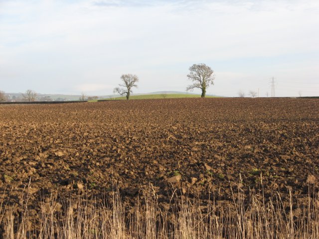
Paxton Glen

Valley in Berwickshire

Scotland

Paxton Glen

Union Suspension Bridge Linking Scotland and England, the oldest suspension bridge still in existence today is the Union Bridge over the River Tweed, a chain-link bridge designed and erected by Captain Samuel Brown in 1820, with a span of 449ft (137m). Predates the Menai Suspension Bridge by about 6 years.
Union Suspension Bridge Credit: William Aris

The requested URL returned error: 429 Too Many Requests

If you have any feedback on the listing, please let us know in the comments section below.

Paxton Glen Images

Images are sourced within 2km of 55.76337/-2.1100615 or Grid Reference NT9352. Thanks to Geograph Open Source API. All images are credited.

Union Suspension Bridge Linking Scotland and England, the oldest suspension bridge still in existence today is the Union Bridge over the River Tweed, a chain-link bridge designed and erected by Captain Samuel Brown in 1820, with a span of 449ft (137m). Predates the Menai Suspension Bridge by about 6 years.
Union Suspension Bridge
Linking Scotland and England, the oldest suspension bridge still in existence today is the Union Bridge over the River Tweed, a chain-link bridge designed and erected by Captain Samuel Brown in 1820, with a span of 449ft (137m). Predates the Menai Suspension Bridge by about 6 years.
Stile, no-man's land Part of the parapet leading to the union bridge aka old chain bridge, this lies between Scotland and England - a stile to nowhere?
Stile, no-man's land
Part of the parapet leading to the union bridge aka old chain bridge, this lies between Scotland and England - a stile to nowhere?
Paxton Gates with road to village from the inside looking out.  Paxton is an outstation of the National Galleries of Scotland. IT doesn't open until 11am and I was there just before 9am this was as far as I got, pretty much.
Paxton Gates with road to village
from the inside looking out. Paxton is an outstation of the National Galleries of Scotland. IT doesn't open until 11am and I was there just before 9am this was as far as I got, pretty much.
Horncliffe House
Horncliffe House
Plaque re the Old Chain Bridge Information about the bridge pictured in <a href="https://www.geograph.org.uk/photo/7193">NT9351 : Union Suspension Bridge</a>.  This is on the Scots side of the bridge, but before the Scotland sign, therefore in no-man's land.
Plaque re the Old Chain Bridge
Information about the bridge pictured in NT9351 : Union Suspension Bridge. This is on the Scots side of the bridge, but before the Scotland sign, therefore in no-man's land.
Union Bridge Photograph taken from the English side.
Union Bridge
Photograph taken from the English side.
Union Bridge Taken from the English side.
Union Bridge
Taken from the English side.
England/Scotland border on the B6461 On the Kelso to Berwick road. Pennine Cycleway.
England/Scotland border on the B6461
On the Kelso to Berwick road. Pennine Cycleway.
Paxton House Situated on the banks of the river Tweed, Paxton House is a hidden gem. Built by the Adam brothers in 1758 for the young Patrick Home it is perhaps the finest example of 18th century Palladian Country houses in Britain.
Paxton House
Situated on the banks of the river Tweed, Paxton House is a hidden gem. Built by the Adam brothers in 1758 for the young Patrick Home it is perhaps the finest example of 18th century Palladian Country houses in Britain.
Salmon Netting below Paxton House Salmon Nets: There were many different types of nets used by salmon fishermen along the River Tweed. Over the centuries many nets were made illegal as they were not considered a fair way of fishing for salmon. An Act passed in 1830 for example, made 'bag', 'bob' and 'T-nets' illegal and the Tweed Fisheries Act 1857 stated that all types of fixed net could not be used along the river.

Different types of nets were used along different sections of the river. A 'ford net' for example, was used on ford heads and in the shallow parts of the river. When the fish were spotted coming up the river a signal was given and the net was drawn so as to trap the fish. 'Wear-shot nets' were also used by salmon fishermen along the River Tweed. A wear-shot net was towed by the boat into the river in a curve and then immediately drawn to the shore. 'Trammel nets', 'cairn nets' and 'pout nets' were used in the middle to upper districts of the river and were legal as long as they were used during the proper fishing hours and by qualified persons. 

'Drift' and 'hang nets' were also used to fish for salmon especially along the coast of Northumberland. Drift or hang nets have been used for catching salmon and sea trout since the early 19th century. A hang net is a net on poles which was placed in the sea below the high water mark. Drift nets are normally rigged to form a curtain in the water. The net is then set out in a straight line and 'drifts' with the current. Fish then swim into the net and are 'gilled' (caught). The fishing depth of the net can be adjusted by adding weights to the bottom of the sheet. A number of drift nets could also be joined together to form a 'fleet' of nets.
Salmon Netting below Paxton House
Salmon Nets: There were many different types of nets used by salmon fishermen along the River Tweed. Over the centuries many nets were made illegal as they were not considered a fair way of fishing for salmon. An Act passed in 1830 for example, made 'bag', 'bob' and 'T-nets' illegal and the Tweed Fisheries Act 1857 stated that all types of fixed net could not be used along the river. Different types of nets were used along different sections of the river. A 'ford net' for example, was used on ford heads and in the shallow parts of the river. When the fish were spotted coming up the river a signal was given and the net was drawn so as to trap the fish. 'Wear-shot nets' were also used by salmon fishermen along the River Tweed. A wear-shot net was towed by the boat into the river in a curve and then immediately drawn to the shore. 'Trammel nets', 'cairn nets' and 'pout nets' were used in the middle to upper districts of the river and were legal as long as they were used during the proper fishing hours and by qualified persons. 'Drift' and 'hang nets' were also used to fish for salmon especially along the coast of Northumberland. Drift or hang nets have been used for catching salmon and sea trout since the early 19th century. A hang net is a net on poles which was placed in the sea below the high water mark. Drift nets are normally rigged to form a curtain in the water. The net is then set out in a straight line and 'drifts' with the current. Fish then swim into the net and are 'gilled' (caught). The fishing depth of the net can be adjusted by adding weights to the bottom of the sheet. A number of drift nets could also be joined together to form a 'fleet' of nets.
Church of Scotland, Paxton
Farmland Broadmeadows Farm is in the background.
Farmland
Broadmeadows Farm is in the background.
Winter crops A field near West Loanend.
Winter crops
A field near West Loanend.
Field boundary near Nabdean
Field with set aside strip
Shelter by the road to Broadmeadows
Farm buildings at West Loanend The track forms part of a public footpath to Loanend.
Farm buildings at West Loanend
The track forms part of a public footpath to Loanend.
Ploughed field, Clarabad Flat farmland above the deep dean of the Whiteadder. The newly ploughed land will have benefited from the recent long frost breaking up the soil.
Ploughed field, Clarabad
Flat farmland above the deep dean of the Whiteadder. The newly ploughed land will have benefited from the recent long frost breaking up the soil.
Show me another place!

Paxton Glen is located at Grid Ref: NT9352 (Lat: 55.76337, Lng: -2.1100615)

Unitary Authority: The Scottish Borders

Police Authority: The Lothians and Scottish Borders

What 3 Words

///falters.golden.innocence. Near Berwick-Upon-Tweed, Northumberland

Nearby Locations

Linn Dean Paxton Glen

Related Wikis

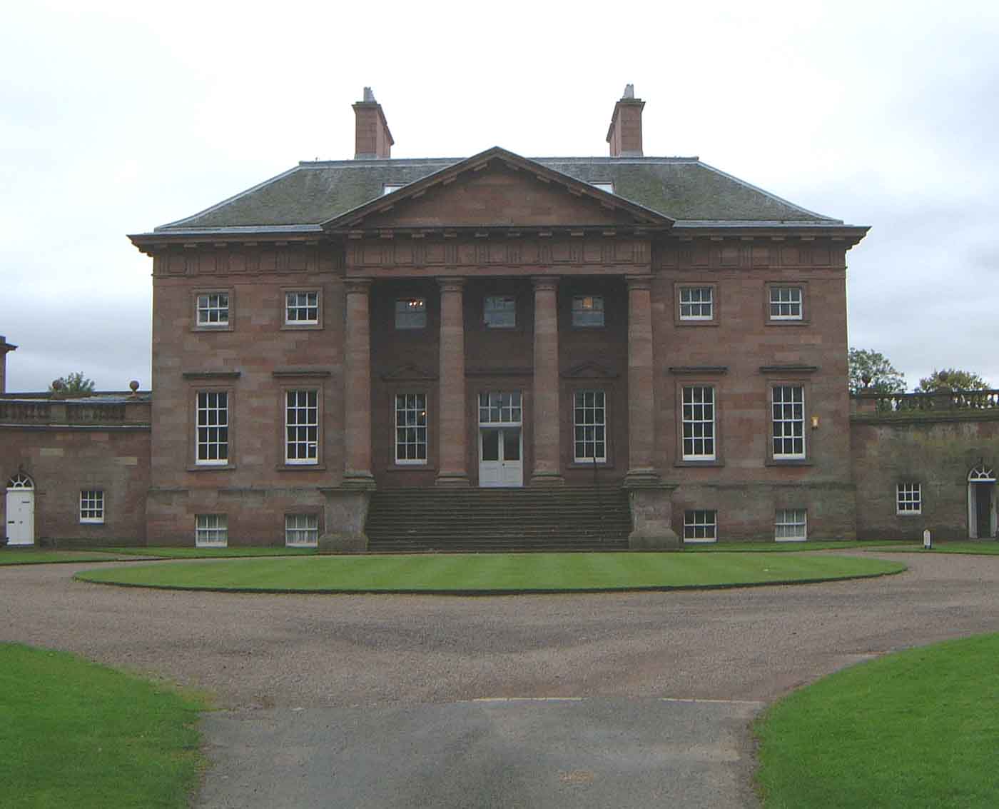
Paxton House, Berwickshire

Paxton House is a historic house at Paxton, Berwickshire, in the Scottish Borders, a few miles south-west of Berwick-upon-Tweed, overlooking the River...

Paxton, Scottish Borders

Paxton is a small village near the B6461 and the B6460, in the pre-1975 ancient county of Berwickshire, now an administrative area of the Scottish Borders...

Union Chain Bridge

The Union Chain Bridge or Union Bridge is a suspension bridge that spans the River Tweed between Horncliffe, Northumberland, England and Fishwick, Berwickshire...
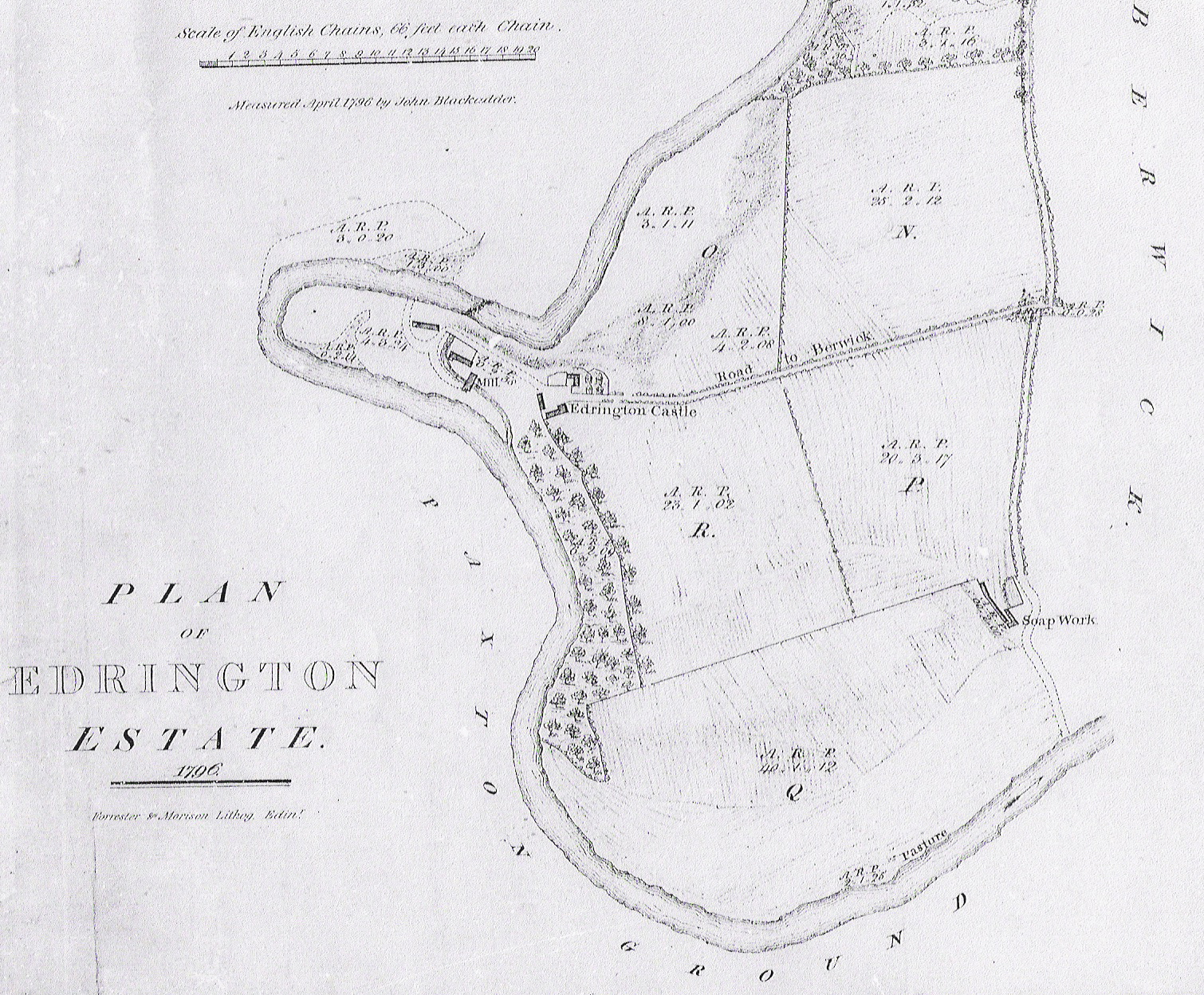
Edrington

Edrington is a medieval estate occupying the lower part of Mordington parish in Berwickshire, Scotland, five miles (8.0 km) west of Berwick-upon-Tweed...

Nearby Amenities

Located within 500m of 55.76337,-2.1100615
Bus Stop
Paxton House Reception
Bus: yes
Naptan AtcoCode: 69001358
Naptan Bearing: W
Naptan CommonName: Paxton House Reception
Naptan Indicator: o/s
Naptan Landmark: Paxton House
Naptan NaptanCode: 72725732
Naptan Street: Car Park
Naptan Verified: yes
Public Transport: platform
Ref: 69001358
Source: NaPTAN
Lat/Long: 55.7617052/-2.1093686
Bus Stop
Paxton House Gates
Bus: yes
Naptan AtcoCode: 69001360
Naptan Bearing: S
Naptan CommonName: Paxton House Gates
Naptan Indicator: opp
Naptan Landmark: B6461 road junction
Naptan NaptanCode: 72725723
Naptan Street: B6460
Naptan Verified: yes
Public Transport: platform
Ref: 69001360
Source: NaPTAN
Lat/Long: 55.7662141/-2.1085613
Post Box
Postal Code: TD15
Ref: TD15 45
Source: survey
Lat/Long: 55.7662081/-2.1088631
Paxton House
Place: isolated_dwelling
Lat/Long: 55.7611065/-2.1100152
Paxton South Mains
Place: hamlet
Lat/Long: 55.7661872/-2.1092805
Description: Very narrow bridge over stream. Only passable by a small car
Maxwidth: 2
Lat/Long: 55.7632947/-2.1096189
Power: pole
Lat/Long: 55.7658021/-2.1160142
Power: pole
Lat/Long: 55.7659545/-2.1144298
Power: pole
Lat/Long: 55.7661105/-2.1127959
Power: pole
Lat/Long: 55.7662072/-2.1110546
Power: pole
Lat/Long: 55.7654332/-2.1123509
Power: pole
Lat/Long: 55.7669353/-2.1126712
Power: pole
Lat/Long: 55.7675678/-2.1117941
Power: pole
Lat/Long: 55.7672364/-2.1107708
Power: pole
Lat/Long: 55.7669123/-2.109769
The data included in this document is from www.openstreetmap.org. The data is made available under ODbL.

Have you been to Paxton Glen?

Leave your review of Paxton Glen below (or comments, questions and feedback).