Coldlaw Hope

Valley in Northumberland

England

Coldlaw Hope

Bridge over the Linhope Burn A small bridge over the Linhope Burn bathed in low late afternoon sun.

This photograph was taken during the Coronavirus (COVID-19) pandemic of 2020/21/22.
Bridge over the Linhope Burn Credit: James T M Towill

Coldlaw Hope is a small village located in the county of Northumberland, England. Situated in the picturesque valley of Northumberland, the village is surrounded by rolling hills and offers stunning views of the countryside. With a population of around 200 residents, Coldlaw Hope is a close-knit community with a strong sense of camaraderie.

The village is primarily residential, with a scattering of charming cottages and houses, many of which date back to the 18th and 19th centuries. The architecture reflects the traditional Northumberland style, with stone walls and slate roofs, adding to the village's rustic charm.

The main focal point of Coldlaw Hope is the village green, a well-maintained open space where locals gather for community events and socialize. A small playground is also situated near the green, providing a safe and enjoyable space for children.

Despite its small size, Coldlaw Hope offers a range of amenities for its residents. The village boasts a community hall, which hosts various events throughout the year, such as dances, concerts, and meetings. There is also a quaint village pub, the Coldlaw Arms, where locals and visitors can enjoy a pint of ale and a hearty meal.

For outdoor enthusiasts, Coldlaw Hope is a paradise. The surrounding countryside offers ample opportunities for hiking, cycling, and exploring nature. The nearby Northumberland National Park provides breathtaking landscapes, with its picturesque valleys, rugged moorlands, and ancient woodlands.

In conclusion, Coldlaw Hope is a charming village nestled in the beautiful Northumberland valley. With its tight-knit community, traditional architecture, and stunning natural surroundings, it is a place that offers tranquility and a strong sense of belonging for its residents.

If you have any feedback on the listing, please let us know in the comments section below.
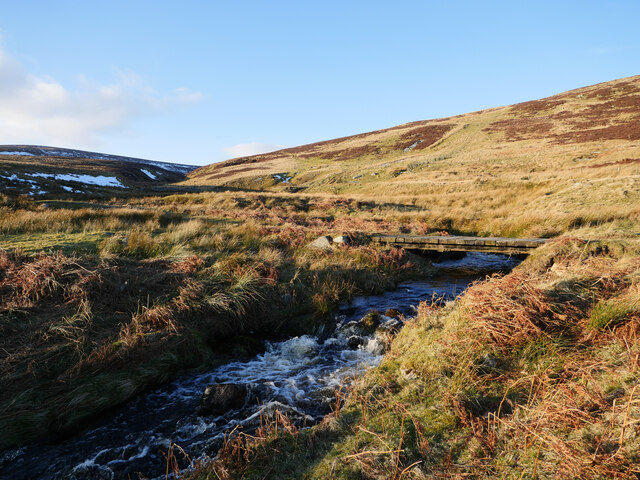
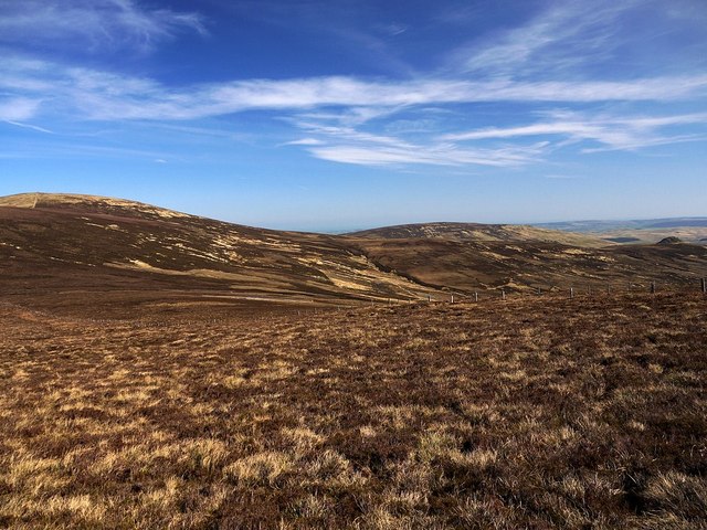
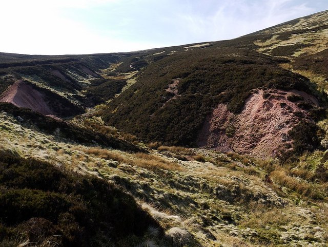
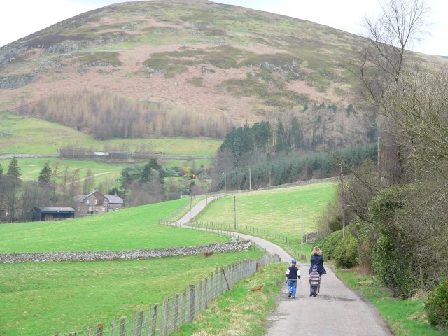
Coldlaw Hope Images

Images are sourced within 2km of 55.455405/-2.1241584 or Grid Reference NT9217. Thanks to Geograph Open Source API. All images are credited.

Bridge over the Linhope Burn A small bridge over the Linhope Burn bathed in low late afternoon sun.

This photograph was taken during the Coronavirus (COVID-19) pandemic of 2020/21/22.
Bridge over the Linhope Burn
A small bridge over the Linhope Burn bathed in low late afternoon sun. This photograph was taken during the Coronavirus (COVID-19) pandemic of 2020/21/22.
Walkers climbing Hedgehope from the west I was told they were doing the Harthope Valley Horseshoe circuit of Cheviot, Comb Fell and Hedgehope from Langleeford in the 'recommended' anti-clockwise direction. I hadn't seen that recommendation but can certainly recommend the walk <span class="nowrap"><a title="http://www.cheviotwalks.org/walk14.html" rel="nofollow ugc noopener" href="http://www.cheviotwalks.org/walk14.html">Link</a><img style="margin-left:2px;" alt="External link" title="External link - shift click to open in new window" src="https://s1.geograph.org.uk/img/external.png" width="10" height="10"/></span>
Walkers climbing Hedgehope from the west
I was told they were doing the Harthope Valley Horseshoe circuit of Cheviot, Comb Fell and Hedgehope from Langleeford in the 'recommended' anti-clockwise direction. I hadn't seen that recommendation but can certainly recommend the walk LinkExternal link
Sinuous water channel between Comb Fell & Hedgehope Hill The peat hags along this ridge rarely dry out but today after a period of little rain it was easy to keep feet dry. There was still water though but largely confined to defined ponds which could be readily jumped.
Sinuous water channel between Comb Fell & Hedgehope Hill
The peat hags along this ridge rarely dry out but today after a period of little rain it was easy to keep feet dry. There was still water though but largely confined to defined ponds which could be readily jumped.
Boggy col between Comb Fell & Hedgehope Hill The top of Hedgehope Hill is just visible above and to the right of the west ridge.
Boggy col between Comb Fell & Hedgehope Hill
The top of Hedgehope Hill is just visible above and to the right of the west ridge.
Fence between Hedgehope Hill and Comb Fell Great Standrop can be seen beyond the fence to the right. Hedgehope Hill is on the left.
There is a photo of the fence from the other side here <a href="https://www.geograph.org.uk/photo/1510666">NT9219 : Fence between Hedgehope Hill and Comb Fell</a>
Fence between Hedgehope Hill and Comb Fell
Great Standrop can be seen beyond the fence to the right. Hedgehope Hill is on the left. There is a photo of the fence from the other side here NT9219 : Fence between Hedgehope Hill and Comb Fell
Pond, Comb Fell Hedgehope Hill is on the right.
Pond, Comb Fell
Hedgehope Hill is on the right.
Fence corner, Comb Fell Cold Law Cairn can be seen on the ridge ahead. This can be a very boggy area of peat hags. Compare this photo from 2009: <a href="https://www.geograph.org.uk/photo/1510689">NT9118 : Fence corner , Comb Fell</a>
Fence corner, Comb Fell
Cold Law Cairn can be seen on the ridge ahead. This can be a very boggy area of peat hags. Compare this photo from 2009: NT9118 : Fence corner , Comb Fell
Comb Fell The fence along the ridge is on the left. Coldlaw Cairn is visible to the left, beyond.
Comb Fell
The fence along the ridge is on the left. Coldlaw Cairn is visible to the left, beyond.
Harthope Burn from the slopes of Comb Fell Bright pink exposures of rock by the stream below catch the eye.
Harthope Burn from the slopes of Comb Fell
Bright pink exposures of rock by the stream below catch the eye.
Pink igneous rock outcrop by upper Harthope Burn See also <a href="https://www.geograph.org.uk/photo/2877676">NT9119 : Ridge of pink igneous rock by upper Harthope Burn</a>
Pink igneous rock outcrop by upper Harthope Burn
Ridge of pink igneous rock by upper Harthope Burn I wasn't sure about my title or description for this interesting geological formation, and was surprised to find that such a prominent feature did not appear to have been previously described or illustrated. It is possible that the ridge alongside the upper Harthope Burn only became uncovered to this extent in recent years, possibly following the large storms in 2009 that caused so much damage in Cheviot valleys further down. An existing geological field guide excursion in the valley has its final site at Harthope Linn (The Cheviot - early Devonian rocks, granite and basement by Peter Allen, Chapter 4, Northumbran Rocks and Landscape: A Field Guide, Yorkshire Geological Society 1995).

An email request for assistance in its interpretation sent to the Natural History Society of Northumbria was kindly answered by geologist, Brian Young. Although unfamiliar with the exact location and not having a rock specimen, he offered me the following likely interpretation:

"The place shown lies well within the outcrop of the Cheviot Granite as shown by the British Geological Survey 1:50 000 scale Sheet 5 (The Cheviot).

The Harthope valley, for much of its course, is determined by a prominent NE-SW trending fault assumed by at least one author to be a shear fault of Hercynian age.

My suggestion is that the pink material forming the prominent ridge in your picture is an exposure of granite, almost certainly affected in some way by proximity to this major fault line. A common feature of the rocks of the Cheviot is the local presence of patchy zones of deep alteration which renders the rocks rather soft and prone to erosion. Various theories have been put forward to account for this alteration, though no definitive answer has yet emerged. It is possible that the rock in your picture includes examples of this sort of alteration."

A second photo of the outcrop just below the ridge <a href="https://www.geograph.org.uk/photo/2877661">NT9119 : Pink igneous rock outcrop by upper Harthope Burn</a> does give a hint of a shattered rock surface that may indeed be a form of eroded modified granite. I must get back up there and collect a bit for a closer look.
Ridge of pink igneous rock by upper Harthope Burn
I wasn't sure about my title or description for this interesting geological formation, and was surprised to find that such a prominent feature did not appear to have been previously described or illustrated. It is possible that the ridge alongside the upper Harthope Burn only became uncovered to this extent in recent years, possibly following the large storms in 2009 that caused so much damage in Cheviot valleys further down. An existing geological field guide excursion in the valley has its final site at Harthope Linn (The Cheviot - early Devonian rocks, granite and basement by Peter Allen, Chapter 4, Northumbran Rocks and Landscape: A Field Guide, Yorkshire Geological Society 1995). An email request for assistance in its interpretation sent to the Natural History Society of Northumbria was kindly answered by geologist, Brian Young. Although unfamiliar with the exact location and not having a rock specimen, he offered me the following likely interpretation: "The place shown lies well within the outcrop of the Cheviot Granite as shown by the British Geological Survey 1:50 000 scale Sheet 5 (The Cheviot). The Harthope valley, for much of its course, is determined by a prominent NE-SW trending fault assumed by at least one author to be a shear fault of Hercynian age. My suggestion is that the pink material forming the prominent ridge in your picture is an exposure of granite, almost certainly affected in some way by proximity to this major fault line. A common feature of the rocks of the Cheviot is the local presence of patchy zones of deep alteration which renders the rocks rather soft and prone to erosion. Various theories have been put forward to account for this alteration, though no definitive answer has yet emerged. It is possible that the rock in your picture includes examples of this sort of alteration." A second photo of the outcrop just below the ridge NT9119 : Pink igneous rock outcrop by upper Harthope Burn does give a hint of a shattered rock surface that may indeed be a form of eroded modified granite. I must get back up there and collect a bit for a closer look.
Tree overhanging Harthope Burn There is another photo of this idyllic spot from 2006 here <a href="https://www.geograph.org.uk/photo/209267">NT9119 : Tree overhanging Harthope Burn</a>
Tree overhanging Harthope Burn
There is another photo of this idyllic spot from 2006 here NT9119 : Tree overhanging Harthope Burn
Bend on Harthope Burn
Harthope Burn at junction with unnamed stream
Unnamed burn south-east of Cheviot
Upper Harthope valley from the north Looking at this photo I just realised the possible derivation of the name of Comb Fell which is the hill on the far side of the valley. The patches of dark heather running down the hillside towards the Harthope Burn and in the eroded gullies along the valley side do look like teeth of a comb. The true origin though is probably that of 'coomb', a dome-like hill
Upper Harthope valley from the north
Looking at this photo I just realised the possible derivation of the name of Comb Fell which is the hill on the far side of the valley. The patches of dark heather running down the hillside towards the Harthope Burn and in the eroded gullies along the valley side do look like teeth of a comb. The true origin though is probably that of 'coomb', a dome-like hill
Comb Fell from slope below Cheviot Coldlaw Cairn can be seen on the ridge to the right. Cushat Law is the hill behind. The hills to its left are Wether Cairn and Hogdon Law.
Comb Fell from slope below Cheviot
Coldlaw Cairn can be seen on the ridge to the right. Cushat Law is the hill behind. The hills to its left are Wether Cairn and Hogdon Law.
Unnamed waterfalls on the Harthope Burn These falls on the Harthope Burn can be seen from the path and may be confused with Harthope Linn (as a Google image search shows). Harthope Linn is in a much more hidden location to the north-east <a href="https://www.geograph.org.uk/photo/2900014">NT9220 : Harthope Linn below Hedgehope Hill</a>
Unnamed waterfalls on the Harthope Burn
These falls on the Harthope Burn can be seen from the path and may be confused with Harthope Linn (as a Google image search shows). Harthope Linn is in a much more hidden location to the north-east NT9220 : Harthope Linn below Hedgehope Hill
Show me another place!

Coldlaw Hope is located at Grid Ref: NT9217 (Lat: 55.455405, Lng: -2.1241584)

Unitary Authority: Northumberland

Police Authority: Northumbria

What 3 Words

///reporting.inhales.wolf. Near Kirknewton, Northumberland

Related Wikis

Hedgehope Hill

Hedgehope Hill is a mountain in the Cheviot Hills of north Northumberland in northeast England, and categorised as a Hewitt. At a height of 714 metres...

The Cheviot

The Cheviot () is an extinct volcano and the highest summit in the Cheviot Hills and in the county of Northumberland. Located in the extreme north of England...

Cheviot Hills

The Cheviot Hills (), or sometimes The Cheviots, are a range of uplands straddling the Anglo-Scottish border between Northumberland and the Scottish Borders...

Linhope

Linhope is a small village in Northumberland, England. It is located in the Cheviots on the River Breamish, and within Northumberland National Park. Linhope...

Nearby Amenities

Located within 500m of 55.455405,-2.1241584
Coldlaw Hope
Place: locality
Lat/Long: 55.4566684/-2.1255016
The data included in this document is from www.openstreetmap.org. The data is made available under ODbL.

Have you been to Coldlaw Hope?

Leave your review of Coldlaw Hope below (or comments, questions and feedback).