Leemings

Settlement in Yorkshire Ribble Valley

England

Leemings

The Higher Buck A pub on The Square in Waddington.
The Higher Buck Credit: Phil and Juliette Platt

Leemings is a small village located in the county of Yorkshire, England. Situated in the northern part of the county, it is nestled amidst picturesque countryside and boasts a population of around 500 residents. The village is known for its idyllic charm and tranquil atmosphere, making it a popular destination for those seeking a peaceful retreat.

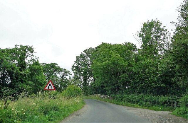
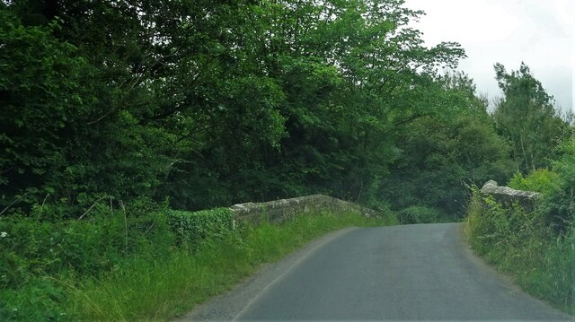
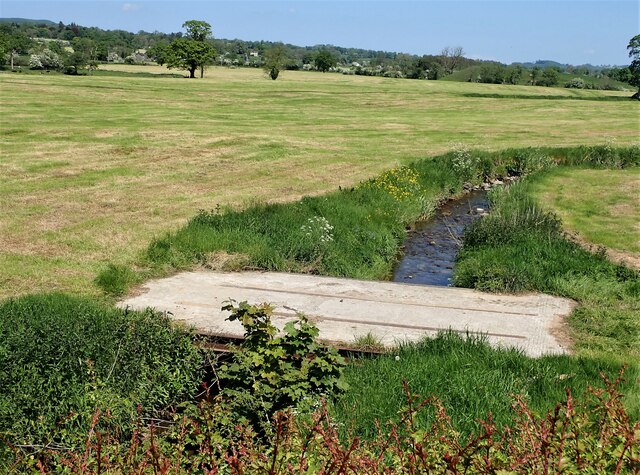
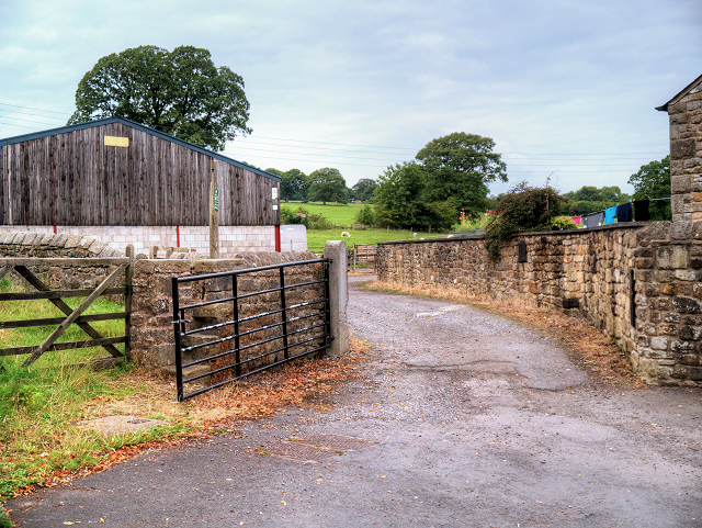
Leemings is characterized by its traditional stone-built houses, which add to the village's charm and reflect its rich heritage. The surrounding landscape is predominantly rural, with rolling green hills and meandering streams providing a scenic backdrop to the village. Agriculture plays a significant role in the local economy, with many residents engaged in farming and livestock rearing.

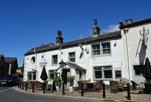
Despite its small size, Leemings offers a range of amenities to its residents and visitors. The village has a primary school, a local pub, and a community center that hosts various events throughout the year. Additionally, there are several walking trails and nature reserves nearby, catering to outdoor enthusiasts and providing opportunities for exploration and relaxation.

Leemings is well-connected to neighboring towns and cities through a reliable road network, making it easily accessible for those wishing to explore the wider region. The village's proximity to the Yorkshire Dales National Park further enhances its appeal, drawing in nature lovers and hikers.

Overall, Leemings is a charming village that offers a peaceful and picturesque setting, making it an ideal destination for those seeking a quiet retreat amidst the beauty of Yorkshire's countryside.

If you have any feedback on the listing, please let us know in the comments section below.
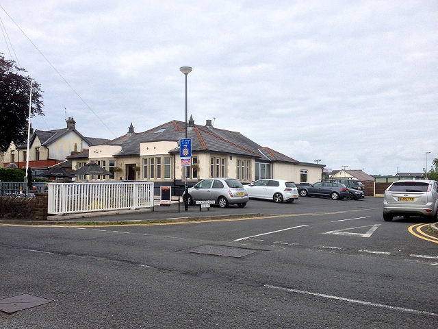
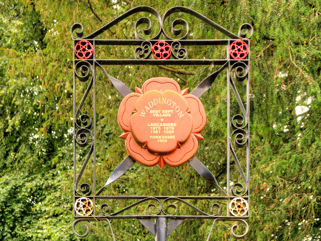
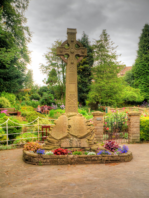
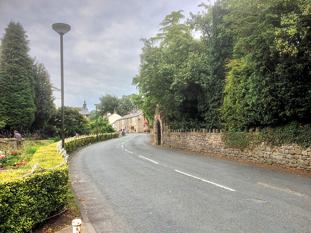
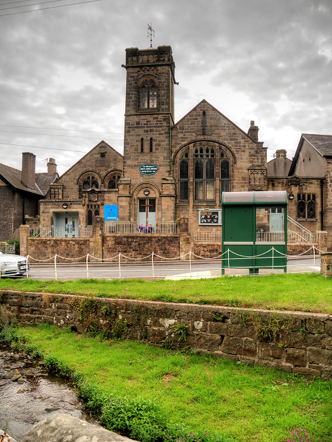
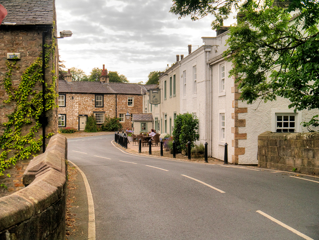
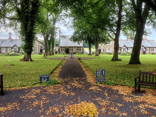
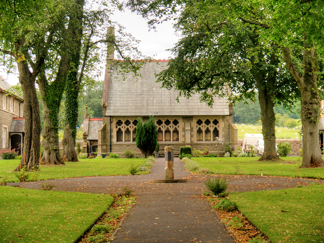
Leemings Images

Images are sourced within 2km of 53.900404/-2.4276153 or Grid Reference SD7245. Thanks to Geograph Open Source API. All images are credited.

The Higher Buck A pub on The Square in Waddington.
The Higher Buck
A pub on The Square in Waddington.
Approaching Wetters Bridge A Grade II listed structure on Twitter Lane spanning Bashall Brook to the south west of Waddington.
Approaching Wetters Bridge
A Grade II listed structure on Twitter Lane spanning Bashall Brook to the south west of Waddington.
Wetters Bridge A grade II listed structure on Twitter Lane outside Waddington.
Wetters Bridge
A grade II listed structure on Twitter Lane outside Waddington.
Millennium Sign Waddington Sign and seating area located on the approach to the village from Clitheroe on the B6478.
Millennium Sign Waddington
Sign and seating area located on the approach to the village from Clitheroe on the B6478.
Bridge over Waddington Brook A bridge used by the farmer to allow access in the field over Waddington Brook.
Bridge over Waddington Brook
A bridge used by the farmer to allow access in the field over Waddington Brook.
Waddington Village Club Private members club on Clitheroe Road at Waddington.
Waddington Village Club
Private members club on Clitheroe Road at Waddington.
Waddington Village Sign Waddington is a small village, 2 miles north-west of Clitheroe, within the Ribble Valley district of Lancashire. Before the 1974 county boundary changes, Waddington just fell within the boundary of Bowland Rural District of the West Riding of Yorkshire. The village sign reflects the boundary change by noting its achievements as “Best Kept Village in Lancashire” and “Best Kept Village in Yorkshire”.
Waddington Village Sign
Waddington is a small village, 2 miles north-west of Clitheroe, within the Ribble Valley district of Lancashire. Before the 1974 county boundary changes, Waddington just fell within the boundary of Bowland Rural District of the West Riding of Yorkshire. The village sign reflects the boundary change by noting its achievements as “Best Kept Village in Lancashire” and “Best Kept Village in Yorkshire”.
Waddington Village War Memorial The inscription reads:
"This cross was erected by the inhabitants of this village, in memory of those brave men who sacrificed their lives in the Great War 1914 - 1918 that we here might live in peace".
Waddington Village War Memorial
The inscription reads: "This cross was erected by the inhabitants of this village, in memory of those brave men who sacrificed their lives in the Great War 1914 - 1918 that we here might live in peace".
Clitheroe Road, Waddington
Waddington Methodist Church
Waddington, West Bradford Road
Waddington Almshouses The Almshouses were once known as Waddington Hospital and were rebuilt by the founder Robert Parker of Marley Hall in Yorkshire and the entrance gate bears an inscription dating to 1706 (<span class="nowrap"><a title="http://www.waddingtonalmshouses.co.uk/" rel="nofollow ugc noopener" href="http://www.waddingtonalmshouses.co.uk/">Link</a><img style="margin-left:2px;" alt="External link" title="External link - shift click to open in new window" src="https://s1.geograph.org.uk/img/external.png" width="10" height="10"/></span>  Waddington Almshouses Sheltered Community Housing).
Waddington Almshouses
The Almshouses were once known as Waddington Hospital and were rebuilt by the founder Robert Parker of Marley Hall in Yorkshire and the entrance gate bears an inscription dating to 1706 (LinkExternal link Waddington Almshouses Sheltered Community Housing).
The Chapel at Waddington Hospital Waddington Hospital is a group of 24 independent dwellings in the village of Waddington. The Almshouses were rebuilt by the founder Robert Parker of Marley Hall in Yorkshire and the entrance gate bears an inscription dating to 1706 (<span class="nowrap"><a title="http://www.waddingtonalmshouses.co.uk/" rel="nofollow ugc noopener" href="http://www.waddingtonalmshouses.co.uk/">Link</a><img style="margin-left:2px;" alt="External link" title="External link - shift click to open in new window" src="https://s1.geograph.org.uk/img/external.png" width="10" height="10"/></span>  Waddington Almshouses Sheltered Community Housing).
The Chapel at Waddington Hospital
Waddington Hospital is a group of 24 independent dwellings in the village of Waddington. The Almshouses were rebuilt by the founder Robert Parker of Marley Hall in Yorkshire and the entrance gate bears an inscription dating to 1706 (LinkExternal link Waddington Almshouses Sheltered Community Housing).
Waddington, Sandersons Farm
Waddington Post Office and Village Store
The Church of St Helen, Waddington St Helen's Church Church was built ca1500 with the nave and chancel rebuilt in 1894. It is a grade II* listed building (English Heritage Building ID: 183300 <span class="nowrap"><a title="http://www.britishlistedbuildings.co.uk/en-183300-church-of-st-helen-waddington-lancashire#.VdsvHnmFOHs" rel="nofollow ugc noopener" href="http://www.britishlistedbuildings.co.uk/en-183300-church-of-st-helen-waddington-lancashire#.VdsvHnmFOHs">Link</a><img style="margin-left:2px;" alt="External link" title="External link - shift click to open in new window" src="https://s1.geograph.org.uk/img/external.png" width="10" height="10"/></span>  British Listed Buildings).
The Church of St Helen, Waddington
St Helen's Church Church was built ca1500 with the nave and chancel rebuilt in 1894. It is a grade II* listed building (English Heritage Building ID: 183300 LinkExternal link British Listed Buildings).
The War Memorial, Clitheroe Road, Waddington The inscription reads:
"This cross was erected by the inhabitants of this village, in memory of those brave men who sacrificed their lives in the Great War 1914 - 1918 that we here might live in peace".
The War Memorial, Clitheroe Road, Waddington
The inscription reads: "This cross was erected by the inhabitants of this village, in memory of those brave men who sacrificed their lives in the Great War 1914 - 1918 that we here might live in peace".
The Inscription on Waddington War Memorial "This cross was erected by the inhabitants of this village, in memory of those brave men who sacrificed their lives in the Great War 1914 - 1918 that we here might live in peace."
The Inscription on Waddington War Memorial
"This cross was erected by the inhabitants of this village, in memory of those brave men who sacrificed their lives in the Great War 1914 - 1918 that we here might live in peace."
Show me another place!

Leemings is located at Grid Ref: SD7245 (Lat: 53.900404, Lng: -2.4276153)

Division: West Riding

Administrative County: Lancashire

District: Ribble Valley

Police Authority: Lancashire

What 3 Words

///riders.microchip.grows. Near Waddington, Lancashire

Nearby Locations

Leemings Feazer Wood

Related Wikis

St Helen's Church, Waddington

St Helen's Church is in the village of Waddington, Lancashire, England. It is an active Anglican parish church in the deanery of Whalley, the archdeaconry...

Waddington, Lancashire

Waddington is a small village, 2 miles (3 km) north-west of Clitheroe in the Ribble Valley, Lancashire, England. The population of the civil parish at...

Eaves Hall

Eaves Hall was built in 1864 for John Burton (1809–1879), first son of James Burton and a wealthy cotton mill-owner.Sold by the Burtons in 1938, having...

West Bradford, Lancashire

West Bradford is a village and civil parish in Lancashire, England, 2.5 miles (4 km) north of Clitheroe. The population at the 2011 census was 788. It...

Waddow Hall

Waddow Hall is a 17th-century Grade II listed building within a 178-acre (72 ha) estate that serves as a conference and activity centre for Girlguiding...

Bashall Eaves

Bashall Eaves is a village and civil parish in the Ribble Valley district of Lancashire, England, about four miles (6 km) west of Clitheroe. The placename...

Moorland School

Moorland School is a selective independent day and boarding school situated in the Ribble Valley, Clitheroe in North West England. The original building...

Bashall Brook

Bashall Brook is a minor river in Lancashire, England. It is 7.09 miles (11.41 km) long and has a catchment area of 6.86 square miles (1,777.68 ha).The...

Nearby Amenities

Located within 500m of 53.900404,-2.4276153
Ford: yes
Lat/Long: 53.8995214/-2.4284561
Ford: yes
Lat/Long: 53.8994262/-2.427655
The data included in this document is from www.openstreetmap.org. The data is made available under ODbL.

Have you been to Leemings?

Leave your review of Leemings below (or comments, questions and feedback).