Bank Bottom

Valley in Yorkshire Craven

England

Bank Bottom

Rainbow over Langstrothdale Taken from the north-west by drone.
Rainbow over Langstrothdale Credit: Andy Beecroft

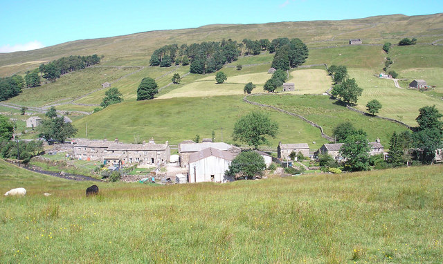
Bank Bottom is a small valley located in the county of Yorkshire, England. Situated in the heart of the Pennines, it is known for its picturesque landscape and rich industrial history. The valley is nestled between rolling hills and is crisscrossed by a meandering river, adding to its natural charm.

Historically, Bank Bottom was a thriving center for the textile industry during the 19th and early 20th centuries. The valley was home to numerous cotton mills, weaving sheds, and dye works, which played a crucial role in the region's economy. Today, remnants of these industrial buildings can still be seen, serving as a reminder of the area's past.

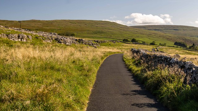
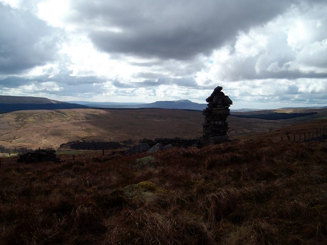
The valley is also renowned for its scenic beauty and attracts nature enthusiasts and hikers. The surrounding hills provide stunning views of the countryside, making it a popular destination for outdoor activities such as walking, cycling, and birdwatching. The river that runs through Bank Bottom is known for its clear waters and supports a diverse range of wildlife, adding to the area's ecological significance.

In terms of amenities, Bank Bottom is a close-knit community with a few local shops, a post office, and a small village hall. The residents take pride in preserving the valley's heritage and organizing events that celebrate its industrial past. The peaceful and tranquil atmosphere of Bank Bottom makes it an ideal location for those seeking a quiet and rural lifestyle.

Overall, Bank Bottom, Yorkshire, offers a unique blend of natural beauty, industrial heritage, and community spirit, making it a hidden gem within the county.

If you have any feedback on the listing, please let us know in the comments section below.

Bank Bottom Images

Images are sourced within 2km of 54.217347/-2.193066 or Grid Reference SD8780. Thanks to Geograph Open Source API. All images are credited.

Rainbow over Langstrothdale Taken from the north-west by drone.
Rainbow over Langstrothdale
Taken from the north-west by drone.
Beckermonds Pots Clearfell area above Green Field Beck.
Beckermonds Pots
Clearfell area above Green Field Beck.
New House Barns above New House.
New House
Barns above New House.
Calf Barn See detailed picture of the date stone: <a href="https://www.geograph.org.uk/photo/7596135">SD8979 : Calf Barn</a>.
Calf Barn
See detailed picture of the date stone: SD8979 : Calf Barn.
Calf Barn Date stone at <a href="https://www.geograph.org.uk/photo/7596134">SD8979 : Calf Barn</a>.
Calf Barn
Date stone at SD8979 : Calf Barn.
Beckermonds Ford This ford is found below East Beckermonds Farm.
Beckermonds Ford
This ford is found below East Beckermonds Farm.
Beckermonds
Beckermonds
Beckermonds Postbox at Beckermonds.
Beckermonds
Postbox at Beckermonds.
Beckermonds Holiday accommodation in Beckermonds.
Beckermonds
Holiday accommodation in Beckermonds.
Beckermonds Forwarder working in a clear fell area at Beckermonds.
Beckermonds
Forwarder working in a clear fell area at Beckermonds.
Beckermonds Road above Beckermonds.
Beckermonds
Road above Beckermonds.
Green Field Beck Limestone outcrops alongside Green Field Beck.
Green Field Beck
Limestone outcrops alongside Green Field Beck.
River Wharfe View looking across the River Wharfe to some nice looking terracettes.
River Wharfe
View looking across the River Wharfe to some nice looking terracettes.
River Wharfe
River Wharfe
Langstrothdale The view eastwards down Langstrothdale near Buckden in the Yorkshire Dales National Park.
Langstrothdale
The view eastwards down Langstrothdale near Buckden in the Yorkshire Dales National Park.
Langstrothdale The view from MR: SD87968016 looking westwards.
Langstrothdale
The view from MR: SD87968016 looking westwards.
Oughtershaw. Tiny village in Upper Langstrothdale.
Oughtershaw.
Tiny village in Upper Langstrothdale.
Beckermonds. Looking SW from the road at SD 875 804.
Beckermonds.
Looking SW from the road at SD 875 804.
Show me another place!

Bank Bottom is located at Grid Ref: SD8780 (Lat: 54.217347, Lng: -2.193066)

Division: West Riding

Administrative County: North Yorkshire

District: Craven

Police Authority: North Yorkshire

What 3 Words

///increases.native.womb. Near Settle, North Yorkshire

Related Wikis

Nearby Amenities

Located within 500m of 54.217347,-2.193066
Beckermonds
Is In: UK, England, Yorkshire, North Yorkshire, Wharfedale, Yorkshire Dales
Is In County: North Yorkshire
Is In Municipality: Craven
Is In Valley: Wharfedale
Place: hamlet
Source: NPE
Wikidata: Q4878677
Lat/Long: 54.2183876/-2.1950458
Ford: yes
Lat/Long: 54.217512/-2.1946765
Barrier: stile
Lat/Long: 54.2167219/-2.1885832
Natural: spring
Source: OS 1:25k
Lat/Long: 54.2185285/-2.1875613
Ford: yes
Lat/Long: 54.2166669/-2.1882986
lime kiln
Historic: ruins
Mineral: limestone
Source: OS 1853;Bing
Lat/Long: 54.2190306/-2.1875457
Post Box
Collection Times: Mo-Fr 16:30; Sa 10:30
Drive Through: no
Post Box Mounting: brick_pillar
Post Box Type: wall
Ref: BD23 42
Royal Cypher: EVIIR
Royal Cypher Wikidata: Q33102324
Lat/Long: 54.2184564/-2.1916209
Give Way
Direction: forward
Lat/Long: 54.2184225/-2.1917811
Grit Bin
Lat/Long: 54.2178013/-2.1959633
Defibrillator
Emergency: defibrillator
Lat/Long: 54.2178969/-2.1955359
Ford: yes
Lat/Long: 54.2172432/-2.1944026
The data included in this document is from www.openstreetmap.org. The data is made available under ODbL.

Have you been to Bank Bottom?

Leave your review of Bank Bottom below (or comments, questions and feedback).