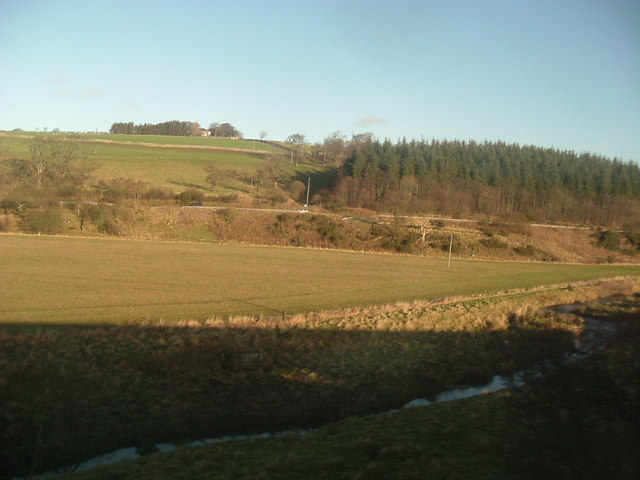
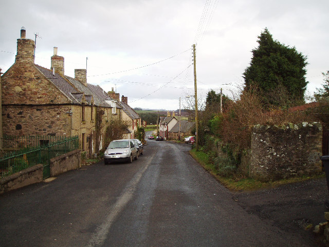
Lemington Dean

Valley in Berwickshire

Scotland

Lemington Dean

Reston View towards the bridge over the railway at the west end of the village.
Reston Credit: Richard Webb

The requested URL returned error: 429 Too Many Requests

If you have any feedback on the listing, please let us know in the comments section below.

Lemington Dean Images

Images are sourced within 2km of 55.859343/-2.2201967 or Grid Reference NT8662. Thanks to Geograph Open Source API. All images are credited.

Reston View towards the bridge over the railway at the west end of the village.
Reston
View towards the bridge over the railway at the west end of the village.
East coast main line. View towards Edinburgh along the famous railway linking the capitals. Electrified in 1987, it carries trains that I have measured at great cost on my GPS unit, running at just under 200kph.
East coast main line.
View towards Edinburgh along the famous railway linking the capitals. Electrified in 1987, it carries trains that I have measured at great cost on my GPS unit, running at just under 200kph.
Berwickshire Railway Heading out to the hinterland, the former railway linking Tweeddale with the East Coast main line at Reston. Closed to passenger traffic in 1951, and finally closed and dismantled in 1966.
Berwickshire Railway
Heading out to the hinterland, the former railway linking Tweeddale with the East Coast main line at Reston. Closed to passenger traffic in 1951, and finally closed and dismantled in 1966.
Fairlaw Farm and road junction just outside Auchencrow.
Fairlaw
Farm and road junction just outside Auchencrow.
Swansfield Former farm with overgrown sheep pens at 170m asl overlooking the A1.
Swansfield
Former farm with overgrown sheep pens at 170m asl overlooking the A1.
Sheep, Swansfield Pastureland above the Eye Water.
Sheep, Swansfield
Pastureland above the Eye Water.
Eye Water Downstream from Howden Bridge.
Eye Water
Downstream from Howden Bridge.
Ag-bag The mother of all silage bags - Lemington, Berwickshire.
Ag-bag
The mother of all silage bags - Lemington, Berwickshire.
Mount Alban Given the large scale switch to arable agriculture in recent years, how many gates are lying soon to be buried beside fields?
Mount Alban
Given the large scale switch to arable agriculture in recent years, how many gates are lying soon to be buried beside fields?
Lemington Field recovering through the winter.
Lemington
Field recovering through the winter.
Lemington View over the Eye Water from Lemington.
Lemington
View over the Eye Water from Lemington.
Road to Mount Alban One of many dead end roads off the A1 up to farms on the slopes above the Eye Water.
Road to Mount Alban
One of many dead end roads off the A1 up to farms on the slopes above the Eye Water.
Eye Water and A1 near Houndwood From the train.
Eye Water and A1 near Houndwood
From the train.
A1 near Houndwood From the train.
A1 near Houndwood
From the train.
Reston Street with chapel, as seen from the railway line as passing by.
Reston
Street with chapel, as seen from the railway line as passing by.
Houndwood Inn On A1; seen from the railway.
Houndwood Inn
On A1; seen from the railway.
Farm road from Gallows Law to Hillend
Track North East of Hillend Farm
Show me another place!

Lemington Dean is located at Grid Ref: NT8662 (Lat: 55.859343, Lng: -2.2201967)

Unitary Authority: The Scottish Borders

Police Authority: The Lothians and Scottish Borders

What 3 Words

///called.caring.waltzes. Near Chirnside, Scottish Borders

Nearby Locations

Lemington Dean

Related Wikis

Reston railway station

Reston is a railway station in the small village of Reston that serves the wider rural parish of Coldingham and nearby small town of Eyemouth in the eastern...

Reston, Scottish Borders

Reston is a village located in the southeast of Scotland, in Berwickshire, Scottish Borders region. The village lies on the western bank of the Eye Water...

Auchencrow

Auchencrow (Scottish Gaelic: Allt na Crà) is a small village in the Scottish Borders area of Scotland, by the Lammermuir range of hills, and near Reston...

Press Castle

Press Castle is a village with 17th-century manor house and country estate in the Scottish Borders, 2m (3 km) west of Coldingham, by the Ale Water. NT871654...

Nearby Amenities

Located within 500m of 55.859343,-2.2201967
Lemington
Place: hamlet
Lat/Long: 55.8597611/-2.2248602
Noexit: yes
Lat/Long: 55.8610076/-2.2232093
Power: pole
Lat/Long: 55.8604856/-2.2124414
Power: pole
Lat/Long: 55.860348/-2.2137678
Power: pole
Lat/Long: 55.8606617/-2.2148857
Power: pole
Lat/Long: 55.8610104/-2.216038
Power: pole
Lat/Long: 55.8613144/-2.2171215
Power: pole
Lat/Long: 55.8613796/-2.2186887
Power: pole
Lat/Long: 55.8614544/-2.2204408
Power: pole
Lat/Long: 55.8616969/-2.2219048
Power: pole
Lat/Long: 55.8625016/-2.2227777
Power: pole
Lat/Long: 55.8632954/-2.2235881
Power: pole
Lat/Long: 55.8627802/-2.2215802
Power: pole
Lat/Long: 55.8630686/-2.2203978
Power: pole
Lat/Long: 55.863644/-2.2192799
The data included in this document is from www.openstreetmap.org. The data is made available under ODbL.

Have you been to Lemington Dean?

Leave your review of Lemington Dean below (or comments, questions and feedback).