Lyons Den

Valley in Aberdeenshire

Scotland

Lyons Den

Forestry near New Aberdour
Forestry near New Aberdour Credit: Steven Brown

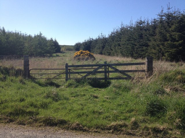
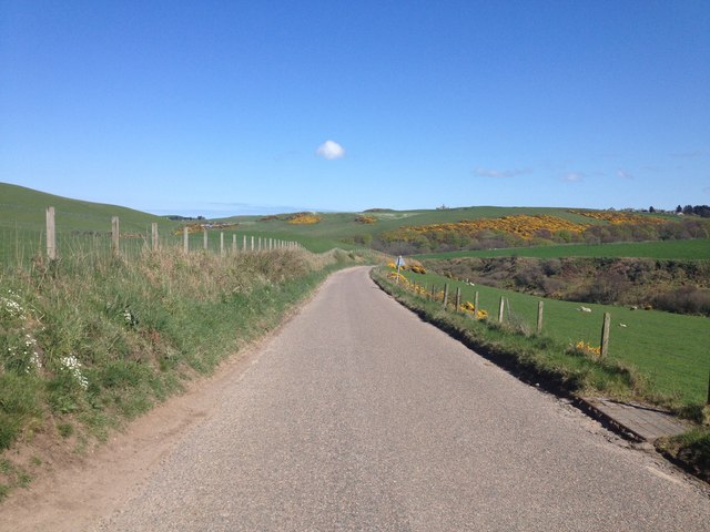
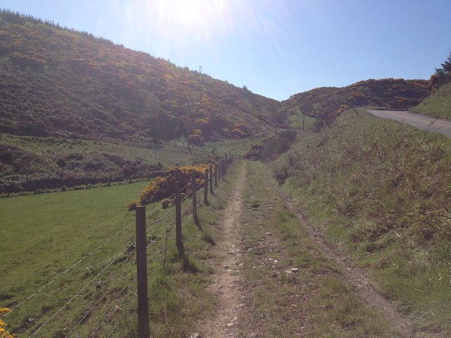
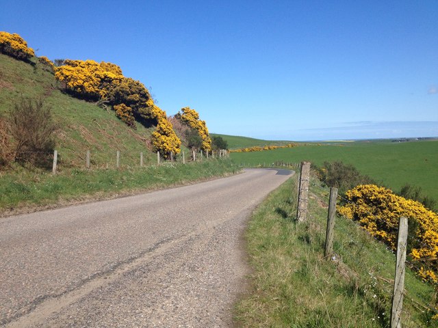
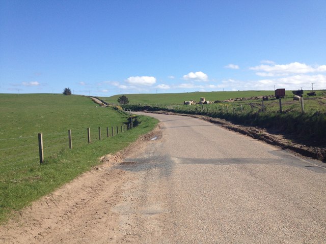
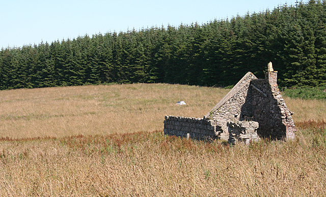
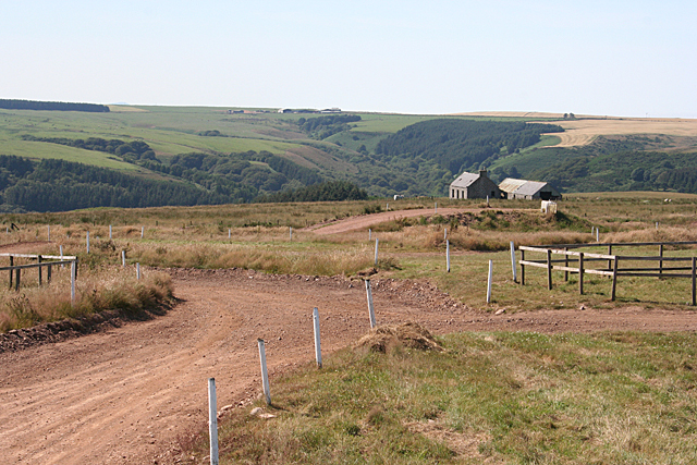
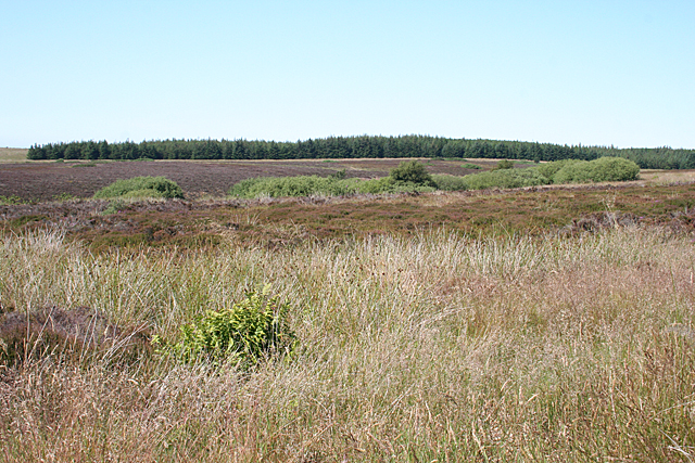
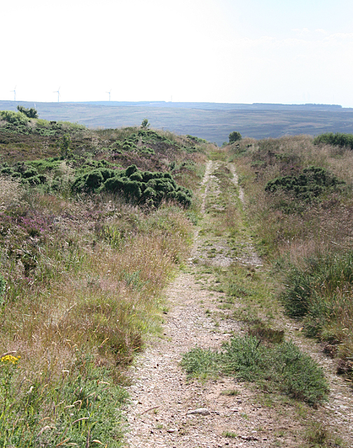
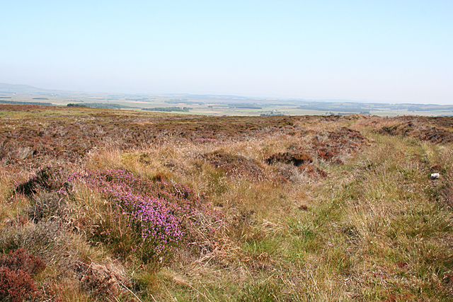
Lyons Den is a picturesque valley located in Aberdeenshire, Scotland. Nestled amidst rolling hills and lush greenery, this natural wonder is a haven for outdoor enthusiasts and nature lovers alike. The valley stretches over a vast area, offering visitors a serene and tranquil setting to escape the hustle and bustle of everyday life.

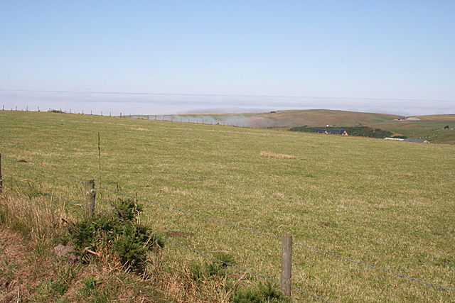
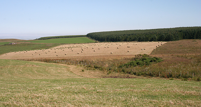
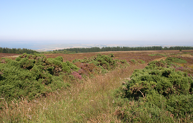
One of the defining features of Lyons Den is its stunning landscape. The valley is adorned with vibrant wildflowers, towering trees, and a meandering river that adds to its ethereal beauty. It provides a breathtaking backdrop for hiking, picnicking, or simply strolling along its scenic trails.

The valley is home to an array of wildlife, making it an ideal spot for birdwatching and animal spotting. Visitors may catch glimpses of red deer, squirrels, and a variety of bird species that inhabit the area. The peaceful and undisturbed environment of Lyons Den offers a unique opportunity to observe these creatures in their natural habitat.

For those seeking more adventurous activities, Lyons Den offers opportunities for rock climbing, mountain biking, and fishing. The rocky cliffs within the valley provide an exciting challenge for climbers of all skill levels, while the well-maintained biking trails cater to cycling enthusiasts. The river that winds through the valley is also a popular spot for anglers, who come to test their skills in catching trout and salmon.

Overall, Lyons Den is a hidden gem in Aberdeenshire, offering visitors a chance to immerse themselves in the beauty of nature. Whether it's a leisurely walk, an adrenaline-filled adventure, or a peaceful retreat, this valley has something to offer everyone who seeks solace in the great outdoors.

If you have any feedback on the listing, please let us know in the comments section below.
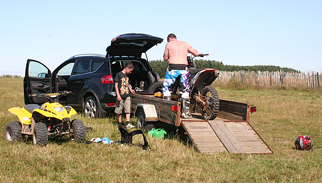
Lyons Den Images

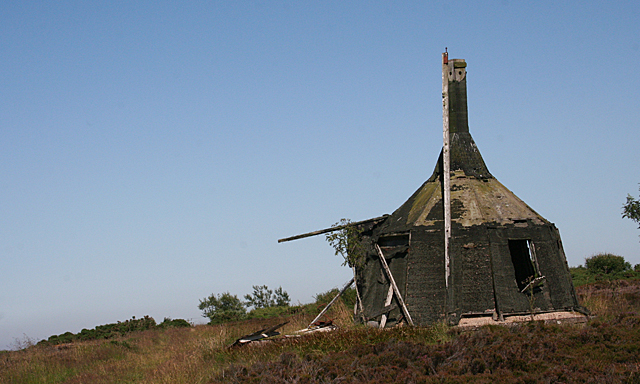
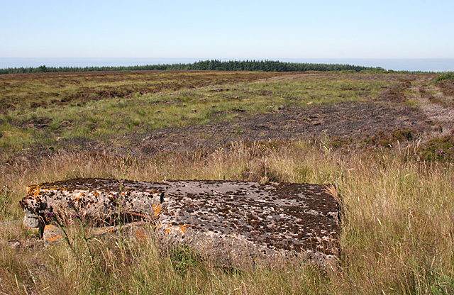
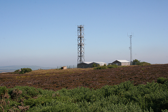
Images are sourced within 2km of 57.654367/-2.2343386 or Grid Reference NJ8662. Thanks to Geograph Open Source API. All images are credited.

Forestry near New Aberdour
B9031 near Towie
B9031 near Towie
Farm track near Towie
B9031 near Towie
B9031 near Towie
B9031 near East Mains
Cummerton Because of the lie of the land, all you can see of Cummerton is the roof. Notice a wisp of haar over the brow of the hill.
Cummerton
Because of the lie of the land, all you can see of Cummerton is the roof. Notice a wisp of haar over the brow of the hill.
Near Lemnas The foreground and the rough vegetation are in this square, but not the more eye-catching bales.
Near Lemnas
The foreground and the rough vegetation are in this square, but not the more eye-catching bales.
Nameless House near Lemnas This is marked on all the older maps, but none of them names it.
Nameless House near Lemnas
This is marked on all the older maps, but none of them names it.
Packing up at the end of the day Buchan Off-road Motorcycle Club has about a kilometre of track at Lemnas for trials and quad bikes. This father and son have just enjoyed a day's sport and are about to head home. BOMC has a web site <span class="nowrap"><a title="http://bomc.info/" rel="nofollow ugc noopener" href="http://bomc.info/">Link</a><img style="margin-left:2px;" alt="External link" title="External link - shift click to open in new window" src="https://s1.geograph.org.uk/img/external.png" width="10" height="10"/></span> with everything you want to know about the club and the track.
Packing up at the end of the day
Buchan Off-road Motorcycle Club has about a kilometre of track at Lemnas for trials and quad bikes. This father and son have just enjoyed a day's sport and are about to head home. BOMC has a web site LinkExternal link with everything you want to know about the club and the track.
Lemnas The abandoned farmhouse stands above the Tore of Troup. The land beside it has been developed as an off-road biking and quad biking track by the Buchan Off-road Motorcycle Club, and part of the track can be seen in the foreground. See <span class="nowrap"><a title="http://bomc.info/" rel="nofollow ugc noopener" href="http://bomc.info/">Link</a><img style="margin-left:2px;" alt="External link" title="External link - shift click to open in new window" src="https://s1.geograph.org.uk/img/external.png" width="10" height="10"/></span>
Lemnas
The abandoned farmhouse stands above the Tore of Troup. The land beside it has been developed as an off-road biking and quad biking track by the Buchan Off-road Motorcycle Club, and part of the track can be seen in the foreground. See LinkExternal link
Long Glen It's just about possible to see the break in slope that defines Long Glen, although you can't see right down into the glen. A return visit, with boots and gaiters, on a clear winter day when there are no insects and no ticks, would be the time to take a good look into the glen.
Long Glen
It's just about possible to see the break in slope that defines Long Glen, although you can't see right down into the glen. A return visit, with boots and gaiters, on a clear winter day when there are no insects and no ticks, would be the time to take a good look into the glen.
Track to the Moss of Kinbeam The track is arrow-straight for almost a mile from here before it bends to descend into the den and cross to the other side.
Track to the Moss of Kinbeam
The track is arrow-straight for almost a mile from here before it bends to descend into the den and cross to the other side.
A Strange Structure I had no idea what this is, or rather was, before someone set fire to it. Compare with <a href="https://www.geograph.org.uk/photo/317502">NJ8562 : Unidentified air warning system on Windyheads Hill.</a>. The explanation is at <span class="nowrap"><a title="http://canmore.rcahms.gov.uk/en/site/285843/details/windyheads+hill+gee+station+vhf+and+df+building/" rel="nofollow ugc noopener" href="http://canmore.rcahms.gov.uk/en/site/285843/details/windyheads+hill+gee+station+vhf+and+df+building/">Link</a><img style="margin-left:2px;" alt="External link" title="External link - shift click to open in new window" src="https://s1.geograph.org.uk/img/external.png" width="10" height="10"/></span>
A Strange Structure
I had no idea what this is, or rather was, before someone set fire to it. Compare with NJ8562 : Unidentified air warning system on Windyheads Hill.. The explanation is at LinkExternal link
Military Remains? There are all sorts of bits of concrete in the heather that look as if they might have been military installations.
Military Remains?
There are all sorts of bits of concrete in the heather that look as if they might have been military installations.
Radio Masts on Windyheads Hill I see that this has something to do with air traffic control.
Radio Masts on Windyheads Hill
I see that this has something to do with air traffic control.
Track to Helenamore The older map shows this track going on to Helenamore. However the later maps suggest that is actually fizzles out, so it's just as well I didn't try to go the whole way along it.
Track to Helenamore
The older map shows this track going on to Helenamore. However the later maps suggest that is actually fizzles out, so it's just as well I didn't try to go the whole way along it.
Track on Windyheads Hill This track goes nowhere - it just stops in the middle of the moor.
Track on Windyheads Hill
This track goes nowhere - it just stops in the middle of the moor.
Ten Padlocks Interesting how many different people or organisations apparently need access to Windyheads Hill. I am still trying to deduce exactly how this system works. I surmise that removing one of the vertical blocks allows the rest to be pushed aside just far enough to slide the bolt over.
Ten Padlocks
Interesting how many different people or organisations apparently need access to Windyheads Hill. I am still trying to deduce exactly how this system works. I surmise that removing one of the vertical blocks allows the rest to be pushed aside just far enough to slide the bolt over.
Show me another place!

Lyons Den is located at Grid Ref: NJ8662 (Lat: 57.654367, Lng: -2.2343386)

Unitary Authority: Aberdeenshire

Police Authority: North East

What 3 Words

///presuming.supreme.outbid. Near New Pitsligo, Aberdeenshire

Nearby Locations

Lyons Den

Related Wikis

Auchmeddan Castle

Auchmeddan Castle was a castle, most likely dating from the 16th century, now demolished, located 9 miles (14 km) west of Fraserburgh, at Mains of Auchmeddan...

New Aberdour

New Aberdour is a small planned village in the Aberdour parish of Aberdeenshire, Scotland, situated south of Aberdour Bay on the Moray Firth. It lies 7...

Pennan

Pennan (Scots: Peenan) is a small village in Aberdeenshire, Scotland, consisting of a small harbour and a single row of homes, including a hotel. It is...

Rescue from SS William Hope

In the 1884 rescue from SS William Hope in Aberdour Bay off the north coast of Aberdeenshire in Scotland Jane Whyte rescued fifteen sailors from their...

Nearby Amenities

Located within 500m of 57.654367,-2.2343386
Power: pole
Lat/Long: 57.6529171/-2.2418278
Power: pole
Lat/Long: 57.6535304/-2.2410774
Power: pole
Lat/Long: 57.6540447/-2.2404489
Power: pole
Lat/Long: 57.6545346/-2.2398508
Power: pole
Lat/Long: 57.6549942/-2.2392897
Power: pole
Lat/Long: 57.6554631/-2.2387047
Power: pole
Lat/Long: 57.656067/-2.2378108
Power: pole
Lat/Long: 57.6565453/-2.23708
Power: pole
Lat/Long: 57.6570491/-2.2363427
Power: pole
Lat/Long: 57.6575517/-2.2356033
Power: pole
Lat/Long: 57.6580543/-2.2348377
Power: pole
Lat/Long: 57.6586896/-2.2348834
The data included in this document is from www.openstreetmap.org. The data is made available under ODbL.

Have you been to Lyons Den?

Leave your review of Lyons Den below (or comments, questions and feedback).