Bailey's Cleugh

Valley in Northumberland

England

Bailey's Cleugh

Bridleway and Public Road Converge near Slymefoot The ancient cross-border route called The Street (right), which can be followed from this point in England to Hownam in Scotland, converges here with the narrow single track public road (left) which runs through Upper Coquetdale from the tiny village of Alwinton to just short of Chew Green close to the English/Scottish border. It is one of the most scenic journeys in Northumberland. For a selection of detailed free to download walking routes in the area visit <span class="nowrap"><a title="www.cheviotwalks.co.uk" rel="nofollow ugc noopener" href="http://www.cheviotwalks.co.uk">Link</a><img style="margin-left:2px;" alt="External link" title="External link - shift click to open in new window" src="https://s1.geograph.org.uk/img/external.png" width="10" height="10"/></span>
Bridleway and Public Road Converge near Slymefoot Credit: Geoff Holland

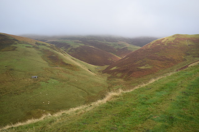
Bailey's Cleugh is a picturesque valley located in Northumberland, England. Situated in the northern part of the county, it is nestled between the Cheviot Hills and the Scottish border. The name "cleugh" is derived from the Old Norse word for a narrow valley or ravine, and it aptly describes the geography of this area.

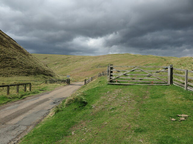
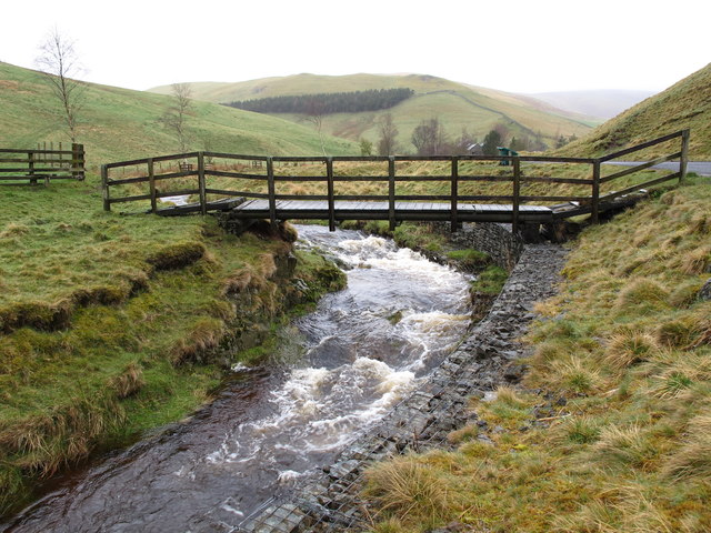
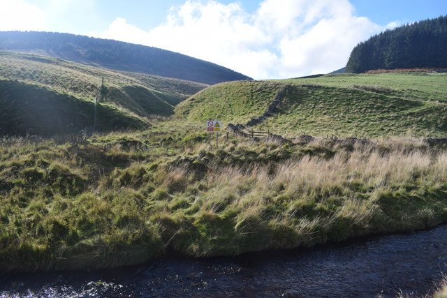
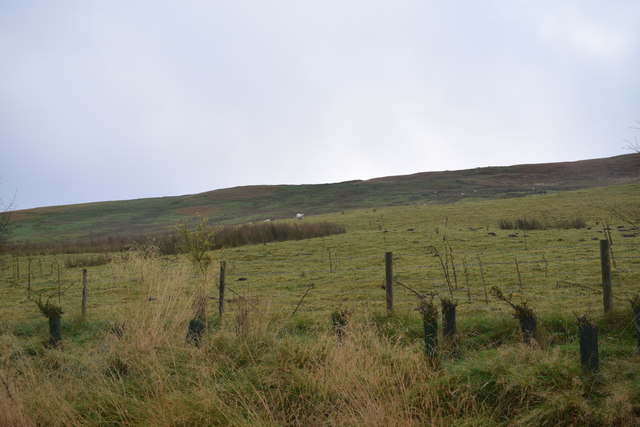
The valley is known for its stunning natural beauty, with rolling green hills, meandering streams, and an abundance of wildlife. It is a haven for hikers and nature enthusiasts, offering a variety of walking trails that showcase the area's diverse flora and fauna. Visitors can expect to see a range of bird species, including red grouse, curlew, and skylarks, as well as occasional sightings of roe deer and otters.

Bailey's Cleugh is also steeped in history, with several historical landmarks dotting the landscape. One notable feature is the ruins of an ancient hillfort, which dates back to the Iron Age. This archaeological site provides a fascinating glimpse into the lives of the people who once inhabited the area.

The valley is easily accessible, with a small car park located nearby for visitors. It offers a peaceful retreat from the hustle and bustle of modern life, allowing individuals to immerse themselves in the tranquility of the Northumberland countryside.

Whether it's exploring the walking trails, admiring the scenic views, or uncovering the valley's rich history, Bailey's Cleugh offers a captivating experience for anyone seeking a true taste of Northumberland's natural and cultural heritage.

If you have any feedback on the listing, please let us know in the comments section below.

Bailey's Cleugh Images

Images are sourced within 2km of 55.40672/-2.2484969 or Grid Reference NT8412. Thanks to Geograph Open Source API. All images are credited.

Bridleway and Public Road Converge near Slymefoot The ancient cross-border route called The Street (right), which can be followed from this point in England to Hownam in Scotland, converges here with the narrow single track public road (left) which runs through Upper Coquetdale from the tiny village of Alwinton to just short of Chew Green close to the English/Scottish border. It is one of the most scenic journeys in Northumberland. For a selection of detailed free to download walking routes in the area visit <span class="nowrap"><a title="www.cheviotwalks.co.uk" rel="nofollow ugc noopener" href="http://www.cheviotwalks.co.uk">Link</a><img style="margin-left:2px;" alt="External link" title="External link - shift click to open in new window" src="https://s1.geograph.org.uk/img/external.png" width="10" height="10"/></span>
Bridleway and Public Road Converge near Slymefoot
The ancient cross-border route called The Street (right), which can be followed from this point in England to Hownam in Scotland, converges here with the narrow single track public road (left) which runs through Upper Coquetdale from the tiny village of Alwinton to just short of Chew Green close to the English/Scottish border. It is one of the most scenic journeys in Northumberland. For a selection of detailed free to download walking routes in the area visit LinkExternal link
Ordnance Survey Cut Mark This OS cut mark can be found at Rowhope Farm. It marks a point 277.283m above mean sea level.
Ordnance Survey Cut Mark
This OS cut mark can be found at Rowhope Farm. It marks a point 277.283m above mean sea level.
Ordnance Survey Cut Mark This OS cut mark can be found on a barn at Trows Farm. It marks a point 288.579m above mean sea level.
Ordnance Survey Cut Mark
This OS cut mark can be found on a barn at Trows Farm. It marks a point 288.579m above mean sea level.
Outer Green Cleugh This cleugh rises on the slopes of Rough Knowe on the south western flanks of Windy Gyle and flows into the Rowhope Burn which in turn rises close to the summit of Windy Gyle. For a selection of free to download walking routes in the area visit <span class="nowrap"><a title="www.cheviotwalks.co.uk" rel="nofollow ugc noopener" href="http://www.cheviotwalks.co.uk">Link</a><img style="margin-left:2px;" alt="External link" title="External link - shift click to open in new window" src="https://s1.geograph.org.uk/img/external.png" width="10" height="10"/></span>
Outer Green Cleugh
This cleugh rises on the slopes of Rough Knowe on the south western flanks of Windy Gyle and flows into the Rowhope Burn which in turn rises close to the summit of Windy Gyle. For a selection of free to download walking routes in the area visit LinkExternal link
Footbridge over the Rowhope Burn This small footbridge is not shown on the Ordnance Survey map. The farm in the distance is Rowhope and the hill behind it is Stob Hill. For a selection of free to download walking routes in the area visit <span class="nowrap"><a title="www.cheviotwalks.co.uk" rel="nofollow ugc noopener" href="http://www.cheviotwalks.co.uk">Link</a><img style="margin-left:2px;" alt="External link" title="External link - shift click to open in new window" src="https://s1.geograph.org.uk/img/external.png" width="10" height="10"/></span>
Footbridge over the Rowhope Burn
This small footbridge is not shown on the Ordnance Survey map. The farm in the distance is Rowhope and the hill behind it is Stob Hill. For a selection of free to download walking routes in the area visit LinkExternal link
View towards Bell Hill Downstream on the Coquet from Carshope.
View towards Bell Hill
Downstream on the Coquet from Carshope.
Footbridge over the River Coquet Near Carlcroft.
Footbridge over the River Coquet
Near Carlcroft.
Ford on the River Coquet Between Blindburn and Carlcroft.
Ford on the River Coquet
Between Blindburn and Carlcroft.
Trows An isolated (and unoccupied?) farmhouse in the valley of Trows Burn.
Trows
An isolated (and unoccupied?) farmhouse in the valley of Trows Burn.
Hillside of Shorthope Hill Looking up the eastern end of the hill's ridge from the path out of Trows.
Hillside of Shorthope Hill
Looking up the eastern end of the hill's ridge from the path out of Trows.
View into Loft Cleugh View across Trows Burn from the path to Windy Gyle.
View into Loft Cleugh
View across Trows Burn from the path to Windy Gyle.
The Street approaching Swinside Law The Street is an ancient drove road.
The Street approaching Swinside Law
The Street is an ancient drove road.
View towards Outer Green Cleugh With Rough Knowe in the mist behind.
View towards Outer Green Cleugh
With Rough Knowe in the mist behind.
Rough Knowe Taken from The Street, looking across the valley of the Rowhope Burn to Rough Knowe. The cleugh in the bottom right is Outer Green Cleugh.
Rough Knowe
Taken from The Street, looking across the valley of the Rowhope Burn to Rough Knowe. The cleugh in the bottom right is Outer Green Cleugh.
View into the valley of the Carlcroft Burn Looking south towards Carlcroft in Upper Coquetdale.
View into the valley of the Carlcroft Burn
Looking south towards Carlcroft in Upper Coquetdale.
On The Street near Bought Law and The Slime The ancient drove road is about to start the descent into Upper Coquetdale ahead.
On The Street near Bought Law and The Slime
The ancient drove road is about to start the descent into Upper Coquetdale ahead.
Rocky outcrop on Trows Law This outcrop lies on the north western slopes of Trows Law which sweep steeply down to the valley of the Trows Burn. For a selection of free to download detailed walking routes in the area visit <span class="nowrap"><a title="www.cheviotwalks.co.uk" rel="nofollow ugc noopener" href="http://www.cheviotwalks.co.uk">Link</a><img style="margin-left:2px;" alt="External link" title="External link - shift click to open in new window" src="https://s1.geograph.org.uk/img/external.png" width="10" height="10"/></span>
Rocky outcrop on Trows Law
This outcrop lies on the north western slopes of Trows Law which sweep steeply down to the valley of the Trows Burn. For a selection of free to download detailed walking routes in the area visit LinkExternal link
Track leading to Loft Hill This track sticks close to the fence as it heads towards Loft Hill, seen in the distance. For a selection of free to download detailed walking routes in the area visit <span class="nowrap"><a title="www.cheviotwalks.co.uk" rel="nofollow ugc noopener" href="http://www.cheviotwalks.co.uk">Link</a><img style="margin-left:2px;" alt="External link" title="External link - shift click to open in new window" src="https://s1.geograph.org.uk/img/external.png" width="10" height="10"/></span>
Track leading to Loft Hill
This track sticks close to the fence as it heads towards Loft Hill, seen in the distance. For a selection of free to download detailed walking routes in the area visit LinkExternal link
Show me another place!

Bailey's Cleugh is located at Grid Ref: NT8412 (Lat: 55.40672, Lng: -2.2484969)

Unitary Authority: Northumberland

Police Authority: Northumbria

What 3 Words

///probable.potential.clutter. Near Rochester, Northumberland

Nearby Locations

Bailey's Cleugh Stob Hill

Related Wikis

Barrow Burn Meadows

Barrow Burn Meadows is a Site of Special Scientific Interest (SSSI) in north Northumberland, England. The site is a species-rich hay meadow of a sort now...

Windy Gyle

Windy Gyle is a mountain in the Cheviot Hills range, on the border between England and Scotland. Like the other hills in the area, it is rounded and grass...

Barrow Burn

Barrowburn is a hamlet in Upper Coquetdale in the county of Northumberland, England. It comprises a working farm with associated buildings and two holiday...

Shillhope Law

Shillhope Law is a hill in the southern Cheviots, a range of hills in Northumberland, England. Shillhope Law is a relatively unremarkable member of this...

Usway Burn

The Usway Burn is an upland river on the southern flanks of the Cheviot Hills, in the Northumberland National Park, England. It is a tributary of the River...

Chew Green

Chew Green is the site of the ancient Roman encampment, commonly but erroneously called Ad Fines (Latin: The Limits) on the 1885-1900 edition of the Ordnance...

Kidland

Kidland is a former civil parish, now in the parish of Alwinton in Northumberland, England, about 2 miles (3 km) northwest of Alwinton village. In 1951...

Featherwood Roman Camps

Featherwood Roman Camps are neighbouring archaeological sites in Northumberland, England, 1 mile (1.6 km) north of Featherwood and about 3 miles (5 km...

Nearby Amenities

Located within 500m of 55.40672,-2.2484969
Bought Law
Place: locality
Lat/Long: 55.4035549/-2.25312
The data included in this document is from www.openstreetmap.org. The data is made available under ODbL.

Have you been to Bailey's Cleugh?

Leave your review of Bailey's Cleugh below (or comments, questions and feedback).