Vale of Gloucester

Valley in Gloucestershire Tewkesbury

England

Vale of Gloucester

1-4 Westfield Terrace, Gloucester Mid C19th semi-detached villas.
1-4 Westfield Terrace, Gloucester Credit: Stephen Richards

The Vale of Gloucester, located in Gloucestershire, England, is a picturesque valley surrounded by rolling hills and dotted with charming villages. Stretching approximately 30 miles from the northern edge of Gloucester to the southern border of the county, this tranquil valley is renowned for its natural beauty and rich agricultural land.

The valley is formed by the River Severn, the longest river in the United Kingdom, which meanders through the heart of the Vale. The river has played a significant role in the area's history and economy, providing a transportation route for goods and a source of water for agriculture.

The Vale of Gloucester is known for its fertile soil, making it an agricultural hub. The valley is covered in vast fields of crops, including wheat, barley, and vegetables, which contribute to the region's economy and provide stunning scenery throughout the year.

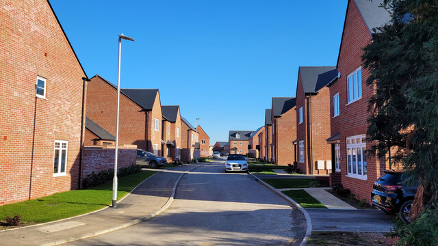
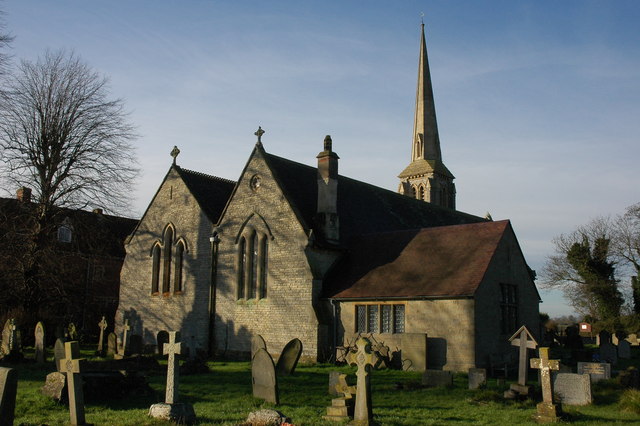
The valley is also home to several picturesque villages, each with its own unique character and charm. These villages offer a glimpse into traditional English rural life, with quaint cottages, historic churches, and welcoming locals. Visitors can explore the narrow lanes, visit local pubs, and soak in the peaceful atmosphere.

The Vale of Gloucester is a haven for outdoor enthusiasts, with numerous walking and cycling routes that showcase the area's natural beauty. The Severn Way, a long-distance footpath, follows the river's course and offers stunning views of the valley and surrounding countryside.

In conclusion, the Vale of Gloucester is a captivating valley in Gloucestershire, characterized by its rolling hills, fertile agricultural land, charming villages, and abundant natural beauty. It is a destination that delights visitors with its tranquility and offers a glimpse into rural England's idyllic way of life.

If you have any feedback on the listing, please let us know in the comments section below.

Vale of Gloucester Images

Images are sourced within 2km of 51.890387/-2.239956 or Grid Reference SO8321. Thanks to Geograph Open Source API. All images are credited.

1-4 Westfield Terrace, Gloucester Mid C19th semi-detached villas.
1-4 Westfield Terrace, Gloucester
Mid C19th semi-detached villas.
Maisemore Bridge, Maisemore Stone-faced concrete, built in 1956 by Harold Stratton Davis. A nearby plaque records that this is at least the sixth bridge on the site, the earliest probably dating back to c1230.
It carries the A417 over the Severn.
Maisemore Bridge, Maisemore
Stone-faced concrete, built in 1956 by Harold Stratton Davis. A nearby plaque records that this is at least the sixth bridge on the site, the earliest probably dating back to c1230. It carries the A417 over the Severn.
Longford Court, Longford Late C18th. Grade II listed.
Longford Court, Longford
Late C18th. Grade II listed.
Twigworth Lodge, Twigworth Early C19th villa with a wrought-iron verandah. Grade II listed.
It was a Premier Inn hotel, but appears to have closed in 2020.
Twigworth Lodge, Twigworth
Early C19th villa with a wrought-iron verandah. Grade II listed. It was a Premier Inn hotel, but appears to have closed in 2020.
Lodge and gatepiers, Sandhurst To Wallsworth Hall. By W.B. Wood, 1914. The piers are topped with dragons.
Lodge and gatepiers, Sandhurst
To Wallsworth Hall. By W.B. Wood, 1914. The piers are topped with dragons.
Gate piers, Sandhurst A fine pair at the approach to Wallsworth Hall. Possibly c1800, Greek key frieze and crowned with lions. Grade II* listed.
Gate piers, Sandhurst
A fine pair at the approach to Wallsworth Hall. Possibly c1800, Greek key frieze and crowned with lions. Grade II* listed.
Wallsworth Hall, housing 'Nature in Art'
Wallsworth Hall, housing 'Nature in Art': Poppy head sculpture
Wallsworth Hall, housing 'Nature in Art': Insect 'hotel'
Wallsworth Hall, housing 'Nature in Art': The horseshoe tail of a peacock sculpture
Wallsworth Hall, housing 'Nature in Art': 'Golden Eagle' from Eagle Star Insurance Building The sculpture in bronze and gilt came from their Bishop's Cleeve building.
Wallsworth Hall, housing 'Nature in Art': 'Golden Eagle' from Eagle Star Insurance Building
The sculpture in bronze and gilt came from their Bishop's Cleeve building.
Leighton Close A corner of a vast new housing estate off the Tewkesbury Road at Twigworth.
Leighton Close
A corner of a vast new housing estate off the Tewkesbury Road at Twigworth.
Base Lane, Sandhurst Looking north at Bengrove Farm.
Base Lane, Sandhurst
Looking north at Bengrove Farm.
By the Horsbere Brook The A40 passes across the scene.
By the Horsbere Brook
The A40 passes across the scene.
Old Boundary Post, Sandhurst On the Western side of Sandhurst Lane, near Bridge House which is 10.3 m Above Sea Level. Just South of the bridge over Broadboard Brook, GHD would stand for Gloucester Hundred Division. Longford, since at least 1950, has not used the Sᵀ Catherine appendage. See Wiki <span class="nowrap"><a title="https://en.wikipedia.org/wiki/Longford,_Gloucestershire" rel="nofollow ugc noopener" href="https://en.wikipedia.org/wiki/Longford,_Gloucestershire">Link</a><img style="margin-left:2px;" alt="External link" title="External link - shift click to open in new window" src="https://s1.geograph.org.uk/img/external.png" width="10" height="10"/></span>. And for Sandhurst see <span class="nowrap"><a title="https://en.wikipedia.org/wiki/Sandhurst,_Gloucestershire" rel="nofollow ugc noopener" href="https://en.wikipedia.org/wiki/Sandhurst,_Gloucestershire">Link</a><img style="margin-left:2px;" alt="External link" title="External link - shift click to open in new window" src="https://s1.geograph.org.uk/img/external.png" width="10" height="10"/></span>

Inscription: G H / D // Longford Sᵀ Catherine // Sandhurst

Milestone Society National ID: GL_LONSAN01pb
Old Boundary Post, Sandhurst
On the Western side of Sandhurst Lane, near Bridge House which is 10.3 m Above Sea Level. Just South of the bridge over Broadboard Brook, GHD would stand for Gloucester Hundred Division. Longford, since at least 1950, has not used the Sᵀ Catherine appendage. See Wiki LinkExternal link. And for Sandhurst see LinkExternal link Inscription: G H / D // Longford Sᵀ Catherine // Sandhurst Milestone Society National ID: GL_LONSAN01pb
Norton Garden Centre car park
New housing estate, Twigworth
Bus shelter by A38, Twigworth
Show me another place!

Vale of Gloucester is located at Grid Ref: SO8321 (Lat: 51.890387, Lng: -2.239956)

Administrative County: Gloucestershire

District: Tewkesbury

Police Authority: Gloucestershire

What 3 Words

///intro.various.commit. Near Gloucester, Gloucestershire

Nearby Locations

Vale of Gloucester

Related Wikis

Longford, Gloucestershire

Longford is a village and civil parish in Gloucestershire, England. Although situated within two miles of Gloucester city centre, Longford parish falls...

Twigworth

Twigworth is a small village near Gloucester in the Borough of Tewkesbury, Gloucestershire, England. The population of Twigworth Parish was 340 people...

Walham

Walham is a village in Longford parish, north of Gloucester, England. It lies on the banks of the River Severn and north of the A40 road. A National Grid...

Innsworth Meadow

Innsworth Meadow (grid reference SO851216) is a 2.9-hectare (7.2-acre) biological Site of Special Scientific Interest in Gloucestershire, notified in 1979...

Sandhurst, Gloucestershire

Sandhurst is a village just outside Gloucester, England. The parish church and Wallsworth Hall are Grade II* listed buildings. The River Severn is the...

Wallsworth Hall

Wallsworth Hall is a stately home in the parish of Sandhurst, Gloucester, England. It is a Grade II* listed building.The hall was featured in Simon Jenkins...

Nature in Art

Nature in Art is a museum and art gallery at Wallsworth Hall, Twigworth, Gloucester, England, dedicated exclusively to art inspired by nature in all forms...

Hartpury College

Hartpury University and Hartpury College, formerly Hartpury College, is a provider of further and higher education which describes itself as specialising...

Nearby Amenities

Located within 500m of 51.890387,-2.239956
Bus Stop
Primary School
Bus: yes
Naptan AtcoCode: 1600GLB531
Naptan Bearing: NE
Naptan CommonName: Primary School
Naptan Indicator: o/s
Naptan NaptanCode: glodapam
Naptan Street: Tewkesbury Road A38
Naptan Verified: no
Public Transport: platform
Source: naptan_import
Lat/Long: 51.8910791/-2.233066
Power: tower
Source: Bing
Lat/Long: 51.8897802/-2.2346422
Power: tower
Source: Bing
Lat/Long: 51.8925817/-2.2457255
Power: tower
Source: Bing
Lat/Long: 51.894589/-2.2421364
Power: pole
Source: Bing
Lat/Long: 51.8904662/-2.2393172
Power: pole
Source: Bing
Lat/Long: 51.8906648/-2.2355595
Power: pole
Source: Bing
Lat/Long: 51.8905953/-2.2369622
Power: pole
Source: Bing
Lat/Long: 51.8907277/-2.2343203
Power: pole
Source: Bing
Lat/Long: 51.8891634/-2.2432386
Power: pole
Source: Bing
Lat/Long: 51.8880526/-2.2455829
Power: pole
Source: Bing
Lat/Long: 51.8897908/-2.241919
Power: pole
Source: Bing
Lat/Long: 51.8903983/-2.2406476
Power: pole
Source: Bing
Lat/Long: 51.8885923/-2.2444429
Power: tower
Source: Bing
Lat/Long: 51.8887265/-2.2393654
Power: tower
Source: Bing
Lat/Long: 51.8862432/-2.2426538
Power: pole
Source: Bing
Lat/Long: 51.8905274/-2.2381263
Barrier: kissing_gate
Lat/Long: 51.8894268/-2.2337247
Barrier: kissing_gate
Foot: yes
Lat/Long: 51.891081/-2.2410258
Barrier: stile
Foot: yes
Lat/Long: 51.8911665/-2.2411633
Marker: aerial
Operator: CLH
Operator Old: GPSS
Source: survey
Utility: oil
Lat/Long: 51.8919659/-2.2353584
Marker: aerial
Operator: CLH
Operator Old: GPSS
Source: survey
Utility: oil
Lat/Long: 51.8903229/-2.2371648
Marker: aerial
Operator: CLH
Operator Old: GPSS
Source: survey
Utility: oil
Lat/Long: 51.8867948/-2.2406637
Power: pole
Lat/Long: 51.8907827/-2.2332441
The data included in this document is from www.openstreetmap.org. The data is made available under ODbL.

Have you been to Vale of Gloucester?

Leave your review of Vale of Gloucester below (or comments, questions and feedback).