Black Cleugh

Valley in Northumberland

England

Black Cleugh

Coatenhill Reservoir Coatenhill Reservoir is one of a number constructed to supply water for power generation in the lead mines of East Allendale. It's in use now as a fishing lake.
Coatenhill Reservoir Credit: Trevor Littlewood

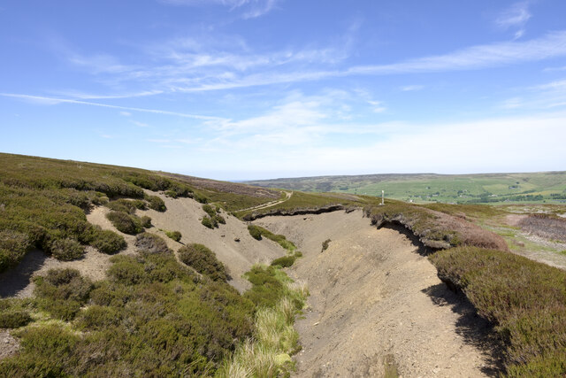
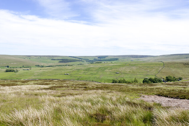
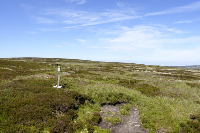
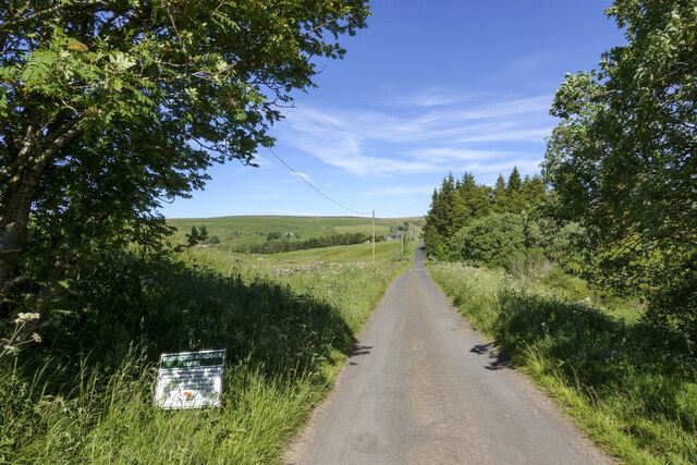
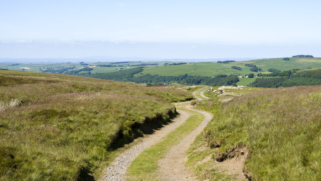
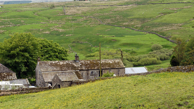
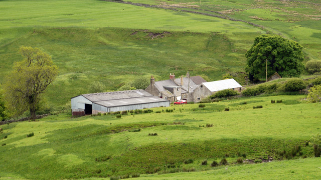
Black Cleugh is a picturesque valley located in the county of Northumberland, England. Situated in the North Pennines Area of Outstanding Natural Beauty, it is renowned for its stunning natural landscapes and rich historical heritage. The valley stretches approximately 6 miles long and is surrounded by rolling hills and dense forests, creating a peaceful and idyllic setting.

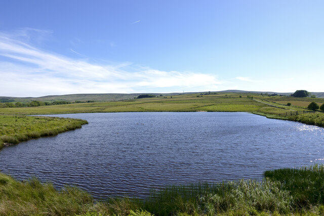
One of the prominent features of Black Cleugh is the meandering Black Cleugh Burn, a small river that flows through the valley, adding to its charm. The river is home to a variety of wildlife, including otters, kingfishers, and brown trout, making it a popular spot for nature enthusiasts and anglers alike.

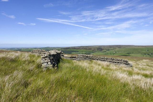
The valley is also scattered with ancient archaeological sites, such as prehistoric settlements and Bronze Age burial cairns, highlighting its long history of human habitation. These sites provide valuable insights into the lives of early inhabitants and are of great archaeological significance.

For outdoor enthusiasts, Black Cleugh offers a plethora of activities. The valley is crisscrossed with a network of walking trails, providing opportunities for hikers to explore the stunning countryside and take in the breathtaking views. Additionally, the nearby Black Cleugh Reservoir attracts visitors for birdwatching, fishing, and picnicking.

Surrounded by natural beauty and steeped in history, Black Cleugh is a true gem of Northumberland. Its tranquil atmosphere, diverse wildlife, and scenic landscapes make it a perfect destination for those seeking a peaceful getaway or a chance to immerse themselves in nature.

If you have any feedback on the listing, please let us know in the comments section below.

Black Cleugh Images

Images are sourced within 2km of 54.826624/-2.2673477 or Grid Reference NY8248. Thanks to Geograph Open Source API. All images are credited.

Coatenhill Reservoir Coatenhill Reservoir is one of a number constructed to supply water for power generation in the lead mines of East Allendale. It's in use now as a fishing lake.
Coatenhill Reservoir
Coatenhill Reservoir is one of a number constructed to supply water for power generation in the lead mines of East Allendale. It's in use now as a fishing lake.
Philipson's Fold Philipson's Fold is on moorland overlooking East Allendale and is probably not actually a sheepfold.
A sheepfold is a pen of some kind which can be used to confine animals. The structure here is in the form of a distorted 'H' shape and is probably more of a shelter about which sheep could gather for protection from weather coming from any direction.
Philipson's Fold
Philipson's Fold is on moorland overlooking East Allendale and is probably not actually a sheepfold. A sheepfold is a pen of some kind which can be used to confine animals. The structure here is in the form of a distorted 'H' shape and is probably more of a shelter about which sheep could gather for protection from weather coming from any direction.
Bare ground of stream side adjacent to Nan Davison's Cleugh The cleugh is just out of view beyond the bare ground, descending left to right. A bridleway, the route of the Isaac Tea Trail, runs along the right edge of the groove; it can be seen in the distance emerging  from the stream's valley.
Bare ground of stream side adjacent to Nan Davison's Cleugh
The cleugh is just out of view beyond the bare ground, descending left to right. A bridleway, the route of the Isaac Tea Trail, runs along the right edge of the groove; it can be seen in the distance emerging from the stream's valley.
Moorland below route of bridleway The heather and grass moorland is on a slope descending towards Swin Hope, a tributary valley of East Allendale; that main valley lies beyond the middle-distance ridge. The village of Allenheads is there, below the coniferous plantations.
Moorland below route of bridleway
The heather and grass moorland is on a slope descending towards Swin Hope, a tributary valley of East Allendale; that main valley lies beyond the middle-distance ridge. The village of Allenheads is there, below the coniferous plantations.
Bridleway crossing moorland beside Blackway Head The bridleway is passing the minor moorland rise on its west side; it's also the route used by the named walk, Isaac's Tea Trail.
Bridleway crossing moorland beside Blackway Head
The bridleway is passing the minor moorland rise on its west side; it's also the route used by the named walk, Isaac's Tea Trail.
Road beside 'protected verge' An unusual notice beside the road: it tells that the verge is being 'positively managed' by Northumberland County Council to conserve wild plants. It gives no added information as to what measures are being taken or how the public should act as a result.
Road beside 'protected verge'
An unusual notice beside the road: it tells that the verge is being 'positively managed' by Northumberland County Council to conserve wild plants. It gives no added information as to what measures are being taken or how the public should act as a result.
Black Way heading north Black Way is a hill road on the west side of East Allendale. It's also the route used by the named walk, Isaac's Tea Trail which has joined it just behind the camera position.
Black Way heading north
Black Way is a hill road on the west side of East Allendale. It's also the route used by the named walk, Isaac's Tea Trail which has joined it just behind the camera position.
Grouse Butts on Hartley Moor
Currick on Knockshield Moor
Shelter on Knockshield Moor
Nan Davidson's Cleugh
Cairn beside Isaac's Tea Trail The moorland ridge dividing the valleys, East and West Allendale is crossed by a bridleway which passes south of Blackway Head. In recent years the route has become part of a 36 mile walk known as Isaac's Tea Trail. The distant hill is Killhope Law.
Cairn beside Isaac's Tea Trail
The moorland ridge dividing the valleys, East and West Allendale is crossed by a bridleway which passes south of Blackway Head. In recent years the route has become part of a 36 mile walk known as Isaac's Tea Trail. The distant hill is Killhope Law.
Moorland east of Blackway Head The view is from a bridleway which crosses between West Allendale and East Allendale; it's now part of a long walk, (36 miles), known as Isaac's Tea Trail. The moorland is a mixture of grass and heather; here the whitened, dead stems of heather show, following, presumably, an earlier burn.
Killhope Law is the skyline hill.
Moorland east of Blackway Head
The view is from a bridleway which crosses between West Allendale and East Allendale; it's now part of a long walk, (36 miles), known as Isaac's Tea Trail. The moorland is a mixture of grass and heather; here the whitened, dead stems of heather show, following, presumably, an earlier burn. Killhope Law is the skyline hill.
Pryfield Cottages Pryfield Cottages, (now perhaps a single dwelling), lie in Swin Hope, a tributary valley to East Allendale.
Pryfield Cottages
Pryfield Cottages, (now perhaps a single dwelling), lie in Swin Hope, a tributary valley to East Allendale.
Swinhope Shield Swinhope Shield is a farm in Swin Hope, a tributary valley to East Allendale.
Swinhope Shield
Swinhope Shield is a farm in Swin Hope, a tributary valley to East Allendale.
Buildings at Swinhope Mill Swinhope Mill lies beside the Swinhope Burn, in the valley, Swin Hope, a side valley of East Allendale. There are certainly farm buildings there, also a terrace of cottages, but no obvious sign of a mill.
Buildings at Swinhope Mill
Swinhope Mill lies beside the Swinhope Burn, in the valley, Swin Hope, a side valley of East Allendale. There are certainly farm buildings there, also a terrace of cottages, but no obvious sign of a mill.
Hayfield, East Allendale The field is rich in its variety of plants but with buttercups dominating in the wide view seen here. The valley of the River East Allen lies beyond the field.
Hayfield, East Allendale
The field is rich in its variety of plants but with buttercups dominating in the wide view seen here. The valley of the River East Allen lies beyond the field.
Philipson's Fold This is a cross fold type sheep enclosure which has over time developed a fold of its own in the wall. This is on Allendale Common on Isaac's Tea Trail walk on the Black Way. The view looks back across and down the East Allen valley.  Philipson's are a branch of a local farming family.
Philipson's Fold
This is a cross fold type sheep enclosure which has over time developed a fold of its own in the wall. This is on Allendale Common on Isaac's Tea Trail walk on the Black Way. The view looks back across and down the East Allen valley. Philipson's are a branch of a local farming family.
Show me another place!

Black Cleugh is located at Grid Ref: NY8248 (Lat: 54.826624, Lng: -2.2673477)

Unitary Authority: Northumberland

Police Authority: Northumbria

What 3 Words

///bring.staring.stylists. Near Alston, Cumbria

Related Wikis

Allendale Moors

Allendale Moors is a Site of Special Scientific Interest (SSSI) in Northumberland, England. The upland moorland ridge site is listed for its heath, flush...

Carr Shield

Carrshield is a village in Northumberland, in England. It is situated in the Pennines approximately between Penrith and Hexham. It is a small village with...

Coalcleugh

Coalcleugh is a hamlet in Northumberland, England. It is situated in the Pennines between Penrith and Hexham. In the past it was well known as a lead mining...

Acton, Northumberland

Acton is a small hamlet in Northumberland, north-east England, about 3 miles (5 km) south of Allendale Town. Acton is usually Anglo-Saxon Old English...

Nearby Amenities

Located within 500m of 54.826624,-2.2673477
Ford: yes
Lat/Long: 54.824626/-2.2615674
The data included in this document is from www.openstreetmap.org. The data is made available under ODbL.

Have you been to Black Cleugh?

Leave your review of Black Cleugh below (or comments, questions and feedback).