Atton Dean

Valley in Berwickshire

Scotland

Atton Dean

Howpark The rocky dean of the Howpark Burn, just downstream of the farm.
Howpark Credit: Richard Webb

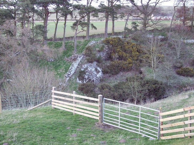
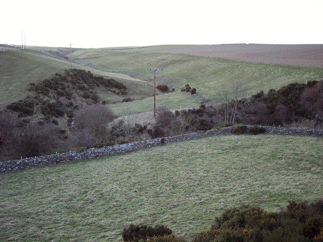
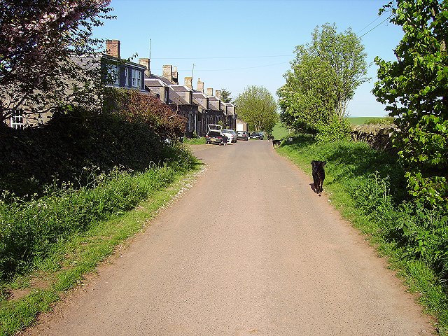
Atton Dean is a picturesque valley located in the historic county of Berwickshire, Scotland. Situated in the southeastern part of the country, this idyllic valley is known for its stunning natural beauty and tranquil atmosphere. It is nestled amidst rolling hills and lush green landscapes, making it a popular destination for nature enthusiasts and those seeking a peaceful retreat.

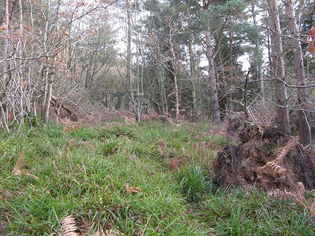
The valley is home to a diverse range of flora and fauna, with its rich biodiversity attracting wildlife enthusiasts and birdwatchers from near and far. Visitors can enjoy exploring the numerous walking trails and nature reserves that dot the area, providing ample opportunities for hiking, wildlife spotting, and photography.

Atton Dean is also known for its historical significance. The valley has been inhabited for centuries, with evidence of ancient settlements and archaeological sites found in the surrounding areas. History buffs can delve into the past by visiting nearby landmarks such as ruined castles and prehistoric sites, gaining insights into the region's fascinating heritage.

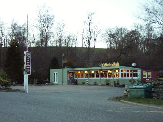
Despite its serene and secluded setting, Atton Dean is conveniently located close to several towns and villages, offering easy access to amenities and services. The village of Berwick-upon-Tweed is just a short drive away, providing a range of shops, restaurants, and accommodation options for visitors.

In summary, Atton Dean in Berwickshire is a captivating valley that combines natural beauty with a rich historical heritage. Its peaceful ambiance and abundance of outdoor activities make it an ideal destination for those looking to escape the hustle and bustle of everyday life.

If you have any feedback on the listing, please let us know in the comments section below.

Atton Dean Images

Images are sourced within 2km of 55.875585/-2.2751556 or Grid Reference NT8264. Thanks to Geograph Open Source API. All images are credited.

Howpark The rocky dean of the Howpark Burn, just downstream of the farm.
Howpark
The rocky dean of the Howpark Burn, just downstream of the farm.
Draining Penmanshiel Moor. A "nameless" cleuch draining the southern slopes of Penmanshiel Moor. Taken from the Howpark Road.
Draining Penmanshiel Moor.
A "nameless" cleuch draining the southern slopes of Penmanshiel Moor. Taken from the Howpark Road.
Cedar Cafe. Cafe popular with truckers. Situated at the foot of the Howpark Road, on an old cut off loop of the A1.
Cedar Cafe.
Cafe popular with truckers. Situated at the foot of the Howpark Road, on an old cut off loop of the A1.
Old A1 Redundant loop of the A1, used as an overnight parking spot for lorries, near the Cedar Cafe.
Old A1
Redundant loop of the A1, used as an overnight parking spot for lorries, near the Cedar Cafe.
Brockholes Hill Lambing time in the Lammermuirs.
Brockholes Hill
Lambing time in the Lammermuirs.
Wood at Brockholes near Coldingham
Brockholes Farm Cottages Small hamlet of cottages, next to Brockhole Farm near Coldingham.
Brockholes Farm Cottages
Small hamlet of cottages, next to Brockhole Farm near Coldingham.
Renton Farm near Grantshouse. Sheep and cattle graze the very green pasture on a shelf above the A1.
Renton
Farm near Grantshouse. Sheep and cattle graze the very green pasture on a shelf above the A1.
Horseley Row of cottages by the farm at Horseley.
Horseley
Row of cottages by the farm at Horseley.
Atton Dean Oakwoods above the A1 in the Lammermuir Hills. The woods rise steeply above an old cut off loop of the road, while the modern route passes to the west.
Atton Dean
Oakwoods above the A1 in the Lammermuir Hills. The woods rise steeply above an old cut off loop of the road, while the modern route passes to the west.
Green Wood Not so green on the day of the Winter Solstice. This is a small Forestry Commission property above Houndwood. The maps are wrong here, a road now runs up through the wood from Houndwood, and the old lane up from the A1 has been closed.
Green Wood
Not so green on the day of the Winter Solstice. This is a small Forestry Commission property above Houndwood. The maps are wrong here, a road now runs up through the wood from Houndwood, and the old lane up from the A1 has been closed.
Houndwood Postbox and local resident.
Houndwood
Postbox and local resident.
A1, Houndwood Underpass and the new section of dual carriageway bypassing Houndwood.
A1, Houndwood
Underpass and the new section of dual carriageway bypassing Houndwood.
Green Wood Forestry Commission woodland above Houndwood. A pleasing mix of trees and dense undergrowth. Full of finches living off the goose and peacock food in the village below.
Green Wood
Forestry Commission woodland above Houndwood. A pleasing mix of trees and dense undergrowth. Full of finches living off the goose and peacock food in the village below.
Atton Dean A cut off loop of the A1 with houses that are now a little quieter.
Atton Dean
A cut off loop of the A1 with houses that are now a little quieter.
Greenwood The new road up to Greenwood. Unfortunately the Forestry Commission have neglected to provide adequate parking for electric trains.   

The new road runs up from Houndwood, on the East Coast main line.  It replaces a more direct ascent from the A1 which was closed for safety reasons.
Greenwood
The new road up to Greenwood. Unfortunately the Forestry Commission have neglected to provide adequate parking for electric trains. The new road runs up from Houndwood, on the East Coast main line. It replaces a more direct ascent from the A1 which was closed for safety reasons.
Houndwood Houndwood is now bypassed. View of some of the old A1 road through the village.
Houndwood
Houndwood is now bypassed. View of some of the old A1 road through the village.
A1 near Houndwood From the train.
A1 near Houndwood
From the train.
Show me another place!

Atton Dean is located at Grid Ref: NT8264 (Lat: 55.875585, Lng: -2.2751556)

Unitary Authority: The Scottish Borders

Police Authority: The Lothians and Scottish Borders

What 3 Words

///drank.follow.deleting. Near Chirnside, Scottish Borders

Nearby Locations

Atton Dean Fisher's Wood

Related Wikis

Grantshouse

Grantshouse is a small village in Berwickshire in the Scottish Borders of Scotland. It lies on the A1, and its nearest railway stations are Dunbar to the...

Grantshouse railway station

Grantshouse railway station served the village of Grantshouse, Berwickshire, Scotland from 1846 to 1964 on the East Coast Main Line. == History == The...

Penmanshiel Tunnel

Penmanshiel Tunnel is a now-disused railway tunnel near Grantshouse, Berwickshire, in the Scottish Borders region of Scotland. It was formerly part of...

A1107 road

The A1107 is a road in south-east Scotland, in the Scottish Borders. It is a non-trunk route from near Cockburnspath to near Burnmouth. It follows the...

Nearby Amenities

Located within 500m of 55.875585,-2.2751556
Bus Stop
South Renton
Naptan AtcoCode: 69001512
Naptan Bearing: SE
Naptan CommonName: South Renton
Naptan Indicator: opp Road End
Naptan Landmark: Schoolhouse Road End
Naptan NaptanCode: 72726354
Naptan Street: A1
Naptan Verified: no
Source: naptan_import
Lat/Long: 55.8755317/-2.2829717
Noexit: yes
Lat/Long: 55.873192/-2.2791151
Deanfoot
Place: hamlet
Lat/Long: 55.872985/-2.277808
Give Way
Direction: forward
Lat/Long: 55.8714461/-2.2763177
Power: pole
Lat/Long: 55.874089/-2.2784185
Power: pole
Lat/Long: 55.87284/-2.2786358
Power: pole
Lat/Long: 55.8733772/-2.2785339
Power: pole
Lat/Long: 55.8760233/-2.2684803
Power: pole
Lat/Long: 55.8766178/-2.2693832
Power: pole
Lat/Long: 55.8773064/-2.2704302
Power: pole
Lat/Long: 55.8776103/-2.2709031
Power: pole
Lat/Long: 55.8781494/-2.271733
Power: pole
Lat/Long: 55.8787379/-2.2726423
Power: pole
Lat/Long: 55.8793203/-2.2735345
Power: pole
Lat/Long: 55.8799/-2.2744484
Power: pole
Lat/Long: 55.8791937/-2.2751017
Power: pole
Lat/Long: 55.87851/-2.2757101
Power: pole
Lat/Long: 55.8779782/-2.2762003
Power: pole
Lat/Long: 55.8776598/-2.276656
Power: pole
Lat/Long: 55.8771641/-2.2773912
Power: pole
Lat/Long: 55.876572/-2.2782856
Power: pole
Lat/Long: 55.875975/-2.2791906
Power: pole
Lat/Long: 55.8752225/-2.2797711
Power: pole
Lat/Long: 55.8744337/-2.2803967
Power: pole
Lat/Long: 55.8744229/-2.2815404
Power: pole
Lat/Long: 55.8744229/-2.2823616
Power: pole
Lat/Long: 55.8753756/-2.2790444
Power: pole
Lat/Long: 55.8747642/-2.2788897
Power: pole
Lat/Long: 55.8741515/-2.278737
The data included in this document is from www.openstreetmap.org. The data is made available under ODbL.

Have you been to Atton Dean?

Leave your review of Atton Dean below (or comments, questions and feedback).