Aucombe Bottom

Valley in Wiltshire

England

Aucombe Bottom

Bridge over A303 at Mere The bridge carries Manor Way, which in turn is carrying the Mid Wilts Way LDP.
Bridge over A303 at Mere Credit: Derek Harper

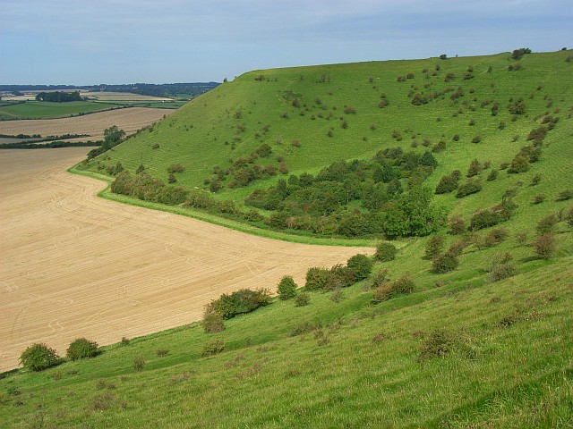
Aucombe Bottom is a picturesque valley located in the county of Wiltshire, England. Nestled within the Cranborne Chase Area of Outstanding Natural Beauty, it offers a tranquil and scenic retreat for nature enthusiasts and outdoor lovers.

The valley is characterized by its rolling hills, lush green meadows, and dense woodlands, creating a diverse and rich ecosystem. The River Ebble meanders through the valley, adding to its natural beauty and providing a habitat for various aquatic species.

Aucombe Bottom is renowned for its stunning flora and fauna. The valley is home to a wide range of plant species, including rare orchids, wildflowers, and ancient woodland. The diverse vegetation attracts an array of wildlife, such as butterflies, birds, and small mammals, making it a haven for nature lovers and birdwatchers.

The valley offers numerous walking trails and footpaths, allowing visitors to explore its natural wonders at their own pace. The scenic routes offer breathtaking views of the surrounding countryside, making it a popular destination for hikers and photographers.

In addition to its natural beauty, Aucombe Bottom also boasts historical and archaeological significance. The presence of ancient burial mounds and earthworks provides evidence of human habitation in the area dating back thousands of years.

Overall, Aucombe Bottom in Wiltshire is a captivating valley that combines stunning natural landscapes, diverse wildlife, and historical significance. It offers a peaceful and idyllic escape from the hustle and bustle of modern life, making it a must-visit destination for those seeking tranquility and natural beauty.

If you have any feedback on the listing, please let us know in the comments section below.

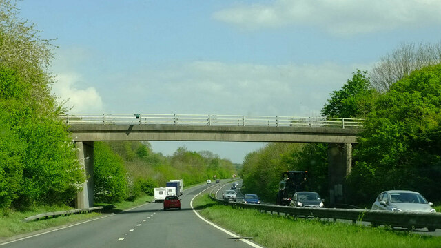
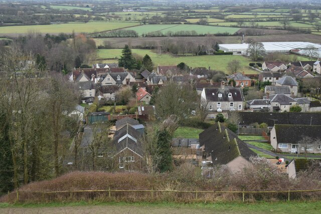
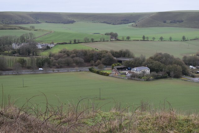
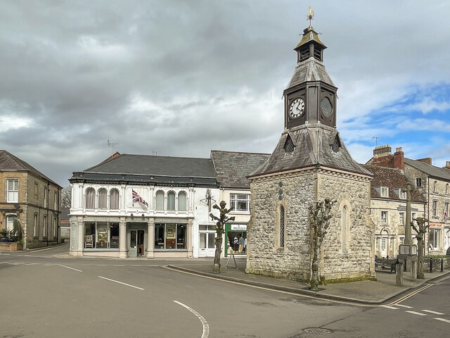
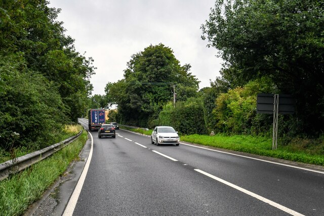
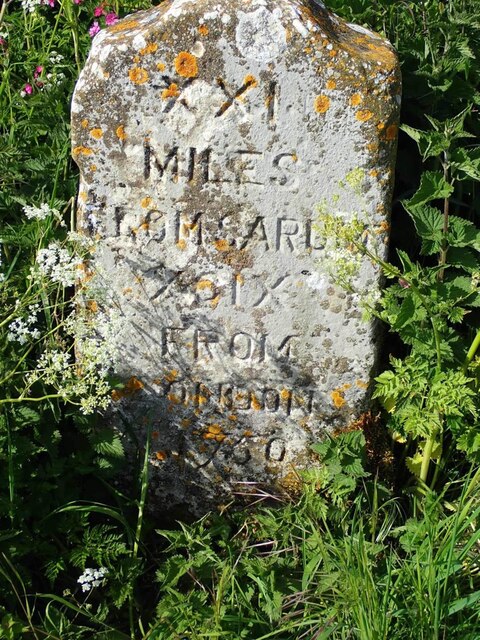
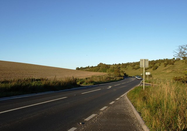
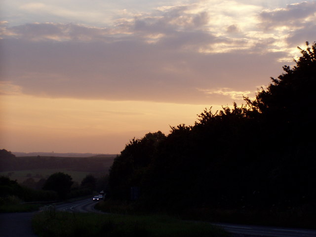
Aucombe Bottom Images

Images are sourced within 2km of 51.098828/-2.2492268 or Grid Reference ST8233. Thanks to Geograph Open Source API. All images are credited.

Bridge over A303 at Mere The bridge carries Manor Way, which in turn is carrying the Mid Wilts Way LDP.
Bridge over A303 at Mere
The bridge carries Manor Way, which in turn is carrying the Mid Wilts Way LDP.
View over Mere from Long Hill
Looking towards White Sheet Downs from Mere Castle The A303 passes under the bridge near the centre of this view.
Looking towards White Sheet Downs from Mere Castle
The A303 passes under the bridge near the centre of this view.
View down track to Manor Farm With Mere Castle beyond.
View down track to Manor Farm
With Mere Castle beyond.
Track towards Manor Farm The Mid Wilts Way descends form the White Sheet Downs towards Mere.
Track towards Manor Farm
The Mid Wilts Way descends form the White Sheet Downs towards Mere.
Northern edge of Great Bottom Terraced slopes of the White Sheet Downs.
Northern edge of Great Bottom
Terraced slopes of the White Sheet Downs.
Clock Tower Clock tower in The Square, at the junction of Castle Street, Church Street and Salisbury Street.  Dated 1868 and designed by London architects Harding and Bond, it replaced a former medieval market house.  Grade II listed - see <span class="nowrap"><a title="https://historicengland.org.uk/listing/the-list/list-entry/1130733?section=official-list-entry" rel="nofollow ugc noopener" href="https://historicengland.org.uk/listing/the-list/list-entry/1130733?section=official-list-entry">Link</a><img style="margin-left:2px;" alt="External link" title="External link - shift click to open in new window" src="https://s1.geograph.org.uk/img/external.png" width="10" height="10"/></span>.  Next to it on the right is Mere War Memorial of 1921 and in the left background is the late 19th Century Walton House.  Both are also grade II listed - see <span class="nowrap"><a title="https://historicengland.org.uk/listing/the-list/list-entry/1452025?section=official-list-entry" rel="nofollow ugc noopener" href="https://historicengland.org.uk/listing/the-list/list-entry/1452025?section=official-list-entry">Link</a><img style="margin-left:2px;" alt="External link" title="External link - shift click to open in new window" src="https://s1.geograph.org.uk/img/external.png" width="10" height="10"/></span> and <span class="nowrap"><a title="https://historicengland.org.uk/listing/the-list/list-entry/1318646?section=official-list-entry" rel="nofollow ugc noopener" href="https://historicengland.org.uk/listing/the-list/list-entry/1318646?section=official-list-entry">Link</a><img style="margin-left:2px;" alt="External link" title="External link - shift click to open in new window" src="https://s1.geograph.org.uk/img/external.png" width="10" height="10"/></span> respectively.
Clock Tower
Clock tower in The Square, at the junction of Castle Street, Church Street and Salisbury Street. Dated 1868 and designed by London architects Harding and Bond, it replaced a former medieval market house. Grade II listed - see LinkExternal link. Next to it on the right is Mere War Memorial of 1921 and in the left background is the late 19th Century Walton House. Both are also grade II listed - see LinkExternal link and LinkExternal link respectively.
Mere : Chaddenwick Hill A303 Looking along Chaddenwick Hill.
Mere : Chaddenwick Hill A303
Looking along Chaddenwick Hill.
Old Milestone by the B3095, Castle Street, Mere parish Metal plate attached to stone post by the B3095, in parish of Mere (Salisbury District), Castle Street, in front of Milestone Cottage, on South side of road. Wincanton iron plate, erected by the Wincanton turnpike trust in the 18th century. 

Inscription reads:-
Wincanton
7
Hindon
7

Grade II listed. 
List Entry Number: 1199925 <span class="nowrap"><a title="https://historicengland.org.uk/listing/the-list/list-entry/1199925" rel="nofollow ugc noopener" href="https://historicengland.org.uk/listing/the-list/list-entry/1199925">Link</a><img style="margin-left:2px;" alt="External link" title="External link - shift click to open in new window" src="https://s1.geograph.org.uk/img/external.png" width="10" height="10"/></span>

Milestone Society National ID: WI_WCHD07
Old Milestone by the B3095, Castle Street, Mere parish
Metal plate attached to stone post by the B3095, in parish of Mere (Salisbury District), Castle Street, in front of Milestone Cottage, on South side of road. Wincanton iron plate, erected by the Wincanton turnpike trust in the 18th century. Inscription reads:- Wincanton 7 Hindon 7 Grade II listed. List Entry Number: 1199925 LinkExternal link Milestone Society National ID: WI_WCHD07
Old Milestone by The Ridgeway, Mere Parish Carved stone post by the UC road, in parish of MERE (SALISBURY District), Ridgeway track; 1100m North West of the junction with the B3095, in middle of current tracks, in centre of road. Wilton Ox-drove stone, erected by an unknown authority in the 18th century. 

Inscription reads:- : XXII / MILES FROM / SARUM / C / FROM / LONDON / 1750 : 

Grade II Listed. List Entry Number: 1318640

Milestone Society National ID: WI_SAOD22.
Old Milestone by The Ridgeway, Mere Parish
Carved stone post by the UC road, in parish of MERE (SALISBURY District), Ridgeway track; 1100m North West of the junction with the B3095, in middle of current tracks, in centre of road. Wilton Ox-drove stone, erected by an unknown authority in the 18th century. Inscription reads:- : XXII / MILES FROM / SARUM / C / FROM / LONDON / 1750 : Grade II Listed. List Entry Number: 1318640 Milestone Society National ID: WI_SAOD22.
Old Milestone by the track on Mere Down, north of Mere Carved stone post by the UC road, in parish of MERE (SALISBURY District), Mere Down; 500m East of large house and junction with B3095, against fence, on North side of track. Wilton Ox-drove stone, erected by an unknown authority in the 18th century. 

Inscription reads:-
XXI
MILES
FROM SARUM
XCIX
FROM
LONDON
1750 

Grade II listed. List Entry Number: 1300867
<span class="nowrap"><a title="https://historicengland.org.uk/listing/the-list/list-entry/1300867" rel="nofollow ugc noopener" href="https://historicengland.org.uk/listing/the-list/list-entry/1300867">Link</a><img style="margin-left:2px;" alt="External link" title="External link - shift click to open in new window" src="https://s1.geograph.org.uk/img/external.png" width="10" height="10"/></span>

Milestone Society National ID: WI_SAOD21.
Old Milestone by the track on Mere Down, north of Mere
Carved stone post by the UC road, in parish of MERE (SALISBURY District), Mere Down; 500m East of large house and junction with B3095, against fence, on North side of track. Wilton Ox-drove stone, erected by an unknown authority in the 18th century. Inscription reads:- XXI MILES FROM SARUM XCIX FROM LONDON 1750 Grade II listed. List Entry Number: 1300867 LinkExternal link Milestone Society National ID: WI_SAOD21.
St. Michael's, Mere, Wiltshire
Churchyard, Mere
Churchyard, Mere
Mere Croquet Club Formed to make use of open space off Steep Street and preserve it from development when the bowls club moved elsewhere, this small ground accommodates a clubhouse, toilet block and boules as well as croquet.
Mere Croquet Club
Formed to make use of open space off Steep Street and preserve it from development when the bowls club moved elsewhere, this small ground accommodates a clubhouse, toilet block and boules as well as croquet.
Milestone Cottage, Mere The stone cottage dates from the 18th century and is Grade II listed.  It derives its name from the milestone at front of cottage.  For a close-up of the milestone <a href="https://www.geograph.org.uk/photo/2514394">ST8132 : Milestone, Castle Street, Mere</a>
Milestone Cottage, Mere
The stone cottage dates from the 18th century and is Grade II listed. It derives its name from the milestone at front of cottage. For a close-up of the milestone ST8132 : Milestone, Castle Street, Mere
Milestone, Castle Street, Mere The mid 18th century sandstone milestone stands adjacent to Milestone Cottage.  The milestone, when originally placed would have stood beside the London to Exeter turnpike road.
Milestone, Castle Street, Mere
The mid 18th century sandstone milestone stands adjacent to Milestone Cottage. The milestone, when originally placed would have stood beside the London to Exeter turnpike road.
The A303 at the foot of Chaddenwick Hill
Dusk Over Dorset The A303 taken at dusk from a layby at the turning to Barrow Street near Mere.
Dusk Over Dorset
The A303 taken at dusk from a layby at the turning to Barrow Street near Mere.
Show me another place!

Aucombe Bottom is located at Grid Ref: ST8233 (Lat: 51.098828, Lng: -2.2492268)

Unitary Authority: Wiltshire

Police Authority: Wiltshire

What 3 Words

///landmark.postings.suffice. Near Mere, Wiltshire

Related Wikis

Charnage Down Chalk Pit

Charnage Down Chalk Pit (grid reference ST837329) is a 3.7 hectare geological Site of Special Scientific Interest in Wiltshire, England, lying east of...

Mere, Wiltshire

Mere is a market town and civil parish in Wiltshire, England. It lies at the extreme southwestern tip of Salisbury Plain, close to the borders of Somerset...

Castle Hill, Mere

Castle Hill, also called Mere Castle, was a medieval fortification built by Richard, the Earl of Cornwall, in 1253 on a hill overlooking the town of Mere...

Dead Maid Quarry

Dead Maid Quarry (grid reference ST803324) is a 4,400 square metre geological Site of Special Scientific Interest in Mere, Wiltshire, England, notified...

White Sheet Hill

White Sheet Hill, also known as Whitesheet Hill, is a hill in the English county of Wiltshire. As one of the most westerly areas of downland in Britain...

Barrow Street, Wiltshire

Barrow Street is a hamlet in Wiltshire, England, about 1.9 miles (3.1 km) southeast of the town of Mere. The name comes from the early Bronze Age bowl...

West Knoyle

West Knoyle is a small village and civil parish in southwest Wiltshire, England, close to the southern edge of Salisbury Plain. The village is about 2...

Hang Wood

Hang Wood (grid reference ST861319) is a 20.3 hectare biological Site of Special Scientific Interest in Wiltshire, notified in 1986. == Sources == Natural...

Nearby Amenities

Located within 500m of 51.098828,-2.2492268
Aucombe Bottom
Place: locality
Lat/Long: 51.1010963/-2.2514147
Ashfield Bottom
Place: locality
Lat/Long: 51.0996407/-2.2434647
The data included in this document is from www.openstreetmap.org. The data is made available under ODbL.

Have you been to Aucombe Bottom?

Leave your review of Aucombe Bottom below (or comments, questions and feedback).