Shop Cleugh

Valley in Northumberland

England

Shop Cleugh

Heading away from Killhope Law A hill walker heading along the broad moorland ridge separating Weardale lying to the right, and West Allendale. Killhope Law's summit is around 300 metres behind the camera position.
Heading away from Killhope Law Credit: Trevor Littlewood

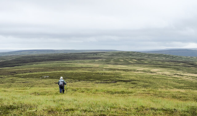
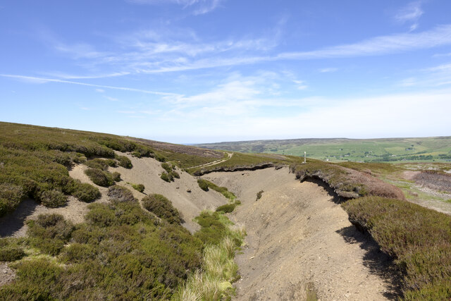
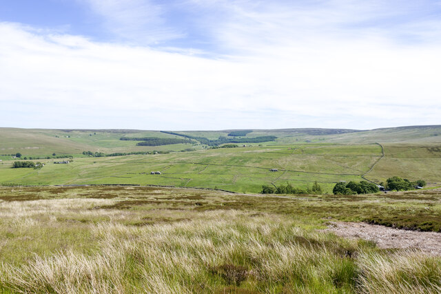
Shop Cleugh is a small village located in the scenic county of Northumberland, England. Nestled within the stunning Northumberland National Park, it is situated in the picturesque valley known as Cleugh Valley. The village is renowned for its unspoiled natural beauty, making it a popular destination for nature lovers and outdoor enthusiasts.

Shop Cleugh is characterized by its quaint charm, with traditional stone houses and a close-knit community. The village is surrounded by rolling hills, lush green fields, and enchanting woodlands, offering an idyllic setting for those seeking tranquility and a break from the hustle and bustle of city life.

Despite its small size, Shop Cleugh has a few notable features. The village is home to a local shop, which serves as a vital hub for residents and visitors alike. Here, one can find essential groceries, daily supplies, and even local products. The shop also acts as a meeting point for the community, fostering a sense of togetherness and camaraderie.

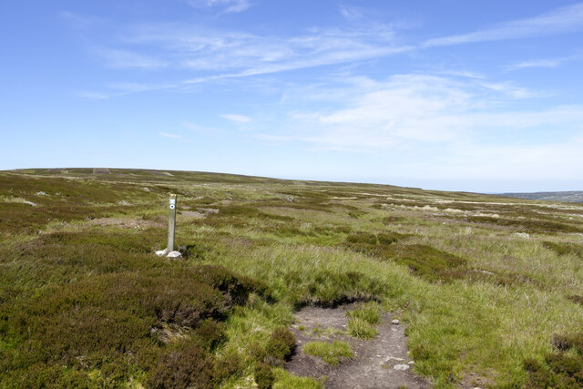
The surrounding area provides ample opportunities for outdoor activities such as hiking, cycling, and birdwatching. There are numerous walking trails that wind through the valley, offering breathtaking views of the surrounding countryside. Wildlife enthusiasts can spot a variety of bird species, including buzzards, owls, and kestrels, as well as other native animals like deer and hares.

Shop Cleugh is a hidden gem in Northumberland, offering a peaceful retreat in the heart of nature. Whether you seek a relaxing getaway or an adventure-filled excursion, this charming village has something to offer for everyone.

If you have any feedback on the listing, please let us know in the comments section below.
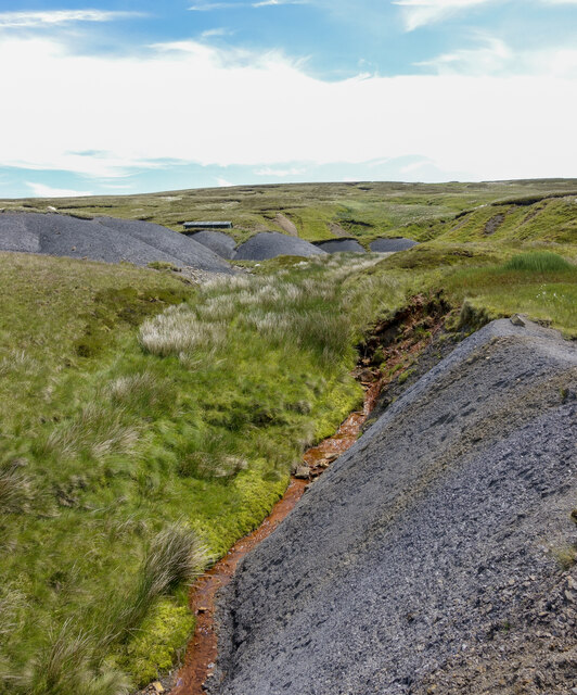
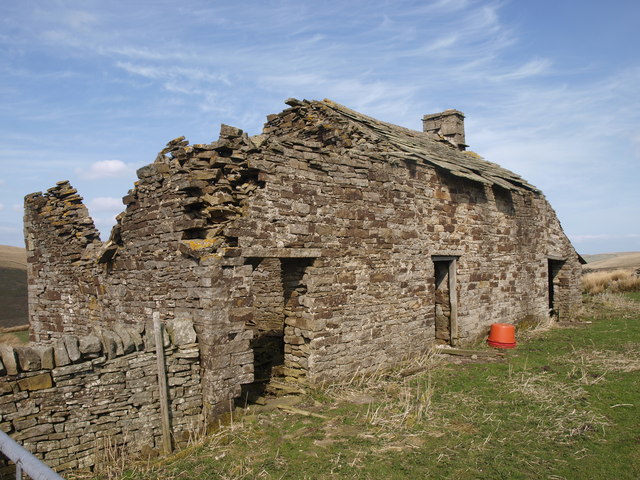
Shop Cleugh Images

Images are sourced within 2km of 54.811177/-2.2752897 or Grid Reference NY8246. Thanks to Geograph Open Source API. All images are credited.

Heading away from Killhope Law A hill walker heading along the broad moorland ridge separating Weardale lying to the right, and West Allendale. Killhope Law's summit is around 300 metres behind the camera position.
Heading away from Killhope Law
A hill walker heading along the broad moorland ridge separating Weardale lying to the right, and West Allendale. Killhope Law's summit is around 300 metres behind the camera position.
Bare ground of stream side adjacent to Nan Davison's Cleugh The cleugh is just out of view beyond the bare ground, descending left to right. A bridleway, the route of the Isaac Tea Trail, runs along the right edge of the groove; it can be seen in the distance emerging  from the stream's valley.
Bare ground of stream side adjacent to Nan Davison's Cleugh
The cleugh is just out of view beyond the bare ground, descending left to right. A bridleway, the route of the Isaac Tea Trail, runs along the right edge of the groove; it can be seen in the distance emerging from the stream's valley.
Moorland below route of bridleway The heather and grass moorland is on a slope descending towards Swin Hope, a tributary valley of East Allendale; that main valley lies beyond the middle-distance ridge. The village of Allenheads is there, below the coniferous plantations.
Moorland below route of bridleway
The heather and grass moorland is on a slope descending towards Swin Hope, a tributary valley of East Allendale; that main valley lies beyond the middle-distance ridge. The village of Allenheads is there, below the coniferous plantations.
Bridleway crossing moorland beside Blackway Head The bridleway is passing the minor moorland rise on its west side; it's also the route used by the named walk, Isaac's Tea Trail.
Bridleway crossing moorland beside Blackway Head
The bridleway is passing the minor moorland rise on its west side; it's also the route used by the named walk, Isaac's Tea Trail.
Moorland on south side of Blackway Head The foreground bog is adjacent to the route of a bridleway now incorporated into the named walk, Isaac's Tea Trail. The shallow dome on the horizon to the right is the minor summit at Blackway Head; to the left of it is the location named as Three Curricks.
Moorland on south side of Blackway Head
The foreground bog is adjacent to the route of a bridleway now incorporated into the named walk, Isaac's Tea Trail. The shallow dome on the horizon to the right is the minor summit at Blackway Head; to the left of it is the location named as Three Curricks.
Ochreous stream beside shaley slope Ochre is an iron oxide or hydroxide present in certain rocks and often found in uplands staining pools and watercourses. The flow of the stream in the image (Bridge Cleugh) is particularly strongly affected.
The loose, shaley material beside the stream is a natural feature. The similar piles higher on the slope have been bulldozed to create a flat parking area for a shooting hut - its roof can be seen.
Ochreous stream beside shaley slope
Ochre is an iron oxide or hydroxide present in certain rocks and often found in uplands staining pools and watercourses. The flow of the stream in the image (Bridge Cleugh) is particularly strongly affected. The loose, shaley material beside the stream is a natural feature. The similar piles higher on the slope have been bulldozed to create a flat parking area for a shooting hut - its roof can be seen.
Trig point and summit area of Killhope Law The pillar stands on the Northumberland / County Durham boundary. It's seen here in dry conditions; more usually there's something of a moat there, as in an image from Andrew Curtis - <a title="https://www.geograph.org.uk/photo/6595945" href="https://www.geograph.org.uk/photo/6595945">Link</a> .
The undulations on the left horizon are the Great and Little Dun Fells and Cross Fell.
Trig point and summit area of Killhope Law
The pillar stands on the Northumberland / County Durham boundary. It's seen here in dry conditions; more usually there's something of a moat there, as in an image from Andrew Curtis - Link . The undulations on the left horizon are the Great and Little Dun Fells and Cross Fell.
Abandoned shooting hut on Killhope Law Almost twelve years on from an earlier image - <a title="https://www.geograph.org.uk/photo/2029676" href="https://www.geograph.org.uk/photo/2029676">Link</a> - there's been significant deterioration to the building. Stone has burst from the bulge in the wall to the left of the door and there's a greater loss at the visible rear corner.
Abandoned shooting hut on Killhope Law
Almost twelve years on from an earlier image - Link - there's been significant deterioration to the building. Stone has burst from the bulge in the wall to the left of the door and there's a greater loss at the visible rear corner.
Moorland with embedded grouse butt Butt No. 9 is beside a hill road which has climbed from the East Allen valley, seen in the distance in the image. Dodd Reservoir is just visible above the top of the butt.
Moorland with embedded grouse butt
Butt No. 9 is beside a hill road which has climbed from the East Allen valley, seen in the distance in the image. Dodd Reservoir is just visible above the top of the butt.
Large cairn on Killhope Law It's clear that the cairn, (which is not quite at the summit of Killhope Law), has been constructed rather than just being a heap of stones, although it's deteriorating and is becoming the latter.
There have been changes on the hill top since the photographer's last visit. There's an addition to the cairn - the pole with the hill name on top created in metal. And behind the camera position close to the actual summit, there's a newly erected tall, wooden pole which replaces the one which stood there for decades but fell a few years ago.
Large cairn on Killhope Law
It's clear that the cairn, (which is not quite at the summit of Killhope Law), has been constructed rather than just being a heap of stones, although it's deteriorating and is becoming the latter. There have been changes on the hill top since the photographer's last visit. There's an addition to the cairn - the pole with the hill name on top created in metal. And behind the camera position close to the actual summit, there's a newly erected tall, wooden pole which replaces the one which stood there for decades but fell a few years ago.
Cleugh above Shieldrigg Bridge
The S (Sheepfold) Aptly named  - see the satellite image <span class="nowrap"><a title="http://wtp2.appspot.com/wheresthepath.htm?lat=54.81394823525864&lon=-2.301902817025226&gz=19&oz=8&gt=1" rel="nofollow ugc noopener" href="http://wtp2.appspot.com/wheresthepath.htm?lat=54.81394823525864&lon=-2.301902817025226&gz=19&oz=8&gt=1">Link</a><img style="margin-left:2px;" alt="External link" title="External link - shift click to open in new window" src="https://s1.geograph.org.uk/img/external.png" width="10" height="10"/></span>.
The S (Sheepfold)
Aptly named - see the satellite image LinkExternal link.
West Allen Dale south of Carrshield (2) Shows the location of <a href="https://www.geograph.org.uk/photo/2324627">NY8046 : The S (Sheepfold)</a>.
West Allen Dale south of Carrshield (2)
Shows the location of NY8046 : The S (Sheepfold).
Loudside
Loudside
Mind the roof The upturned orange tubs were a lovely place to sit for a lunch stop but only if you were prepared to gamble on the rather large and heavy roof slates remaining in place. Luckily they did.
Mind the roof
The upturned orange tubs were a lovely place to sit for a lunch stop but only if you were prepared to gamble on the rather large and heavy roof slates remaining in place. Luckily they did.
Curricks, Carrshield Moor
Grouse Butts on Hartley Moor
Currick on Knockshield Moor
Show me another place!

Shop Cleugh is located at Grid Ref: NY8246 (Lat: 54.811177, Lng: -2.2752897)

Unitary Authority: Northumberland

Police Authority: Northumbria

What 3 Words

///react.mammoths.huddled. Near Alston, Cumbria

Related Wikis

Coalcleugh

Coalcleugh is a hamlet in Northumberland, England. It is situated in the Pennines between Penrith and Hexham. In the past it was well known as a lead mining...

Allendale Moors

Allendale Moors is a Site of Special Scientific Interest (SSSI) in Northumberland, England. The upland moorland ridge site is listed for its heath, flush...

Carr Shield

Carrshield is a village in Northumberland, in England. It is situated in the Pennines approximately between Penrith and Hexham. It is a small village with...

Old Moss Lead Vein

Old Moss Lead Vein, also known as Killhope Head, is a Site of Special Scientific Interest in the Wear Valley district of County Durham, England. It consists...

Have you been to Shop Cleugh?

Leave your review of Shop Cleugh below (or comments, questions and feedback).