Baguley Bottoms
Valley in Cheshire
England
Baguley Bottoms
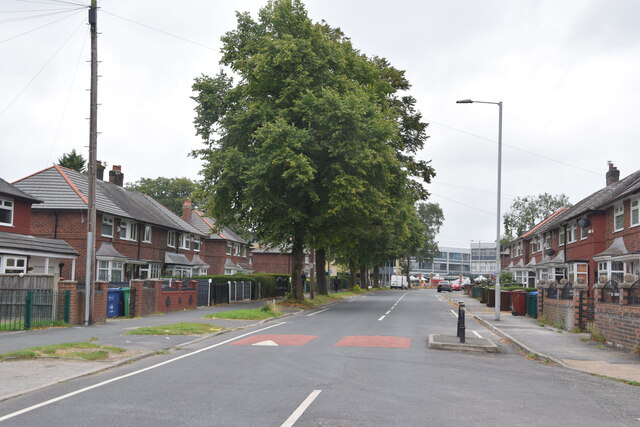
Baguley Bottoms is a small valley located in the county of Cheshire, England. Situated southwest of Manchester, it covers an area of approximately 2 square miles and is part of the borough of Trafford. The valley is characterized by its picturesque landscape, with rolling hills, meandering streams, and lush greenery.
Baguley Bottoms is known for its rich history, dating back to medieval times. The area was primarily used for agriculture, with fields of crops and grazing lands for livestock. Over the years, the valley has seen various developments, including the establishment of several small settlements and the construction of roads and bridges.
Today, Baguley Bottoms is a mix of residential and rural areas, offering a peaceful and tranquil environment for its residents. The valley is home to a small but tight-knit community, with a range of amenities available nearby. Residents can enjoy the beauty of nature through walking trails and parks that dot the landscape.
The valley is also fortunate to have a diverse range of wildlife, including various bird species, small mammals, and insects. This makes Baguley Bottoms a popular spot for nature enthusiasts and birdwatchers.
Overall, Baguley Bottoms offers a serene and idyllic setting, where residents can enjoy the beauty of nature while still being within reach of urban amenities. Its rich history and natural charm make it a unique and attractive location within Cheshire.
If you have any feedback on the listing, please let us know in the comments section below.
Baguley Bottoms Images
Images are sourced within 2km of 53.394203/-2.2713467 or Grid Reference SJ8288. Thanks to Geograph Open Source API. All images are credited.


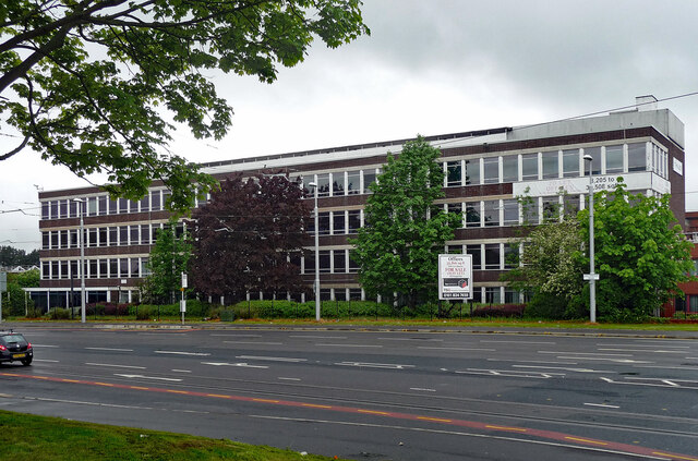


![Delta House, Wavell Road, Manchester An interesting Y-shaped 1960s office block, the upper storeys above a hexagonal ground floor.
I would have tried to get a closer look, but the &quot;ISO27001-compliant building has some of the most sophisticated security of any data centre in Europe ... with an on-site police-linked, NSI Gold Approved, BS5979 certified control room and alarm receiving centre [it is] unique in the UK. ...biometric access controls, virtual tripwires, visitor turnstiles and man-traps, and full-height perimeter fencing provide multiple layers of physical security.&quot; Operated by Teledata UK Ltd.](https://s0.geograph.org.uk/geophotos/07/57/16/7571684_3af7842c.jpg)


Baguley Bottoms is located at Grid Ref: SJ8288 (Lat: 53.394203, Lng: -2.2713467)
Unitary Authority: Manchester
Police Authority: Greater Manchester
What 3 Words
///saying.feared.spun. Near Didsbury, Manchester
Nearby Locations
Related Wikis
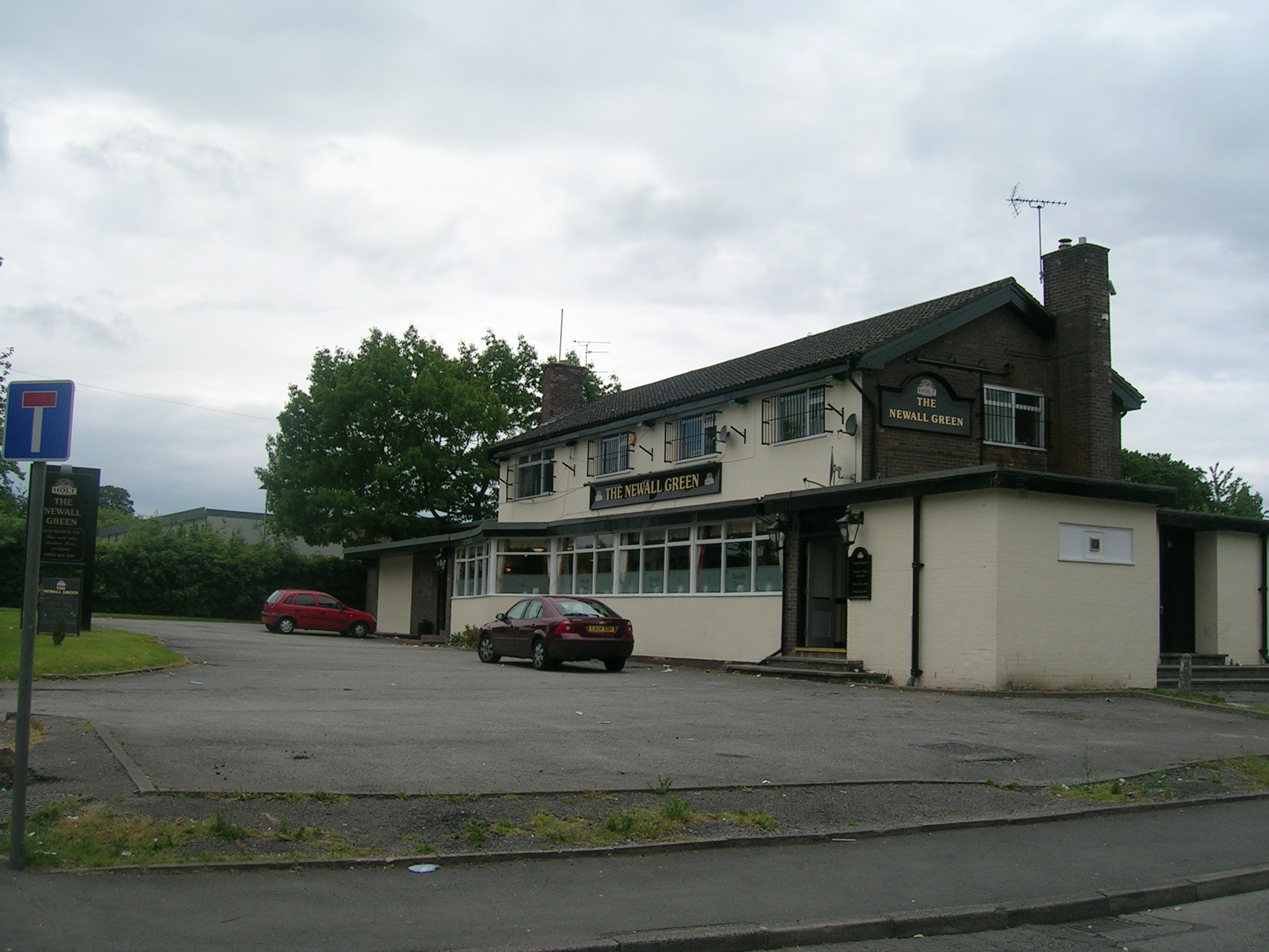
Newall Green
Newall Green is an area in the Wythenshawe district of Manchester, England. It is on the west side of the M56 motorway, approximately 1 mile from Wythenshawe...
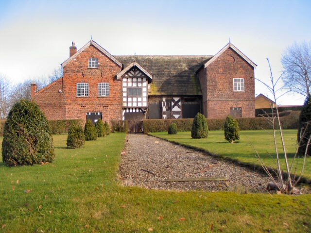
Baguley Hall
Baguley Hall is a 14th-century timber-framed building in Baguley, Greater Manchester (grid reference SJ81628874), North West England.A former country house...

Manchester Wythenshawe (UK Parliament constituency)
Manchester Wythenshawe was a parliamentary constituency centred on the Wythenshawe suburb of Manchester. It returned one Member of Parliament (MP) to...
Haveley tram stop
Haveley tram stop was a proposed tram stop on the phase 3b plans to Manchester Airport which would have been located immediately east of the M56 motorway...
Related Videos
First snow in Manchester 2024❄️❄️❄️
My way after work to home. #snow #firstsnow @winter #cold #morning #afterwork #5am #Street #walk #lonely #letmedownslowly ...

A walk in Historic Rose Hill Woodland in Northenden, October 2021 #rosehill #Nature #Manchester
Rose Hill in Northenden , a short walk through the woods on a autumn afternoon. Travel down Longley Lane towards Gatley , then ...

Walking the Mersey, pt.4: Northenden, Chorlton-cum-Hardy, Sale
Manchester adventure. Mersey; Northenden; Chorlton-cum-Hardy; Sale. Friends. Birds. Water. Sunset. Tram. Sexy. Fun. Oasis.

“Good Morning Northern Moor, Manchester!”It’s 8am on a snowy day ,as you travel to work
A short drone footage video of Northern Moor, Manchester on a very cold (snowy) January morning in 2023. It shows the ...
Nearby Amenities
Located within 500m of 53.394203,-2.2713467Have you been to Baguley Bottoms?
Leave your review of Baguley Bottoms below (or comments, questions and feedback).