Hindberry Cleugh

Valley in Roxburghshire

Scotland

Hindberry Cleugh

The Pennine Way near Stell Rig
The Pennine Way near Stell Rig Credit: Dave Kelly

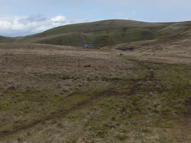
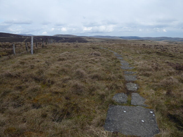
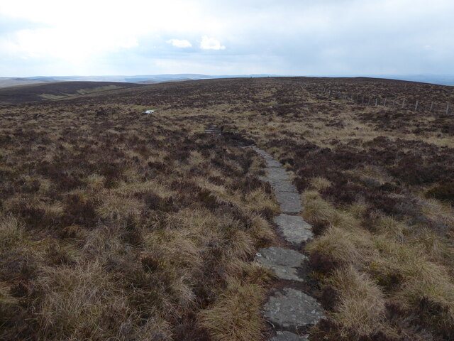
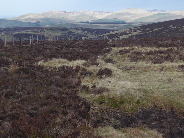
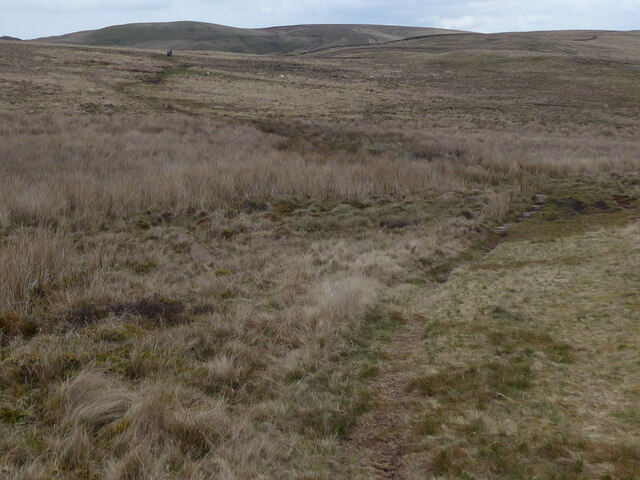
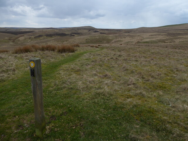
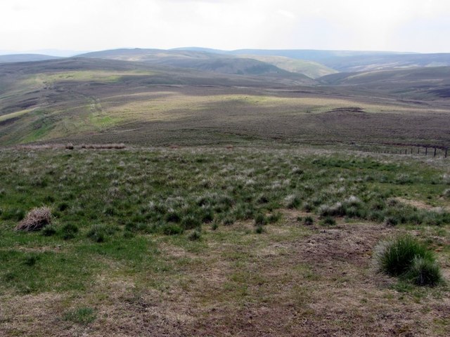
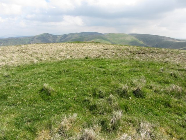
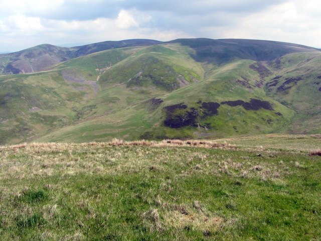
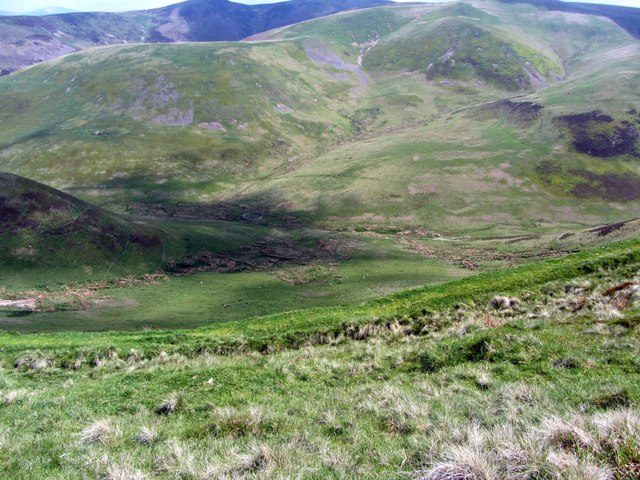
Hindberry Cleugh is a picturesque valley located in the county of Roxburghshire, Scotland. The cleugh, which is a Scottish term for a narrow, steep-sided valley, is nestled amidst the rolling hills and beautiful countryside of the Scottish Borders region.

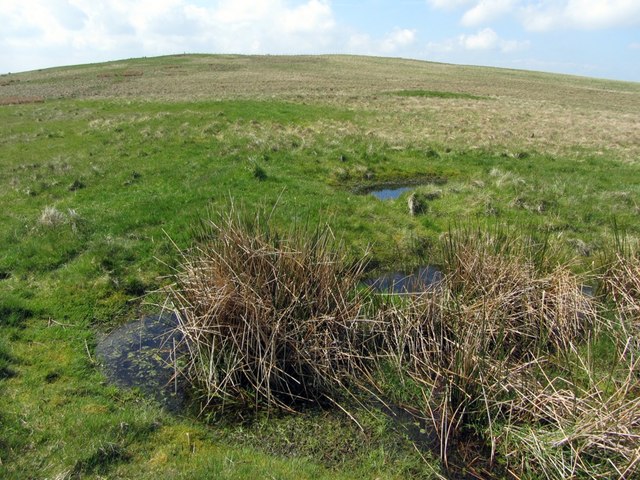
The valley of Hindberry Cleugh is a haven for nature lovers and outdoor enthusiasts, offering stunning landscapes and a wealth of wildlife. It is characterized by its lush green meadows, babbling streams, and dense woodlands, providing a tranquil and serene environment for visitors to enjoy.

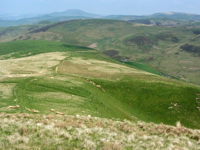
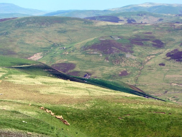
Throughout the valley, there are several walking trails and hiking routes that allow visitors to explore the area's natural beauty. These trails offer breathtaking views of the surrounding hills and valleys, and provide opportunities for spotting various bird species, including pheasants, owls, and woodpeckers. The woodlands are also home to red squirrels, badgers, and deer.

Hindberry Cleugh is an idyllic spot for picnics and relaxation. The peaceful atmosphere and stunning scenery make it a perfect place to unwind and soak in the beauty of nature. The valley's abundance of wildflowers, including bluebells and primroses, adds to its charm, creating a colorful and vibrant backdrop.

Despite its remote location, Hindberry Cleugh is easily accessible by car, with a small parking area available for visitors. The valley is also nearby to several other attractions in Roxburghshire, including historic castles, quaint villages, and the popular River Tweed for fishing enthusiasts.

Overall, Hindberry Cleugh offers a captivating and enchanting experience for those seeking to immerse themselves in the scenic wonders of the Scottish countryside.

If you have any feedback on the listing, please let us know in the comments section below.

Hindberry Cleugh Images

Images are sourced within 2km of 55.416373/-2.3033706 or Grid Reference NT8013. Thanks to Geograph Open Source API. All images are credited.

The Pennine Way near Stell Rig
The Pennine Way on Lamb Hill
The Pennine Way near Beefstand Hill
The Pennine Way near Raeshaw Fell
The Pennine Way near Stell Rig
Moorland on Border Ridge above Dormount Hope The line of the linear earthwork that surrounds the head of the valley of Dormount Hope can be seen on the left. It has been interpreted as a Medieval deer trap described here <a href="https://www.geograph.org.uk/photo/3508971">NT7913 : Linear earthwork towards Peelinick</a>
Moorland on Border Ridge above Dormount Hope
The line of the linear earthwork that surrounds the head of the valley of Dormount Hope can be seen on the left. It has been interpreted as a Medieval deer trap described here NT7913 : Linear earthwork towards Peelinick
Turf mound north-east of Raeshaw Fell
Small ponds north-east of Raeshaw Fell Probably a similar structure to the nearby grassy mound <a href="https://www.geograph.org.uk/photo/3501692">NT7913 : Turf mound north-east of Raeshaw Fell</a> visible behind to the right which had also shown signs of disturbance. The small ponds were filled with active tadpoles.
Small ponds north-east of Raeshaw Fell
Probably a similar structure to the nearby grassy mound NT7913 : Turf mound north-east of Raeshaw Fell visible behind to the right which had also shown signs of disturbance. The small ponds were filled with active tadpoles.
Stell Rig above Dormount Hope The valley just to the right of the long ridge of Stell Rig is called Hymer's Gap. Its burn has a source just west of Lamb Hill on the England-Scotland Border.
Stell Rig above Dormount Hope
The valley just to the right of the long ridge of Stell Rig is called Hymer's Gap. Its burn has a source just west of Lamb Hill on the England-Scotland Border.
Ridge west of Dormount Hope The remote farmhouse of Peelinick is just right of centre.
Ridge west of Dormount Hope
The remote farmhouse of Peelinick is just right of centre.
Peelinick from the south Huntford Hill with its hillfort and sheepfolds can be seen above the valley of Yett Burn.
Peelinick from the south
Huntford Hill with its hillfort and sheepfolds can be seen above the valley of Yett Burn.
Sheepfold in Dormount Hope
Old wall above Dormount Hope
Linear earthwork north-east of Raeshaw Fell The earthwork that runs along both west and east sides of the steep valley of Dormount Hope is part of the deer trap described here <a href="https://www.geograph.org.uk/photo/3508971">NT7913 : Linear earthwork towards Peelinick</a>
Linear earthwork north-east of Raeshaw Fell
The earthwork that runs along both west and east sides of the steep valley of Dormount Hope is part of the deer trap described here NT7913 : Linear earthwork towards Peelinick
Linear earthwork towards Peelinick Part of the substantial earthwork that extends along the west and east edges and southern head of Dormount Hope. It has a ditch on the downhill side, making it impossible for anything to leap out of the valley onto the grazing lands of Raeshaw Fell but perhaps so designed to let deer in from the outside. It may be the dyke referred to in Liber de Melrose (dated to around AD 1190), and if not added to or extended since then, may be one of the first examples of emparkment in Scotland. It is known that baronial and monastic hunting rights were given in this parish at an early date in the Medieval period.
John Barber (1999) in his paper 'The Linear Earthworks of Southern Scotland' classifies this example as a 'park pale or enclosure boundary'.
Canmore describes it as a 'deer-trap' <span class="nowrap"><a title="http://canmore.rcahms.gov.uk/en/site/318822/details/dormount+hope/" rel="nofollow ugc noopener" href="http://canmore.rcahms.gov.uk/en/site/318822/details/dormount+hope/">Link</a><img style="margin-left:2px;" alt="External link" title="External link - shift click to open in new window" src="https://s1.geograph.org.uk/img/external.png" width="10" height="10"/></span>

There is a photo in the opposite direction here <a href="https://www.geograph.org.uk/photo/3508957">NT7913 : Linear earthwork north-east of Raeshaw Fell</a>
Linear earthwork towards Peelinick
Part of the substantial earthwork that extends along the west and east edges and southern head of Dormount Hope. It has a ditch on the downhill side, making it impossible for anything to leap out of the valley onto the grazing lands of Raeshaw Fell but perhaps so designed to let deer in from the outside. It may be the dyke referred to in Liber de Melrose (dated to around AD 1190), and if not added to or extended since then, may be one of the first examples of emparkment in Scotland. It is known that baronial and monastic hunting rights were given in this parish at an early date in the Medieval period. John Barber (1999) in his paper 'The Linear Earthworks of Southern Scotland' classifies this example as a 'park pale or enclosure boundary'. Canmore describes it as a 'deer-trap' LinkExternal link There is a photo in the opposite direction here NT7913 : Linear earthwork north-east of Raeshaw Fell
Dormount Hope below Tuft Slack
Raeshaw Fell from the north
Show me another place!

Hindberry Cleugh is located at Grid Ref: NT8013 (Lat: 55.416373, Lng: -2.3033706)

Unitary Authority: The Scottish Borders

Police Authority: The Lothians and Scottish Borders

What 3 Words

///given.ambitions.insect. Near Rochester, Northumberland

Related Wikis

Windy Gyle

Windy Gyle is a mountain in the Cheviot Hills range, on the border between England and Scotland. Like the other hills in the area, it is rounded and grass...

Pennymuir Roman camps

The Pennymuir Roman camps are situated southeast of Jedburgh in the Scottish Borders area of Scotland, near the Anglo-Scottish border, in the former Roxburghshire...

Chew Green

Chew Green is the site of the ancient Roman encampment, commonly but erroneously called Ad Fines (Latin: The Limits) on the 1885-1900 edition of the Ordnance...

Hownam

Hownam or Hounam is a small village and parish situated 8 miles east of Jedburgh in the Scottish Borders area of Scotland, near the Anglo-Scottish border...

Nearby Amenities

Located within 500m of 55.416373,-2.3033706
Lamb Hill
Ele: 511
Natural: peak
Lat/Long: 55.4140029/-2.2984639
The data included in this document is from www.openstreetmap.org. The data is made available under ODbL.

Have you been to Hindberry Cleugh?

Leave your review of Hindberry Cleugh below (or comments, questions and feedback).