Sisterpath Cleugh

Valley in Berwickshire

Scotland

Sisterpath Cleugh

Barley at Blackburn Looking northeast into Haddies Cleugh.
Barley at Blackburn Credit: M J Richardson

Sisterpath Cleugh is a picturesque valley located in the region of Berwickshire, Scotland. Nestled amidst the rolling hills and lush greenery, this valley is renowned for its natural beauty and tranquil atmosphere. The name "Cleugh" refers to a narrow valley or ravine, and Sisterpath Cleugh certainly lives up to this description.

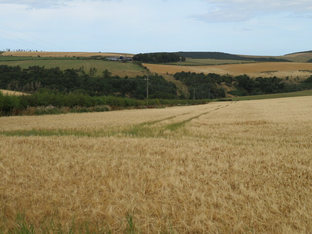
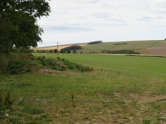
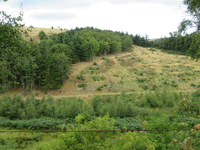
The valley is characterized by its stunning landscape, with steep slopes and rocky outcrops dotting the terrain. The lush vegetation, including a variety of trees, shrubs, and wildflowers, adds to the charm of the area. A small stream meanders through the valley, adding a touch of serenity as it gurgles along.

Sisterpath Cleugh is a haven for wildlife enthusiasts, as it is home to a diverse range of flora and fauna. Visitors may spot various bird species, such as buzzards and kestrels, soaring through the skies. Additionally, the valley provides a habitat for small mammals like badgers, foxes, and rabbits.

Outdoor enthusiasts often flock to Sisterpath Cleugh to enjoy the numerous walking and hiking trails that crisscross the area. The trails offer breathtaking views of the surrounding countryside, making it a popular destination for nature lovers and photographers alike.

Overall, Sisterpath Cleugh is a hidden gem in Berwickshire, offering visitors a chance to immerse themselves in the tranquil beauty of the Scottish countryside. Whether it's a leisurely stroll, a challenging hike, or simply a peaceful retreat, this valley has something to offer for everyone.

If you have any feedback on the listing, please let us know in the comments section below.

Sisterpath Cleugh Images

Images are sourced within 2km of 55.898193/-2.3224427 or Grid Reference NT7967. Thanks to Geograph Open Source API. All images are credited.

Barley at Blackburn Looking northeast into Haddies Cleugh.
Barley at Blackburn
Looking northeast into Haddies Cleugh.
Cattle pasture at Blackburn With Edmond's Dean beyond.
Cattle pasture at Blackburn
With Edmond's Dean beyond.
Bowshiel Dean and Wood With a gap in the wood which has been replanted.
Bowshiel Dean and Wood
With a gap in the wood which has been replanted.
Newly cut hay/silage fields at Blackburn House The house is by the wood, and mast, at the top of the hill.
Newly cut hay/silage fields at Blackburn House
The house is by the wood, and mast, at the top of the hill.
Blackburn road-end on the A1 near Grantshouse With Give Way sign and Southern Upland Way finger post. For a view in the opposite direction, in 2011, see <a href="https://www.geograph.org.uk/photo/2627098">NT7966 : Southern Upland Way</a>.
Blackburn road-end on the A1 near Grantshouse
With Give Way sign and Southern Upland Way finger post. For a view in the opposite direction, in 2011, see NT7966 : Southern Upland Way.
The A1 at Blackburn Roadend Looking north. The road and the railway passes through a shallow gap at the eastern end of the Lammermuir Hills. The red and white marker indicating a break [farm gate, drive entrance, joining road etc.] in rural road margins was used for many years on the Continent before being adopted in the UK.
The A1 at Blackburn Roadend
Looking north. The road and the railway passes through a shallow gap at the eastern end of the Lammermuir Hills. The red and white marker indicating a break [farm gate, drive entrance, joining road etc.] in rural road margins was used for many years on the Continent before being adopted in the UK.
Burgess bridge crossing the East Coast Main Line At Penmanshiel, where the Southern Upland Way also crosses the railway.
Burgess bridge crossing the East Coast Main Line
At Penmanshiel, where the Southern Upland Way also crosses the railway.
The East Coast Main Line Looking north, passing Penmanshiel Wood. With plenty of spare rails.
The East Coast Main Line
Looking north, passing Penmanshiel Wood. With plenty of spare rails.
The East Coast Main Line Looking south, with Penmanshiel Wood on the left.
The East Coast Main Line
Looking south, with Penmanshiel Wood on the left.
Litter on the ex-A1 An ideal site for dumpers - a bit of the A1 which was bypassed after the Penmanshiel Tunnel collapsed in 1979. As a result the railway, and so the road, had to be realigned. See  <a href="https://www.geograph.org.uk/photo/3592056">NT7967 : Penmanshiel Tunnel Disaster Memorial</a>. Google Earth imagery of April 2021 shows this caravan, and three other 'things' of similar size nearby - they have now gone.
Litter on the ex-A1
An ideal site for dumpers - a bit of the A1 which was bypassed after the Penmanshiel Tunnel collapsed in 1979. As a result the railway, and so the road, had to be realigned. See NT7967 : Penmanshiel Tunnel Disaster Memorial. Google Earth imagery of April 2021 shows this caravan, and three other 'things' of similar size nearby - they have now gone.
Telecommunication mast at Bowshiel A small mast in an enclosure, with a missing lock on the left hand cabinet, allowing access from outside the cage, which seemed strange.
Telecommunication mast at Bowshiel
A small mast in an enclosure, with a missing lock on the left hand cabinet, allowing access from outside the cage, which seemed strange.
The road from Bowshiel Going down to its junction with the A1.
The road from Bowshiel
Going down to its junction with the A1.
A view through the trees From the road to Bowshiel, across the A1 to a field with a protected crop [others in the area are Swedes], and across the East Coast Main Line [in a cutting] to Penmanshiel Wood.
A view through the trees
From the road to Bowshiel, across the A1 to a field with a protected crop [others in the area are Swedes], and across the East Coast Main Line [in a cutting] to Penmanshiel Wood.
Penmanshiel Wood Looking across the A1, with a stubble field between wood and road.
Penmanshiel Wood
Looking across the A1, with a stubble field between wood and road.
Protected crop Between Penmanshiel Wood and the A1. Others in the area are Swedes <a href="https://www.geograph.org.uk/photo/7265491">NT8862 : Protected crop at Blackhill</a>.
Protected crop
Between Penmanshiel Wood and the A1. Others in the area are Swedes NT8862 : Protected crop at Blackhill.
The A1 at Penmanshiel Heading north towards Edinburgh. The white post is one of those markers that indicate an access to/from the carriageway.
The A1 at Penmanshiel
Heading north towards Edinburgh. The white post is one of those markers that indicate an access to/from the carriageway.
Road sign for Penmanshiel on the A1 Looking north on a single-track section of the Great North Road.
Road sign for Penmanshiel on the A1
Looking north on a single-track section of the Great North Road.
Speed camera on the A1 For traffic heading south [60mph!].
Speed camera on the A1
For traffic heading south [60mph!].
Show me another place!

Sisterpath Cleugh is located at Grid Ref: NT7967 (Lat: 55.898193, Lng: -2.3224427)

Unitary Authority: The Scottish Borders

Police Authority: The Lothians and Scottish Borders

What 3 Words

///anchovies.decoder.bridges. Near Chirnside, Scottish Borders

Nearby Locations

Sisterpath Cleugh

Related Wikis

Penmanshiel Tunnel

Penmanshiel Tunnel is a now-disused railway tunnel near Grantshouse, Berwickshire, in the Scottish Borders region of Scotland. It was formerly part of...

Old Cambus

Old Cambus is a village in the Scottish Borders, Scotland. St. Helens church, which is now a ruin served the area. == References ==

Grantshouse

Grantshouse is a small village in Berwickshire in the Scottish Borders of Scotland. It lies on the A1, and its nearest railway stations are Dunbar to the...

Grantshouse railway station

Grantshouse railway station served the village of Grantshouse, Berwickshire, Scotland from 1846 to 1964 on the East Coast Main Line. == History == The...

Nearby Amenities

Located within 500m of 55.898193,-2.3224427
Barrier: jersey_barrier
Lat/Long: 55.8954577/-2.3287957
Penmanshiel Tunnel Collapse
Description: Memorial for the two men that were killed when the Penmanshiel tunnel collapsed on 17 March 1979.
Historic: memorial
Wikidata: Q7163109
Wikipedia: en:Penmanshiel Tunnel
Lat/Long: 55.8964657/-2.3274389
Penmanshiel
Place: hamlet
Lat/Long: 55.8965596/-2.3172418
Generator Method: photovoltaic
Generator Output Electricity: yes
Generator Source: solar
Generator Type: solar_photovoltaic_panel
Power: generator
Lat/Long: 55.8971219/-2.3152125
Power: pole
Lat/Long: 55.8960776/-2.315705
Power: pole
Lat/Long: 55.8965718/-2.3154642
The data included in this document is from www.openstreetmap.org. The data is made available under ODbL.

Have you been to Sisterpath Cleugh?

Leave your review of Sisterpath Cleugh below (or comments, questions and feedback).