Alston Cleugh

Valley in Northumberland

England

Alston Cleugh

A689 descending Westwards from Killhope Cross Long descent from Killhope Cross towards the Nent Valley in Cumbria
A689 descending Westwards from Killhope Cross Credit: Chris Heaton

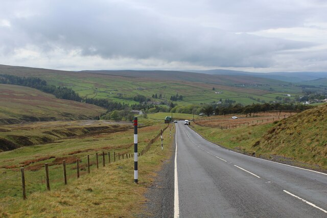
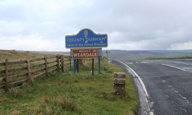
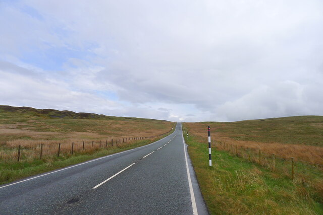
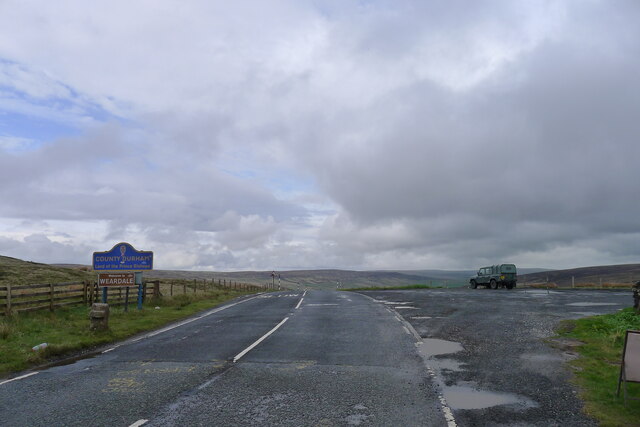
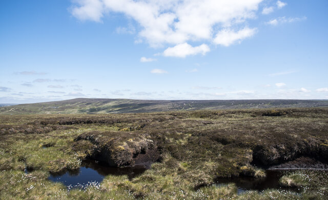
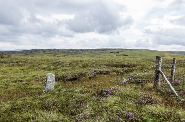
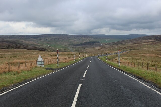
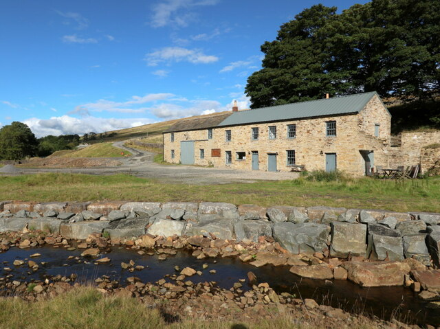
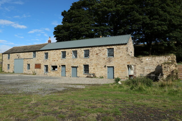
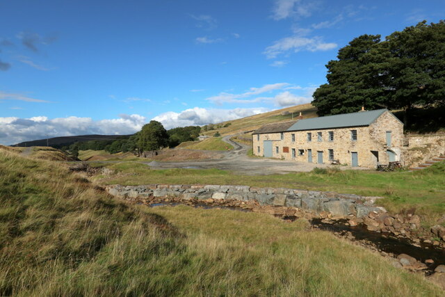
Alston Cleugh is a small, picturesque valley situated in the county of Northumberland, England. Nestled within the Pennines, it is located approximately 20 miles southeast of the town of Hexham. The valley is renowned for its stunning natural beauty, with rolling hills, lush green meadows, and charming stone-built cottages dotting the landscape.

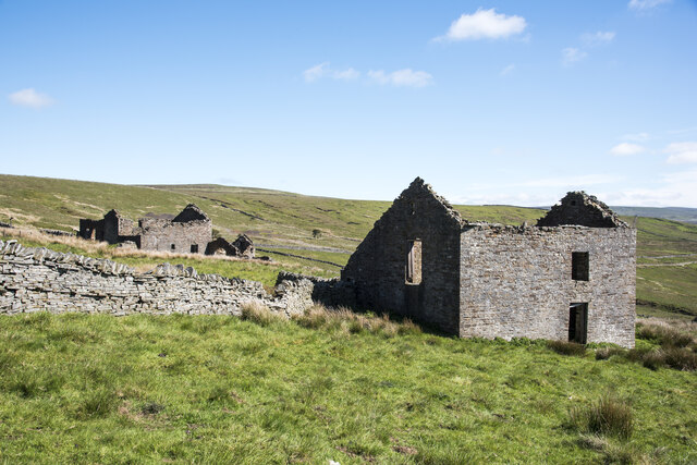
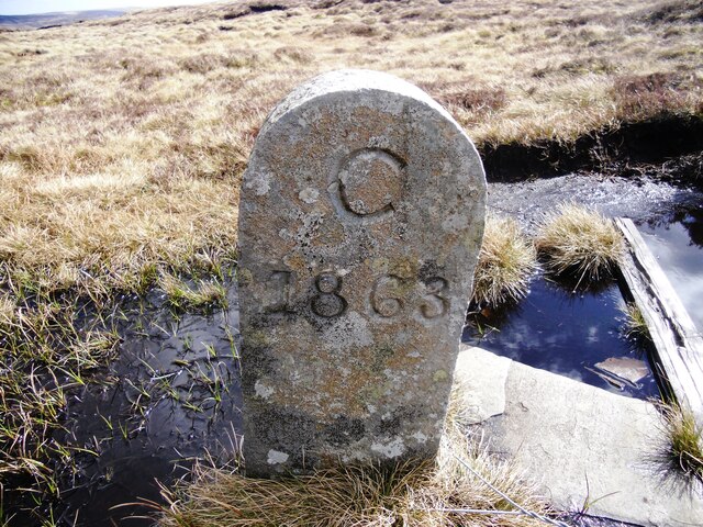
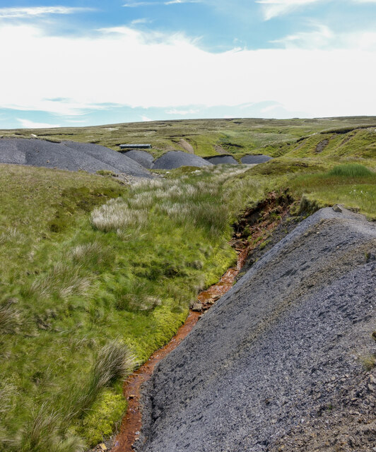
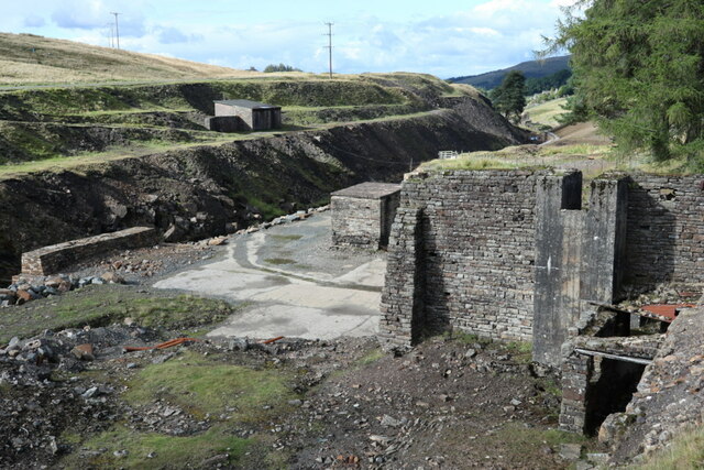
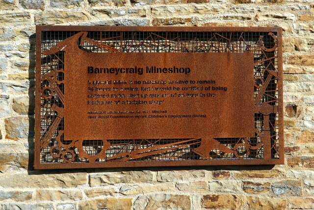
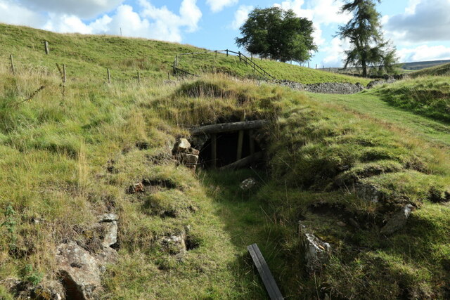
The area has a rich history, dating back centuries. Alston Cleugh was once a bustling lead mining center during the 18th and 19th centuries, and remnants of this industrial past can still be seen today. The ruins of old mine buildings and mine shafts serve as reminders of the area's mining heritage.

The valley is also home to a vibrant community, with a population of around 600 residents. The locals have a strong sense of community pride and are known for their warm hospitality. The village of Alston, which lies within the Cleugh, is the main hub of activity, offering a range of amenities including shops, cafes, and pubs.

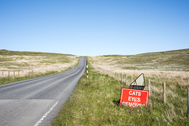
Alston Cleugh is a haven for outdoor enthusiasts, attracting hikers, cyclists, and nature lovers from near and far. The valley is crisscrossed by a network of scenic walking trails, offering breathtaking views of the surrounding countryside. The nearby Nenthead Mines and South Tynedale Railway are popular attractions for visitors, providing insights into the area's industrial past.

In summary, Alston Cleugh in Northumberland is a picturesque valley that combines stunning natural beauty with a rich history. With its charming village, thriving community, and abundance of outdoor activities, it offers a delightful retreat for those seeking to immerse themselves in the beauty of the English countryside.

If you have any feedback on the listing, please let us know in the comments section below.

Alston Cleugh Images

Images are sourced within 2km of 54.799889/-2.3162003 or Grid Reference NY7945. Thanks to Geograph Open Source API. All images are credited.

A689 descending Westwards from Killhope Cross Long descent from Killhope Cross towards the Nent Valley in Cumbria
A689 descending Westwards from Killhope Cross
Long descent from Killhope Cross towards the Nent Valley in Cumbria
Furniture on Killhope Cross County sign, Weardale sign, watershed and the old stone cross stand beside the highest point an "A" Road attains in England.
Furniture on Killhope Cross
County sign, Weardale sign, watershed and the old stone cross stand beside the highest point an "A" Road attains in England.
Milestone on the A689 east of Nenthead Listed Grade II, early 19th century, for the Alston Turnpike Trust <span class="nowrap"><a title="https://historicengland.org.uk/listing/the-list/list-entry/1104870?section=official-list-entry" rel="nofollow ugc noopener" href="https://historicengland.org.uk/listing/the-list/list-entry/1104870?section=official-list-entry">Link</a><img style="margin-left:2px;" alt="External link" title="External link - shift click to open in new window" src="https://s1.geograph.org.uk/img/external.png" width="10" height="10"/></span>. For close-up <a href="https://www.geograph.org.uk/photo/5622943">NY7843 : Old Milestone by the A689, south east of Nenthead</a>
Milestone on the A689 east of Nenthead
Listed Grade II, early 19th century, for the Alston Turnpike Trust LinkExternal link. For close-up NY7843 : Old Milestone by the A689, south east of Nenthead
The A689 climbing eastward to the watershed at Slate Hill Leaving Nentdale and approaching the head of Weardale
The A689 climbing eastward to the watershed at Slate Hill
Leaving Nentdale and approaching the head of Weardale
The A689 crossing the Cumbria/Durham county boundary at the top of Slate Hill The 'Kilhope Cross' stone cross in front of the sign is a Listed Grade II "Boundary marker of uncertain date but possibly medieval; moved to its present site in C18." <span class="nowrap"><a title="https://historicengland.org.uk/listing/the-list/list-entry/1326948?section=official-list-entry" rel="nofollow ugc noopener" href="https://historicengland.org.uk/listing/the-list/list-entry/1326948?section=official-list-entry">Link</a><img style="margin-left:2px;" alt="External link" title="External link - shift click to open in new window" src="https://s1.geograph.org.uk/img/external.png" width="10" height="10"/></span>
The A689 crossing the Cumbria/Durham county boundary at the top of Slate Hill
The 'Kilhope Cross' stone cross in front of the sign is a Listed Grade II "Boundary marker of uncertain date but possibly medieval; moved to its present site in C18." LinkExternal link
Peat banks on The Dodd There's a prominent cairn at the camera position, not in view in the image of course. It's likely that it was built to mark what someone considered to be the hill's summit but others think differently. The authoritative web site 'Hillbagging' has the summit to be at NY 79159 45761, over 100 m. SSW. of the cairn. At a different location again there's an OS spot height of 614 m. which might well be an accurate height but of course there's no necessary claim of that as the highest point. It's impossible to judge; when at The Dodd's summit area there are clearly countless locations which could be the prime one!
The view from the cairn over the peat banks is across the head of West Allendale with Killhope Law distant.
Peat banks on The Dodd
There's a prominent cairn at the camera position, not in view in the image of course. It's likely that it was built to mark what someone considered to be the hill's summit but others think differently. The authoritative web site 'Hillbagging' has the summit to be at NY 79159 45761, over 100 m. SSW. of the cairn. At a different location again there's an OS spot height of 614 m. which might well be an accurate height but of course there's no necessary claim of that as the highest point. It's impossible to judge; when at The Dodd's summit area there are clearly countless locations which could be the prime one! The view from the cairn over the peat banks is across the head of West Allendale with Killhope Law distant.
Cruel suggestion along Cumbrian road! This is the A689 heading towards Killhope Cross on the boundary between Cumbria and County Durham which is the highest point reached by any A-classified road in England - 623 metres. (It's beaten in Scotland by the A93 at the Cairnwell Pass - 670 metres.)
It's to be hoped that the road sign isn't advertising a barbaric service!
(Cruelty there too to the English language... missing apostrophe!)
Cruel suggestion along Cumbrian road!
This is the A689 heading towards Killhope Cross on the boundary between Cumbria and County Durham which is the highest point reached by any A-classified road in England - 623 metres. (It's beaten in Scotland by the A93 at the Cairnwell Pass - 670 metres.) It's to be hoped that the road sign isn't advertising a barbaric service! (Cruelty there too to the English language... missing apostrophe!)
Roofless barns at Roughside At over 520 m. the farmhouse at Roughside must have been one of the highest occupied houses in the UK. It's long gone but the barns there still stand as roofless ruins.
Roofless barns at Roughside
At over 520 m. the farmhouse at Roughside must have been one of the highest occupied houses in the UK. It's long gone but the barns there still stand as roofless ruins.
Boundary stone near fence angle on Slate Hill Slate Hill is a location close to the A689 at Killhope Cross, the highest point reached by any A-classified road in England.
The stone is cleanly and deeply cut, 'C 1863'. It's on the County Durham / Cumbria boundary  which in 1863 would have been between Durham and Cumberland. It's possible then, but not certain that the C denotes the county; there's no corresponding D on the other side, nothing in fact.
Knoutberry Hill is in the distance.
Boundary stone near fence angle on Slate Hill
Slate Hill is a location close to the A689 at Killhope Cross, the highest point reached by any A-classified road in England. The stone is cleanly and deeply cut, 'C 1863'. It's on the County Durham / Cumbria boundary which in 1863 would have been between Durham and Cumberland. It's possible then, but not certain that the C denotes the county; there's no corresponding D on the other side, nothing in fact. Knoutberry Hill is in the distance.
Old Boundary Marker County Boundary Marker against the boundary fence on Slate Hill, north of  Killhope Cross CBED_ALS. On the boundary of Alston Moor, Cumbria, was Cumberland, and Stanhope, County Durham.

Milestone Society National ID: CU_ALMSTA02cb
Old Boundary Marker
County Boundary Marker against the boundary fence on Slate Hill, north of Killhope Cross CBED_ALS. On the boundary of Alston Moor, Cumbria, was Cumberland, and Stanhope, County Durham. Milestone Society National ID: CU_ALMSTA02cb
Descending East off Killhope Cross A689 descending off Killhope Cross into County Durham and towards Weardale
Descending East off Killhope Cross
A689 descending off Killhope Cross into County Durham and towards Weardale
Ochreous stream beside shaley slope Ochre is an iron oxide or hydroxide present in certain rocks and often found in uplands staining pools and watercourses. The flow of the stream in the image (Bridge Cleugh) is particularly strongly affected.
The loose, shaley material beside the stream is a natural feature. The similar piles higher on the slope have been bulldozed to create a flat parking area for a shooting hut - its roof can be seen.
Ochreous stream beside shaley slope
Ochre is an iron oxide or hydroxide present in certain rocks and often found in uplands staining pools and watercourses. The flow of the stream in the image (Bridge Cleugh) is particularly strongly affected. The loose, shaley material beside the stream is a natural feature. The similar piles higher on the slope have been bulldozed to create a flat parking area for a shooting hut - its roof can be seen.
Carrshield lead mines and ore works The small building on the west bank of River West Allen is next to the adit of Scraithole Mine. This was the second mine at the Carrshield complex. Scraithole Mine was operated during the 19th century by the Beaumont Company, and was reopened in the 1950s when it continued to be operational until 1981. Access to this mine was also through an adit; the entrance is situated on the left bank of the river immediately east of the track to Greenpit, opposite Bluerow Cottages <a href="https://www.geograph.org.uk/photo/7292516">NY8046 : Scraithole Mine, Carrshield</a>.
Carrshield lead mines and ore works
The small building on the west bank of River West Allen is next to the adit of Scraithole Mine. This was the second mine at the Carrshield complex. Scraithole Mine was operated during the 19th century by the Beaumont Company, and was reopened in the 1950s when it continued to be operational until 1981. Access to this mine was also through an adit; the entrance is situated on the left bank of the river immediately east of the track to Greenpit, opposite Bluerow Cottages NY8046 : Scraithole Mine, Carrshield.
Barneycraig Mine Shop, Carrshield The two storeyed lodging shop is the largest in the north Pennines and retains several original internal features including arched furnace openings and a blacksmiths' forge. Inside and surrounding the lodging shop there are a series of culverts, some of which are thought to have been used to drain the mines; others are thought to be related to the water management system associated with ore processing at the northern end of the monument.

Also see: <a href="https://www.geograph.org.uk/photo/7292526">NY8046 : Plaque, Barneycraig Mine Shop, Carrshield</a> and <a href="https://www.geograph.org.uk/photo/7292245">NY8046 : Barneycraig Mine Shop, Carrshield</a>

The range of buildings is Grade II Listed (1042932): <span class="nowrap"><a title="https://historicengland.org.uk/listing/the-list/list-entry/1042932" rel="nofollow ugc noopener" href="https://historicengland.org.uk/listing/the-list/list-entry/1042932">Link</a><img style="margin-left:2px;" alt="External link" title="External link - shift click to open in new window" src="https://s1.geograph.org.uk/img/external.png" width="10" height="10"/></span>

With funding from Historic England and the Heritage Lottery Fund, the North Pennines Area of Outstanding Natural Beauty Partnership renovated the building using traditional methods and existing materials, converting the upper floors into a basic Camping Barn. It is now owned and managed by Allen Valleys Enterprise Limited, for the benefit of the local community.  ​
<span class="nowrap"><a title="https://www.carrshieldcampingbarn.co.uk/" rel="nofollow ugc noopener" href="https://www.carrshieldcampingbarn.co.uk/">Link</a><img style="margin-left:2px;" alt="External link" title="External link - shift click to open in new window" src="https://s1.geograph.org.uk/img/external.png" width="10" height="10"/></span> <span class="nowrap"><a title="https://web.archive.org/web/20221003161945/https://www.carrshieldcampingbarn.co.uk/" rel="nofollow ugc noopener" href="https://web.archive.org/web/20221003161945/https://www.carrshieldcampingbarn.co.uk/">Archive Link</a><img style="margin-left:2px;" alt="External link" title="External link - shift click to open in new window" src="https://s1.geograph.org.uk/img/external.png" width="10" height="10"/></span>
Barneycraig Mine Shop, Carrshield
The two storeyed lodging shop is the largest in the north Pennines and retains several original internal features including arched furnace openings and a blacksmiths' forge. Inside and surrounding the lodging shop there are a series of culverts, some of which are thought to have been used to drain the mines; others are thought to be related to the water management system associated with ore processing at the northern end of the monument. Also see: NY8046 : Plaque, Barneycraig Mine Shop, Carrshield and NY8046 : Barneycraig Mine Shop, Carrshield The range of buildings is Grade II Listed (1042932): LinkExternal link With funding from Historic England and the Heritage Lottery Fund, the North Pennines Area of Outstanding Natural Beauty Partnership renovated the building using traditional methods and existing materials, converting the upper floors into a basic Camping Barn. It is now owned and managed by Allen Valleys Enterprise Limited, for the benefit of the local community. ​ LinkExternal link Archive LinkExternal link
Barneycraig Mine Shop, Carrshield Notice attached to front wall of restored building now used as a bunk-house <a href="https://www.geograph.org.uk/photo/7292241">NY8046 : Barneycraig Mine Shop, Carrshield</a>.

"I should think it no hardship to have remained 24 hours in a mine, but I would be terrified of being ordered to be shut up quarter of an hour in the bedroom of a lodging shop’. 
Assistant Commissioner, Dr W.R. Mitchell (1842), Royal Commission Report on Employment of Children (Mines).
Barneycraig Mine Shop, Carrshield
Notice attached to front wall of restored building now used as a bunk-house NY8046 : Barneycraig Mine Shop, Carrshield. "I should think it no hardship to have remained 24 hours in a mine, but I would be terrified of being ordered to be shut up quarter of an hour in the bedroom of a lodging shop’. Assistant Commissioner, Dr W.R. Mitchell (1842), Royal Commission Report on Employment of Children (Mines).
Barneycraig Mine Shop, Carrshield The monument includes the remains of two lead mines and an ore works, situated on the base and lower slopes of the valley of the West Allen at Carrshield. The visible remains of the lead industry at Carrshield are complex and represent several phases of mining over three centuries. The latest phase of the mining dominates, although earlier remains will survive beneath these, as well as in the areas untouched by later mining. The earliest known mining activity at the site was the Barney Crag Horse level, situated at the southern end of the complex; this mine was opened during the 1760s and continued in use throughout the 19th century. The access to this mine was through an adit, or horizontal tunnel into the valley side.

The second mine at the complex was Scraithole Mine which was operated during the 19th century by the Beaumont Company, and was reopened in the 1950s when it continued to be operational until 1981. Access to this mine was also through an adit; the entrance is situated on the left bank of the river immediately east of the track to Greenpit, opposite Bluerow Cottages.

Historic England Scheduled Monument (1015849): <span class="nowrap"><a title="https://historicengland.org.uk/listing/the-list/list-entry/1015849" rel="nofollow ugc noopener" href="https://historicengland.org.uk/listing/the-list/list-entry/1015849">Link</a><img style="margin-left:2px;" alt="External link" title="External link - shift click to open in new window" src="https://s1.geograph.org.uk/img/external.png" width="10" height="10"/></span>

Barney Crag Industrial Complex, RCHME Report (1992): <span class="nowrap"><a title="https://historicengland.org.uk/research/results/reports/7293/BarneyCragIndustrialComplexCarrShieldNorthumberland" rel="nofollow ugc noopener" href="https://historicengland.org.uk/research/results/reports/7293/BarneyCragIndustrialComplexCarrShieldNorthumberland">Link</a><img style="margin-left:2px;" alt="External link" title="External link - shift click to open in new window" src="https://s1.geograph.org.uk/img/external.png" width="10" height="10"/></span> <span class="nowrap"><a title="https://web.archive.org/web/20221003171209/https://historicengland.org.uk/research/results/reports/7293/BarneyCragIndustrialComplexCarrShieldNorthumberland" rel="nofollow ugc noopener" href="https://web.archive.org/web/20221003171209/https://historicengland.org.uk/research/results/reports/7293/BarneyCragIndustrialComplexCarrShieldNorthumberland">Archive Link</a><img style="margin-left:2px;" alt="External link" title="External link - shift click to open in new window" src="https://s1.geograph.org.uk/img/external.png" width="10" height="10"/></span>

Carne, P. and Jenkins, C. (2015). Barney Craig Mine Water Treatment Scheme, Carrshield, Northumberland - heritage assessment. Archaeological Services, Durham University.
<span class="nowrap"><a title="https://doi.org/10.5284/1037930" rel="nofollow ugc noopener" href="https://doi.org/10.5284/1037930">Link</a><img style="margin-left:2px;" alt="External link" title="External link - shift click to open in new window" src="https://s1.geograph.org.uk/img/external.png" width="10" height="10"/></span>

In 2016, Northern Archaeological Associates was commissioned to assist with the remedial works at Carrshield designed to redirect water into the River West Allen away from the spoil heaps of the former mine workings. This consisted of the archaeological monitoring of soil removal, repair of the mine tailings retaining wall and the partial demolition of a miner’s cottage at nearby Low Blue Row to make it safe.
<span class="nowrap"><a title="https://www.northernarchaeologicalassociates.co.uk/drainage-works-carrshield-and-coalcleugh" rel="nofollow ugc noopener" href="https://www.northernarchaeologicalassociates.co.uk/drainage-works-carrshield-and-coalcleugh">Link</a><img style="margin-left:2px;" alt="External link" title="External link - shift click to open in new window" src="https://s1.geograph.org.uk/img/external.png" width="10" height="10"/></span> <span class="nowrap"><a title="https://web.archive.org/web/20221005120609/https://www.northernarchaeologicalassociates.co.uk/drainage-works-carrshield-and-coalcleugh" rel="nofollow ugc noopener" href="https://web.archive.org/web/20221005120609/https://www.northernarchaeologicalassociates.co.uk/drainage-works-carrshield-and-coalcleugh">Archive Link</a><img style="margin-left:2px;" alt="External link" title="External link - shift click to open in new window" src="https://s1.geograph.org.uk/img/external.png" width="10" height="10"/></span>
Barneycraig Mine Shop, Carrshield
The monument includes the remains of two lead mines and an ore works, situated on the base and lower slopes of the valley of the West Allen at Carrshield. The visible remains of the lead industry at Carrshield are complex and represent several phases of mining over three centuries. The latest phase of the mining dominates, although earlier remains will survive beneath these, as well as in the areas untouched by later mining. The earliest known mining activity at the site was the Barney Crag Horse level, situated at the southern end of the complex; this mine was opened during the 1760s and continued in use throughout the 19th century. The access to this mine was through an adit, or horizontal tunnel into the valley side. The second mine at the complex was Scraithole Mine which was operated during the 19th century by the Beaumont Company, and was reopened in the 1950s when it continued to be operational until 1981. Access to this mine was also through an adit; the entrance is situated on the left bank of the river immediately east of the track to Greenpit, opposite Bluerow Cottages. Historic England Scheduled Monument (1015849): LinkExternal link Barney Crag Industrial Complex, RCHME Report (1992): LinkExternal link Archive LinkExternal link Carne, P. and Jenkins, C. (2015). Barney Craig Mine Water Treatment Scheme, Carrshield, Northumberland - heritage assessment. Archaeological Services, Durham University. LinkExternal link In 2016, Northern Archaeological Associates was commissioned to assist with the remedial works at Carrshield designed to redirect water into the River West Allen away from the spoil heaps of the former mine workings. This consisted of the archaeological monitoring of soil removal, repair of the mine tailings retaining wall and the partial demolition of a miner’s cottage at nearby Low Blue Row to make it safe. LinkExternal link Archive LinkExternal link
Mine adit near Barneycraig Mine Shop, Carrshield Lead mine adit portal, probably C18th. Built of roughly squared rubble with a round-arched tunnel. The actual portal has fallen but the arching survives intact from 4 metres back. This was the Barneycraig Horse Level, working the rich Barneycraig Vein, and was driven c.1760 and continued in use throughout the C19th.

The adit portal is Grade II Listed (1155612): <span class="nowrap"><a title="https://historicengland.org.uk/listing/the-list/list-entry/1155612" rel="nofollow ugc noopener" href="https://historicengland.org.uk/listing/the-list/list-entry/1155612">Link</a><img style="margin-left:2px;" alt="External link" title="External link - shift click to open in new window" src="https://s1.geograph.org.uk/img/external.png" width="10" height="10"/></span>
Mine adit near Barneycraig Mine Shop, Carrshield
Lead mine adit portal, probably C18th. Built of roughly squared rubble with a round-arched tunnel. The actual portal has fallen but the arching survives intact from 4 metres back. This was the Barneycraig Horse Level, working the rich Barneycraig Vein, and was driven c.1760 and continued in use throughout the C19th. The adit portal is Grade II Listed (1155612): LinkExternal link
Show me another place!

Alston Cleugh is located at Grid Ref: NY7945 (Lat: 54.799889, Lng: -2.3162003)

Unitary Authority: Northumberland

Police Authority: Northumbria

What 3 Words

///tightest.enormous.cult. Near Alston, Cumbria

Nearby Locations

Alston Cleugh The Dodd

Related Wikis

Nearby Amenities

Located within 500m of 54.799889,-2.3162003
Coalcleugh
Place: hamlet
Wikidata: Q5137854
Wikipedia: en:Coalcleugh
Lat/Long: 54.8008372/-2.3108806
Abandoned: yes
Man Made: mineshaft
Lat/Long: 54.8026991/-2.3219376
Abandoned: yes
Man Made: mineshaft
Lat/Long: 54.8034877/-2.3175422
Abandoned: yes
Man Made: mineshaft
Lat/Long: 54.8033451/-2.3170542
Abandoned: yes
Man Made: mineshaft
Lat/Long: 54.8039909/-2.317934
Abandoned: yes
Man Made: mineshaft
Lat/Long: 54.8037572/-2.3177072
Abandoned: yes
Man Made: mineshaft
Lat/Long: 54.7958511/-2.3194488
Abandoned: yes
Man Made: mineshaft
Lat/Long: 54.7960277/-2.319329
Abandoned: yes
Man Made: mineshaft
Lat/Long: 54.7964917/-2.3189149
Abandoned: yes
Man Made: mineshaft
Lat/Long: 54.7966233/-2.3182946
Abandoned: yes
Man Made: mineshaft
Lat/Long: 54.7968979/-2.3178033
Abandoned: yes
Man Made: mineshaft
Lat/Long: 54.7971098/-2.3174641
Abandoned: yes
Man Made: mineshaft
Lat/Long: 54.797256/-2.3172538
Abandoned: yes
Man Made: mineshaft
Lat/Long: 54.7988339/-2.3152056
Abandoned: yes
Man Made: mineshaft
Lat/Long: 54.7993659/-2.314012
Abandoned: yes
Man Made: mineshaft
Lat/Long: 54.7998379/-2.3134115
Allendale Common
Place: locality
Lat/Long: 54.7996133/-2.3207983
Coalcleugh Mine
Historic: mine
Lat/Long: 54.8007872/-2.3128408
Abandoned: yes
Man Made: adit
Lat/Long: 54.803968/-2.3145295
Coalcleugh Farm
Place: farm
Lat/Long: 54.8007863/-2.3097587
Generator Method: wind_turbine
Generator Source: wind
Power: generator
Lat/Long: 54.8013242/-2.3124732
The data included in this document is from www.openstreetmap.org. The data is made available under ODbL.

Have you been to Alston Cleugh?

Leave your review of Alston Cleugh below (or comments, questions and feedback).