Mossy Bottom
Valley in Yorkshire South Lakeland
England
Mossy Bottom

Mossy Bottom is a picturesque valley located in the heart of Yorkshire, England. Surrounded by rolling hills and lush greenery, this charming village offers residents and visitors a peaceful retreat from the hustle and bustle of modern life.
The valley gets its name from the abundance of moss-covered stones that dot the landscape, adding to its rustic and idyllic charm. Mossy Bottom is known for its stunning natural beauty, with crystal-clear streams and meandering footpaths that invite outdoor enthusiasts to explore the area.
The village itself is a small, close-knit community with a population of around 500. It is home to a delightful mix of traditional stone cottages and more modern houses, blending seamlessly with the surrounding countryside. The friendly locals take great pride in their village and its heritage, ensuring that Mossy Bottom retains its authentic character.
Although small in size, Mossy Bottom offers a range of amenities to cater to the needs of its residents. The village boasts a charming pub, where locals and visitors can enjoy a pint of locally brewed ale and indulge in traditional Yorkshire dishes. Additionally, there is a village hall that hosts various community events throughout the year, fostering a strong sense of community spirit.
For those seeking outdoor activities, Mossy Bottom offers ample opportunities for walking, hiking, and cycling. The valley is crisscrossed by a network of well-maintained footpaths and trails, allowing visitors to immerse themselves in the natural beauty of the area.
Overall, Mossy Bottom is a hidden gem in the Yorkshire countryside, offering a tranquil and beautiful setting for those seeking respite from the demands of everyday life.
If you have any feedback on the listing, please let us know in the comments section below.
Mossy Bottom Images
Images are sourced within 2km of 54.248704/-2.3455148 or Grid Reference SD7783. Thanks to Geograph Open Source API. All images are credited.


Mossy Bottom is located at Grid Ref: SD7783 (Lat: 54.248704, Lng: -2.3455148)
Division: West Riding
Administrative County: Cumbria
District: South Lakeland
Police Authority: Cumbria
What 3 Words
///octagon.cabinet.erupt. Near Ingleton, North Yorkshire
Nearby Locations
Related Wikis

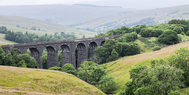
Dent Head Viaduct
Dent Head Viaduct is a railway viaduct on the Settle–Carlisle line in Dentdale, Cumbria, England. It is the second major viaduct on the line northwards...
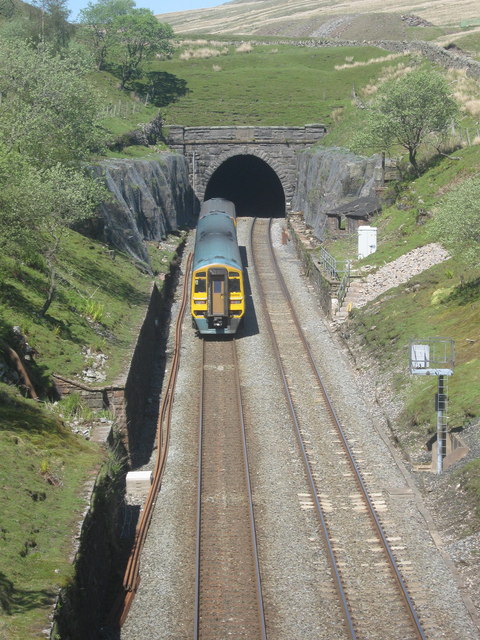
Blea Moor Tunnel
Blea Moor Tunnel is a 2,629 yards (1.494 mi)(2,404 m) railway tunnel located between Ribblehead Viaduct and Dent railway station in England. It is the...

Newby Head
Newby Head, Newby Head Farm or Newby Head Inn is part of the Beresford Estate and was a popular drovers' inn in North Yorkshire, England. Now a farmhouse...

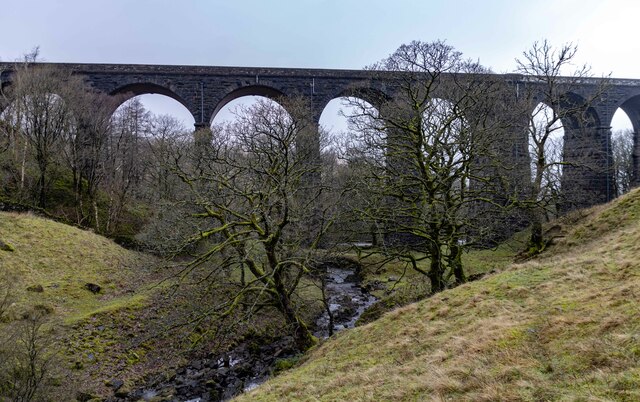
Arten Gill Viaduct
Arten Gill Viaduct is an eleven-arch railway bridge in Dentdale, Cumbria, England. The viaduct carries the Settle to Carlisle railway line over Artengill...
Nearby Amenities
Located within 500m of 54.248704,-2.3455148Have you been to Mossy Bottom?
Leave your review of Mossy Bottom below (or comments, questions and feedback).