Shore Dean

Valley in Roxburghshire

Scotland

Shore Dean

Hownham Mains Hownam has several spellings knocking around various maps:Hownam, Hounam, Hownham.
Hownham Mains Credit: Richard Webb

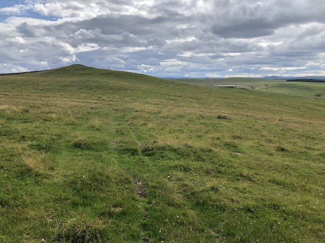
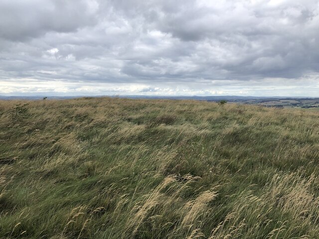
Shore Dean is a picturesque valley located in Roxburghshire, a county in the Scottish Borders region of Scotland. Nestled within the beautiful Scottish countryside, this scenic valley offers breathtaking views and a tranquil atmosphere.

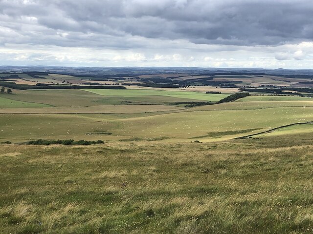
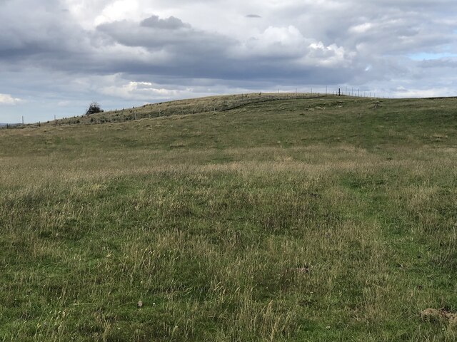
The valley is known for its lush greenery and rolling hills, which are dotted with charming farms and cottages. It is also home to a meandering river that adds to the area's natural beauty. The landscape is perfect for outdoor enthusiasts, with opportunities for hiking, cycling, and wildlife spotting.

Shore Dean is a popular destination for those seeking a peaceful retreat away from the hustle and bustle of city life. The valley attracts visitors who are looking to immerse themselves in nature and enjoy the serenity of the countryside. The area is also renowned for its vibrant wildlife, including various bird species and small mammals.

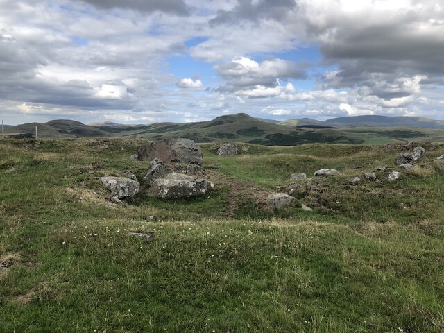
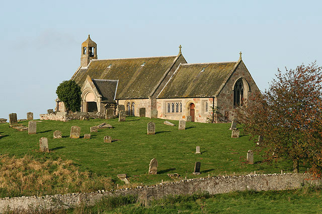
In addition to its natural wonders, Shore Dean is steeped in history and boasts several historical landmarks. The ruins of old castles and ancient sites can be found scattered throughout the valley, providing a glimpse into its rich past.

For those looking to explore further afield, Shore Dean is conveniently located near other attractions in Roxburghshire, such as the picturesque town of Kelso and the historic Floors Castle.

In summary, Shore Dean is a hidden gem in Roxburghshire, offering visitors a chance to escape into nature, immerse themselves in history, and experience the tranquility of the Scottish countryside.

If you have any feedback on the listing, please let us know in the comments section below.

Shore Dean Images

Images are sourced within 2km of 55.478021/-2.3570345 or Grid Reference NT7720. Thanks to Geograph Open Source API. All images are credited.

Hownham Mains Hownam has several spellings knocking around various maps:Hownam, Hounam, Hownham.
Hownham Mains
Hownam has several spellings knocking around various maps:Hownam, Hounam, Hownham.
View from Hownam Steeple Over the headwaters of the Hownam Burn.
View from Hownam Steeple
Over the headwaters of the Hownam Burn.
Young trees, Gateshaw Behind a very elaborate electric fence.
Young trees, Gateshaw
Behind a very elaborate electric fence.
Harrow Law
Harrow Law
Farm track, Gateshaw
Beside the Kale Water Field downstream of Hownam
Beside the Kale Water
Field downstream of Hownam
Cultivation terraces, Howgate An extensive area of terraced hillside above the Kale Water.
Cultivation terraces, Howgate
An extensive area of terraced hillside above the Kale Water.
Deanbrae Law 10 years on from <a href="https://www.geograph.org.uk/photo/3149784">NT7721 : Deanbrae Law</a>
Deanbrae Law
10 years on from NT7721 : Deanbrae Law
Kale Water and tree From Heavyside Bridge, downstream.
Kale Water and tree
From Heavyside Bridge, downstream.
Kale Water Downstream from Heavyside Bridge
Kale Water
Downstream from Heavyside Bridge
Over Whitton Hill Grazed by cattle
Over Whitton Hill
Grazed by cattle
View from Over Whitton Hill
Heatherland Hill The summit is now in a fenced enclosure with young trees.
Heatherland Hill
The summit is now in a fenced enclosure with young trees.
Rocks on Heatherland Hill A rocky area just below the summit which is the other side of a deer fence.
Rocks on Heatherland Hill
A rocky area just below the summit which is the other side of a deer fence.
Summit, Heatherland Hill The summit, planted with trees. Taken through a high deer and rabbit fence.
Summit, Heatherland Hill
The summit, planted with trees. Taken through a high deer and rabbit fence.
Grassland under Hownam Law Soon to be cut for silage, this grassland is adjacent to cattle and sheep grazing land on the approach to Hownam Law from Howgate.  The prominent hill in the distance, centre of view is Dirrington Great Law (398 metres) near Longformacus.
Grassland under Hownam Law
Soon to be cut for silage, this grassland is adjacent to cattle and sheep grazing land on the approach to Hownam Law from Howgate. The prominent hill in the distance, centre of view is Dirrington Great Law (398 metres) near Longformacus.
Onlookers encountered on the descent from Hownam Law The route back down from Hownam Law to Howgate passes cattle grazing land on former cultivation terraces.
Onlookers encountered on the descent from Hownam Law
The route back down from Hownam Law to Howgate passes cattle grazing land on former cultivation terraces.
Show me another place!

Shore Dean is located at Grid Ref: NT7720 (Lat: 55.478021, Lng: -2.3570345)

Unitary Authority: The Scottish Borders

Police Authority: The Lothians and Scottish Borders

What 3 Words

///swipes.assets.named. Near Jedburgh, Scottish Borders

Nearby Locations

Shore Dean

Related Wikis

Hownam

Hownam or Hounam is a small village and parish situated 8 miles east of Jedburgh in the Scottish Borders area of Scotland, near the Anglo-Scottish border...

Mowhaugh

Mowhaugh is a hamlet and farm steading near the Calroust Burn and the Bowmont Water, near Morebattle, in the Scottish Borders area of Scotland, and in...

Morebattle

Morebattle is a village in the Scottish Borders area of Scotland, on the B6401, seven miles south of Kelso, Scottish Borders, beside the Kale Water, a...

Cessford Castle

Cessford Castle is a large ruined mid-15th century L-plan castle near the village of Cessford, midway Jedburgh and Kelso, in the historic county of Roxburghshire...

Cessford, Scottish Borders

Cessford is a hamlet and former barony about a mile south of the B6401 road, in the Scottish Borders area of Scotland. The placename is from Gaelic 'ceis...

Cessford Burn

Cessford Burn is a small stream which eventually runs to meet the Kale Water and then joins the River Teviot, finally entering the River Tweed at Kelso...

Linton, Scottish Borders

Linton is a small village in the Scottish Borders area of Scotland. It is situated a mile north of the village of Morebattle. == History == People have...

Pennymuir Roman camps

The Pennymuir Roman camps are situated southeast of Jedburgh in the Scottish Borders area of Scotland, near the Anglo-Scottish border, in the former Roxburghshire...

Nearby Amenities

Located within 500m of 55.478021,-2.3570345
Chesterhouse
Place: isolated_dwelling
Lat/Long: 55.4759604/-2.3614304
Heavyside
Place: hamlet
Lat/Long: 55.4812383/-2.3521166
Howgate
Place: hamlet
Lat/Long: 55.4768584/-2.3502818
Power: pole
Lat/Long: 55.474969/-2.3516678
Power: pole
Lat/Long: 55.4751106/-2.3516344
Power: pole
Lat/Long: 55.475779/-2.3515674
Power: pole
Lat/Long: 55.4764693/-2.3514773
Power: pole
Lat/Long: 55.477072/-2.3513872
Power: pole
Lat/Long: 55.4771989/-2.3513099
Power: pole
Lat/Long: 55.4777155/-2.3509623
Power: pole
Lat/Long: 55.4782161/-2.3506044
Power: pole
Lat/Long: 55.4786699/-2.3503186
Power: pole
Lat/Long: 55.4791704/-2.3499606
Power: pole
Lat/Long: 55.4797571/-2.3506584
Power: pole
Lat/Long: 55.480348/-2.3513357
Power: pole
Lat/Long: 55.480958/-2.3520541
The data included in this document is from www.openstreetmap.org. The data is made available under ODbL.

Have you been to Shore Dean?

Leave your review of Shore Dean below (or comments, questions and feedback).