Smallcombe Vale

Valley in Somerset

England

Smallcombe Vale

Bath - Dorchester Street
Bath - Dorchester Street Credit: Peter Whatley

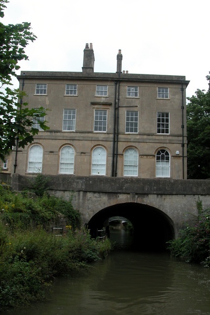
Smallcombe Vale is a picturesque valley located in Somerset, England. Nestled between the rolling hills of the Mendip Range, this small but enchanting valley is a haven for nature enthusiasts and those seeking tranquility.

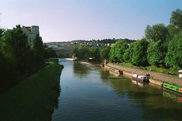
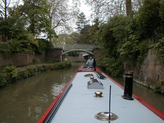
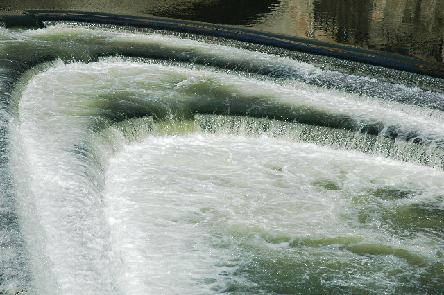
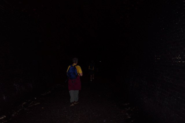
The valley is characterized by its lush greenery and diverse wildlife, making it an ideal destination for hiking and exploring the great outdoors. The meandering river that flows through the valley adds to its charm, providing a soothing ambiance and creating a habitat for various aquatic species.

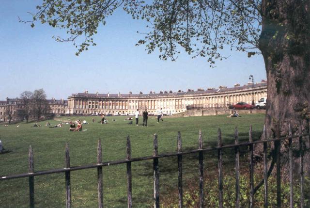
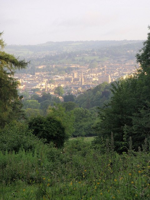
Smallcombe Vale is also known for its rich history and archaeological significance. The area has been inhabited since prehistoric times, with evidence of ancient settlements and burial sites discovered in the vicinity. The valley's proximity to Bath, a UNESCO World Heritage site, further enhances its historical appeal.

Walking through Smallcombe Vale, visitors can expect to encounter a wide variety of flora and fauna. The valley is home to an array of plant species, including wildflowers, ferns, and mosses. Birdwatchers will have the opportunity to spot a range of avian species, such as woodpeckers, kingfishers, and herons. Other animals, such as deer and badgers, can also be spotted in the valley.

Smallcombe Vale offers a peaceful retreat from the hustle and bustle of city life. Its natural beauty, combined with its historical significance, makes it a must-visit destination for both locals and tourists alike. Whether it's a leisurely stroll, a challenging hike, or a spot of birdwatching, this hidden gem in Somerset has something to offer everyone.

If you have any feedback on the listing, please let us know in the comments section below.

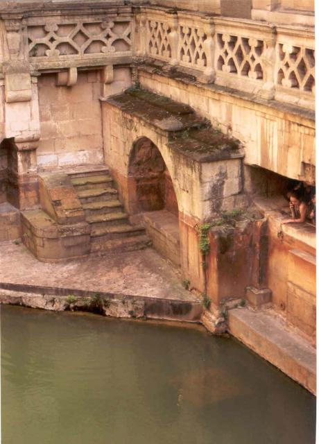
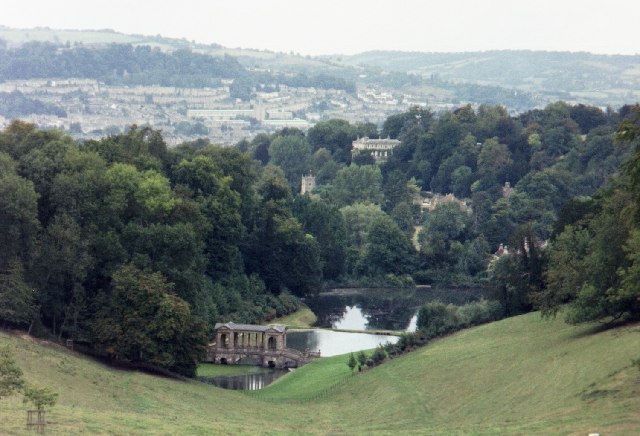
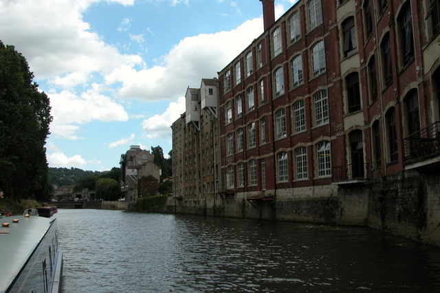
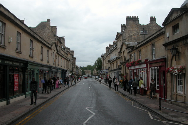
Smallcombe Vale Images

Images are sourced within 2km of 51.377206/-2.3457789 or Grid Reference ST7664. Thanks to Geograph Open Source API. All images are credited.

Bath - Dorchester Street
Bath: River Avon through Bath This picture was taken from the south side of the bridge and east of the Abbey and Roman Baths. The bridge is situated right in the upper left quadrant of the square.
Bath: River Avon through Bath
This picture was taken from the south side of the bridge and east of the Abbey and Roman Baths. The bridge is situated right in the upper left quadrant of the square.
Sydney Gardens, Bath A very distinctive length of the Kennet & Avon Canal as it passes under ornate bridges in Sydney Gardens.
Sydney Gardens, Bath
A very distinctive length of the Kennet & Avon Canal as it passes under ornate bridges in Sydney Gardens.
Royal Crescent, Bath Georgian Architecture
Royal Crescent, Bath
Georgian Architecture
The Circus, Bath Georgian Architecture
The Circus, Bath
Georgian Architecture
Pulteney Bridge, Bath from the park
Pulteney Bridge, Bath
from the park
Near North Parade Passage, Bath Close to Bath Abbey
Near North Parade Passage, Bath
Close to Bath Abbey
Sacred Springs Roman Baths, Bath Part of the Roman Bath site
Sacred Springs Roman Baths, Bath
Part of the Roman Bath site
Bath Abbey Pump Rooms on the right
Bath Abbey
Pump Rooms on the right
Kennet and Avon Canal north-east of Bath The Kennet and Avon Canal, near the Ministry of Defence offices, north-east of Bath, with a view across the valley to the Kensington and Walcot area of the city.
Kennet and Avon Canal north-east of Bath
The Kennet and Avon Canal, near the Ministry of Defence offices, north-east of Bath, with a view across the valley to the Kensington and Walcot area of the city.
Prior Park Landscape Garden, Bath Property of the National Trust.  The view down the valley shows the Palladian Bridge (18th century) and the lakes beyond.
Prior Park Landscape Garden, Bath
Property of the National Trust. The view down the valley shows the Palladian Bridge (18th century) and the lakes beyond.
Pulteney Bridge
Pulteney Bridge
Warehouses by River Avon in the centre of Bath.
Pulteney Bridge, Bath - at street level This is the only bridge in the UK which has shops all across it. It was modelled on the Ponte Vecchio in Florence.
Pulteney Bridge, Bath - at street level
This is the only bridge in the UK which has shops all across it. It was modelled on the Ponte Vecchio in Florence.
Pulteney Bridge, Bath - from river level This is the only bridge in the UK covered with shops. It was modelled on the Pont Aveccio. I think the church is St Michael with St Paul.
Pulteney Bridge, Bath - from river level
This is the only bridge in the UK covered with shops. It was modelled on the Pont Aveccio. I think the church is St Michael with St Paul.
The tunnel at Sydney Gardens, Bath. The Kennet and Avon canal going under the house at Sydney Gardens.
The tunnel at Sydney Gardens, Bath.
The Kennet and Avon canal going under the house at Sydney Gardens.
Pulteney Weir Bath
Pulteney Weir Bath
Inside Combe Down tunnel, near Bath Combe Down tunnel was on the old Somerset & Dorset Joint Railway which ran from Bath to Bournemouth. The line closed in 1966 and the tunnel, which is more than a mile long, is now owned by Wessex Water. It is occasionally opened to the public.
Inside Combe Down tunnel, near Bath
Combe Down tunnel was on the old Somerset & Dorset Joint Railway which ran from Bath to Bournemouth. The line closed in 1966 and the tunnel, which is more than a mile long, is now owned by Wessex Water. It is occasionally opened to the public.
Show me another place!

Smallcombe Vale is located at Grid Ref: ST7664 (Lat: 51.377206, Lng: -2.3457789)

Unitary Authority: Bath and North East Somerset

Police Authority: Avon and Somerset

What 3 Words

///snow.garage.brain. Near Bath, Somerset

Related Wikis

Bath Skyline

Bath Skyline is a circular trail that affords views of the historic city of Bath in England. It is managed by The National Trust. == Route == The trail...
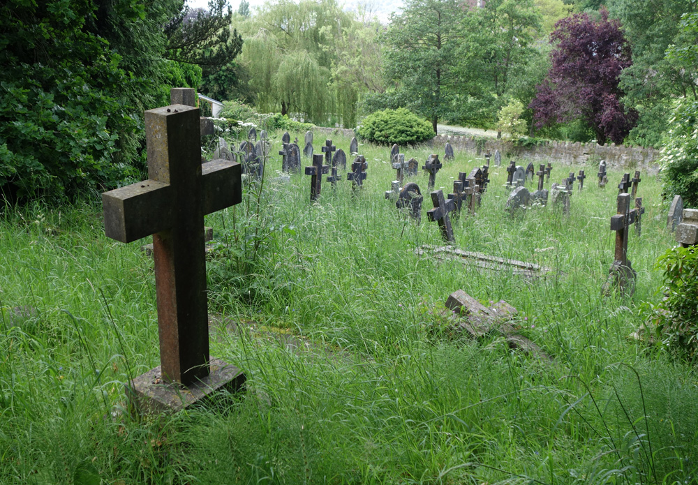
Smallcombe Cemetery

Smallcombe Cemetery is on the edge of Bath, Somerset, England, in a valley between Widcombe Hill and Bathwick Hill. It has two distinct parts, the Anglican...

Bathwick Hill

Bathwick Hill in Bath, Somerset, England is a street lined with historic houses, many of which are designated as listed buildings. It climbs south east...

Crowe Hall

Crowe Hall is a Georgian house in Widcombe, Bath, Somerset, England. It is a Grade II listed building, and the gardens are on the Register of Historic...

Nearby Amenities

Located within 500m of 51.377206,-2.3457789
Barrier: kissing_gate
Foot: yes
Source: survey
Lat/Long: 51.3804739/-2.3459297
Turning Circle
Lat/Long: 51.3758151/-2.3467317
Barrier: kissing_gate
Lat/Long: 51.3785547/-2.3442024
Barrier: kissing_gate
Lat/Long: 51.3758908/-2.3455893
Turning Circle
Lat/Long: 51.3769466/-2.3505414
Post Box
Postal Code: BA2
Ref: BA2 111
Lat/Long: 51.3800655/-2.3511414
Seamark Type: gate
Waterway: lock_gate
Lat/Long: 51.3788114/-2.3493301
Seamark Type: gate
Waterway: lock_gate
Lat/Long: 51.3805503/-2.3490347
Post Box
Collection Times: Mo-Fr 09:00; Sa 07:00
Post Box Mounting: pier
Post Box Type: lamp
Ref: BA2 68D
Royal Cypher: EIIR
Royal Cypher Wikidata: Q33102113
Lat/Long: 51.3810271/-2.3452486
Barrier: kissing_gate
Lat/Long: 51.3782935/-2.3437853
Post Box
Collection Times: Mo-Fr 09:00; Sa 07:00
Post Box Mounting: wall
Post Box Type: wall
Ref: BA2 42D
Royal Cypher: EVIIR
Royal Cypher Wikidata: Q33102324
Lat/Long: 51.3805015/-2.3482981
Barrier: kissing_gate
Lat/Long: 51.3760622/-2.3432744
Seamark Type: gate
Waterway: lock_gate
Lat/Long: 51.3772889/-2.3512072
Crossing
Crossing: unmarked
Crossing Island: no
Tactile Paving: no
Lat/Long: 51.3804233/-2.3483598
Seamark Type: gate
Waterway: lock_gate
Lat/Long: 51.3789756/-2.349083
Seamark Type: gate
Waterway: lock_gate
Lat/Long: 51.3770944/-2.3514613
Seamark Type: gate
Waterway: lock_gate
Lat/Long: 51.3769111/-2.3521924
Seamark Type: gate
Waterway: lock_gate
Lat/Long: 51.3769469/-2.3525406
Seamark Type: gate
Waterway: lock_gate
Lat/Long: 51.3803235/-2.3490012
Seamark Type: gate
Waterway: lock_gate
Lat/Long: 51.3798623/-2.3489423
Seamark Type: gate
Waterway: lock_gate
Lat/Long: 51.379641/-2.3489088
Barrier: kissing_gate
Lat/Long: 51.379028/-2.3447641
Barrier: kissing_gate
Lat/Long: 51.378211/-2.3453989
Barrier: kissing_gate
Lat/Long: 51.3738875/-2.3415821
Barrier: bollard
Bollard: fixed
Lat/Long: 51.3781453/-2.3505768
Bus Stop
Youth Hostel
Bench: no
Bin: no
Bus: yes
Lit: no
Naptan AtcoCode: 0180BAC30048
Naptan Bearing: SE
Naptan CommonName: Youth Hostel
Naptan NaptanCode: bthmamp
Naptan PlusbusZoneRef: BATHSPA
Naptan Street: Bathwick Hill
Public Transport: platform
Shelter: no
Source: naptan_import;survey
Tactile Paving: no
Lat/Long: 51.3785853/-2.3399886
White Guest House
Addr Housenumber: 23
Addr Postcode: BA2 4HG
Addr Street: Pulteney Gardens
Fhrs Id: 205368
Guest House: bed_and_breakfast
Phone: +44 1225 426 075
Tourism: guest_house
Website: https://www.whiteguesthouse.co.uk/
Wheelchair: limited
Lat/Long: 51.3795964/-2.3507105
Brindleys
Addr Housenumber: 14
Addr Postcode: BA2 4HG
Addr Street: Pulteney Gardens
Fhrs Id: 205388
Guest House: bed_and_breakfast
Internet Access: wlan
Phone: +44 1225 310444
Toilets Wheelchair: no
Tourism: guest_house
Website: http://www.brindleysbath.co.uk/
Wheelchair: no
Wikidata: Q111368764
Lat/Long: 51.3797749/-2.3499507
Appletree Guest House
Addr Housenumber: 7
Addr Postcode: BA2 4HG
Addr Street: Pulteney Gardens
Fhrs Id: 701421
Guest House: bed_and_breakfast
Phone: +44 1225 337 642
Toilets Wheelchair: no
Tourism: guest_house
Website: https://www.appletreeguesthouse.com//
Wheelchair: no
Lat/Long: 51.3798352/-2.3505274
Crossing
Check Date Tactile Paving: 2023-03-09
Crossing: unmarked
Crossing Island: yes
Crossing Markings: no
Tactile Paving: no
Lat/Long: 51.3793501/-2.351166
Lynwood House
Addr Housenumber: 6
Addr Postcode: BA2 4HG
Addr Street: Pulteney Gardens
Disused Fhrs Id: 205706
Disused Tourism: guest_house
Guest House: bed_and_breakfast
Note: "Lynwood will be temporarily closed from 12th March 2023"
Phone: +44 1225 426410
Website: https://www.lynwood.house/
Lat/Long: 51.3798406/-2.3506035
Membland B&B
Addr Postcode: BA2 4HJ
Fhrs Id: 205289
Guest House: bed_and_breakfast
Toilets Wheelchair: no
Tourism: guest_house
Website: https://www.memblandguesthouse.co.uk/
Wheelchair: no
Lat/Long: 51.3792039/-2.3508729
Bench
Backrest: yes
Colour: brown
Material: wood
Seats: 3
Lat/Long: 51.3810502/-2.3492785
Avon Guest House
Addr Housenumber: 1
Addr Postcode: BA2 4HG
Addr Street: Pulteney Gardens
Fhrs Id: 205705
Guest House: bed_and_breakfast
Toilets Wheelchair: no
Tourism: guest_house
Website: https://www.avonguesthousebath.co.uk/
Wheelchair: no
Lat/Long: 51.379929/-2.3510075
Bench
Backrest: yes
Colour: brown
Material: wood
Seats: 2
Lat/Long: 51.3803907/-2.349156
Bench
Backrest: yes
Colour: brown
Material: wood
Seats: 2
Lat/Long: 51.3789728/-2.3493304
Covered: no
Leisure: picnic_table
Lat/Long: 51.3791746/-2.3491387
Bus Stop
Pultney Court - N-bound
Bench: no
Bin: no
Bus: yes
Naptan AtcoCode: 0180BAZ02414
Naptan NaptanCode: bthjtpj
Public Transport: platform
Shelter: no
Tactile Paving: no
Wheelchair: yes
Lat/Long: 51.378264/-2.351351
Bus Stop
Youth Hostel
Bench: yes
Bin: yes
Bus: yes
Lit: yes
Naptan AtcoCode: 0180BAC30047
Naptan Bearing: NW
Naptan CommonName: Youth Hostel
Naptan NaptanCode: bthmamg
Naptan PlusbusZoneRef: BATHSPA
Naptan Street: Bathwick Hill
Public Transport: platform
Shelter: yes
Source: naptan_import;survey
Tactile Paving: no
Lat/Long: 51.3786674/-2.3404175
Bus Stop
White Lodge
Bus: yes
Naptan AtcoCode: 0180BAC30049
Naptan Bearing: NW
Naptan CommonName: White Lodge
Naptan NaptanCode: bthmagj
Naptan PlusbusZoneRef: BATHSPA
Naptan Street: Bathwick Hill
Public Transport: platform
Shelter: no
Source: naptan_import;survey
Lat/Long: 51.3799166/-2.3437172
Bus Stop
White Lodge
Bus: yes
Naptan AtcoCode: 0180BAC30050
Naptan Bearing: SE
Naptan CommonName: White Lodge
Naptan NaptanCode: bthmagp
Naptan PlusbusZoneRef: BATHSPA
Naptan Street: Bathwick Hill
Public Transport: platform
Shelter: no
Source: naptan_import;survey
Lat/Long: 51.3797432/-2.342594
Bus Stop
Cleveland Walk
Bench: yes
Bin: yes
Bus: yes
Lit: yes
Naptan AtcoCode: 0180BAC30051
Naptan Bearing: N
Naptan CommonName: Cleveland Walk
Naptan Crossing: Cleveland Walk
Naptan NaptanCode: bthjwta
Naptan PlusbusZoneRef: BATHSPA
Naptan Street: Bathwick Hill
Public Transport: platform
Shelter: yes
Source: naptan_import;survey
Tactile Paving: no
Toilets Wheelchair: no
Wheelchair: yes
Lat/Long: 51.3808819/-2.345693
Bus Stop
Cleveland Walk
Bench: yes
Bin: no
Bus: yes
Lit: yes
Naptan AtcoCode: 0180BAC30052
Naptan Bearing: SE
Naptan CommonName: Cleveland Walk
Naptan Crossing: Cleveland Walk
Naptan NaptanCode: bthjwtd
Naptan PlusbusZoneRef: BATHSPA
Naptan Street: Bathwick Hill
Public Transport: platform
Shelter: no
Source: naptan_import;survey
Tactile Paving: no
Toilets Wheelchair: no
Wheelchair: yes
Lat/Long: 51.3810174/-2.3454785
Bus Stop
The Tyning
Bench: no
Bin: no
Bus: yes
Naptan AtcoCode: 0180BAC30061
Naptan Bearing: E
Naptan CommonName: The Tyning
Naptan Crossing: The Tyning
Naptan NaptanCode: bthjwdt
Naptan PlusbusZoneRef: BATHSPA
Naptan Street: Widcombe Hill
Naptan Verified: no
Public Transport: platform
Shelter: no
Source: naptan_import
Tactile Paving: no
Toilets Wheelchair: no
Wheelchair: yes
Lat/Long: 51.3752156/-2.3491847
Bus Stop
The Tyning
Bus: yes
Naptan AtcoCode: 0180BAC30062
Naptan Bearing: NW
Naptan CommonName: The Tyning
Naptan Crossing: The Tyning
Naptan NaptanCode: bthjwdp
Naptan PlusbusZoneRef: BATHSPA
Naptan Street: Widcombe Hill
Naptan Verified: no
Public Transport: platform
Source: naptan_import
Toilets Wheelchair: no
Wheelchair: yes
Lat/Long: 51.3752946/-2.3498319
Bus Stop
Widcombe Hall
Bus: yes
Naptan AtcoCode: 0180BAC30063
Naptan Bearing: E
Naptan CommonName: Widcombe Hall
Naptan Crossing: Church Street
Naptan NaptanCode: bthmada
Naptan PlusbusZoneRef: BATHSPA
Naptan Street: Widcombe Hill
Naptan Verified: no
Public Transport: platform
Shelter: no
Source: naptan_import
Lat/Long: 51.3745897/-2.3449848
Bus Stop
Widcombe Hall
Bus: yes
Naptan AtcoCode: 0180BAC30064
Naptan Bearing: W
Naptan BusStopType: CUS
Naptan CommonName: Widcombe Hall
Naptan Crossing: Church Street
Naptan NaptanCode: bthjwtw
Naptan PlusbusZoneRef: BATHSPA
Naptan Street: Widcombe Hill
Naptan Verified: no
Public Transport: platform
Shelter: no
Source: naptan_import
Lat/Long: 51.3744997/-2.3449984
Bus Stop
Pulteney Gardens
Bench: no
Bin: no
Bus: yes
Check Date Shelter: 2023-03-09
Lit: yes
Naptan AtcoCode: 0180BAC30067
Naptan Bearing: S
Naptan CommonName: Pulteney Gardens
Naptan Crossing: Pulteney Gardens
Naptan NaptanCode: bthjtwa
Naptan PlusbusZoneRef: BATHSPA
Naptan Street: Pulteney Road
Naptan Verified: no
Public Transport: platform
Shelter: no
Source: naptan_import
Tactile Paving: no
Toilets Wheelchair: no
Wheelchair: yes
Lat/Long: 51.379562/-2.3511001
Bus Stop
Pulteney Gardens
Bench: no
Bin: no
Bus: yes
Lit: yes
Naptan AtcoCode: 0180BAC30068
Naptan Bearing: N
Naptan CommonName: Pulteney Gardens
Naptan Crossing: Ferry Lane
Naptan NaptanCode: bthjtpm
Naptan PlusbusZoneRef: BATHSPA
Naptan Street: Pulteney Road
Naptan Verified: no
Public Transport: platform
Shelter: no
Source: naptan_import
Tactile Paving: no
Toilets Wheelchair: no
Wheelchair: yes
Lat/Long: 51.3800378/-2.3513624
Bus Stop
Widcombe Hill
Bus: yes
Naptan AtcoCode: 0180BAZ02392
Naptan Bearing: E
Naptan CommonName: Widcombe Hill
Naptan Crossing: Prior Park Road
Naptan NaptanCode: bthjtmj
Naptan PlusbusZoneRef: BATHSPA
Naptan Street: Widcombe Hill
Naptan Verified: no
Public Transport: platform
Shelter: no
Source: naptan_import
Wheelchair: yes
Lat/Long: 51.3764186/-2.3528289
Bench
Backrest: yes
Colour: brown
Material: wood
Seats: 3
Source: survey
Lat/Long: 51.3791443/-2.3413224
Crossing
Crossing Island: yes
Mapillary: 627503065314793
Survey Date: 2021-03-19
Tactile Paving: yes
Lat/Long: 51.3779275/-2.3516218
Barrier: kissing_gate
Lat/Long: 51.3764179/-2.3444092
Barrier: kissing_gate
Lat/Long: 51.3764769/-2.3443555
Barrier: kissing_gate
Foot: yes
Source: survey
Lat/Long: 51.3789056/-2.3416893
Barrier: stile
Material: wood
Source: survey
Step Count: 1
Stile: stepover
Lat/Long: 51.3776458/-2.3428788
Barrier: kissing_gate
Lat/Long: 51.3771714/-2.3435412
Tourism: viewpoint
Lat/Long: 51.3777879/-2.3440147
Barrier: kissing_gate
Lat/Long: 51.3805501/-2.3474748
Barrier: bollard
Bollard: fixed
Lat/Long: 51.3807336/-2.3476704
Barrier: kissing_gate
Lat/Long: 51.3792304/-2.3471733
Crossing
Crossing: traffic_signals
Crossing Ref: puffin
Mapillary: 535898324086680
Survey Date: 2021-05-04
Tactile Paving: yes
Lat/Long: 51.3772033/-2.3527301
Barrier: bollard
Bollard: fixed
Lat/Long: 51.3782435/-2.3509366
Addr Housename: Abbey View House
Addr Postcode: BA2 6DG
Addr Street: Abbey View
Building: residential
Wikidata: Q26673198
Lat/Long: 51.3783167/-2.3493344
Barrier: stile
Lat/Long: 51.3761484/-2.3453595
Barrier: kissing_gate
Lat/Long: 51.3739506/-2.3416129
Crossing
Crossing: traffic_signals
Crossing Ref: puffin
Tactile Paving: yes
Lat/Long: 51.3772142/-2.3524098
Crossing
Crossing: traffic_signals
Crossing Ref: puffin
Tactile Paving: yes
Lat/Long: 51.3772293/-2.3525833
Crossing
Crossing: traffic_signals
Crossing Island: no
Crossing Ref: puffin
Mapillary: 535898324086680
Survey Date: 2021-05-04
Tactile Paving: yes
Lat/Long: 51.3773041/-2.3527274
Bench
Backrest: yes
Lat/Long: 51.3771266/-2.3512842
Man Made: survey_point
Note: OS Benchmark in corner stone of wall, near the ground and just to the right of hte postbox.
Survey Point: benchmark
Lat/Long: 51.3752883/-2.349511
Clock
Display: sundial
Lat/Long: 51.3783752/-2.3504071
Covered: no
Leisure: picnic_table
Lat/Long: 51.3791406/-2.3491863
Covered: no
Leisure: picnic_table
Lat/Long: 51.3791478/-2.3491481
Bench
Backrest: yes
Check Date: 2024-02-16
Colour: brown
Material: wood
Seats: 3
Lat/Long: 51.3806388/-2.3491776
Bench
Backrest: yes
Lat/Long: 51.3786061/-2.3500629
Bench
Backrest: yes
Check Date: 2024-02-16
Colour: brown
Material: wood
Seats: 3
Lat/Long: 51.3807391/-2.3491892
Bench
Backrest: yes
Lat/Long: 51.3784774/-2.3503087
Bench
Backrest: yes
Lat/Long: 51.3783322/-2.3504381
Waste Basket
Check Date: 2023-09-03
Lat/Long: 51.3808691/-2.3456552
Recycling
Recycling Type: container
Lat/Long: 51.3791132/-2.3412316
Post Box
Collection Times: Mo-Fr 09:00; Sa 07:00
Post Box Type: wall
Ref: BA2 164D
Royal Cypher: EIIR
Royal Cypher Wikidata: Q33102113
Lat/Long: 51.3796507/-2.3426076
Bench
Backrest: yes
Mapillary: 513966839606670
Survey Date: 2019-04-26
Lat/Long: 51.3786957/-2.3404456
Waste Basket
Check Date: 2023-02-24
Lat/Long: 51.3787097/-2.34047
Barrier: kerb
Kerb: raised
Tactile Paving: no
Lat/Long: 51.3774663/-2.3519407
The Pump House Chimney
Historic: monument
Man Made: chimney
Wikidata: Q26674781
Lat/Long: 51.3791817/-2.3491756
Waterway: water_point
Lat/Long: 51.3809927/-2.3491814
Smallcombe Vale
Place: locality
Lat/Long: 51.376027/-2.3443266
Old Manor Farm Grotto
Historic: monument
Lat/Long: 51.3731455/-2.3457814
Barrier: bollard
Lat/Long: 51.3782607/-2.3511688
Clock
Lat/Long: 51.3763158/-2.3521612
Post Box
Collection Times: Mo-Fr 09:00; Sa 07:00
Post Box Mounting: wall
Post Box Type: wall
Ref: BA2 149
Royal Cypher: EIIR
Royal Cypher Wikidata: Q33102113
Lat/Long: 51.3752994/-2.3495384
Milestone
Inscription: 1 Mile // from the // Guildhall // BATH
Note: Metal plate attached to stone wall on north side of road.
Lat/Long: 51.3747763/-2.3462823
Charging Station
PG 90843 Will-Pete
Access: private
Capacity: 1
Operator: Pod Point
Operator Wikidata: Q42888154
Socket: type2
Socket Type2: 1
Socket Type2 Output: 7 kW
Lat/Long: 51.3784458/-2.3509858
Bathwick Hill
Place: locality
Wikidata: Q4869145
Wikipedia: en:Bathwick Hill
Lat/Long: 51.3809247/-2.3454892
Chartwells
Addr Postcode: BA2 4JG
Addr Street: Archway Street
Craft: caterer
Fhrs Id: 1203521
Lat/Long: 51.3780345/-2.351844
Waste Basket
Waste: trash
Lat/Long: 51.3738582/-2.3415584
Direction: both
Surface: asphalt
Traffic Calming: hump
Lat/Long: 51.3783327/-2.3525597
Barrier: bollard
Lat/Long: 51.3732246/-2.3466695
Barrier: bollard
Lat/Long: 51.3736425/-2.3468893
Bench
Lat/Long: 51.3788854/-2.3416836
Bench
Lat/Long: 51.3758052/-2.350981
Access: private
Bicycle Parking: shed
Capacity: 6
Covered: yes
Operator: Falco
Proposed Amenity: bicycle_parking
Website: https://rentals.falco.co.uk/
Lat/Long: 51.3802304/-2.3498654
Bicycle Parking
Access: private
Bicycle Parking: shed
Capacity: 6
Covered: yes
Operator: Falco
Ref: 398
Website: https://rentals.falco.co.uk/
Lat/Long: 51.378486/-2.3524046
Bicycle Parking
Access: private
Bicycle Parking: stands
Capacity: 10
Covered: no
Lat/Long: 51.3780894/-2.3523181
Bicycle Parking
Access: private
Bicycle Parking: stands
Capacity: 8
Covered: yes
Lat/Long: 51.3781036/-2.3523523
Waste Basket
Lat/Long: 51.3779337/-2.3523409
Waste Basket
Lat/Long: 51.3792221/-2.3471789
Waste Basket
Lat/Long: 51.380517/-2.3483188
Bench
Backrest: yes
Lat/Long: 51.3759077/-2.3413816
Bench
Backrest: yes
Lat/Long: 51.3759551/-2.343301
Bench
Backrest: yes
Lat/Long: 51.3754261/-2.3429845
The data included in this document is from www.openstreetmap.org. The data is made available under ODbL.

Have you been to Smallcombe Vale?

Leave your review of Smallcombe Vale below (or comments, questions and feedback).