Black Cleugh
Valley in Northumberland
England
Black Cleugh

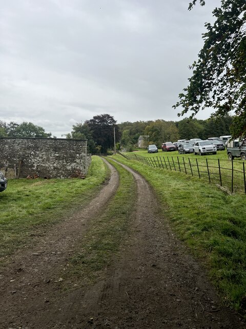
Black Cleugh is a picturesque valley located in Northumberland, England. Nestled in the northernmost part of the country, it is a place of remarkable natural beauty and stunning landscapes. The valley is situated within the North Pennines Area of Outstanding Natural Beauty, showcasing its exceptional environmental qualities.
Characterized by its rugged terrain, Black Cleugh is defined by its steep slopes, deep gorges, and rocky outcrops. It is home to diverse flora and fauna, with heather moorland, meadows, and woodlands dotting the landscape. The valley is traversed by a meandering stream, adding to its charm and creating a tranquil atmosphere.
Black Cleugh is renowned for its walking trails and hiking opportunities. Visitors can explore the valley by following well-marked paths that offer breathtaking views of the surrounding countryside. The trails cater to varying levels of difficulty, making them suitable for both experienced hikers and those seeking a leisurely stroll.
The valley also holds historical significance, with remnants of its mining past still visible. In the 19th century, lead mining was a prominent industry in the area, and remnants of mine workings and spoil heaps can be seen throughout the valley.
Black Cleugh is a haven for outdoor enthusiasts, nature lovers, and those seeking a peaceful escape from the hustle and bustle of everyday life. With its stunning landscapes, rich biodiversity, and historical significance, it is a place that captivates the hearts of all who visit.
If you have any feedback on the listing, please let us know in the comments section below.
Black Cleugh Images
Images are sourced within 2km of 54.953338/-2.3912131 or Grid Reference NY7562. Thanks to Geograph Open Source API. All images are credited.


Black Cleugh is located at Grid Ref: NY7562 (Lat: 54.953338, Lng: -2.3912131)
Unitary Authority: Northumberland
Police Authority: Northumbria
What 3 Words
///sofas.liability.vines. Near Bardon Mill, Northumberland
Nearby Locations
Related Wikis
Melkridge
Melkridge is a village and civil parish in Northumberland, England, on the river South Tyne. The village of Melkridge is in the south of the parish, and...

Unthank Hall
Unthank Hall is a Grade II listed property now serving as commercial offices, situated on the southern bank of the River South Tyne east of Plenmeller...

Unthank, Haltwhistle
Unthank is a village near Haltwhistle in Northumberland, England. It is first mentioned in writing as Unthanc around 1200. == Governance == Unthank is...
Henshaw, Northumberland
Henshaw is a small village and civil parish in Northumberland, within the vicinity of the ancient Hadrian's Wall. It is located around 11.5 miles (19 km...

Redburn, Northumberland
Redburn is a village in Northumberland, England about 0.5 miles (0.80 km) west of Bardon Mill. It is situated about 4 miles (6 km) south of Hadrian's Wall...

Haltwhistle Burn
The Haltwhistle Burn is a river which lies to the east of the Northumbrian town of Haltwhistle. Rising in the peaty uplands below the ridge of the Whin...

Beltingham
Beltingham is a small village on the River South Tyne in Northumberland, in England. It is situated 1 mile (2 km) southeast of Bardon Mill and 10 miles...

Bardon Mill railway station
Bardon Mill is a railway station on the Tyne Valley Line, which runs between Newcastle and Carlisle via Hexham. The station, situated 27 miles 54 chains...
Nearby Amenities
Located within 500m of 54.953338,-2.3912131Have you been to Black Cleugh?
Leave your review of Black Cleugh below (or comments, questions and feedback).