Shorthope Cleugh

Valley in Berwickshire

Scotland

Shorthope Cleugh

Ellemford Viewed from Ellemford Bridge.
Plenty of sheep!
Ellemford Credit: Russel Wills

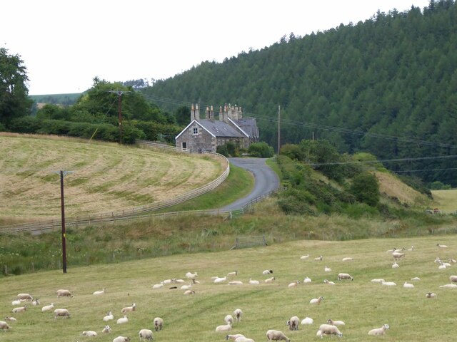
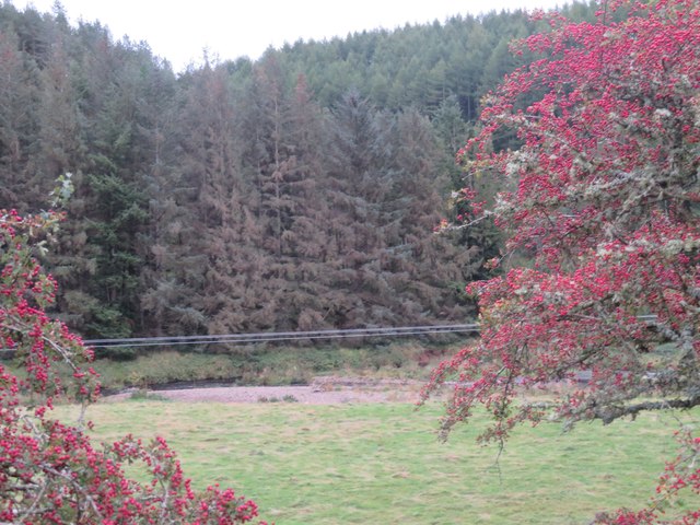
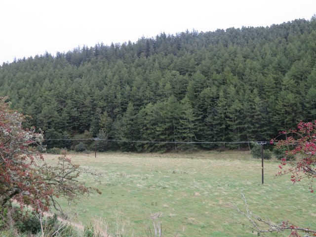
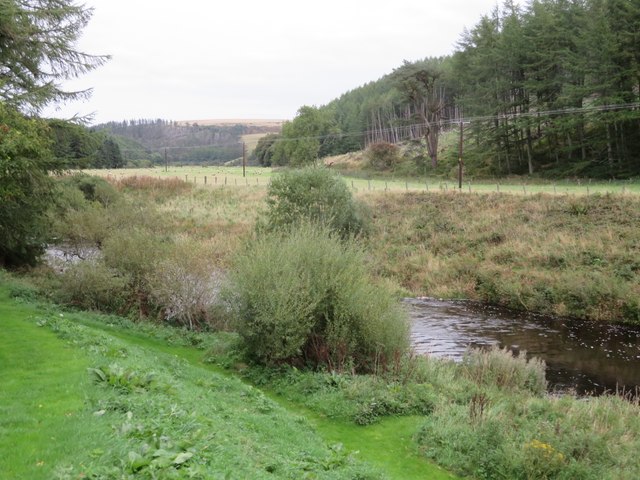
Shorthope Cleugh is a picturesque valley located in Berwickshire, a historic county in the southeast of Scotland. Nestled between rolling hills and surrounded by lush greenery, this valley is renowned for its natural beauty and tranquil atmosphere.

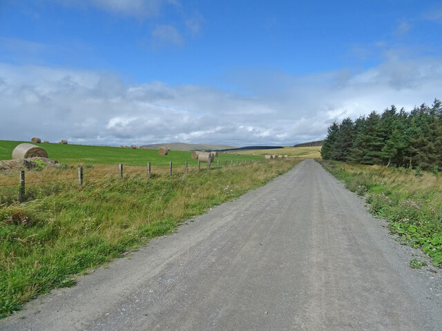
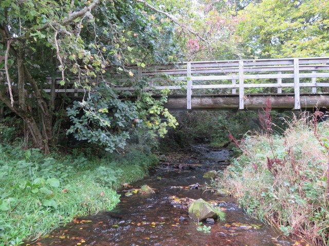
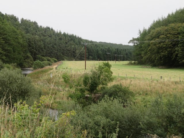
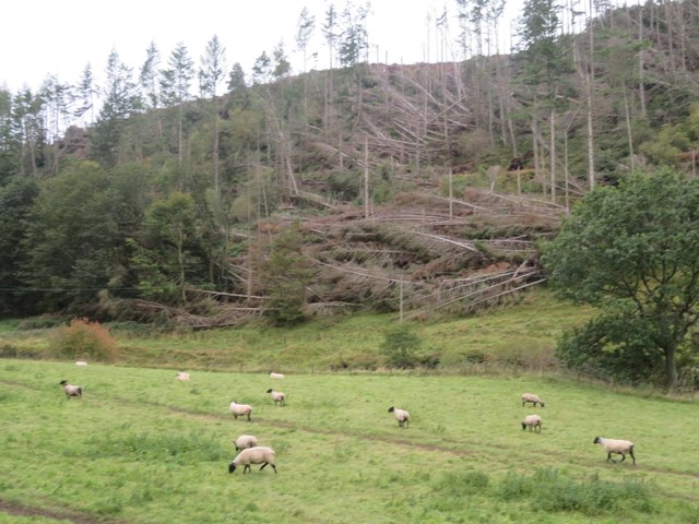
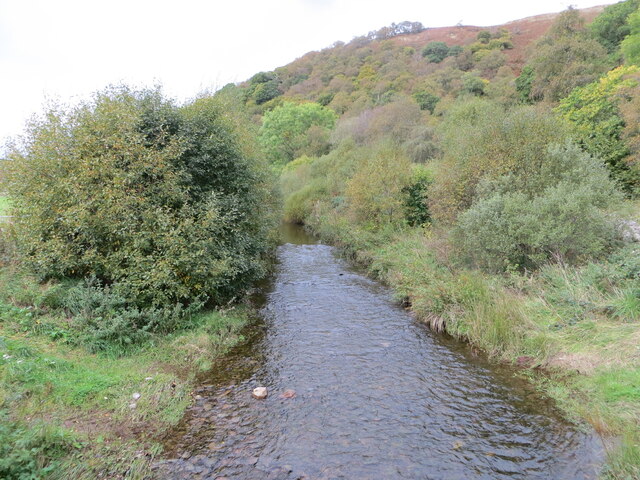
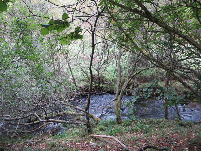
The cleugh, a Scottish term for a narrow valley, is formed by the Shorthope Burn, a small stream that meanders through the landscape. The valley stretches for approximately 2 miles, offering stunning views of the surrounding countryside and the nearby Cheviot Hills.

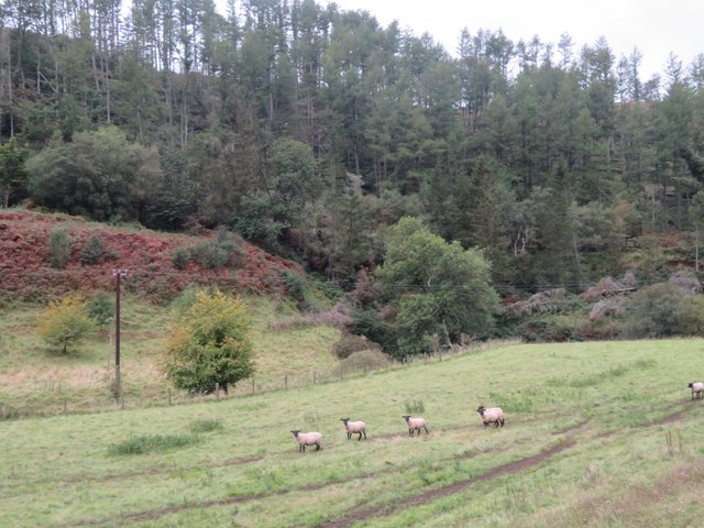
The area is home to a diverse range of flora and fauna, with wildflowers blooming in abundance during the spring and summer months. Visitors can expect to see a variety of bird species, including buzzards and kestrels, soaring overhead. The valley also supports a thriving population of small mammals, such as rabbits and voles.

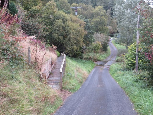
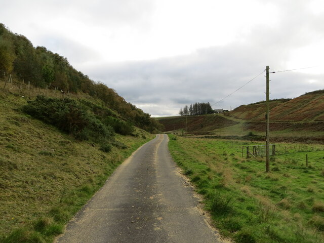
Shorthope Cleugh offers numerous opportunities for outdoor activities and exploration. Hiking and walking trails crisscross the area, allowing visitors to immerse themselves in the natural surroundings. The valley is also a popular spot for picnicking, with several designated areas providing picturesque spots to enjoy a meal or a moment of relaxation.

Due to its rural location, Shorthope Cleugh remains relatively untouched by modern development. This makes it an ideal destination for those seeking a peaceful escape from the hustle and bustle of everyday life. Whether it's for a leisurely stroll, birdwatching, or simply taking in the breathtaking scenery, Shorthope Cleugh is a hidden gem waiting to be discovered.

If you have any feedback on the listing, please let us know in the comments section below.

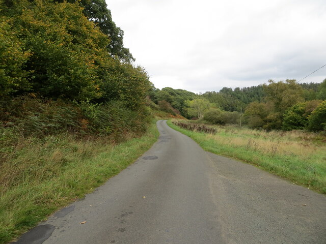
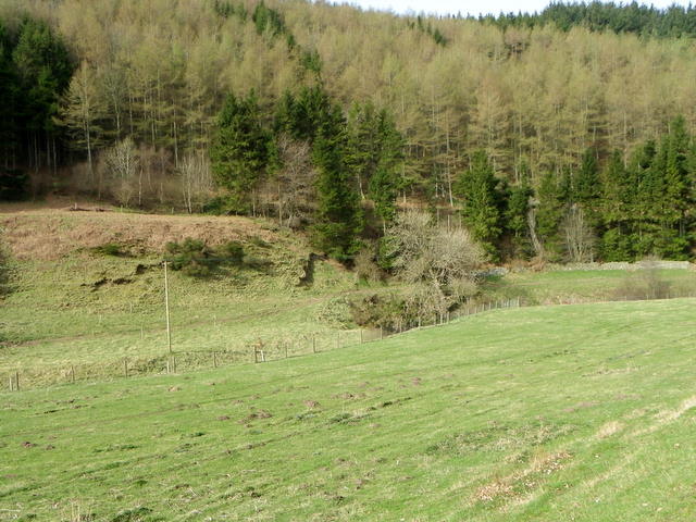
Shorthope Cleugh Images

Images are sourced within 2km of 55.853998/-2.4329796 or Grid Reference NT7262. Thanks to Geograph Open Source API. All images are credited.

Ellemford Viewed from Ellemford Bridge.
Plenty of sheep!
Ellemford
Viewed from Ellemford Bridge. Plenty of sheep!
Track, Kirkgate Hill Track between forest and recently harvested field on the east side of Kirkgate Hill.  Hill in the distance is Spartleton.
Track, Kirkgate Hill
Track between forest and recently harvested field on the east side of Kirkgate Hill. Hill in the distance is Spartleton.
Bales, Kirkgate Hill Bales on the south-east side of Kirkgate Hill in the Scottish Borders near Cranshaws. Presumably for animal feed and have been brought here from elsewhere, given that the field does not look like its recently been harvested.
Bales, Kirkgate Hill
Bales on the south-east side of Kirkgate Hill in the Scottish Borders near Cranshaws. Presumably for animal feed and have been brought here from elsewhere, given that the field does not look like its recently been harvested.
Ellemford farm The farm buildings, beyond a rough grass field.
Ellemford farm
The farm buildings, beyond a rough grass field.
Roughside Wood, Ellemford On the east side of the Whiteadder Water. Looking between two roadside Hawthorns.
Roughside Wood, Ellemford
On the east side of the Whiteadder Water. Looking between two roadside Hawthorns.
Pasture by the Whiteadder Water With the coniferous Roughside Wood across the river.
Pasture by the Whiteadder Water
With the coniferous Roughside Wood across the river.
5 & 6 Ellemford Cottages  On the road to Greenhope. Nos 1-5 are beyond.
5 & 6 Ellemford Cottages
On the road to Greenhope. Nos 1-5 are beyond.
The Whiteadder Water at Greenhope Looking across LT power lines to Roughside Wood.
The Whiteadder Water at Greenhope
Looking across LT power lines to Roughside Wood.
Footbridge over Greenhope Burn Looking upstream from the ford <a href="https://www.geograph.org.uk/photo/7611541">NT7361 : Footpath and ford at Greenhope</a>, just a few metres before the burn joins the Whiteadder Water.
Footbridge over Greenhope Burn
Looking upstream from the ford NT7361 : Footpath and ford at Greenhope, just a few metres before the burn joins the Whiteadder Water.
Footpath and ford at Greenhope The path leads to the footbridge across the Greenhope Burn <a href="https://www.geograph.org.uk/photo/7611533">NT7361 : Footbridge over Greenhope Burn</a>.
Footpath and ford at Greenhope
The path leads to the footbridge across the Greenhope Burn NT7361 : Footbridge over Greenhope Burn.
The valley of the Whiteadder Water at Greenhope With Greenhope Wood on the left and Roughside Wood on the right.
The valley of the Whiteadder Water at Greenhope
With Greenhope Wood on the left and Roughside Wood on the right.
Sheep pasture near Abbey St Bathans By the Monynut Water, with Millbrae Wood beyond.
Sheep pasture near Abbey St Bathans
By the Monynut Water, with Millbrae Wood beyond.
Windthrow in Millbrae Wood Storm damage by the Monynut Burn.
Windthrow in Millbrae Wood
Storm damage by the Monynut Burn.
Minor road following the course of Monynut Water down the valley Looking southward.
Minor road following the course of Monynut Water down the valley
Looking southward.
Monynut Water viewed from Bushelhill Farm Bridge Looking north-westward upstream.
Monynut Water viewed from Bushelhill Farm Bridge
Looking north-westward upstream.
Monynut Water flowing between fields and wooded banks near Godscroft Looking southward.
Monynut Water flowing between fields and wooded banks near Godscroft
Looking southward.
Minor road following the course of Monynut Water down the valley Looking north-eastward from beside Hallbank Wood.
Minor road following the course of Monynut Water down the valley
Looking north-eastward from beside Hallbank Wood.
Molehills near Mill Brae The moles have been very busy in the grassfield near Mill Brae

Moles live in loose, easily diggable soil throughout Britain, from sea level to about 3000ft, but there are no moles in Ireland. They do not colonise poor mountain soil or acid, sandy soil because these contain few earthworms. 

Moles belong to the order of mammals called insectivores, and are related to hedgehogs.

Molehills spoil lawns and sports grounds and reduce the value of pasture. They may also damage blades of cutting machines. In addition, moles rob the soil of earthworms. Farmers and gardeners are therefore their chief enemies. Other enemies include owls, foxes, dogs and cats.

The mole's name is possibly a shortened form of 'mouldiwarp', a names still used in northern England, which is derived from Old English 'molde', meaning earth and 'werpen', meaning to throw. But how can they make the hills when the earth is as hard as iron.
Molehills near Mill Brae
The moles have been very busy in the grassfield near Mill Brae Moles live in loose, easily diggable soil throughout Britain, from sea level to about 3000ft, but there are no moles in Ireland. They do not colonise poor mountain soil or acid, sandy soil because these contain few earthworms. Moles belong to the order of mammals called insectivores, and are related to hedgehogs. Molehills spoil lawns and sports grounds and reduce the value of pasture. They may also damage blades of cutting machines. In addition, moles rob the soil of earthworms. Farmers and gardeners are therefore their chief enemies. Other enemies include owls, foxes, dogs and cats. The mole's name is possibly a shortened form of 'mouldiwarp', a names still used in northern England, which is derived from Old English 'molde', meaning earth and 'werpen', meaning to throw. But how can they make the hills when the earth is as hard as iron.
Show me another place!

Shorthope Cleugh is located at Grid Ref: NT7262 (Lat: 55.853998, Lng: -2.4329796)

Unitary Authority: The Scottish Borders

Police Authority: The Lothians and Scottish Borders

What 3 Words

///libraries.cools.approach. Near Duns, Scottish Borders

Related Wikis

Abbey St Bathans

Abbey St Bathans (Scottish Gaelic: Abaid Bhaoithin) is a parish in the Lammermuir district of Berwickshire, in the eastern part of the Scottish Borders...

Dye Water

The Dye Water (Scottish Gaelic: Uisge DhĂ idh) is a river in the Lammermuir Hills in the Scottish Borders area of Scotland. It rises in the Hope Hills,...

Bothwell Water

The Bothwell Water is a river in the Scottish Borders area of Scotland. It rises in the Lammermuir Hills near Caldercleugh and continues past the Upper...

Cranshaws Castle

Cranshaws Castle or Cranshaws Tower is a privately owned 15th-century pele situated by the village of Cranshaws in Berwickshire, Scotland. The building...

Have you been to Shorthope Cleugh?

Leave your review of Shorthope Cleugh below (or comments, questions and feedback).