Green's Combe

Valley in Somerset Mendip

England

Green's Combe

Farmland next to the A359 North of Bruton
Farmland next to the A359 North of Bruton Credit: David Gearing

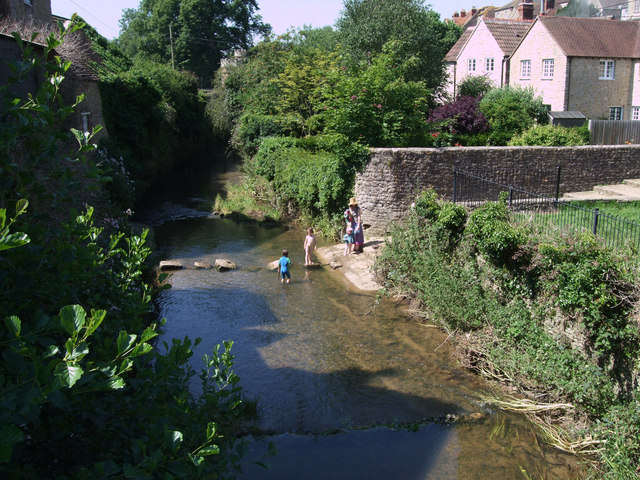
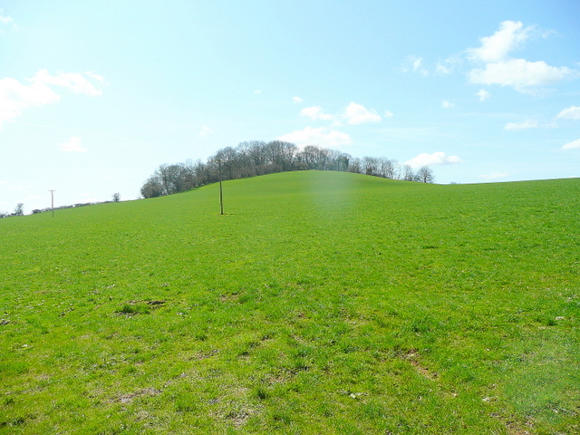
Green's Combe is a picturesque valley located in Somerset, England. Nestled amidst the rolling hills of the Quantock Hills Area of Outstanding Natural Beauty, it is a haven of tranquility and natural beauty. The valley is characterized by its lush green meadows, dense woodlands, and charming streams that meander through the landscape.

The valley is home to a diverse range of flora and fauna, with a variety of wildflowers, ancient trees, and bird species found within its boundaries. The verdant meadows provide a perfect habitat for grazing animals such as sheep and cows, adding to the idyllic rural scenery.

Green's Combe offers numerous walking trails, allowing visitors to explore its unspoiled beauty and enjoy breathtaking views of the surrounding countryside. The trails range in difficulty, catering to both casual strollers and more adventurous hikers. The valley's peaceful atmosphere and stunning vistas make it a popular destination for nature lovers, photographers, and those seeking a break from the hustle and bustle of everyday life.

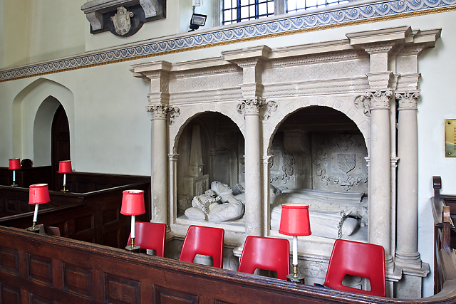
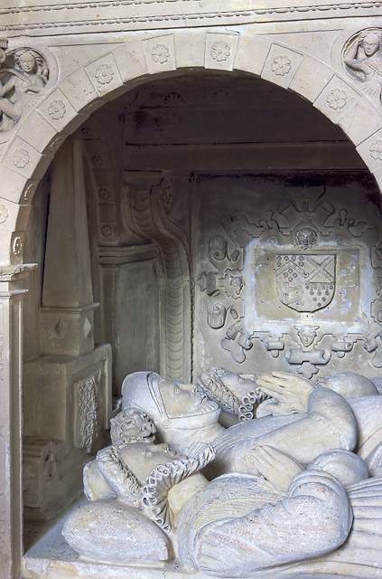
The valley is also steeped in history, with evidence of human settlement dating back thousands of years. Archaeological finds have revealed traces of ancient settlements and burial sites, offering a glimpse into the area's past.

Green's Combe is a true gem of Somerset, offering a slice of unspoiled natural beauty and a chance to connect with nature. Whether it's a leisurely stroll, a picnic by the stream, or simply enjoying the serenity of the surroundings, this valley has something to offer for everyone seeking solace in the embrace of nature.

If you have any feedback on the listing, please let us know in the comments section below.

Green's Combe Images

Images are sourced within 2km of 51.128577/-2.4590124 or Grid Reference ST6736. Thanks to Geograph Open Source API. All images are credited.

Farmland next to the A359 North of Bruton
Stepping Stones, Bruton The stepping stones across the River Brue in Bruton are an ideal place for children to bathe on a hot summer's day. Here, they are seen from the Packhorse Bridge.
Stepping Stones, Bruton
The stepping stones across the River Brue in Bruton are an ideal place for children to bathe on a hot summer's day. Here, they are seen from the Packhorse Bridge.
St Mary's church, Bruton - Berkeley tomb In the chancel are the recumbent effigies of Sir Maurice Berkeley of Bruton, flanked on either side by his two wives. The stone tomb-chest has strapwork panels below hidden by the seating, and cartouches at the back of the recess. Sir Maurice died in 1581, his first wife Catherine in 1559, and Elizabeth his second wife in 1585.
St Mary's church, Bruton - Berkeley tomb
In the chancel are the recumbent effigies of Sir Maurice Berkeley of Bruton, flanked on either side by his two wives. The stone tomb-chest has strapwork panels below hidden by the seating, and cartouches at the back of the recess. Sir Maurice died in 1581, his first wife Catherine in 1559, and Elizabeth his second wife in 1585.
St Mary's church, Bruton - Berkeley tomb (detail)
St Mary's church, Bruton - monument to William Godolphin Set within an oval niche is an impressive bronze bust of William Godolphin in armour (†1636) that has been attributed to Hubert Le Suer.
St Mary's church, Bruton - monument to William Godolphin
Set within an oval niche is an impressive bronze bust of William Godolphin in armour (†1636) that has been attributed to Hubert Le Suer.
St Mary's church, Bruton - monument to William Godolphin (detail)
St Mary's church, Bruton - Royal Arms of Charles II The colourful coat of arms of Charles II.
St Mary's church, Bruton - Royal Arms of Charles II
The colourful coat of arms of Charles II.
St Mary's church, Bruton - interior The view east towards the chancel.
St Mary's church, Bruton - interior
The view east towards the chancel.
St Mary's church, Bruton - interior (2) The chancel dates from a rebuild of 1743.
St Mary's church, Bruton - interior (2)
The chancel dates from a rebuild of 1743.
St Mary's church, Bruton Described by Pevsner as 'One of the proudest churches of East Somerset' it dates from the C14. Its very fine tower of over 100 feet was added in the late C15.
St Mary's church, Bruton
Described by Pevsner as 'One of the proudest churches of East Somerset' it dates from the C14. Its very fine tower of over 100 feet was added in the late C15.
Benchmark on St Mary's Church Buttress Ordnance Survey cut mark benchmark described on the Bench Mark Database at <span class="nowrap"><a title="http://www.bench-marks.org.uk/bm45515" rel="nofollow ugc noopener" href="http://www.bench-marks.org.uk/bm45515">Link</a><img style="margin-left:2px;" alt="External link" title="External link - shift click to open in new window" src="https://s1.geograph.org.uk/img/external.png" width="10" height="10"/></span>
Benchmark on St Mary's Church Buttress
Ordnance Survey cut mark benchmark described on the Bench Mark Database at LinkExternal link
St Mary's Church There is an OS benchmark <a href="https://www.geograph.org.uk/photo/3205454">ST6834 : Benchmark on St Mary's Church Buttress</a> on the near tower corner buttress
St Mary's Church
There is an OS benchmark ST6834 : Benchmark on St Mary's Church Buttress on the near tower corner buttress
Benchmark on the north face of St Mary's Church tower Ordnance Survey cut mark benchmark described on the Bench Mark Database at <span class="nowrap"><a title="http://www.bench-marks.org.uk/bm35994" rel="nofollow ugc noopener" href="http://www.bench-marks.org.uk/bm35994">Link</a><img style="margin-left:2px;" alt="External link" title="External link - shift click to open in new window" src="https://s1.geograph.org.uk/img/external.png" width="10" height="10"/></span>
Benchmark on the north face of St Mary's Church tower
Ordnance Survey cut mark benchmark described on the Bench Mark Database at LinkExternal link
Flood level marker beside St Mary's Church tower The flood level plate to the right of the tower buttresses records a flood on 28 June 1917. There is also an OS benchmark <a href="https://www.geograph.org.uk/photo/3205476">ST6834 : Benchmark on the north face of St Mary's Church tower</a> to the left of the buttresses.
Flood level marker beside St Mary's Church tower
The flood level plate to the right of the tower buttresses records a flood on 28 June 1917. There is also an OS benchmark ST6834 : Benchmark on the north face of St Mary's Church tower to the left of the buttresses.
Benchmark on the School Shop Ordnance Survey cut mark benchmark described on the Bench Mark Database at <span class="nowrap"><a title="http://www.bench-marks.org.uk/bm45516" rel="nofollow ugc noopener" href="http://www.bench-marks.org.uk/bm45516">Link</a><img style="margin-left:2px;" alt="External link" title="External link - shift click to open in new window" src="https://s1.geograph.org.uk/img/external.png" width="10" height="10"/></span>
Benchmark on the School Shop
Ordnance Survey cut mark benchmark described on the Bench Mark Database at LinkExternal link
The School Shop There is an OS benchmark <a href="https://www.geograph.org.uk/photo/3206338">ST6834 : Benchmark on the School Shop</a> on the side of the buttress on the right hand side of the porch.
The School Shop
There is an OS benchmark ST6834 : Benchmark on the School Shop on the side of the buttress on the right hand side of the porch.
Benchmark on #30 High Street Ordnance Survey cut mark benchmark described on the Bench Mark Database at <span class="nowrap"><a title="http://www.bench-marks.org.uk/bm45517" rel="nofollow ugc noopener" href="http://www.bench-marks.org.uk/bm45517">Link</a><img style="margin-left:2px;" alt="External link" title="External link - shift click to open in new window" src="https://s1.geograph.org.uk/img/external.png" width="10" height="10"/></span>
Benchmark on #30 High Street
Ordnance Survey cut mark benchmark described on the Bench Mark Database at LinkExternal link
#30 High Street Listed Grade II described as:
Small town house, in row. Early C18. Local stone rubble with Doulting stone dressings; possibly flat roof hidden by parapets; brick end chimney stack. 3 storeys, one bay. Plinth, large ashlar quoins, band course below shallow parapet which has angled upsweeps each side. Ground floor re-arranged, with 2 single-light casements in plain surrounds to left of late C20 part glazed door - door originally central with smaller sidelights; to first floor Venetian window with small-pane casements in plain surround; above 3 single-light casements in linked surround. Interior much altered at ground floor level.
There is an OS benchmark <a href="https://www.geograph.org.uk/photo/3206932">ST6834 : Benchmark on #30 High Street</a> on the side jut face of the building which is next to a (former?) church on the far side.
#30 High Street
Listed Grade II described as: Small town house, in row. Early C18. Local stone rubble with Doulting stone dressings; possibly flat roof hidden by parapets; brick end chimney stack. 3 storeys, one bay. Plinth, large ashlar quoins, band course below shallow parapet which has angled upsweeps each side. Ground floor re-arranged, with 2 single-light casements in plain surrounds to left of late C20 part glazed door - door originally central with smaller sidelights; to first floor Venetian window with small-pane casements in plain surround; above 3 single-light casements in linked surround. Interior much altered at ground floor level. There is an OS benchmark ST6834 : Benchmark on #30 High Street on the side jut face of the building which is next to a (former?) church on the far side.
Show me another place!

Green's Combe is located at Grid Ref: ST6736 (Lat: 51.128577, Lng: -2.4590124)

Administrative County: Somerset

District: Mendip

Police Authority: Avon and Somerset

What 3 Words

///enrolling.merely.strutting. Near Bruton, Somerset

Nearby Locations

Green's Combe

Related Wikis

Creech Hill

Creech Hill is a hill in south east Somerset, England, which is notable for a univallate Iron Age hill fort. The hill is situated approximately 1.2 miles...

Milton Clevedon

Milton Clevedon is a village and civil parish 1 mile (1.6 km) south of Evercreech in the Mendip district of Somerset, England. == History == The name of...

Bruton

Bruton ( BROO-tən) is a market town, electoral ward, and civil parish in Somerset, England, on the River Brue and the A359 between Frome and Yeovil. It...

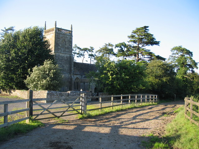
Church of St James, Milton Clevedon

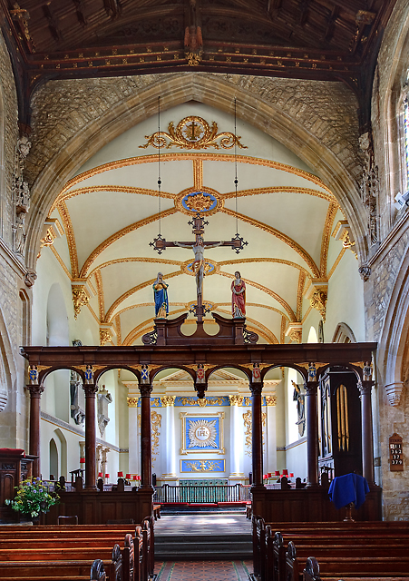
The Anglican Church of St James in Milton Clevedon, within the English county of Somerset, was rebuilt in 1790. It is a Grade II* listed building.The first...

Sexey's Hospital

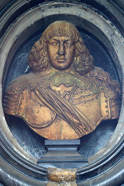
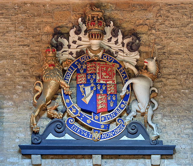
Sexey's Hospital in Bruton, Somerset, England was built around 1630 as almshouses. The West Wing and chapel have been designated as a Grade I listed building...
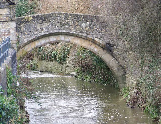
Bow Bridge, Plox

Bow Bridge is a 15th-century packhorse bridge over the River Brue in Plox, Bruton, Somerset, England. It has been designated as a Grade I listed building...

Church of St Mary and St John, Lamyat

The Anglican Church Of St Mary and St John in Lamyatt, within the English county of Somerset, was built in the 13th century. It is a Grade II* listed building...

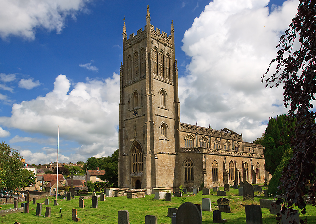
St Mary's Church, Bruton

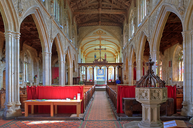
The Church of St Mary in Bruton, Somerset, England was largely built in the 14th century. Like many Somerset churches, it has a very fine tower; less usually...

Nearby Amenities

Located within 500m of 51.128577,-2.4590124
The data included in this document is from www.openstreetmap.org. The data is made available under ODbL.

Have you been to Green's Combe?

Leave your review of Green's Combe below (or comments, questions and feedback).