Batcombe Bottom

Valley in Somerset Mendip

England

Batcombe Bottom

2011 : Track and footpath to Batcombe The track is not a public right of way, the footpath is.
Batcome is in the valley beyond the well trimmed hedgerow.
2011 : Track and footpath to Batcombe Credit: Maurice Pullin

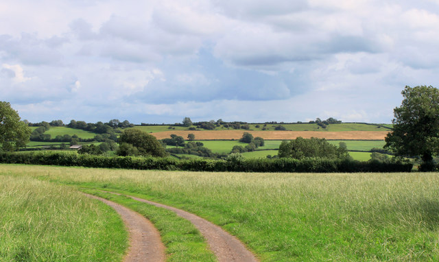
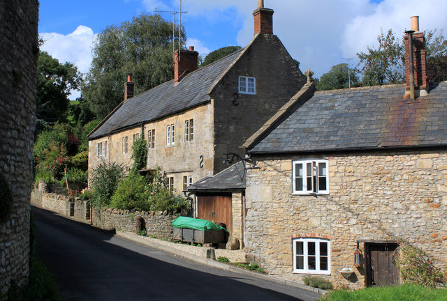
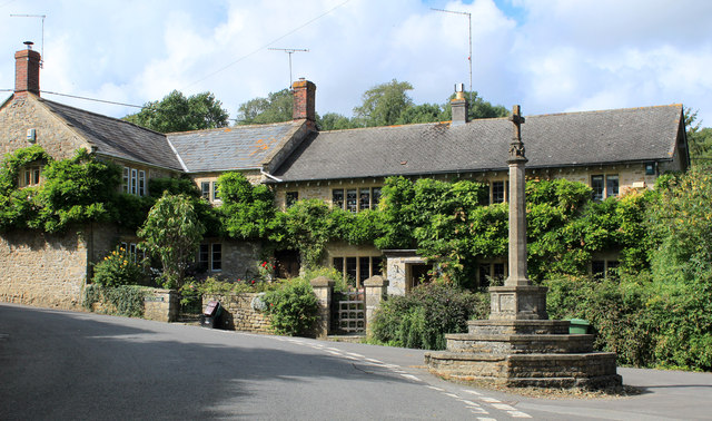
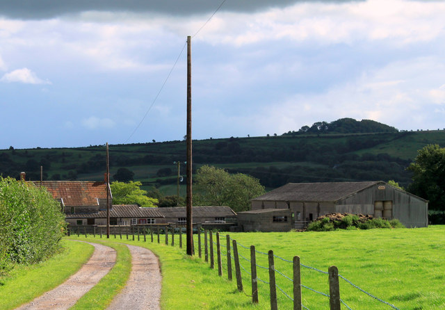
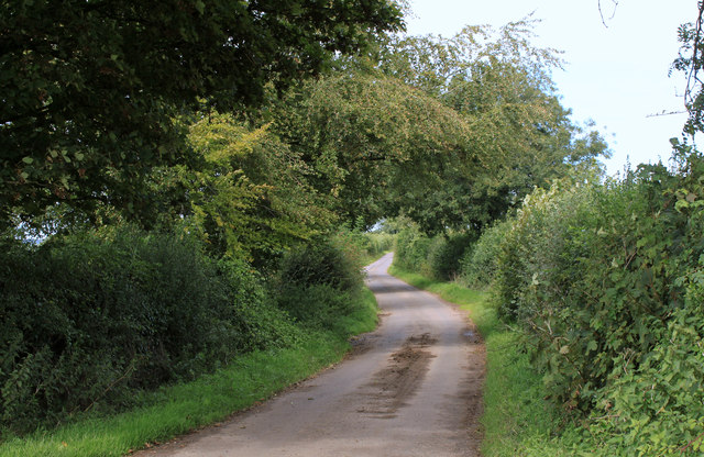
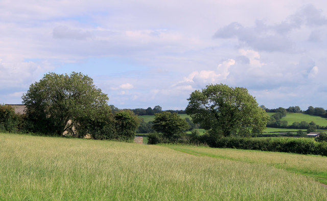
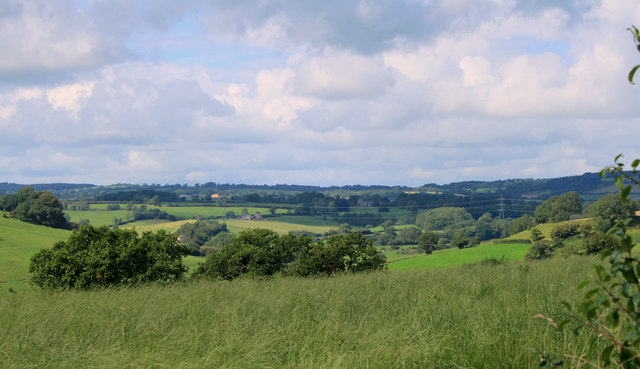
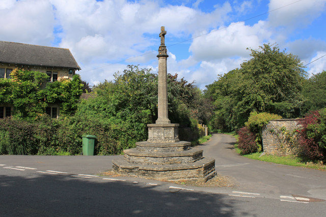
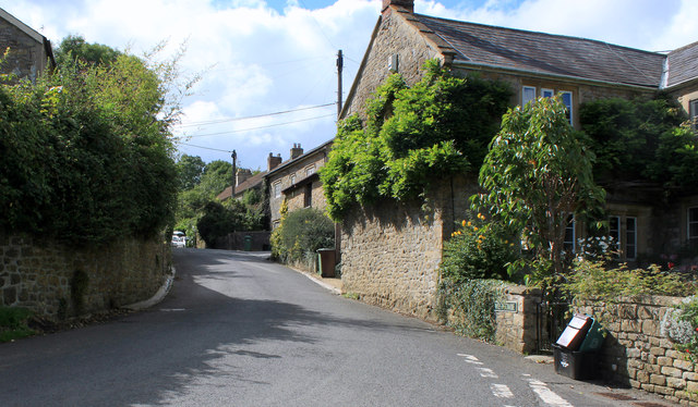
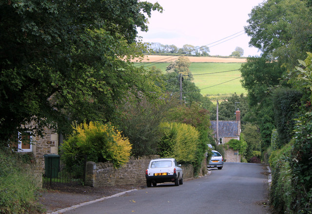
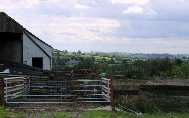
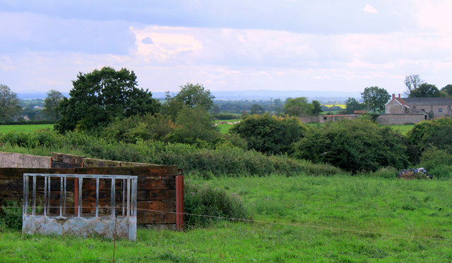
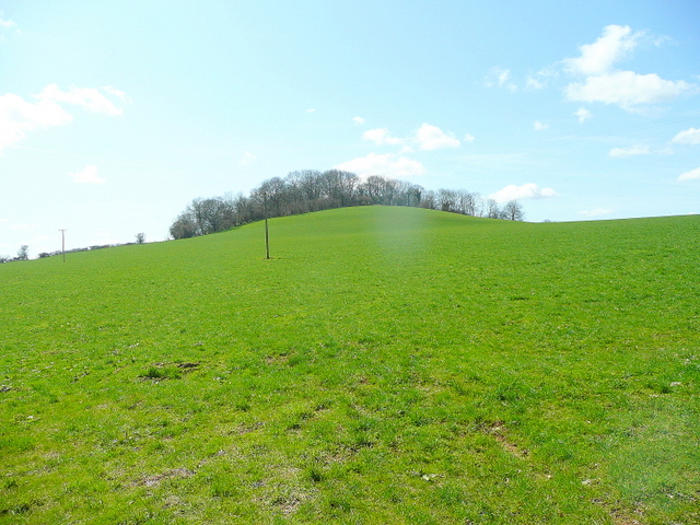
Batcombe Bottom is a picturesque valley located in the county of Somerset, England. Situated near the village of Batcombe, this valley offers breathtaking natural beauty and a tranquil atmosphere. It is surrounded by rolling hills, lush green meadows, and ancient woodlands, making it an ideal destination for nature enthusiasts and those seeking a peaceful retreat.

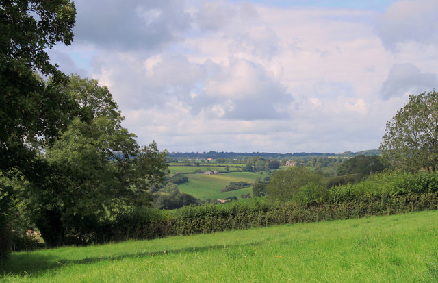
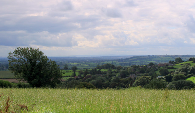
The valley is renowned for its diverse flora and fauna, including a variety of wildflowers, birds, and small mammals. Walking along the footpaths that crisscross the area, visitors can enjoy the sights and sounds of nature, while also taking in the stunning panoramic views of the surrounding countryside.

Batcombe Bottom is intersected by a charming stream, which adds to the valley's charm and provides a calming soundtrack as it meanders through the landscape. The stream is home to various aquatic species, and its banks offer a serene spot for picnicking or simply relaxing by the water's edge.

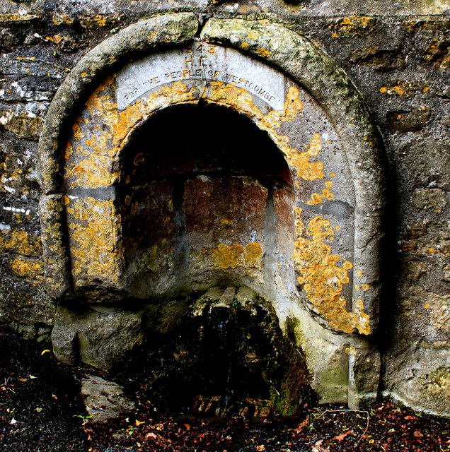
The valley is also steeped in history, with evidence of human habitation dating back thousands of years. Archaeological discoveries in the area have included ancient settlements, burial sites, and remnants of Roman occupation, providing a glimpse into the region's rich past.

Overall, Batcombe Bottom is a hidden gem in Somerset, offering visitors a chance to escape the hustle and bustle of modern life and immerse themselves in the beauty of the natural world. Whether it's a leisurely stroll, a picnic by the stream, or a day of wildlife spotting, this valley provides a truly enchanting experience for all who visit.

If you have any feedback on the listing, please let us know in the comments section below.

Batcombe Bottom Images

Images are sourced within 2km of 51.142363/-2.4633804 or Grid Reference ST6738. Thanks to Geograph Open Source API. All images are credited.

2011 : Track and footpath to Batcombe The track is not a public right of way, the footpath is.
Batcome is in the valley beyond the well trimmed hedgerow.
2011 : Track and footpath to Batcombe
The track is not a public right of way, the footpath is. Batcome is in the valley beyond the well trimmed hedgerow.
2011 : Cottages in Batcombe On my first visit to Batcome the impression I had was of a small but lively village, an impression borne out by its website.

"The village of Batcombe has a long history that goes back to Saxon times. It became rich in the 14th century due to the woollen trade and it was during this time that the very fine Parish Church of St Mary the Blessed Virgin was built to replace the earlier structure. It boasts a fine tower which affords splendid views of the beautiful valley in which Batcombe nestles.
Local Mendip limestone has historically been used to construct the local cottages and houses, many of which date from the 17th and 18th centuries."

The above was copied from: <span class="nowrap"><a title="http://www.batcombe.org.uk/history.htm" rel="nofollow ugc noopener" href="http://www.batcombe.org.uk/history.htm">Link</a><img style="margin-left:2px;" alt="External link" title="External link - shift click to open in new window" src="https://s1.geograph.org.uk/img/external.png" width="10" height="10"/></span> an informative website.
2011 : Cottages in Batcombe
On my first visit to Batcome the impression I had was of a small but lively village, an impression borne out by its website. "The village of Batcombe has a long history that goes back to Saxon times. It became rich in the 14th century due to the woollen trade and it was during this time that the very fine Parish Church of St Mary the Blessed Virgin was built to replace the earlier structure. It boasts a fine tower which affords splendid views of the beautiful valley in which Batcombe nestles. Local Mendip limestone has historically been used to construct the local cottages and houses, many of which date from the 17th and 18th centuries." The above was copied from: LinkExternal link an informative website.
2011 : War Memorial and cottages Westcombe The three front gates, three front doors and three TV aerials suggest this is a row of three cottages not a single grand house, though it may have been at one time. 

The wisteria must have been terrific.
2011 : War Memorial and cottages Westcombe
The three front gates, three front doors and three TV aerials suggest this is a row of three cottages not a single grand house, though it may have been at one time. The wisteria must have been terrific.
2011 : Drive to Fosse Combe Cottage OS Explorer 142 calls it a cottage but looks more like a farm to me.
The hill in the background keeps itself in the shadow because it is in the next grid square.
2011 : Drive to Fosse Combe Cottage
OS Explorer 142 calls it a cottage but looks more like a farm to me. The hill in the background keeps itself in the shadow because it is in the next grid square.
2011 : South on Cockpit Lane to Batcombe
2011 : Top of the hill above Batcombe Looking south east, Batcombe is in the valley below.
2011 : Top of the hill above Batcombe
Looking south east, Batcombe is in the valley below.
2011 : West of north from Cockpit Lane Looking up the valley toward Higher Alham.
2011 : West of north from Cockpit Lane
Looking up the valley toward Higher Alham.
2011 : West from Cockpit Lane A meadow which looks overdue for mowing then the valley of the River Alham.
2011 : West from Cockpit Lane
A meadow which looks overdue for mowing then the valley of the River Alham.
2011 : Mendip view from Cockpit Lane
2011 : Kale Street, Batcombe Heading east toward Upton Noble.
The green sign proclaims "Designers Makers" what they design and what they make have been unable to discover, even with the power of the web.
2011 : Kale Street, Batcombe
Heading east toward Upton Noble. The green sign proclaims "Designers Makers" what they design and what they make have been unable to discover, even with the power of the web.
2011 : Cottages in Kale Street, Batcombe Signs of roof repairs bottom left. Pretty successful top left.
Kale Street heads east out of the village to the A359 and Upton Noble.
2011 : Cottages in Kale Street, Batcombe
Signs of roof repairs bottom left. Pretty successful top left. Kale Street heads east out of the village to the A359 and Upton Noble.
2011 : Gold Hill, Batcombe Looking toward the River Alham.
2011 : Gold Hill, Batcombe
Looking toward the River Alham.
2011 : Westcombe War Memorial And wheely bin.
For a view from the west see <a href="https://www.geograph.org.uk/photo/341181">ST6739 : Westcombe</a>
The lane behind goes to Home Farm.
2011 : Westcombe War Memorial
And wheely bin. For a view from the west see ST6739 : Westcombe The lane behind goes to Home Farm.
2011 : The heart of Westcombe, looking west Toward Stoney Stratton and Evercreech.
Like Batcombe, Westcombe displays a healthy contempt for the web. Makes life a little difficult for the geographer but who is to blame it?
2011 : The heart of Westcombe, looking west
Toward Stoney Stratton and Evercreech. Like Batcombe, Westcombe displays a healthy contempt for the web. Makes life a little difficult for the geographer but who is to blame it?
2011 : Down Westcombe Way When people in Westcombe say "Drop in sometime" they really mean it.
Cockpit Lane is at the top of the distant hill, the River Alham runs along the foot.
2011 : Down Westcombe Way
When people in Westcombe say "Drop in sometime" they really mean it. Cockpit Lane is at the top of the distant hill, the River Alham runs along the foot.
2011 : Water supply Westcombe This image has been over-enhanced to improve the legibility of the inscription which reads: "1843  H.E. for the people of Westcombe".
2011 : Water supply Westcombe
This image has been over-enhanced to improve the legibility of the inscription which reads: "1843 H.E. for the people of Westcombe".
2011 : Farm buildings south of Westcombe Road Looking south between Stoney Stratton and Westcombe.
Fosse Combe Gully is beyond the farm buildings with Manor Farm beyond that, a church tower is almost hidden by trees, visible in the enlarged version. Seems to be connected to the farm, possibly all that is left of a lost village.
2011 : Farm buildings south of Westcombe Road
Looking south between Stoney Stratton and Westcombe. Fosse Combe Gully is beyond the farm buildings with Manor Farm beyond that, a church tower is almost hidden by trees, visible in the enlarged version. Seems to be connected to the farm, possibly all that is left of a lost village.
2011 : South west from Westcombe Road The corner of a farmyard with a cattle feeder. Recycled railway sleepers form the wall.
Fosse Combe Gully crosses the frame, Fosse Combe Cottage is to the right.
2011 : South west from Westcombe Road
The corner of a farmyard with a cattle feeder. Recycled railway sleepers form the wall. Fosse Combe Gully crosses the frame, Fosse Combe Cottage is to the right.
Show me another place!

Batcombe Bottom is located at Grid Ref: ST6738 (Lat: 51.142363, Lng: -2.4633804)

Administrative County: Somerset

District: Mendip

Police Authority: Avon and Somerset

What 3 Words

///tastes.lads.wisdom. Near Evercreech, Somerset

Nearby Locations

Batcombe Bottom

Related Wikis

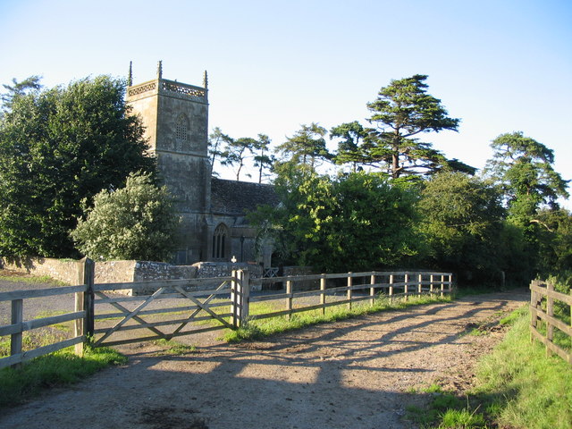
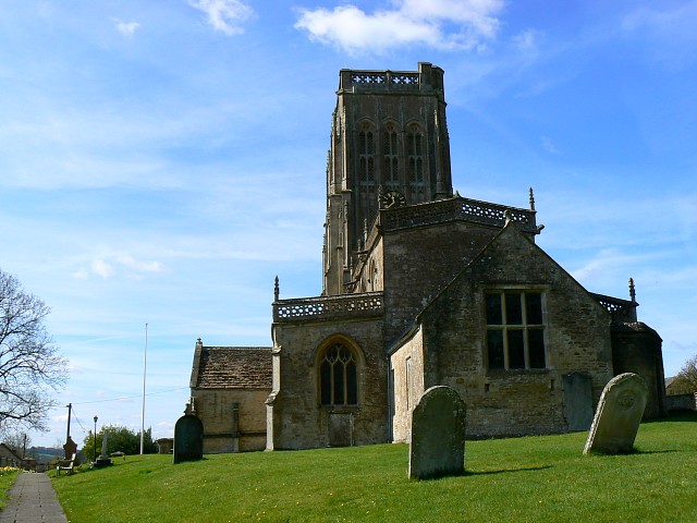
Church of St James, Milton Clevedon

The Anglican Church of St James in Milton Clevedon, within the English county of Somerset, was rebuilt in 1790. It is a Grade II* listed building.The first...

Milton Clevedon

Milton Clevedon is a village and civil parish 1 mile (1.6 km) south of Evercreech in the Mendip district of Somerset, England. == History == The name of...

Batcombe, Somerset

Batcombe is a village and civil parish in Somerset, England, situated in the steep valley of the River Alham 5 miles (8 km) south-east of Shepton Mallet...

Church of St Mary and St John, Lamyat

The Anglican Church Of St Mary and St John in Lamyatt, within the English county of Somerset, was built in the 13th century. It is a Grade II* listed building...

Small Down Knoll

Small Down Knoll, or Small Down Camp, is a Bronze Age hill fort near Evercreech in Somerset, England. The hill is on the southern edge of the Mendip Hills...

Creech Hill

Creech Hill is a hill in south east Somerset, England, which is notable for a univallate Iron Age hill fort. The hill is situated approximately 1.2 miles...

Evercreech

Evercreech is a village and civil parish in Somerset, England. The village is 3 miles (4.8 km) southeast of Shepton Mallet, and 5 miles (8.0 km) northeast...

Evercreech New railway station

Evercreech New, originally called "Evercreech Village", was a railway station at Evercreech on the Somerset and Dorset Joint Railway. The station opened...

Nearby Amenities

Located within 500m of 51.142363,-2.4633804
Barrier: swing_gate
Lat/Long: 51.1425181/-2.4603583
Barrier: kissing_gate
Kissing Gate: square_profile
Lat/Long: 51.1424744/-2.4604012
Barrier: swing_gate
Lat/Long: 51.1434522/-2.4697968
Barrier: stile
Lat/Long: 51.1433777/-2.4698664
The data included in this document is from www.openstreetmap.org. The data is made available under ODbL.

Have you been to Batcombe Bottom?

Leave your review of Batcombe Bottom below (or comments, questions and feedback).