Bowderdale

Valley in Westmorland Eden

England

Bowderdale

Bowderdale Beck Lovely watercourse through the valley.
Bowderdale Beck Credit: steven ruffles

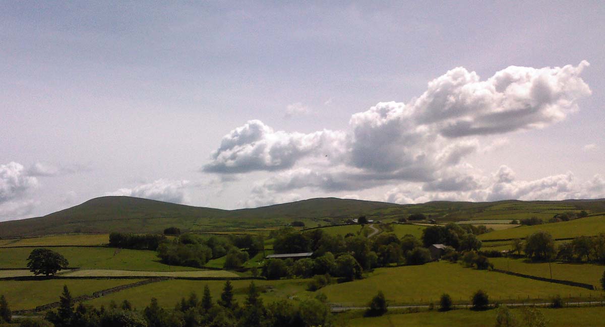
Bowderdale is a picturesque valley located in the historical county of Westmorland, in the northwestern region of England. Nestled within the Yorkshire Dales National Park, this stunning valley is renowned for its natural beauty, diverse wildlife, and tranquil atmosphere.

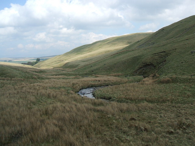
Situated to the east of the village of Ravenstonedale, Bowderdale offers visitors breathtaking views of rolling hills, lush green meadows, and babbling streams. The valley is flanked by towering peaks, including the prominent mountains of Kensgriff and Yarlside, which provide a dramatic backdrop to the scenery.

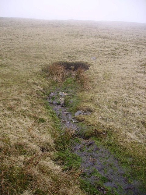
Bowderdale is a haven for nature lovers and outdoor enthusiasts. The valley is crisscrossed by numerous walking and hiking trails, ranging from gentle strolls to challenging treks. The landscape is dotted with ancient stone walls and scattered with traditional stone barns, adding to its charm and character.

Wildlife thrives in Bowderdale, with sightings of red deer, birds of prey, and various small mammals being common. The valley is also home to a diverse range of plant species, including rare orchids and wildflowers.

For those seeking tranquility and a break from the hustle and bustle of city life, Bowderdale offers the perfect retreat. The valley boasts several camping and caravan sites, allowing visitors to immerse themselves in the peaceful surroundings and enjoy the starry night skies.

In conclusion, Bowderdale in Westmorland is a stunning valley that offers visitors a chance to experience the beauty of the Yorkshire Dales National Park. With its breathtaking landscapes, abundant wildlife, and peaceful atmosphere, it is a destination that appeals to nature lovers and outdoor enthusiasts alike.

If you have any feedback on the listing, please let us know in the comments section below.
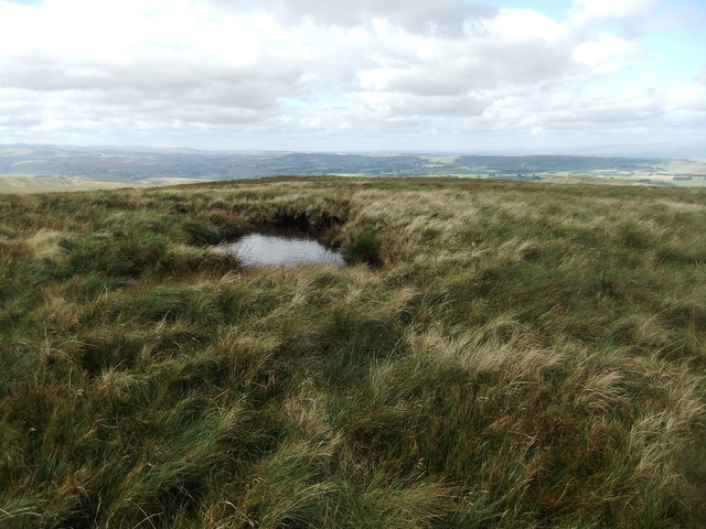
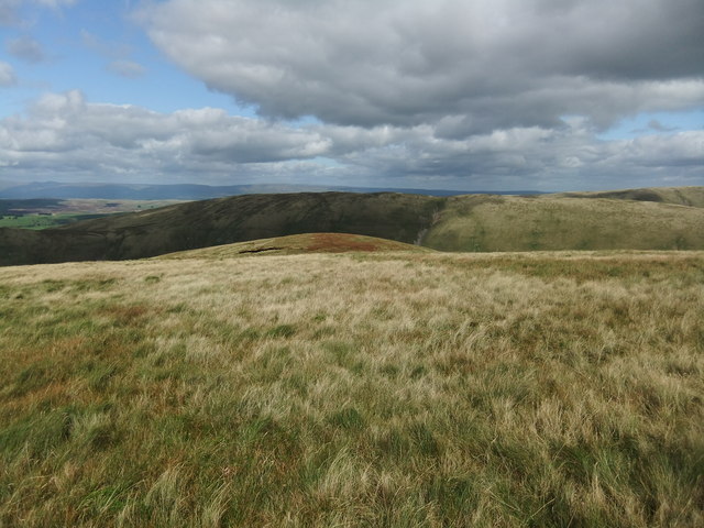
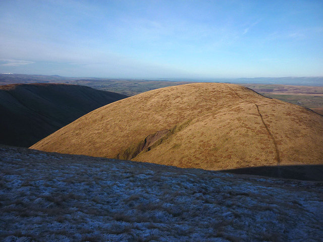
Bowderdale Images

Images are sourced within 2km of 54.407137/-2.5001826 or Grid Reference NY6701. Thanks to Geograph Open Source API. All images are credited.

Bowderdale Beck Lovely watercourse through the valley.
Bowderdale Beck
Lovely watercourse through the valley.
Gill confluence Little Nevy Gill on the right and Great Nevy Gill on the left.
Gill confluence
Little Nevy Gill on the right and Great Nevy Gill on the left.
Small pool at the 561m spot height
The sunlit hump is Combs
The track climbing onto Hooksey A quad bike/tractor track makes for easy going up the long gradient onto Hooksey, a spur that runs north from the dome of Randygill Top. Across the deep trench of Bowderdale is the shadowed ridge of West Fell. In the distance, snow sits on the tops of the High Street fells in the eastern Lake District.
The track climbing onto Hooksey
A quad bike/tractor track makes for easy going up the long gradient onto Hooksey, a spur that runs north from the dome of Randygill Top. Across the deep trench of Bowderdale is the shadowed ridge of West Fell. In the distance, snow sits on the tops of the High Street fells in the eastern Lake District.
Sheep bield, Hooksey Two low drystone walls in the shape of a right-angle provide very little shelter to any sheep up here in foul weather. Rocks and stones are at a premium here in the Howgills so whoever built this had a job on their hands. They may have had to haul them up from the valley slopes below.
Sheep bield, Hooksey
Two low drystone walls in the shape of a right-angle provide very little shelter to any sheep up here in foul weather. Rocks and stones are at a premium here in the Howgills so whoever built this had a job on their hands. They may have had to haul them up from the valley slopes below.
On Hooksey looking over Weasdale Looking out from the northern Howgills to the limestone hills around Smardale. Beyond, on the skyline are the moors about Stainmore leading north to the North Pennines further left.
On Hooksey looking over Weasdale
Looking out from the northern Howgills to the limestone hills around Smardale. Beyond, on the skyline are the moors about Stainmore leading north to the North Pennines further left.
Small cairn on Hooksey Somebody (possibly a keen walker, I doubt a farmer would bother with such a small pile) went to some considerable trouble to gather these together in such an overwhelmingly grassy area. There isn't even a noticeably high spot to place a cairn on Hooksey (unless the name also applies to the more pronounced high point further south before Leathgill Bridge). Whatever, we are sufficiently elevated here and sufficiently far north to be able to see most of the Lakeland skyline along the western horizon.
Small cairn on Hooksey
Somebody (possibly a keen walker, I doubt a farmer would bother with such a small pile) went to some considerable trouble to gather these together in such an overwhelmingly grassy area. There isn't even a noticeably high spot to place a cairn on Hooksey (unless the name also applies to the more pronounced high point further south before Leathgill Bridge). Whatever, we are sufficiently elevated here and sufficiently far north to be able to see most of the Lakeland skyline along the western horizon.
On Hooksey looking over Weasdale Great Swindale is the side valley in deep shadow with the moors around Stainmore on the far skyline.
On Hooksey looking over Weasdale
Great Swindale is the side valley in deep shadow with the moors around Stainmore on the far skyline.
Frozen pool on Hooksey Iced over after several days of sub-zero temperatures.
Frozen pool on Hooksey
Iced over after several days of sub-zero temperatures.
The Weasdale flank of Green Bell A typically Howgill scene of steep, uniform grass slopes scored by scree gullies. The trig point on the 605m summit can just be seen with a walker standing next to it (one of only three people I saw out on the hills all afternoon).
The Weasdale flank of Green Bell
A typically Howgill scene of steep, uniform grass slopes scored by scree gullies. The trig point on the 605m summit can just be seen with a walker standing next to it (one of only three people I saw out on the hills all afternoon).
Hooksey (586m) The winter afternoon sunshine lights up the southern slopes of Hooksey leaving the northern flank of Randygill Top frozen in shadow. Actually, the 586m top has no name on the map, 'Hooksey' seemingly referring to the end of the spur a kilometre to the north.
Hooksey (586m)
The winter afternoon sunshine lights up the southern slopes of Hooksey leaving the northern flank of Randygill Top frozen in shadow. Actually, the 586m top has no name on the map, 'Hooksey' seemingly referring to the end of the spur a kilometre to the north.
Scree and sheep above Weasdale A few sheep graze between scree patches on the steep flank of Green Bell.
Scree and sheep above Weasdale
A few sheep graze between scree patches on the steep flank of Green Bell.
Frozen pools on Leathgill Bridge The steep northern flanks of Randygill Top ensure that the col of Leathgill Bridge is in almost permanent shade at this time of year. While Green Bell and Stockless bask in winter sunshine the pools are frozen and the grass rimed with frost down here.
Frozen pools on Leathgill Bridge
The steep northern flanks of Randygill Top ensure that the col of Leathgill Bridge is in almost permanent shade at this time of year. While Green Bell and Stockless bask in winter sunshine the pools are frozen and the grass rimed with frost down here.
High Knott A fairly nondescript rise on the moor above Weasdale.
High Knott
A fairly nondescript rise on the moor above Weasdale.
Sunlight and shadow, Weasdale Looking down into the sequestered valley of Weasdale in the remote-feeling northern Howgills. At this time of year there will be places down there that rarely (if at all) see direct sunshine.
Sunlight and shadow, Weasdale
Looking down into the sequestered valley of Weasdale in the remote-feeling northern Howgills. At this time of year there will be places down there that rarely (if at all) see direct sunshine.
Across Langdale Knott An easterly gale is blasting the summit (bare, exposed and no shelter). Beyond is the deep trench of Langdale, the longest and most remote of the valleys that penetrate the heart of the Howgill Fells.
Across Langdale Knott
An easterly gale is blasting the summit (bare, exposed and no shelter). Beyond is the deep trench of Langdale, the longest and most remote of the valleys that penetrate the heart of the Howgill Fells.
Overlooking Langdale, the Howgill Fells A freezing easterly gale is sweeping across the exposed summits and so we have abandoned our plan to continue onto West Fell. Unfortunately, we now face a very steep descent into Langdale via a scree gully and grass slopes covered in slippery powder snow.
Overlooking Langdale, the Howgill Fells
A freezing easterly gale is sweeping across the exposed summits and so we have abandoned our plan to continue onto West Fell. Unfortunately, we now face a very steep descent into Langdale via a scree gully and grass slopes covered in slippery powder snow.
Show me another place!

Bowderdale is located at Grid Ref: NY6701 (Lat: 54.407137, Lng: -2.5001826)

Administrative County: Cumbria

District: Eden

Police Authority: Cumbria

What 3 Words

///cable.situates.sheet. Near Sedbergh, Cumbria

Nearby Locations

West Fell Bowderdale

Related Wikis

Howgill Fells

The Howgill Fells are uplands in Northern England between the Lake District and the Yorkshire Dales, lying roughly within a triangle formed by the town...

Randygill Top

Randygill Top is a mountain located in the Howgill Fells, Cumbria (historically Westmorland), England. == References ==

Weasdale

Weasdale is a small hamlet in Cumbria, England, 850 feet (260 m) above sea-level on the northern flanks of the Howgill Fells. It is located approximately...

Yarlside

Yarlside is a hill in the Howgill Fells, Cumbria (historically Westmorland), England. This fell is not to be confused with the Yarlside area near Barrow...

Bowderdale

Bowderdale is a hamlet in Cumbria, England, 6 miles (10 km) southwest of Kirkby Stephen. It is also the name of a dale in the Howgill Fells, the valley...

Weasdale Beck

Weasdale Beck is a stream in Cumbria, England. The Beck rises in Ravenstonedale and drains Leathgill Bridge on Randygill Top and Great Swindale, below...

Sandwath Beck

Sandwath Beck is a river running through Cumbria in England. The beck rises beneath Green Bell in Ravenstonedale as Dale Gill, changing its designation...

Kelleth

Kelleth is a hamlet in Cumbria, England, containing around a dozen houses and formerly a toy factory. It is approximately 19 miles (31 km) from Penrith...

Nearby Amenities

Located within 500m of 54.407137,-2.5001826
Ford: yes
Lat/Long: 54.4101689/-2.5022597
Ford: yes
Lat/Long: 54.4105405/-2.50074
Ford: yes
Lat/Long: 54.4097744/-2.5010964
Ford: yes
Lat/Long: 54.4066484/-2.49935
The data included in this document is from www.openstreetmap.org. The data is made available under ODbL.

Have you been to Bowderdale?

Leave your review of Bowderdale below (or comments, questions and feedback).